
Putnam County, Missouri facts for kids
Quick facts for kids
Putnam County
|
|
|---|---|

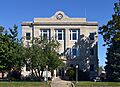
Putnam County Courthouse in Unionville
|
|

Location within the U.S. state of Missouri
|
|
 Missouri's location within the U.S. |
|
| Country | |
| State | |
| Founded | February 28, 1845 |
| Named for | Israel Putnam |
| Seat | Unionville |
| Largest city | Unionville |
| Area | |
| • Total | 520 sq mi (1,300 km2) |
| • Land | 517 sq mi (1,340 km2) |
| • Water | 2.3 sq mi (6 km2) 0.4% |
| Population
(2020)
|
|
| • Total | 4,681 |
| • Density | 9.00/sq mi (3.48/km2) |
| Time zone | UTC−6 (Central) |
| • Summer (DST) | UTC−5 (CDT) |
| Congressional district | 6th |
Putnam County is a county located in north central Missouri. In 2020, about 4,681 people lived there. Its main town, or county seat, is Unionville.
The county was officially started on February 28, 1845. It was named after Israel Putnam. He was a brave hero in the French and Indian War and a general in the American Revolutionary War.
Contents
History of Putnam County
Putnam County was created from parts of Adair and Sullivan counties. A small part of Putnam was later used to form Dodge County.
Both Putnam and Dodge counties used to stretch further north. But in 1851, the Supreme Court decided that this land belonged to Iowa. This decision was part of a disagreement called the Honey War. After this, Dodge County became too small and was added to Putnam County.
In its early years, the main town of Putnam County changed often. Places like Putnamville, Bryant Station, and Hartford were county seats at different times. Finally, a central spot called Harmony was chosen. It was later renamed Unionville.
In 1860, Putnam County had 9,240 people. There were many sawmills and flour mills. Coal was also found in large amounts from the very beginning. When the Burlington & Southwestern Railway arrived in 1873, coal mining became a huge business. At one point, three different railroads crossed Putnam County.
Between 1900 and 2000, Putnam County's population dropped a lot. This happened as the United States changed from a country with many people living in rural areas to one where more people lived in cities.
Geography of Putnam County
Putnam County covers a total area of about 520 square miles. Most of this, about 517 square miles, is land. The rest, about 2.3 square miles, is water.
Neighboring Counties
- Wayne County, Iowa (to the northwest)
- Appanoose County, Iowa (to the northeast)
- Schuyler County (to the east)
- Adair County (to the southeast)
- Sullivan County (to the south)
- Mercer County (to the west)
Main Roads
 U.S. Route 136
 Route 5
 Route 129
 Route 139
 Route 149
People of Putnam County
| Historical population | |||
|---|---|---|---|
| Census | Pop. | %± | |
| 1850 | 1,636 | — | |
| 1860 | 9,207 | 462.8% | |
| 1870 | 11,217 | 21.8% | |
| 1880 | 13,555 | 20.8% | |
| 1890 | 15,365 | 13.4% | |
| 1900 | 16,668 | 8.5% | |
| 1910 | 14,308 | −14.2% | |
| 1920 | 13,115 | −8.3% | |
| 1930 | 11,503 | −12.3% | |
| 1940 | 11,327 | −1.5% | |
| 1950 | 9,166 | −19.1% | |
| 1960 | 6,999 | −23.6% | |
| 1970 | 5,916 | −15.5% | |
| 1980 | 6,092 | 3.0% | |
| 1990 | 5,079 | −16.6% | |
| 2000 | 5,223 | 2.8% | |
| 2010 | 4,979 | −4.7% | |
| 2020 | 4,681 | −6.0% | |
| U.S. Decennial Census 1790-1960 1900-1990 1990-2000 2010-2015 |
|||
In 2010, there were 4,979 people living in Putnam County. There were 2,228 households, and 1,517 families. The population density was about 10 people per square mile.
Most people in the county were White (99.14%). About 27.90% of households had children under 18 living with them. The average household had 2.32 people.
The median age in the county was 42 years old. This means half the people were older than 42 and half were younger. About 24% of the population was under 18.
The median income for a household was $26,282. This is the middle income for all households. About 16% of the population lived below the poverty line.
2020 Census Information
| Race | Number | Percent |
|---|---|---|
| White (Not Hispanic) | 4,446 | 95% |
| Black or African American (Not Hispanic) | 11 | 0.23% |
| Native American (Not Hispanic) | 5 | 0.1% |
| Asian (Not Hispanic) | 0 | 0% |
| Pacific Islander (Not Hispanic) | 0 | 0% |
| Other/Mixed (Not Hispanic) | 107 | 2.3% |
| Hispanic or Latino | 112 | 2.4% |
Education
Putnam County has public schools for all ages.
Public Schools
- Putnam County Elementary School (Grades PK-05)
- Putnam County Middle School (Grades 06-08)
- Putnam County High School (Grades 09-12)
Public Libraries
- Putnam County Public Library
Communities
City
- Unionville (This is the county seat)
Villages
Census-designated place
Other Communities
Images for kids
-
Putnam County Courthouse in Unionville
See also
 In Spanish: Condado de Putnam (Misuri) para niños
