San Carlos, California facts for kids
Quick facts for kids
San Carlos, California
|
|||
|---|---|---|---|
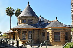
San Carlos Train Station
|
|||
|
|||
| Motto(s):
"City Of Good Living"
|
|||
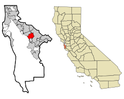
Location in San Mateo County and the state of California
|
|||
| Country | United States | ||
| State | California | ||
| County | San Mateo | ||
| Incorporated | July 8, 1925 | ||
| Named for | Unknown (suggested to be San Carlos, King Charles III, Feast of St. Charles) | ||
| Government | |||
| • Type | Council–manager | ||
| Area | |||
| • Total | 5.41 sq mi (14.02 km2) | ||
| • Land | 5.41 sq mi (14.02 km2) | ||
| • Water | 0.00 sq mi (0.00 km2) 0.01% | ||
| Elevation | 33 ft (10 m) | ||
| Population
(2023)
|
|||
| • Total | 28,557 | ||
| • Density | 5,578.2/sq mi (2,153.76/km2) | ||
| Demonym(s) | San Carlan | ||
| Time zone | UTC−8 (Pacific) | ||
| • Summer (DST) | UTC−7 (PDT) | ||
| ZIP codes |
94070, 94071
|
||
| Area code | 650 | ||
| FIPS code | 06-65070 | ||
| GNIS feature IDs | 277592, 2411780 | ||
San Carlos is a city in San Mateo County, California, United States. Its name means "St. Charles" in Spanish. According to the 2020 census, about 30,722 people live there. San Carlos is known as the "City Of Good Living."
Contents
History of San Carlos
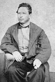
San Carlos has a long and interesting history, from its first inhabitants to its growth into a modern city.
Native American Life in San Carlos
Before the Spanish arrived in 1769, the land of San Carlos was home to a group of Native Americans called the Lamchins. They were part of the larger Ohlone or Costanoan tribes in the Bay Area.
The Lamchins called their main living area "Cachanihtac." This name included their word for vermin. When the Spanish came, they translated this as "the fleas," or "las Pulgas." This is why many places and roads in the area still have "Pulgas" in their names today.
The Lamchins lived by hunting and gathering food. They found plenty of game, birds, and fish from the San Francisco Bay. They also gathered plants, grasses, and acorns from oak trees. Tools found by archaeologists show they processed these foods. They also traded with other tribes for goods they couldn't find locally. Their main village was likely located between today's Alameda de las Pulgas and Cordilleras Avenue, near San Carlos Avenue.
Spanish Arrival and Ranchos
In 1769, Gaspar de Portolá was the first European to see the San Francisco Bay. While some thought he saw it from the San Carlos hills, experts now believe he first saw it from Belmont.
The Spanish quickly took control of the Bay Area. They invited local Native Americans to join them at Mission San Francisco de Asís (also known as Mission Dolores) and become Christians. Many Lamchin people moved to the mission between 1777 and 1794.
Later, the Spanish government gave large pieces of land, called "ranchos," to wealthy Spaniards. These ranchos were given without considering the Native Americans living there. The new ranch owners raised cattle, which changed the land and affected the native food supply.
The land that is now San Carlos became a large rancho given to Don José Darío Argüello. His family raised cattle and crops there. José's son, Luis Argüello, became the first California-born governor. After his death in 1830, his family moved to the ranch, which was then called Rancho de las Pulgas. Their home was at the spot where Magnolia and Cedar streets are today.
Growth in the Late 1800s
Even though the California Gold Rush of 1849 didn't bring gold to San Carlos, people who were disappointed in the Sierra Nevada came to the area. These were the first non-Spanish settlers. The Argüello family kept their ranch when the land became part of the United States. In the 1850s, they started selling parts of it.
While nearby towns like Redwood City and Belmont grew quickly, San Carlos grew much slower. Large areas were bought by families like the Brittans, Hulls, and Ralstons, and by Timothy Guy Phelps.
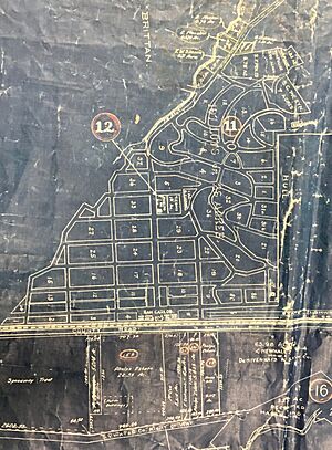
Timothy Phelps, a rich politician, tried to develop San Carlos. He paid for improvements like sewer lines and street paving. He tried to sell lots in an area he called "The Town of Phelps."
Phelps' sales didn't go well, and he sold much of his land to the San Carlos Land Development Company. Other developers didn't like the name "Phelps," so they renamed the town. Some maps show the area as "Lomitas" (meaning "little hills"). Eventually, the name "San Carlos" was chosen. This was because people believed Portolá first saw San Francisco Bay on November 4, the feast day of St. Charles, from the San Carlos hills. Also, the Spanish king at the time was Carlos III, and the first ship to sail into San Francisco Bay was named San Carlos.
The new town got a boost when the Peninsula Railroad Corridor was built in 1863, and a train station was added in San Carlos in 1888.
Growth remained slow into the 1900s. Most residents enjoyed the short train ride to San Francisco while living in a rural area. The Hull family ran a dairy farm. Many other residents were wealthy business people who worked with the railroad or in San Francisco. By the end of the 1800s, San Carlos had fewer than one hundred houses.
Early 1900s Development
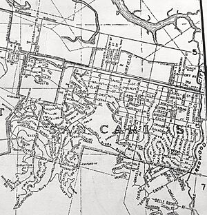
In the early 1900s, the first town streets were laid out. "Old County Road" had been used since at least 1850. New streets like Cedar, Elm, Laurel, Magnolia, Maple (now El Camino Real), and Walnut were built.
Growth was still slow until 1918. That year, the town had grown enough to build a school at 600 Elm Street. A year before, Frederick Drake, often called "The Father of San Carlos," bought a large amount of land and started selling it. The town grew quickly. In the early 1920s, Drake built an office that is still there today and is now Drake's Restaurant.
In the early 1920s, the cypress trees along Cypress Avenue were removed, and the street was widened and renamed San Carlos Avenue. In 1923, the growing town started a fire station. On July 8, 1925, the founders voted to officially become a city.
The Great Depression affected families everywhere, but San Carlos continued to grow. Its population grew from about 600 people in 1925 to 5,000 in 1941.
In 1932, Charles Litton Sr. started Litton Engineering Laboratories in San Carlos. He invented a special machine for making vacuum tubes, which helped improve electronics and communication.
Before World War II, San Carlos was still mostly a rural community. Much of the land was used for farming, and photos from that time show many fields with only a few houses.
San Carlos During World War II
War Dogs Training Center
During World War II, after the attack on Pearl Harbor, groups like the American Kennel Club and "Dogs for Defense" asked dog owners to donate their pets to the Army. These dogs helped save soldiers' lives in combat.
In October 1942, the US Army chose a 178-acre site in San Carlos, known as the H and H Ranch, to become the US Army War Dog Reception and Training Center. It was set up between October 15 and November 7, 1942.
The first soldiers for the army post stayed temporarily at the San Carlos Fire Station in December 1942. Each dog handler trained four dogs. At the end of the training, the handler chose the best dog to go with them. Dogs were trained for guard duty, attacking, scouting, and carrying messages. Later, they were also trained to find mines. The center could train up to 1,200 dogs at a time.
The first army dog team to go overseas in the Pacific was the 25th Quartermaster Corps War Dog Platoon. They left San Carlos on May 11, 1944, heading for assignments in the Pacific.
The training center closed in October 1944. About 4,500 dogs were trained there during the war.
Post-War Growth and Industry
After 1945, San Carlos saw a big increase in electronics companies. Dalmo Victor opened the city's first large electronics plant in 1944. Soon after, companies like Eitel McCullough, Varian Associates (later Tesla Motors and now Devil's Canyon Brewing Company), and Lenkurt Electric Company also opened.
These companies helped the population of San Carlos grow four times larger in the decade after 1940. By 1950, with a population of 14,371, the city had 89 different businesses, including factories and distributors making everything from electronics to cosmetics. By 1958, the electronics industry was a major part of the city's economy.
In the late 1940s, the San Carlos Airport moved to its current location. The county bought the airport in 1964. In 2025, San Carlos celebrated its Centennial Year, marking 100 years since it became a city.
Geography and Climate
San Carlos is located on the San Francisco Peninsula. The city covers about 5.41 square miles (14.02 square kilometers) of land. Only a very small part is water.
San Carlos Weather
San Carlos has a mild climate. Here's a look at the average temperatures and rainfall:
| Climate data for San Carlos, California | |||||||||||||
|---|---|---|---|---|---|---|---|---|---|---|---|---|---|
| Month | Jan | Feb | Mar | Apr | May | Jun | Jul | Aug | Sep | Oct | Nov | Dec | Year |
| Record high °F (°C) | 78 (26) |
80 (27) |
89 (32) |
97 (36) |
102 (39) |
109 (43) |
110 (43) |
105 (41) |
110 (43) |
104 (40) |
87 (31) |
77 (25) |
110 (43) |
| Mean daily maximum °F (°C) | 58.5 (14.7) |
62.3 (16.8) |
65.5 (18.6) |
70.2 (21.2) |
74.4 (23.6) |
79.2 (26.2) |
82.4 (28.0) |
82.1 (27.8) |
80.2 (26.8) |
74.4 (23.6) |
65.3 (18.5) |
58.2 (14.6) |
71.1 (21.7) |
| Mean daily minimum °F (°C) | 40.3 (4.6) |
43.8 (6.6) |
45.2 (7.3) |
46.5 (8.1) |
50.7 (10.4) |
54.3 (12.4) |
56.3 (13.5) |
56.5 (13.6) |
54.4 (12.4) |
50.5 (10.3) |
44.3 (6.8) |
40.1 (4.5) |
48.6 (9.2) |
| Record low °F (°C) | 16 (−9) |
25 (−4) |
29 (−2) |
33 (1) |
36 (2) |
39 (4) |
40 (4) |
43 (6) |
38 (3) |
33 (1) |
29 (−2) |
19 (−7) |
16 (−9) |
| Average precipitation inches (mm) | 4.02 (102) |
4.09 (104) |
3.13 (80) |
1.16 (29) |
0.47 (12) |
0.1 (2.5) |
0.01 (0.25) |
0.05 (1.3) |
0.16 (4.1) |
1.06 (27) |
2.37 (60) |
3.84 (98) |
20.46 (520.15) |
| Source: "The Weather Channel | |||||||||||||
Population and People
| Historical population | |||
|---|---|---|---|
| Census | Pop. | %± | |
| 1930 | 1,132 | — | |
| 1940 | 3,520 | 211.0% | |
| 1950 | 14,371 | 308.3% | |
| 1960 | 21,370 | 48.7% | |
| 1970 | 26,053 | 21.9% | |
| 1980 | 24,710 | −5.2% | |
| 1990 | 26,167 | 5.9% | |
| 2000 | 27,718 | 5.9% | |
| 2010 | 28,406 | 2.5% | |
| 2020 | 30,722 | 8.2% | |
| U.S. Decennial Census | |||
San Carlos has grown steadily over the years. Here's a look at its population.
San Carlos Population in 2020
The 2020 United States census showed that San Carlos had 30,722 people. Most residents, about 71.1%, were White. About 17.6% were Asian, and 8.2% were Hispanic or Latino.
There were 10,955 households. The average household had 2.69 people. About 18.0% of the population was aged 6 to 18. The median household income was $189,739, which was one of the highest in San Mateo County.
San Carlos Population in 2010
The 2010 United States Census reported 28,406 people in San Carlos. About 79.2% were White, 11.5% were Asian, and 10.1% were Hispanic or Latino.
There were 11,524 households. About 33.4% of these households had children under 18. The average household size was 2.46 people. The median age in San Carlos was 42.6 years.
San Carlos Population in 2000
In the census of 2000, San Carlos had 27,238 people. There were 11,455 households. About 29.7% of households had children under 18. The average household size was 2.40 people.
The median income for a household was $99,110. For families, it was $137,325.
Economy and Jobs
San Carlos is home to several important companies. These include Check Point, MarkLogic, Helix, and Natera.
Major Employers in San Carlos
Here are some of the top employers in San Carlos, based on a 2022 report:
| # | Employer | # of Employees |
|---|---|---|
| 1 | Natera | 934 |
| 2 | Pacific Gas and Electric | 323 |
| 3 | The Home Depot | 291 |
| 4 | Check Point Software Technologies | 225 |
| 5 | Delta Star | 214 |
| 6 | ChemoCentryx Inc. | 182 |
| 7 | Joby Aero Inc. | 170 |
| 8 | Allakos Inc. | 163 |
| 9 | Atreca Inc. | 140 |
| 10 | Thought Stream | 132 |
L-3 Communications used to make special tubes for radar and TV systems in San Carlos. In 2016, the company moved its operations to other parts of California and Pennsylvania.
Arts and Culture in San Carlos
San Carlos offers several cultural attractions and community events.
The San Carlos History Museum shows the town's history, from early Native American times to the modern age. It is open every Saturday. The Hiller Aviation Museum focuses on helicopters and aviation history. It has interactive exhibits and over forty aircraft, including a replica of the first aircraft to fly and a spy drone.
San Carlos was once home to the Circle Star Theater, where many famous performers appeared. This theater was later taken down and replaced with office buildings.
Every May, San Carlos hosts "Hometown Days" at Burton Park, the city's largest park. In October, the Chamber of Commerce holds the San Carlos "Art & Wine Faire." This event celebrated its 25th year in October 2015. On Sunday mornings during the summer, Laurel Street hosts a weekly farmer's market. San Carlos also has a sculpture called "Balancing Act" by James Moore, located in front of Frank D. Harrington park. It is often decorated for holidays.
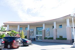
The city's library is the San Carlos Public Library, which is part of the San Mateo County Libraries system.
City Government
How San Carlos is Governed
San Carlos is led by a City Council. The current mayor of San Carlos is Sara McDowell. Pranita Venkatesh is the current vice mayor. The other three city council members are John Duggan, Neil Layton, and Adam Rak.
Brad Lewis, a film producer known for Ratatouille, served as mayor in 2008.
As of February 10, 2019, San Carlos had 19,706 registered voters. Most voters, about 48.7%, were registered as Democrats. About 18.6% were registered Republicans, and 28.9% chose not to state a political party.
State and Federal Representation
In the California State Legislature, San Carlos is part of the 13th Senate District, represented by Democrat Jerry Hill for the State Senate and the 21st Assembly District, represented by Democrat Adam Gray for the State Assembly.
In the United States House of Representatives, San Carlos is in California's 15th congressional district, represented by Democrat Eric Swalwell.
Education in San Carlos
Public schools in San Carlos are managed by the San Carlos School District. The district has several elementary schools (grades K–3), two upper elementary schools (grades 4–5), and two middle schools (grades 6–8). Since San Carlos High School closed in 1982, local students attend Sequoia High School in Redwood City and Carlmont High School in Belmont.
In 1996, Vice President Al Gore visited Arundel Elementary School for Net Day 1996. Former president Bill Clinton visited Charter Learning Center in 1997 to recognize it as one of the first charter schools in the nation.
Elementary Schools
- Arundel
- Brittan Acres
- Heather
- White Oaks
Upper Elementary Schools
- Arroyo
- Mariposa
Middle Schools
- Central Middle School
- Tierra Linda Middle School
- Charter Learning Center (Kindergarten through 8th grade)
High Schools
San Carlos used to have its own public high school, San Carlos High School, until 1982. It closed because fewer students were enrolling. Students from San Carlos middle schools now go to Carlmont High School in Belmont and Sequoia High School in Redwood City. The old high school's playing fields became Highlands Park, which is now used by many youth sports groups. The school building was replaced with new homes. By the late 1990s and early 2000s, more young families with children moved to San Carlos, creating new challenges for local schools due to growing student numbers.
In December 2014, the Sequoia Union High School District suggested building a small high school in east San Carlos. However, due to community concerns, a different location in Menlo Park was chosen. This new school, TIDE Academy, opened in 2019.
Private Schools
- St. Charles School (parochial)
- Arbor Bay School (non-parochial)
Transportation and Infrastructure
Bus and Rail Services
San Carlos has both bus and train services. SamTrans provides bus service, and Caltrain provides rail service. Both companies have their main offices in downtown San Carlos. In 2002, the city tried a free shuttle bus service called SCOOT. This shuttle was meant to help people living in the hills get around, especially for school. However, voters did not approve a tax to pay for it, and the SCOOT program ended on June 17, 2005.
San Carlos Airport
San Carlos Airport is located in San Carlos. It is a private airport.
Notable People from San Carlos
Many interesting people have lived in San Carlos:
- Luís Antonio Argüello, the first governor of Alta California.
- Kathryn Bigelow, a film producer and director. She was the first woman to win an Academy Award for Best Director.
- Bryan Bishop, a podcast personality.
- Hunter Bishop (born 1998), a baseball player.
- Barry Bonds, a famous former MLB baseball player.
- Bobby Bonds, also a former MLB baseball player.
- Dana Carvey, an actor and comedian who grew up in San Carlos.
- Emma Chamberlain, an internet personality and YouTuber who attended middle school here.
- Jim Davenport, a former MLB player, coach, and manager.
- Jennifer Granholm, former governor of Michigan, who graduated from San Carlos High School.
- Brad Lewis, a producer of the Pixar film Ratatouille and a former city mayor.
- Rex J. Walheim, a NASA astronaut who flew on three Space Shuttle missions.
Sister Cities
San Carlos has special relationships with cities in other countries.
Current Sister Cities
 Omura, Japan
 Metepec, Mexico
Former Sister Cities
See also
 In Spanish: San Carlos (California) para niños
- Episcopal Church of the Epiphany
 | Georgia Louise Harris Brown |
 | Julian Abele |
 | Norma Merrick Sklarek |
 | William Sidney Pittman |


