
Sorocaba facts for kids
Quick facts for kids
Sorocaba
|
|||
|---|---|---|---|
|
Municipality
|
|||
| Municipality of Sorocaba | |||
|
|
|||
|
|||
| Motto(s): | |||

Location in São Paulo
|
|||
| Country | |||
| Region | Southeast Brazil | ||
| State | |||
| Metropolitan Region | Sorocaba | ||
| Founded | 1654 | ||
| Founded by | Baltazar Fernandes | ||
| Named for | Sorocaba River | ||
| Government | |||
| • Type | Mayor–Council | ||
| Area | |||
| • Municipality | 450 km2 (170 sq mi) | ||
| Elevation | 601 m (1,972 ft) | ||
| Population
(2022)
|
|||
| • Municipality | 723,682 | ||
| • Density | 1,608/km2 (4,170/sq mi) | ||
| • Metro | 2,000,000 | ||
| Demonym(s) | sorocabano | ||
| Area code | +55 15 | ||
| HDI (2010) | 0.798 – high | ||

.jpg)


_-_panoramio.jpg)

.jpg)


Sorocaba (Portuguese pronunciation: [soɾoˈkabɐ]) is a large city in the state of São Paulo, Brazil. It has over 723,000 people, making it the seventh-largest city in the state. It is also the second-largest city outside the Greater São Paulo area.
Sorocaba is part of the Metropolitan Region of Sorocaba, which includes 27 towns and has about 2 million people. This makes it the 15th most populated area in Brazil. The city covers an area of about 450 square kilometers (170 square miles).
Sorocaba is a very industrial city. Its factories send products to over 120 countries. The city's economy is very strong, with a GDP (Gross Domestic Product) of over R$32 billion. More than 22,000 companies work in Sorocaba, and 2,000 of them are factories.
Contents
History of Sorocaba
Early Beginnings and Founding
In the late 1500s, Dom Francisco de Sousa, a governor of Brazil, thought there was gold in the area. He set up a village called Nova Vila de Nossa Senhora da Ponte de Mont Serrat. When no gold was found, he left. Later, the village's name was changed to Itavuvu.
Baltasar Fernandes officially founded Sorocaba in 1654. He built the chapel of Nossa Senhora da Ponte, which is now the city's main Cathedral. He also built the São Bento de Parnaíba monastery. Fernandes brought the first Benedictine monks to the area. They helped teach people, cared for the sick, and worked with the Native Americans.
In 1661, Sorocaba became known as Vila de Nossa Senhora da Ponte de Sorocaba. A local government council was soon formed.
The Era of Tropeirismo
A big part of Sorocaba's history began in 1773 with the arrival of Colonel Cristóvão Pereira de Abreu. This started the time of Tropeirismo. This was when goods were transported across the country on the backs of mules.
Sorocaba was a key stop on the main route between Rio Grande do Sul, Minas Gerais, and Rio de Janeiro. The city became famous for its mule and horse fairs. Travelers would stop to rest their animals and buy or sell goods. This led to more shops and early industries in Sorocaba. The Tropeirismo period lasted for about 100 years, from 1770 to 1870.
Cotton and Industrial Growth
During the American Civil War, English factories needed cotton. They looked for new places to grow it, and Sorocaba was one of them. In 1862, Francisco Gonçalves de Oliveira Machado started the first cotton farm in Sorocaba. The climate was perfect, and the cotton grew well.
This success brought many English textile companies to the city. They built factories with tall chimneys and unique roofs. Sorocaba became known as "Manchester Paulista," like the industrial city of Manchester in England.
The Estrada de Ferro Sorocabana (Sorocabana Railway) opened on June 20, 1872. This railway helped transport cotton, animals, and people to São Paulo. It brought a huge boost to Sorocaba's growth. The railway later expanded across the state, with Sorocaba as a central hub.
Geography and Climate
Where is Sorocaba Located?
Sorocaba is in the southeastern part of São Paulo state. It is about 92 kilometers (57 miles) from the state capital. Major highways like Castelo Branco (SP-280) and Raposo Tavares (SP-270) connect the city.
The city is located on the Sorocaba River, which flows into the Tiete river. Sorocaba is also on the Tropic of Capricorn. This imaginary line passes through parts of the city.
Population and People
In 2010, Sorocaba had 586,311 people. The population grew a lot since 2000. Most people live in urban areas, with only a small percentage in rural areas. There are slightly more women than men in Sorocaba.
Sorocaba's Weather
Sorocaba has a subtropical climate. This means it has warm weather with rain in the summer. July is usually the coldest month, and January and February are the warmest. The city gets about 1300 mm (51 inches) of rain each year.
| Climate data for Sorocaba (1981–2010) | |||||||||||||
|---|---|---|---|---|---|---|---|---|---|---|---|---|---|
| Month | Jan | Feb | Mar | Apr | May | Jun | Jul | Aug | Sep | Oct | Nov | Dec | Year |
| Mean daily maximum °C (°F) | 29.2 (84.6) |
30.0 (86.0) |
29.4 (84.9) |
27.6 (81.7) |
24.8 (76.6) |
23.9 (75.0) |
24.0 (75.2) |
25.8 (78.4) |
26.4 (79.5) |
27.8 (82.0) |
28.8 (83.8) |
29.1 (84.4) |
27.2 (81.0) |
| Daily mean °C (°F) | 23.5 (74.3) |
23.9 (75.0) |
23.3 (73.9) |
21.6 (70.9) |
18.6 (65.5) |
17.1 (62.8) |
17.0 (62.6) |
18.4 (65.1) |
19.6 (67.3) |
21.1 (70.0) |
22.4 (72.3) |
23.0 (73.4) |
20.8 (69.4) |
| Mean daily minimum °C (°F) | 19.6 (67.3) |
19.7 (67.5) |
19.1 (66.4) |
17.4 (63.3) |
14.1 (57.4) |
12.3 (54.1) |
12.0 (53.6) |
13.0 (55.4) |
14.7 (58.5) |
16.3 (61.3) |
17.7 (63.9) |
18.7 (65.7) |
16.2 (61.2) |
| Average precipitation mm (inches) | 284.2 (11.19) |
155.5 (6.12) |
142.9 (5.63) |
64.7 (2.55) |
82.5 (3.25) |
54.5 (2.15) |
55.7 (2.19) |
31.9 (1.26) |
67.9 (2.67) |
100.6 (3.96) |
131.5 (5.18) |
183.7 (7.23) |
1,355.6 (53.37) |
| Average precipitation days (≥ 1.0 mm) | 15 | 12 | 9 | 5 | 7 | 4 | 4 | 4 | 7 | 9 | 9 | 13 | 98 |
| Average relative humidity (%) | 77.7 | 75.9 | 75.8 | 76.4 | 76.7 | 76.5 | 72.7 | 68.4 | 69.9 | 71.5 | 71.8 | 74.5 | 74.0 |
| Mean monthly sunshine hours | 149.7 | 161.4 | 189.3 | 180.2 | 177.5 | 166.8 | 187.1 | 202.0 | 168.0 | 177.9 | 178.6 | 161.4 | 2,099.9 |
| Source: Instituto Nacional de Meteorologia | |||||||||||||
Land and Soil
Sorocaba's land is mostly hilly, with an average height of 632 meters (2,073 feet) above sea level. The highest point is 1028 meters (3,373 feet) in the Serra de Sao Francisco. The lowest point is 539 meters (1,768 feet) in the Sorocaba River valley. The soil is mostly red-yellow clay. The original plants were part of the Atlantic Forest.
Geology of the Region
Sorocaba sits where two different types of rock meet. One type is from the Parana Basin, made of sedimentary rocks. The other is older, crystalline rock. The Ipanema Hill is a special isolated hill formed by ancient volcanic activity. It was once Brazil's first iron mine.
Industry and Economy
Sorocaba's Industrial Hub
Sorocaba has a large industrial area, covering over 25 million square meters. More than 1,600 factories are located here. Key industries include:
- Making industrial machinery
- Working with heavy metallurgy (metals)
- Producing ironmaking and steelmaking
- Making automotive parts
- Creating industrial textiles (fabrics)
- Building agricultural equipment
- Producing chemicals and petrochemicals
- Making cement
- Manufacturing solar panels and eolic (wind) energy parts
- Developing pharmaceutics (medicines)
- Producing paper and cellulose
- Making electronics and telecommunications equipment
- Creating tools
Sorocaba's industries for tools, car parts, and medicines are the biggest in Brazil.
Transportation for Industry
The Ferroban railroad connects Sorocaba to São Paulo and the Santos Seaport. This is the largest seaport in South America. The railway also links to Mercosur countries like Argentina and Bolivia.
Sorocaba also has a dry port terminal. This helps move goods efficiently by road to various ports and airports. The Bertram Luiz Leupolz Airport is one of the busiest cargo airports in the state.
Economic Strength
Sorocaba's economy is the fifth strongest in the state. It has attracted about US$3.5 billion in investments. The city's industries export goods to over 115 countries, earning about US$370 million each year. There are also more than 8,000 shops and 8,000 service businesses in the city.
Education in Sorocaba
Sorocaba is home to many universities and colleges. There are nine universities, including:
- University of Medical and Health Sciences at the Catholic University of São Paulo (PUC-SP)
- University of Sorocaba (UNISO)
- University Paulista (UNIP)
- Two public universities: Universidade Estadual Paulista (UNESP) and University of Sao Carlos (UFSCar)
The city also has nine colleges, such as:
- Law School of Sorocaba (FADI)
- Engineering College of Sorocaba (FACENS)
- College of Technology of São Paulo - Sorocaba (FATEC-SO)
There are also hundreds of public and private schools from elementary to high school. Many offer special courses to help students prepare for jobs. Institutions like SENAI and SENAC also provide professional training.
Media and Resources
Sorocaba has two International Convention Centers for large events. The city has three main newspapers: Jornal Bom Dia, Cruzeiro do Sul, and Diário de Sorocaba.
For telecommunications, the city was first served by Telecomunicações de São Paulo. This company was later bought by Telefónica, which now uses the Vivo brand. Vivo provides cell phone, landline, internet, and television services.
Sights and Sports
Places to Visit
Sorocaba has many parks and historical sites. You can visit:
- Historic churches
- Walking and racing paths
- Historical monuments
- Museums
- The municipal Zoo "Quinzinho de Barros", which is one of the largest zoos in South America.
Sports in Sorocaba
The main sports stadium in the city is Estádio Municipal Walter Ribeiro. The city's main football (soccer) team is EC São Bento. There is also a basketball team called Liga Sorocabana de Basquete. The futsal (indoor soccer) team, Magnus Futsal, has won the Intercontinental Futsal Cup in 2016 and 2018.
Transportation in Sorocaba
Roads and Highways
Sorocaba is well-connected by several important highways:
- SP-75 - Rod. Santos Dumont (connects Sorocaba to Campinas)
- SP-79 - Rod. Waldomiro Correa de Camargo (Sorocaba to Itu) and Rod. Raimundo Antunes Soares (Sorocaba to Piedade)
- SP-270 - Rod. Raposo Tavares (connects Sorocaba to São Paulo and Presidente Prudente)
- SP-280 - Rod. Castelo Branco (connects Sorocaba to São Paulo and Ourinhos)
Public Transport
The city has four main urban bus terminals: São Paulo, Santo Antônio, Vitória Régia, and São Bento.
Bike Lanes
Sorocaba has 60 kilometers (about 37 miles) of bike lanes on its main streets. The city plans to build the largest cycling network in Latin America. It also aims to start a public bike-sharing system, like those in European cities such as Barcelona and Paris. Sorocaba currently has the second-largest cycling network in Brazil, after Rio de Janeiro.
City Administration
The current mayor of Sorocaba is Rodrigo Maganhato from the REPUBLICANS party. He started his term on January 1st, 2021.
Sister Cities
Sorocaba has "sister city" relationships with other cities around the world. These partnerships help promote cultural exchange and friendship. Sorocaba is twinned with:
Notable People from Sorocaba
- Átila Abreu, a racing car driver
- Francisco Adolfo de Varnhagen, a diplomat and important historical figure
- Rafael Tobias de Aguiar, a military officer and politician
- Marinho Peres, a football (soccer) player
- Diego Farias, a football (soccer) player
Images for kids
-
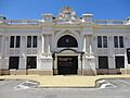
Sorocaba City Hall
-
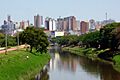
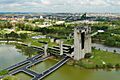
Sorocaba River
-
Ettore Marangoni Cultural Power Plant
-
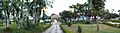
Bike path along the Sorocaba River
-
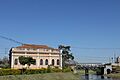
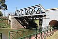
Old Sorocabana Railway Station
-
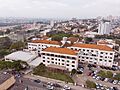
Sorocaba Hospital Complex
-
Villagio Shopping Square
See also
 In Spanish: Sorocaba para niños
