
St. Tammany Parish, Louisiana facts for kids
Quick facts for kids
St. Tammany Parish
|
|
|---|---|
|
Parish
|
|

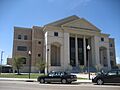
St. Tammany Parish Justice Center in Covington
|
|

Location within the U.S. state of Louisiana
|
|
 Louisiana's location within the U.S. |
|
| Country | |
| State | |
| Founded | October 27, 1810 |
| Named for | Indian Chief Tamanend |
| Seat | Covington |
| Largest city | Slidell |
| Area | |
| • Total | 1,124 sq mi (2,910 km2) |
| • Land | 846 sq mi (2,190 km2) |
| • Water | 279 sq mi (720 km2) 25% |
| Population
(2020)
|
|
| • Total | 264,570 |
| • Density | 312.73/sq mi (120.75/km2) |
| Time zone | UTC−6 (Central) |
| • Summer (DST) | UTC−5 (CDT) |
| Congressional district | 1st |


St. Tammany Parish is a special kind of county in Louisiana. It's named after Tamanend, a famous Native American Chief of the Lenape people. He was known for being a good and wise leader.
In 2020, about 264,570 people lived here. This makes St. Tammany the fourth-largest parish in Louisiana by population. The main town, or "parish seat," is Covington. The parish was officially started in 1810.
St. Tammany Parish is part of a larger area that includes Slidell, Mandeville, and Covington. It's also part of the bigger New Orleans area. St. Tammany is one of the fastest-growing parishes in Louisiana. Its population has grown a lot since 1970. Many people moved here after Hurricane Katrina in 2005.
Contents
History of St. Tammany Parish
Early History and Native Americans
Long ago, many different Native American groups lived in the St. Tammany area. These included the Colapissas, Bayou Goulas, Chickasaw, Biloxi, Choctaw, and Pensacola nations.
In 1699, a French explorer named Pierre Le Moyne d'Iberville was the first European to visit this region. He explored the lakes nearby, like Lake Pontchartrain and Lake Maurepas. Iberville wrote in his journal that the area was beautiful, with pine trees and open land. He also saw many tracks of buffalo and deer.
Becoming Part of West Florida
After the city of New Orleans was built, French settlers began to move into the St. Tammany area. They mostly worked with the forests, making things like pitch, tar, and turpentine from the trees.
Later, after France lost the French and Indian War, St. Tammany became part of British West Florida. During this time, some British loyalists, who supported the King during the American Revolutionary War, moved here to avoid problems in the Thirteen Colonies. After Great Britain lost the Revolutionary War, the Spanish took control of West Florida. This period ended when the United States took over the area.
How the Parish Was Created
In 1810, U.S. President James Madison said that West Florida was part of Louisiana. He sent William C. C. Claiborne to claim the land. Claiborne set up the boundaries for the different parishes. He created St. Tammany Parish and named it after Chief Tamanend.
Chief Tamanend was a leader of the Delaware Indian (Lenape) people. He was known for making peace with William Penn. St. Tammany is special because it's the only parish in Louisiana named after a "saint" who wasn't a Roman Catholic saint. Tamanend was not Christian, but he became known as an "American patron saint" after the American Revolution.
Before it was St. Tammany, the area east of the Tangipahoa River was called the St. Ferdinand District by the Spanish. But because Ferdinand was also the name of a Spanish king at the time, people wanted a more "American" name for the new parish.
Life in the 1800s
In the early 1830s, there were only two main towns in St. Tammany Parish. These were Covington, which was a popular place for summer homes and hotels, and Madisonville, a town known for shipbuilding and sawmills.
The area south of Covington, stretching to Lake Pontchartrain and east to the Pearl River, was called the Covington Lowlands. This region included places we know today as Mandeville, Abita Springs, Lacombe, Slidell, and Pearl River.
Mandeville was founded in 1834. It became a health resort for wealthy people from New Orleans. People believed that the fresh air from the many trees, called "ozone," was good for health. This led to the area being called the "Ozone Belt."
Ferry services started across Lake Pontchartrain, making it easier to travel. Soon after, another resort town, Abita Springs, was founded. In the 1880s, a railroad was built. It connected Covington and Abita Springs to Mandeville and New Orleans. This helped the towns grow even more, especially Abita Springs, where people enjoyed baths in the natural spring waters.
Growth in the 1900s

With new, faster roads connecting St. Tammany to New Orleans, the parish started to become a "bedroom community." This means many people lived in St. Tammany but traveled to New Orleans for work. This growth first happened around Slidell in the eastern part of the parish.
The Lake Pontchartrain Causeway, a very long bridge, was finished in 1956. It connected the western part of St. Tammany to Metairie, a suburb of New Orleans. However, the towns of Mandeville, Covington, and Madisonville didn't really start growing fast until the late 1960s.
St. Tammany in the 2000s
In the 1950s, St. Tammany was mostly rural with few people. But after Hurricane Katrina hit in 2005, the population grew to over 200,000.
A big change for the parish happened in 2008. Chevron, a large company, moved its regional offices from downtown New Orleans to an office park near Covington. This helped St. Tammany become more economically independent.
How Hurricane Katrina Affected St. Tammany
Hurricane Katrina made its final landfall in eastern St. Tammany Parish on August 29, 2005. The storm was a Category 3 hurricane when it hit. Communities like Slidell, Avery Estates, and Oak Harbor were flooded by the storm surge. This surge, which is a rise in water level caused by the storm, went over 6 miles inland.
The storm surge affected all 57 miles of St. Tammany Parish's coastline. This included towns like Lacombe, Mandeville, and Madisonville. The surge was estimated to be about 16 feet high in some areas.
The I-10 bridges between Slidell and New Orleans were badly damaged. The Lake Pontchartrain Causeway and the U.S. Highway 11 bridge were only open for emergency vehicles.
First responders, like fire departments and the Sheriff's office, rescued over 3,000 people from flooded homes. Radio communication worked, but the 9-1-1 emergency system was down for ten days. Electricity and other services were not available. Hospitals ran on generators.
The strong winds knocked down many trees and telephone poles, blocking roads. Cleanup efforts for debris continued for years. Hurricane Katrina damaged nearly 49,000 homes in St. Tammany Parish due to floods, strong winds, or both.
Geography of St. Tammany Parish
St. Tammany Parish covers about 1,124 square miles. About 846 square miles are land, and 279 square miles (25%) are water. The parish is located north of Lake Pontchartrain.
Main Roads and Highways
 Interstate 10
 Interstate 12
 Interstate 59
 U.S. Highway 11
 U.S. Highway 90
 U.S. Highway 190
 Louisiana Highway 21
 Louisiana Highway 22
 Louisiana Highway 25
 Louisiana Highway 36
 Louisiana Highway 40
 Louisiana Highway 41
Neighboring Areas
St. Tammany Parish shares borders with these other parishes and counties:
- Washington Parish (north)
- Pearl River County, Mississippi (northeast)
- Hancock County, Mississippi (east)
- Orleans Parish (south)
- Jefferson Parish (southwest)
- St. Bernard Parish (southeast)
- Tangipahoa Parish (west)
Protected Natural Areas
- Big Branch Marsh National Wildlife Refuge
- Bogue Chitto National Wildlife Refuge (part)
- Pearl River Wildlife Management Area
- Lake Ramsey Savannah Wildlife Management Area
State Parks to Visit
- Fairview-Riverside State Park
- Fontainebleau State Park
Towns and Communities

Cities in St. Tammany
- Covington (the main parish town)
- Mandeville
- Slidell (the largest town)
Smaller Towns
- Abita Springs
- Madisonville
- Pearl River
Villages
Other Communities
- Alton
- Audubon
- Barker's Corner
- Big Branch
- Blond
- Bonfouca
- Bush
- Chinchuba
- Colt
- Crawford Landing
- Dave
- Davis Landing
- Eden Isle
- Florenville
- Goodbee
- Haaswood
- Houltonville
- Hickory
- Lacombe
- Lewisburg
- Maude
- McClane City
- Morgan Bluff
- North Slidell
- Oaklawn
- St. Benedict
- St. Joe
- St. Tammany
- St. Tammany Corner
- Talisheek
- Waldheim
- White Kitchen
People and Population
| Historical population | |||
|---|---|---|---|
| Census | Pop. | %± | |
| 1820 | 1,723 | — | |
| 1830 | 2,864 | 66.2% | |
| 1840 | 4,598 | 60.5% | |
| 1850 | 6,364 | 38.4% | |
| 1860 | 5,406 | −15.1% | |
| 1870 | 5,586 | 3.3% | |
| 1880 | 6,887 | 23.3% | |
| 1890 | 10,160 | 47.5% | |
| 1900 | 13,335 | 31.3% | |
| 1910 | 18,917 | 41.9% | |
| 1920 | 20,645 | 9.1% | |
| 1930 | 20,929 | 1.4% | |
| 1940 | 23,624 | 12.9% | |
| 1950 | 26,988 | 14.2% | |
| 1960 | 38,643 | 43.2% | |
| 1970 | 68,585 | 77.5% | |
| 1980 | 110,869 | 61.7% | |
| 1990 | 144,508 | 30.3% | |
| 2000 | 191,268 | 32.4% | |
| 2010 | 233,740 | 22.2% | |
| 2020 | 264,570 | 13.2% | |
| U.S. Decennial Census 1790-1960 1900-1990 1990-2000 2010 |
|||
St. Tammany Parish has grown a lot over the years. In 2020, there were 264,570 people living there. The average age of people in the parish was about 40 years old. About 6% of the population was under 5 years old, and about 16% was 65 or older.
Many people in St. Tammany Parish own their homes. The average home value was around $218,500. The average household income was about $68,905 per year. About 11.5% of the people lived below the poverty line.
When it comes to backgrounds, many people in St. Tammany have French, German, Irish, or Italian family roots. The second most common language spoken in the parish, after English, is Spanish.
Most people in St. Tammany Parish are Christian. The largest group is Roman Catholic, followed by Baptists and other Protestant churches.
Education in St. Tammany
Schools for Kids (K-12)
The St. Tammany Parish Public Schools system runs all the public schools in the parish. These schools are known for being some of the best-performing in Louisiana.
There are also Catholic high schools in the area:
- Archbishop Hannan High School (near Covington)
- Pope John Paul II Catholic High School (in Slidell)
Other private schools include:
- Christ Episcopal School (in Covington and a nearby area)
- Saint Paul's School (Covington)
- Saint Scholastica Academy (Covington)
- Northlake Christian School (near Covington)
Colleges and Higher Education
St. Tammany Parish is served by two community colleges: Northshore Technical Community College and Delgado Community College. Northshore Technical Community College has its main campus in Lacombe.
There are also other colleges nearby, like Nunez Community College and a campus of Delgado Community College in New Orleans. In the past, Delgado Community College had campuses in Covington and Slidell, but they have since closed.
The parish also has a building named Saint Tammany Hall at Southeastern Louisiana University. This university is located in the neighboring Tangipahoa Parish.
Images for kids
-
St. Tammany Parish Justice Center in Covington
See also
 In Spanish: Parroquia de St. Tammany para niños
