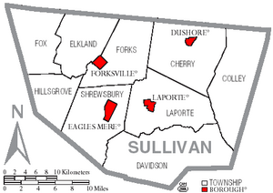
Sullivan County, Pennsylvania facts for kids
Quick facts for kids
Sullivan County
|
|
|---|---|
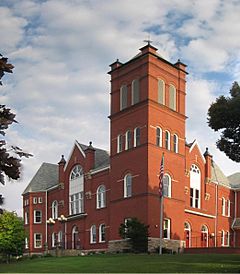
Sullivan County Courthouse in Sullivan County, September 2006
|
|
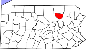
Location within the U.S. state of Pennsylvania
|
|
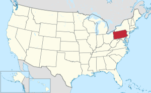 Pennsylvania's location within the U.S. |
|
| Country | |
| State | |
| Founded | March 15, 1847 |
| Named for | Charles C. Sullivan |
| Seat | Laporte |
| Largest borough | Dushore |
| Area | |
| • Total | 452 sq mi (1,170 km2) |
| • Land | 450 sq mi (1,200 km2) |
| • Water | 2.6 sq mi (7 km2) 0.6% |
| Population | |
| • Estimate
(2020)
|
5,840 |
| • Density | 13/sq mi (5/km2) |
| Time zone | UTC−5 (Eastern) |
| • Summer (DST) | UTC−4 (EDT) |
| Congressional district | 9th |
Sullivan County is a county in Pennsylvania. In 2020, about 5,840 people lived here. This makes it the second-least populated county in Pennsylvania. The main town, or county seat, is Laporte.
The county was created on March 15, 1847. It was named after Major General John Sullivan. Sullivan County is part of the Northeast Pennsylvania region.
Contents
History of Sullivan County
The land that became Sullivan County was first bought from the Iroquois people in 1768. This was part of the first Treaty of Fort Stanwix.
Later, it was part of Northumberland County. Then, it became part of Lycoming County in 1795. Sullivan County was officially formed from the northeast part of Lycoming County on March 15, 1847. It was the last of thirteen counties made from Lycoming County.
Sullivan County was named after Charles C. Sullivan. He was a Pennsylvania state senator who helped create the county. However, some people believe it was named after General John Sullivan. He led a military trip against the Iroquois in 1779.
Geography and Nature
Sullivan County covers about 452 square miles. Most of this (450 square miles) is land, and a small part (2.6 square miles) is water.
The land here goes from 779 feet high near Loyalsock Creek to 2,593 feet high at North Mountain. The county has several main roads: Pennsylvania Route 42, Pennsylvania Route 87, Pennsylvania Route 154, Pennsylvania Route 487, and U.S. Route 220.
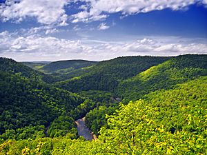
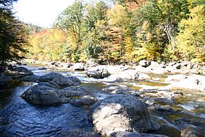
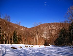
Important rivers in the county include Loyalsock Creek, Little Loyalsock Creek, Muncy Creek, and Fishing Creek. Most of Sullivan County is covered by forests. There is also some farmland, especially in the northern areas. You can find many river valleys in the southern and western parts of the county.
Sullivan County has a warm-summer humid continental climate. This means it has warm summers and cold winters. For example, in Laporte, the average temperature is about 21.8 °F in January and 67.9 °F in July.
Neighboring Counties
Sullivan County shares borders with these other counties:
- Bradford County (to the north)
- Wyoming County (to the east)
- Luzerne County (to the southeast)
- Columbia County (to the south)
- Lycoming County (to the west)
Geology and Landforms
Sullivan County is mostly in the Appalachian Plateau region. This area has gently folded and faulted sedimentary rocks. These rocks formed a very long time ago. The mountains in the county are part of the Endless Mountains.
The rocks in the county range from the Devonian period to the Pennsylvanian period. The lowlands are mostly made of Catskill Formation rocks. The mountain tops are often covered by harder sandstones. There are no volcanic or changed rocks here.
The bedrock in Sullivan County is gently folded. This means the layers of rock bend in large waves. There are also a few faults, which are cracks in the Earth's crust.
Most of Sullivan County was covered by glaciers many times during the "Ice Age." These glaciers left behind till, which is a mix of clay, sand, and rocks.
All the rivers and streams in Sullivan County flow into the Chesapeake Bay Watershed. This means their water eventually reaches the Chesapeake Bay.
Small areas of coal can be found in Sullivan County. This coal formed from ancient plants during the Pennsylvanian period.
Some interesting natural spots in Sullivan County include:
- The Haystacks: These are unusual sandstone mounds along Loyalsock Creek near Dushore.
- Ganoga Lake: This is the highest lake in Pennsylvania.
- Ricketts Glen State Park: Famous for its many beautiful waterfalls.
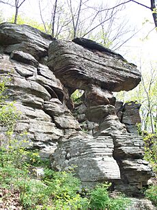
- Worlds End State Park: Here you can see interesting rock formations and a "rock city."
- Ticklish Rock: A unique rock formation near Glen Mawr.
Mountains in Sullivan County
| Name | Height |
| North Mountain | 2,584 ft (788 meters) |
| Huckleberry Mountain | 2,496 ft (761 m) |
| Roundtop | 2,484 ft (757 m) |
| Prospect Hill | 2,140 ft (652 m) |
| Tomkins Corners Vista | 2,110 ft (643 m) |
| High Knob | 2,025 ft (617 m) |
| Bear Mountain | 1,995 ft (608 m) |
| Lovers Rock | 1,995 ft (608 m) |
| Gooseberry Hill | 1,940 ft (591 m) |
| Middle Hill | 1,927 ft (587 m) |
| Camp Mountain | 1,920 ft (585 m) |
| Hogback Hill | 1,923 ft (586 m) |
| Pole Hill | 1,917 ft (584 m) |
| Big Hill | 1,897 ft (578 m) |
| Browns Vista | 1,819 ft (554 m) |
| Lambert Hill | 1,743 ft (532 meters) |
| Warburton Hill | 1,743 ft (531 m) |
| Molyneux Hill | 1,740 ft (530 m) |
| Wright Hill | 1,717 ft (523 m) |
| Shrimp Hill | 1,661 ft (506 m) |
People of Sullivan County
| Historical population | |||
|---|---|---|---|
| Census | Pop. | %± | |
| 1850 | 3,694 | — | |
| 1860 | 5,637 | 52.6% | |
| 1870 | 6,191 | 9.8% | |
| 1880 | 8,073 | 30.4% | |
| 1890 | 11,620 | 43.9% | |
| 1900 | 12,134 | 4.4% | |
| 1910 | 11,293 | −6.9% | |
| 1920 | 9,520 | −15.7% | |
| 1930 | 7,499 | −21.2% | |
| 1940 | 7,504 | 0.1% | |
| 1950 | 6,745 | −10.1% | |
| 1960 | 6,251 | −7.3% | |
| 1970 | 5,961 | −4.6% | |
| 1980 | 6,349 | 6.5% | |
| 1990 | 6,104 | −3.9% | |
| 2000 | 6,556 | 7.4% | |
| 2010 | 6,428 | −2.0% | |
| 2020 | 5,840 | −9.1% | |
| U.S. Decennial Census 1790-1960 1900-1990 1990-2000 2010-2017 2010-2020 |
|||
In 2000, there were 6,556 people living in Sullivan County. The county had 2,660 households. About 95.58% of the people were White. Other groups included Black or African American, Native American, and Asian. About 1.10% of the population was Hispanic or Latino.
Many people in the county have German, Irish, English, American, Polish, or Italian family backgrounds.
The average household had 2.30 people. About 24.20% of households had children under 18. The median age in the county was 43 years old.
2020 Census Information
| Race | Num. | Perc. |
|---|---|---|
| White (NH) | 5,406 | 92.6% |
| Black or African American (NH) | 77 | 1.32% |
| Native American (NH) | 9 | 0.15% |
| Asian (NH) | 17 | 0.3% |
| Pacific Islander (NH) | 0 | 0% |
| Other/Mixed (NH) | 226 | 3.8% |
| Hispanic or Latino | 105 | 1.8% |
Education in Sullivan County
Sullivan County has one school district: Sullivan County School District. This district has two schools. Sullivan County High School teaches grades 7–12 and is in Laporte. Sullivan County Elementary School teaches grades K-6 and is right behind the high school.
Transportation
Public transportation in Sullivan County is provided by BeST Transit.
Sullivan County is one of only two counties in Pennsylvania that does not have any active railroad lines today. However, in the past, several smaller narrow-gauge railroads were used for logging.
Main Roads
 US 220
 PA 42
PA 42 PA 87
PA 87 PA 154
 PA 487
Fun and Recreation
Sullivan County is home to two Pennsylvania state parks:
- Part of Ricketts Glen State Park is in the eastern part of the county.
- Worlds End State Park is near Forksville on Loyalsock Creek.
There is also a large, private hunting club called Painter Den, Inc. It has a pond stocked with perch and pike.
Yearly Events
Sullivan County hosts several fun events each year:
- Dushore Dairy Parade: Held in mid-June, this parade celebrates dairy farming.
- Dushore Founder's Day: In August, this event has fun activities like Outhouse Races and Roll-a-Keg Races. There are also arts, crafts, and food vendors.
- Laporte Fireman's Carnival: Held in August, this carnival has rides and games.
- Sullivan County Fair: In late August and early September, this fair offers carnival rides, games, exhibitions, competitions, and a demolition derby.
Communities in Sullivan County
In Pennsylvania, there are different types of towns. Sullivan County has boroughs and townships.
Boroughs
- Dushore
- Eagles Mere
- Forksville
- Laporte (This is the county seat, the main town.)
Townships
- Cherry
- Colley
- Davidson
- Elkland
- Forks
- Fox
- Hillsgrove
- Laporte
- Shrewsbury
Other Communities
- Bedford Corners
- Beech Glen
- Bernice
- Bethel
- Campbellville
- Cherry Mills
- Colley
- Coveytown
- Eagles Mere Park
- Eldredsville
- Elk Grove (partly in Columbia County)
- Elkland Meeting House
- Emmons
- Estella
- Foley Corner
- Hemlock Grove
- Hillsgrove
- Hugos Corner
- Kinsley Corners
- Lincoln Falls
- Long Brook
- Lopez
- Maple Summit
- McCaroll Corner
- Mildred
- Millview
- Muncy Valley
- Murray
- Nordmont
- Ogdonia
- Ricketts
- Ringdale
- Satterfield
- Shinerville
- Shunk
- Sonestown
- Summit
- Tompkins Corners
- Wheelerville
- Wissingers
Towns by Population (2010)
This table shows the population of the main towns in Sullivan County from the 2010 census.
† county seat
| Rank | City/Town/etc. | Municipal type | Population (2010 Census) |
|---|---|---|---|
| 1 | Dushore | Borough | 608 |
| 2 | Laporte † | Borough | 316 |
| 3 | Forksville | Borough | 145 |
| 4 | Eagles Mere | Borough | 120 |
See also
 In Spanish: Condado de Sullivan (Pensilvania) para niños
 | William L. Dawson |
 | W. E. B. Du Bois |
 | Harry Belafonte |


