Worlds End State Park facts for kids
Quick facts for kids Worlds End State Park |
|
|---|---|
|
IUCN Category III (Natural Monument)
|
|
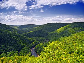
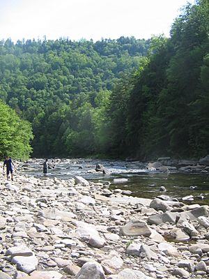
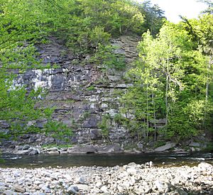
Worlds End State Park and Loyalsock Creek from the Canyon Vista on Cold Run Road
|
|
| Location | Sullivan, Pennsylvania, United States |
| Area | 780 acres (320 ha) |
| Elevation | 1,175 ft (358 m) |
| Established | 1932 |
| Named for | its remote location, or a whirlpool in Loyalsock Creek |
| Governing body | Pennsylvania Department of Conservation and Natural Resources |
Worlds End State Park is a 780-acre state park in Sullivan County, Pennsylvania. It is almost completely surrounded by Loyalsock State Forest. The park is located in the beautiful valley of Loyalsock Creek. You can find it on Pennsylvania Route 154, near the town of Forksville. The name "Worlds End" has been used since at least 1872. Its exact origin is a bit of a mystery. The park was first called "Worlds End State Forest Park" in 1932.
This land was once home to Native Americans. Later, settlers came and cleared the forests for farms and sawmills. The forests you see today are "second growth." This means they grew back after the original trees were cut down. Young men from the Civilian Conservation Corps (CCC) helped replant trees during the Great Depression. They also built many of the park's buildings. These include the cabins, which are now listed on the National Register of Historic Places.
Worlds End State Park is full of different kinds of wildlife. It is also part of an Important Bird Area. The park is in the Endless Mountains region of the Allegheny Plateau. It has a continental climate and rocks from the Carboniferous period. The Pennsylvania Department of Conservation and Natural Resources calls it one of "Twenty Must-See Pennsylvania State Parks." They describe it as a "wild, rugged and rustic area." The park offers fun activities all year round. These include hiking, camping, swimming, and fishing.
Contents
What's in a Name?
An old map from 1872 already showed the name "Worlds End" for this area. It's where Loyalsock Creek makes an S-shaped bend. When Worlds End State Forest Park opened in 1932, its name caused some confusion.
In 1935, a forester named William S. Swingler wrote about the name. He said some people called it "Worlds End," others "Whirl's Glen," and some "Whirls End." The name "Worlds End" came from the landscape. Seven mountain ranges meet here, making it feel like the "ends of the earth." "Whirl's Glen" came from a whirlpool in Loyalsock Creek. "Whirls End" was probably a mix of the two. Since the whirlpool was mostly gone, they decided "Worlds End" was the best name.
But the debate wasn't over! In 1936, the park's name was changed to "Whirls End State Forest Park." People who liked the old name wrote many letters to change it back. Finally, in 1943, the State Geographic Board decided to change it back to "Worlds End State Forest Park." On November 11, 1954, the word "Forest" was dropped. The park officially became "Worlds End State Park." Even today, you might hear "Whirls End" or "Whirls Glen" used to describe the area.
Other ideas for the name's origin exist. One is that an old road along the gorge had a huge drop. This made early travelers feel like they were at the world's end. Another idea is that the area was first called "Huerle's Bend." Over time, people mispronounced it, and it became "World's End." No matter the true origin, "Worlds End State Park" is a unique name in the United States. The apostrophe in "World's" is not part of the official name.
Park History
Native American Life
People have lived in Pennsylvania for at least 12,000 years. The first people were Paleo-Indian hunters who moved from place to place. Later, people started to live in villages and grow crops. They made pottery, used bows and arrows, and built burial mounds.
Worlds End State Park is in the West Branch Susquehanna River area. The first people known to live here were the Susquehannocks. They lived in villages with large longhouses. Their population decreased due to sickness and wars. By 1675, they had either died out or joined other tribes.
After this, the Iroquois tribe controlled the land. They encouraged other tribes, like the Shawnee and Lenape, to settle here. The French and Indian War (1754–1763) caused many Native Americans to move west. In 1768, the land that is now Worlds End State Park was bought by the Province of Pennsylvania. After the American Revolutionary War, most Native Americans left Pennsylvania.
From Horse Trails to Lumber
Early settlers used two horse trails to travel through these mountains. These trails were used until 1895, when Pennsylvania Route 154 was built. Some parts of these old horse trails are still used today. They are called Pioneer Road and Double Run Road. They are now part of the park's hiking trails.
Before Europeans arrived, most of Pennsylvania was covered in thick forests. These forests had white pine, eastern hemlock, and many hardwood trees. Early settlers used timber to build homes and clear land for farming. As more people came, the demand for lumber grew.
By the mid-1800s, the lumber industry reached this area. Loggers cut down the huge white pine and hemlock trees. They sent the logs down Loyalsock Creek to sawmills. The old-growth forests were soon completely cut down. The land was left bare, with only dried tree tops. This caused many fires. In the 1920s, a sawmill was built in the park area. After all the trees were cut, the land became a tangled mess of bushes.
The Civilian Conservation Corps
The history of Worlds End State Park began in 1929. The state started buying land that had been damaged by logging and fires. This was to create a state forest. The land for the park was bought in 1929 and 1931. Worlds End State Park was started in 1932 with a small budget of $50.
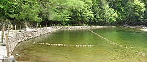
The Civilian Conservation Corps (CCC) was a program started in 1933. It helped young men who were unemployed during the Great Depression. The CCC workers built many of the park's facilities. This included the dam for the swimming area, the cabins, hiking trails, and roads. They even blasted rocks in the creek to create the swimming area.
CCC Camp S-95 opened in 1933. Two big floods hit the area in 1933 and 1936. The 1933 flood badly damaged the new camp. During this flood, two young men from Camp S-95 saved two drowning children. After the 1936 flood, the CCC workers helped clean up and rebuild many bridges and roads. In 1936, the park was made much larger. Camp S-95 closed in 1941.
Historic Cabins
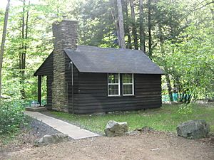
In 1987, the cabins built by the CCC were recognized as important. The "Worlds End State Park Family Cabin District" was added to the National Register of Historic Places. This area includes 19 cabins and three restrooms built by the CCC between 1933 and 1941. These buildings show the quality of work done by the CCC. They used local stones and wood. The buildings were placed to fit in with the park's natural beauty.
Modern Park Life
Since the CCC finished their work in 1941, Worlds End State Park has continued to grow. In 1951, the Loyalsock Trail, which goes through the park, was created. The park became popular outside of Pennsylvania in the 1960s. In 1964, it hosted its first annual whitewater slalom race on Loyalsock Creek.
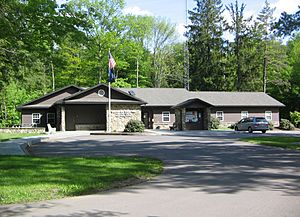
In 2002, a new visitor center and park office was built. This building has space for environmental education programs. It was built using energy-efficient design and recycled materials. In 2003, the park improved its restrooms and cabins.
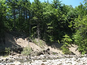
In 2010, heavy rain and melting snow caused flooding. This washed out a bridge and damaged a road in the cabin area. The park was closed for a while for repairs. In 2011, two more floods hit the park from Hurricane Irene and Tropical Storm Lee. These storms caused a lot of damage to roads and bridges. Worlds End State Park was closed for two weeks after the second flood.
Today, the park has modern facilities like a visitor center, restrooms, and camping areas. Worlds End State Park is still one of Pennsylvania's "Twenty Must-See State Parks." It is praised for its wild beauty, camping, hiking, and amazing views.
Geology and Fossils
The land at Worlds End State Park has changed a lot over millions of years. It was once part of a shallow sea's coastline. Mountains to the east slowly wore down, creating layers of clay, sand, and gravel. Over time, this sediment turned into the rocks you see today. These include sandstone, shale, and conglomerates.
The park is on the Allegheny Plateau. This plateau formed about 300 million years ago when two huge landmasses collided. The local area is called the Endless Mountains. But these are not true mountains. Millions of years of erosion have carved deep valleys, making the land look mountainous. Loyalsock Creek has played a big role in forming these valleys. The gorge in the park is about 800 feet deep.
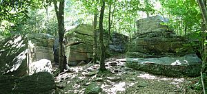
Fossils have been found in Worlds End State Park. This is because the area was once a river delta on an ancient coastline. An ancient ancestor of the lungfish lived here. These fish would burrow in the mud to survive dry periods. Fossils of these burrows have been found in the red siltstone rocks.
Climate and Weather
The Allegheny Plateau has a continental climate. This means it has cold winters and warm summers. In January, the average low temperature is 10°F. In July, the average high temperature is 75°F. The park gets about 42 to 48 inches of rain each year.
Pennsylvania gets a lot of acid rain. Loyalsock Creek flows through a region with rocks that don't easily neutralize acid. This makes the creek vulnerable to acid rain. Acid rain can harm the plants and animals in the creek. The highest temperature recorded at the park was 104°F in 1936. The lowest was -27°F in 1994. July is usually the hottest month, January is the coldest, and June is the wettest.
| Climate data for Worlds End State Park | |||||||||||||
|---|---|---|---|---|---|---|---|---|---|---|---|---|---|
| Month | Jan | Feb | Mar | Apr | May | Jun | Jul | Aug | Sep | Oct | Nov | Dec | Year |
| Mean daily maximum °F (°C) | 32 (0) |
36 (2) |
44 (7) |
58 (14) |
68 (20) |
76 (24) |
81 (27) |
79 (26) |
71 (22) |
60 (16) |
48 (9) |
37 (3) |
58 (14) |
| Mean daily minimum °F (°C) | 14 (−10) |
16 (−9) |
23 (−5) |
33 (1) |
42 (6) |
52 (11) |
56 (13) |
55 (13) |
47 (8) |
35 (2) |
29 (−2) |
20 (−7) |
35 (2) |
| Average precipitation inches (mm) | 2.59 (66) |
2.26 (57) |
3.15 (80) |
3.58 (91) |
3.42 (87) |
4.22 (107) |
3.66 (93) |
3.63 (92) |
3.90 (99) |
3.49 (89) |
3.38 (86) |
2.89 (73) |
40.17 (1,020) |
| Source: The Weather Channel | |||||||||||||
Wildlife and Birds
Worlds End State Park has lots of forest cover. This makes it a great home for "big woods" wildlife. You might see white-tailed deer, black bears, wild turkeys, and squirrels. Less common animals like bobcats, coyotes, and timber rattlesnakes also live here. Loyalsock Creek is home to native brook trout and black bass.
Bird watchers have seen over 200 species of birds in the park. These include the great blue heron and white-throated sparrow. Rare breeding birds like the northern goshawk also live here. The park and surrounding forest are part of Pennsylvania Important Bird Area #42. This area is important for protecting bird populations. It is home to the ruffed grouse, which is Pennsylvania's state bird.
Other birds you might see include common mergansers along the creek. You could also spot belted kingfishers, barred owls, and the hard-to-find northern saw-whet owls. Many different kinds of warblers also breed in the park. These bird populations are typical of old forests with hemlock and hardwood trees.
Fun Activities
Hiking Trails
Worlds End State Park has over 20 miles of hiking trails. Many trails are rocky and steep. So, it's important to wear good shoes. Be ready for icy conditions in winter. The park is open in winter for snowmobiling and cross-country skiing. Most trails are too steep for these activities, but park roads are open.
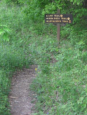
- Loyalsock Trail (LT): This is a rugged 59.28-mile hiking trail. It follows the ridges and streams of the Loyalsock Creek area. The trail is mostly in Loyalsock State Forest. It uses old logging roads and abandoned railroad paths.
- Link Trail: This is a moderate 8.5-mile trail. It starts at the Cabin Bridge in the park and follows Loyalsock Creek. It then goes up to Canyon Vista. You can connect to the Loyalsock Trail to make a longer loop.
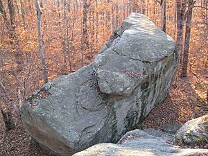
- Canyon Vista Trail: This is a 3.5-mile loop trail. It goes through the eastern part of the park and a forest of ash, sugar maple, and black cherry trees. This trail passes a rocky area called the Rock Garden. Canyon Vista is at 1,750 feet high and gives amazing views of the Loyalsock Creek gorge.
- Worlds End Trail: This 3.25-mile trail starts at the park office. It climbs to a view of the swimming area. It crosses an old road used by early settlers. You can connect to the Loyalsock Trail for an 11.5-mile loop.
- Butternut Trail: This 2.5-mile trail loops through a hardwood forest. It crosses Butternut Run.
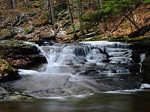
- Double Run Nature Trail: This is an easy 1.2-mile loop trail. It goes through woodlands along Double Run. You can see wildflowers like Jack-in-the-pulpit and wild ginger. It also passes a small waterfall.
- High Rock Trail: This 1.0-mile trail passes a waterfall on High Rock Run. It's a steep trail that climbs to a great view. A part of this trail was moved for safety because it was too close to cliffs.
Fishing, Hunting, and Whitewater
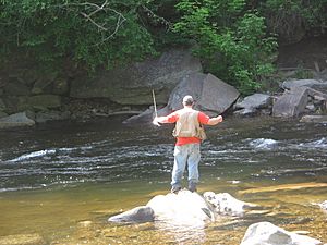
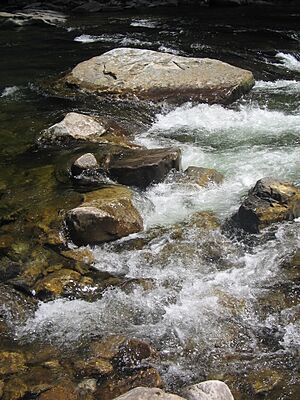
Loyalsock Creek is known for its rushing waters. The creek and its tributary, Double Run, are approved for trout fishing. This means they are stocked with trout during fishing season. Hunting is allowed on about half of the park's land. Hunters must follow the rules of the Pennsylvania Game Commission. You can hunt ruffed grouse, squirrels, turkey, deer, and bears.
Loyalsock Creek is also a favorite for whitewater paddlers. The section of the creek in the park is exciting. It has rapids that need your attention. There's even a special chute for boats through the swimming area dam. The best time for whitewater boating is from March to May. The park hosts a slalom race on the creek every spring. The water is too fast for open canoes, so kayaks are recommended. The swimming area is closed to boats in the summer.
Cabins, Camping, and Swimming
Camping is very popular at Worlds End State Park. The rustic cabins are a favorite for many visitors. The park has three options for staying overnight. There are 19 rustic cabins. Each has a refrigerator, stove, fireplace, table, and beds. There is also a 70-site tent and camper campground. Some campsites have electric hook-ups. There are also three group tenting areas for up to 90 campers.
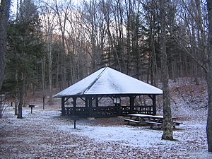
The picnic and swimming areas are next to each other. There are many picnic tables and pavilions for day visitors. The Civilian Conservation Corps built a 7-foot tall dam on Loyalsock Creek. This created a 1-acre swimming area. Since 2008, there are no lifeguards on duty at the park.
Nearby State Parks
Other state parks close to Worlds End State Park include:
- Mount Pisgah State Park (Bradford County)
- Ricketts Glen State Park (Columbia, Luzerne, and Sullivan Counties)
- Susquehanna State Park (Lycoming County)
See also
 In Spanish: Parque estatal del Fin del Mundo para niños
 | John T. Biggers |
 | Thomas Blackshear |
 | Mark Bradford |
 | Beverly Buchanan |


