Southwest Territory facts for kids
Quick facts for kids Territory South of the River Ohio |
|||||||||
|---|---|---|---|---|---|---|---|---|---|
| Organized incorporated territory of United States | |||||||||
| 1790–1796 | |||||||||
|
Flag
|
|||||||||
 |
|||||||||
| Capital | Rocky Mount (1790–92) Knoxville (from 1792) |
||||||||
| Population | |||||||||
|
• 1791
|
35,691 | ||||||||
|
• 1795
|
77,262 | ||||||||
| Government | |||||||||
| • Type | Organized incorporated territory | ||||||||
| Governor | |||||||||
|
• 1790–1796
|
William Blount | ||||||||
| Secretary | |||||||||
|
• 1790–1796
|
Daniel Smith | ||||||||
| Legislature | Territorial Assembly | ||||||||
|
• Upper chamber
|
Territorial Council | ||||||||
|
• Lower chamber
|
House of Representatives | ||||||||
| History | |||||||||
|
• Ceded by North Carolina
|
2 April 1790 | ||||||||
|
• Southwest Ordinance
|
May 26, 1790 | ||||||||
|
• House convened
|
February 24, 1794 | ||||||||
|
• Full Assembly convened
|
August 26, 1794 | ||||||||
| 1 June 1796 | |||||||||
|
|||||||||
The Southwest Territory was a special area of land in the United States. It was officially called the Territory South of the River Ohio. This territory existed from May 26, 1790, until June 1, 1796. On that date, it became the state of Tennessee.
The Southwest Territory was created from land that North Carolina had given to the U.S. government. William Blount was the only governor of this territory. Before it became a territory, people living there had tried to form their own governments. One famous attempt was the State of Franklin.
The people in the territory hoped the U.S. government would protect them better from conflicts with Native American tribes. Many important figures in Tennessee's early history, like John Sevier and Andrew Jackson, were part of the Southwest Territory's government.
Contents
How the Southwest Territory Began
| Historical population | ||
|---|---|---|
| Year | Pop. | ±% |
| 1770 | 1,000 | — |
| 1780 | 10,000 | +900.0% |
| 1790 | 35,691 | +256.9% |
| Source: 1770–1780; 1790 | ||
Long ago, the land that became the Southwest Territory was part of North Carolina. However, the Blue Ridge Mountains made it hard for North Carolina to control this far-off area. Early settlers and traders often came from Virginia and South Carolina.
In 1772, settlers living near the Watauga River formed their own government called the Watauga Association. They leased land from the Cherokee people. A trading post, Fort Watauga, was built at Sycamore Shoals.
In 1775, a land buyer named Richard Henderson met with Cherokee leaders. They signed the "Treaty of Sycamore Shoals". Henderson bought a huge area of land, about 20 million acres. This land was called the Transylvania Purchase. However, this land deal was against the law. Both North Carolina and Virginia did not approve of it.
When the American Revolutionary War started in 1776, these settlers supported the American side. They organized themselves into the "Washington District". In July 1776, some Cherokee groups, who were against the land sale, attacked the Watauga settlements. After the settlers fought them off, North Carolina finally agreed to include the settlements as the Washington District.
In 1780, a group of settlers known as the Overmountain Men gathered at Sycamore Shoals. They marched to South Carolina and helped defeat a British-allied force at the Battle of Kings Mountain.
In 1784, North Carolina voted to give up control of these western settlements. Some settlers then formed the State of Franklin and tried to become a state. John Sevier was their governor. But not all settlers agreed, and there were conflicts. By 1789, the State of Franklin had rejoined North Carolina.
Forming the Territory
North Carolina officially joined the United States in November 1789. In December, the state decided to give its western lands to the new U.S. government. This was to help pay what it owed.
On April 2, 1790, the U.S. Congress accepted this land. On May 26, 1790, Congress created the "Territory of the United States South of the River Ohio." This territory mostly covered what is now Tennessee.
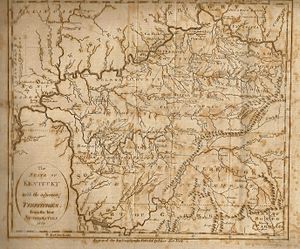
The new territory was governed much like the Northwest Territory, which was north of the Ohio River. However, the rule against slavery in the Northwest Ordinance did not apply to the Southwest Territory. The rules also explained how a territory could become a state. First, it needed a government. Then, with 5,000 adult males, it could have a legislature. Finally, with 60,000 people, it could write a state constitution and join the U.S.
President George Washington chose William Blount to be the territory's governor on June 8, 1790. Blount was a strong supporter of western settlers. Daniel Smith was appointed as the territory's Secretary. John Sevier and James Robertson were made generals of the local militias.
In September 1790, Governor Blount set up a temporary capital at Rocky Mount. He also helped start a newspaper, the Knoxville Gazette. Blount traveled across the territory, appointing people to government and militia jobs.
Blount wanted the permanent capital to be where the Clinch and Tennessee rivers meet. But he couldn't get the Cherokee to give up that land. So, he chose James White's Fort instead. In 1791, this new city was planned and named "Knoxville" after Henry Knox, who was in charge of the War Department.
In the 1790 United States census, the Southwest Territory had a population of 35,691 people.
Conflicts with Native American Tribes
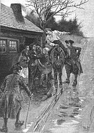
The settlers in the Southwest Territory hoped the U.S. government would protect them from Native American attacks. However, the U.S. government was also busy with other areas. Much of the land was still controlled by Native American tribes.
President Washington tried to prevent settlers from moving onto Native American lands. Secretary of War Knox often said settlers were illegally taking land. Governor Blount had a difficult job. He had to keep the settlers happy while also following the government's rules.
In 1791, Blount signed the Treaty of Holston with the Cherokee. This treaty gave the U.S. control over lands south of the French Broad River. It also allowed a road to connect different parts of the territory. The next year, Blount made an agreement with the Chickasaw tribe about land boundaries.
Despite these agreements, settlers continued to move onto Native American lands. This led to attacks, mainly from the Chickamauga Cherokee and Creek Indians. The Spanish, who controlled Florida, also encouraged and armed these tribes.
Attacks continued through 1792 and 1793. Settlements near Nashville were hit hard. Secretary of War Knox did not want to authorize a full invasion of Native American territory.
In September 1793, while Governor Blount was away, acting governor Daniel Smith ordered the militia to invade Cherokee land. General Sevier led the militia and destroyed several Chickamauga villages. This angered Knox, who refused to pay the militiamen. In 1794, James Ore led a force that destroyed the Chickamauga towns of Nickajack and Running Water.
After a major defeat of northern tribes in 1794 and the destruction of Nickajack and Running Water, attacks decreased. In November 1794, Blount negotiated an end to the Cherokee–American wars at the Tellico Blockhouse.
Becoming a State
A count in 1791 showed the territory had 35,691 people. This included 6,271 free adult white males. This was more than the 5,000 needed to form a legislature. Governor Blount waited until 1793 to call for elections.
The first House of Representatives met on February 24, 1794. They chose ten people for the territorial council. President Washington appointed five of them, including John Sevier. The full assembly met on August 26, 1794. They immediately pushed for statehood.
The assembly appointed James White as their representative in Congress. This was one of the first times a U.S. territory used this power. In June 1795, another count was taken. It showed a population of 77,262 people. This was more than the 60,000 needed for statehood.
The territory quickly moved to become a state. In December 1795, delegates were elected for a state constitution meeting. This meeting took place in Knoxville in January 1796. They wrote a new state constitution. They chose the name "Tennessee" for the new state. This name had been used since 1793.
The rules for becoming a state were not very clear. So, Tennessee's leaders went ahead and formed a state government. John Sevier was elected governor. The first Tennessee General Assembly met in March 1796. Governor Blount told the U.S. Secretary of State that the territorial government was ending.
Joseph McMinn, a future governor, delivered a copy of the new state constitution. William Blount and William Cocke were chosen as the state's U.S. Senators. Andrew Jackson was elected as the state's representative.
Since the Southwest Territory was the first federal territory to ask to join the Union, Congress was a bit confused. But on June 1, 1796, Tennessee was admitted as the 16th state.
Land and Districts
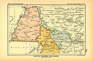
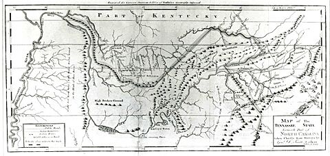
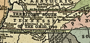
The Southwest Territory covered about 43,000 square miles (110,000 km²). This is roughly the size of modern Tennessee. To its north was Kentucky, which became a state in 1792. The lands to the south were claimed by Georgia or disputed with Spain. These later became part of the Mississippi Territory.
When it was created in 1790, the Southwest Territory had two main parts. The Washington District was in the northeast. The Mero District was around Nashville. Most of the rest of the territory was still controlled by Native American tribes. The Cherokee were in the east, and the Chickasaw were in the west.
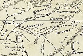
The Washington District included lands north of the French Broad River. The 1791 Treaty of Holston moved the boundary further south. This district originally had four counties: Washington, Sullivan, Greene, and Hawkins. Governor Blount created Knox and Jefferson counties in 1792. He then grouped these new counties into a "Hamilton District." Later, Blount and Sevier counties were added.
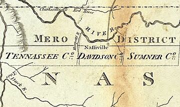
The Mero District included lands around Nashville and along the Cumberland River. It had three counties: Davidson, Sumner, and Tennessee. A road called Avery's Trace connected the Mero and Washington districts.
In 1791, the Southwest Territory had 35,691 people. This included 3,417 enslaved people and 361 free people of color. The Washington District had 28,649 people, and the Mero District had 7,042. By 1795, the total population grew to 77,262. This included 10,613 enslaved people and 973 free people of color.
See also
 In Spanish: Territorio del Suroeste para niños


