Vail, Colorado facts for kids
Quick facts for kids
Vail, Colorado
|
|||
|---|---|---|---|
|
Town
|
|||
|
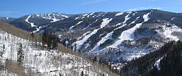
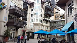
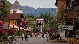
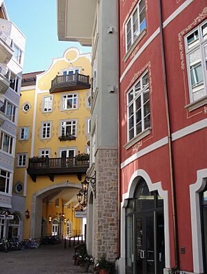
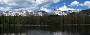
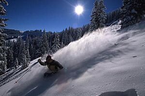
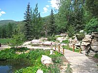
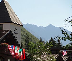
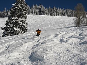
Top to bottom: Vail Ski Resort, Lionshead district, Vail village
|
|||
|
|||
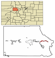
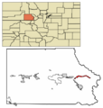
Location of Vail in Eagle County, Colorado
|
|||
| Country | United States | ||
| State | Colorado | ||
| County | Eagle | ||
| Incorporated | August 23, 1966 | ||
| Government | |||
| • Type | Home rule municipality | ||
| Area | |||
| • Total | 4.72 sq mi (12.23 km2) | ||
| • Land | 4.71 sq mi (12.19 km2) | ||
| • Water | 0.01 sq mi (0.04 km2) | ||
| Elevation | 8,239 ft (2,511 m) | ||
| Population
(2020)
|
|||
| • Total | 4,835 | ||
| • Density | 1,024.4/sq mi (395.34/km2) | ||
| Time zone | UTC−7 (MST) | ||
| • Summer (DST) | UTC−6 (MDT) | ||
| ZIP code |
81657
|
||
| Area code(s) | 970 | ||
| FIPS code | 08-80040 | ||
| GNIS feature ID | 2413415 | ||
| Website | Town of Vail | ||
Vail is a town in Eagle County, Colorado, United States. It's known for being home to Vail Ski Resort, which is the largest ski mountain in Colorado. The town is also famous for its many hotels, restaurants, and fun events held every year. Some of these events include the Vail Film Festival and Bravo! Vail. In 2020, about 4,835 people lived in Vail.
Contents
History of Vail
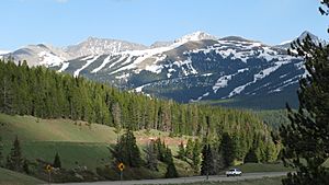
Vail became an official town in 1966. This was four years after the Vail Ski Resort first opened. The ski area was started by Pete Seibert and a local rancher named Earl Eaton in 1962. It was built at the base of Vail Pass. The pass itself was named after Charles Vail, an engineer who planned a highway route through the Eagle Valley in 1940.
Pete Seibert was a soldier in the U.S. Army's 10th Mountain Division during World War II. This group trained at Camp Hale, which is south of Vail. Seibert was hurt in Italy but later became a professional skier.
After the war, Seibert and other former soldiers from the 10th Mountain Division wanted to open a ski resort in Colorado. Seibert had camped on Vail Mountain during his training and thought it would be a perfect place for skiing. In the early 1960s, he got money from investors and, with Earl Eaton, bought land at the mountain's base. They formed a company called Vail Associates.
Vail officially opened for its first ski season in December 1962. It had a gondola lift and two other ski lifts. A village was built at the mountain's base for people living there and for visitors. The town quickly grew, with more homes added in different areas. By 1969, Vail was the most popular ski resort in Colorado. In 1988, Vail added China Bowl, making it one of the largest ski areas in North America.
Geography of Vail
Vail is located high up in the mountains, about 8,150 feet (2,484 meters) above sea level. The town covers about 4.5 square miles (12 square kilometers). A stream called Gore Creek flows through the middle of the town.
The town is surrounded by the White River National Forest. The land for the Vail Ski Resort is rented from the United States Forest Service. You can even see Mount of the Holy Cross from Vail Mountain.
Vail Mountain: A Skiing Paradise
Vail Mountain starts at 8,120 feet (2,475 meters) and goes up to 11,570 feet (3,527 meters). This means it has a vertical drop of 3,450 feet (1,052 meters).
The mountain has a huge skiable area of 5,289 acres (2,140 hectares). There are 33 ski lifts and 193 marked trails for skiing. These trails are on three different sides of the mountain: the front side, the back bowls, and Blue Sky Basin.
The seven back bowls are named Sun Down Bowl, Sun Up Bowl, Teacup Bowl, China Bowl, Siberia Bowl, Inner Mongolia Bowl, and Outer Mongolia Bowl. Blue Sky Basin has Pete's Bowl and Earl's Bowl, named after the founders, Pete Seibert and Earl Eaton. Besides skiing, the resort also has 17 miles (27 kilometers) of paths for walking, beautiful gardens, and an outdoor theater.
Climate and Weather in Vail
Vail has warm summers and cold winters because it's so high up. From late September to late May, the temperatures usually stay below freezing at night. The town gets about 200 inches (5 meters) of snow each winter. Sometimes, heavy snow can even close roads.
Summer temperatures can reach the 80s Fahrenheit (around 27-30 degrees Celsius). However, they are usually in the mid to high 70s Fahrenheit (around 24-26 degrees Celsius). Mountain breezes make the summers feel cool and refreshing.
| Climate data for Vail, Colorado, 1991–2020 normals, extremes 1985–present | |||||||||||||
|---|---|---|---|---|---|---|---|---|---|---|---|---|---|
| Month | Jan | Feb | Mar | Apr | May | Jun | Jul | Aug | Sep | Oct | Nov | Dec | Year |
| Record high °F (°C) | 51 (11) |
55 (13) |
66 (19) |
74 (23) |
82 (28) |
91 (33) |
95 (35) |
92 (33) |
86 (30) |
78 (26) |
66 (19) |
51 (11) |
95 (35) |
| Mean maximum °F (°C) | 40.9 (4.9) |
45.6 (7.6) |
55.0 (12.8) |
64.1 (17.8) |
74.4 (23.6) |
81.1 (27.3) |
84.6 (29.2) |
82.2 (27.9) |
77.0 (25.0) |
68.5 (20.3) |
52.7 (11.5) |
41.0 (5.0) |
85.0 (29.4) |
| Mean daily maximum °F (°C) | 28.5 (−1.9) |
33.0 (0.6) |
41.7 (5.4) |
49.4 (9.7) |
60.4 (15.8) |
71.4 (21.9) |
76.7 (24.8) |
74.0 (23.3) |
66.6 (19.2) |
54.1 (12.3) |
37.7 (3.2) |
28.0 (−2.2) |
51.8 (11.0) |
| Daily mean °F (°C) | 17.5 (−8.1) |
21.1 (−6.1) |
29.2 (−1.6) |
36.6 (2.6) |
45.7 (7.6) |
53.5 (11.9) |
59.2 (15.1) |
57.4 (14.1) |
50.3 (10.2) |
39.7 (4.3) |
26.4 (−3.1) |
17.6 (−8.0) |
37.9 (3.2) |
| Mean daily minimum °F (°C) | 6.6 (−14.1) |
9.2 (−12.7) |
16.7 (−8.5) |
23.8 (−4.6) |
31.0 (−0.6) |
35.6 (2.0) |
41.6 (5.3) |
40.8 (4.9) |
34.0 (1.1) |
25.2 (−3.8) |
15.1 (−9.4) |
7.1 (−13.8) |
23.9 (−4.5) |
| Mean minimum °F (°C) | −10.3 (−23.5) |
−7.5 (−21.9) |
−0.1 (−17.8) |
10.7 (−11.8) |
20.9 (−6.2) |
28.3 (−2.1) |
34.8 (1.6) |
34.4 (1.3) |
24.3 (−4.3) |
10.9 (−11.7) |
−2.9 (−19.4) |
−9.0 (−22.8) |
−12.9 (−24.9) |
| Record low °F (°C) | −21 (−29) |
−32 (−36) |
−16 (−27) |
−1 (−18) |
14 (−10) |
20 (−7) |
22 (−6) |
22 (−6) |
14 (−10) |
−6 (−21) |
−16 (−27) |
−22 (−30) |
−32 (−36) |
| Average precipitation inches (mm) | 1.98 (50) |
2.01 (51) |
1.76 (45) |
2.41 (61) |
2.00 (51) |
1.24 (31) |
1.77 (45) |
1.75 (44) |
1.96 (50) |
1.83 (46) |
2.00 (51) |
1.73 (44) |
22.44 (569) |
| Average snowfall inches (cm) | 35.3 (90) |
35.7 (91) |
28.2 (72) |
21.2 (54) |
4.8 (12) |
0.6 (1.5) |
0.0 (0.0) |
0.0 (0.0) |
0.9 (2.3) |
8.6 (22) |
25.9 (66) |
28.0 (71) |
189.2 (481.8) |
| Average extreme snow depth inches (cm) | 33.3 (85) |
38.4 (98) |
34.8 (88) |
20.9 (53) |
6.1 (15) |
0.5 (1.3) |
0.0 (0.0) |
0.0 (0.0) |
0.6 (1.5) |
4.3 (11) |
12.9 (33) |
22.3 (57) |
38.8 (99) |
| Average precipitation days (≥ 0.01 in) | 12.1 | 11.5 | 9.7 | 9.4 | 9.2 | 6.9 | 10.0 | 11.0 | 9.1 | 7.2 | 9.5 | 10.9 | 116.5 |
| Average snowy days (≥ 0.1 in) | 12.0 | 11.7 | 9.2 | 7.9 | 2.4 | 0.3 | 0.0 | 0. | 0.6 | 3.5 | 8.9 | 10.7 | 67.2 |
| Source 1: NOAA | |||||||||||||
| Source 2: National Weather Service | |||||||||||||
People and Economy of Vail
| Historical population | |||
|---|---|---|---|
| Census | Pop. | %± | |
| 1970 | 484 | — | |
| 1980 | 2,261 | 367.1% | |
| 1990 | 3,659 | 61.8% | |
| 2000 | 4,531 | 23.8% | |
| 2010 | 5,305 | 17.1% | |
| 2020 | 4,835 | −8.9% | |
| U.S. Decennial Census 2020 | |||
In 2020, there were 4,835 people living in Vail. Most people in Vail are White (86.33%). About 10.34% of the population identified as Hispanic or Latino.
The average age of people in Vail was 50.2 years old. Many adults in Vail have a college degree. The median income for families was about $127,336 per year.
Vail's Tourism-Driven Economy
Vail's economy mostly depends on tourism. In winter, people come for skiing, snowboarding, snowmobiling, and snowshoeing. In summer, Vail is a popular spot for golfing. Other summer activities include guided hikes, mountain biking, horseback riding, and fishing.
Vail is also becoming a place for arts and culture. Many art and music events happen during the summer. The town also has many different restaurants.
Houses in Vail are very expensive, with the average price being over $1 million. This high cost makes it hard for workers to find affordable places to live.
Culture and Events in Vail
Vail hosts many exciting events and has interesting places to visit.
Notable Annual Events
- Bravo! Vail: A music festival featuring famous orchestras like the New York Philharmonic Orchestra.
- Vail Film Festival: An annual film festival held in March or early April.
- Vail International Dance Festival: A summer dance festival with major ballet and modern dance companies.
- Vail Lacrosse Shootout: A lacrosse tournament held in late June and early July.
- Vail Summer Bluegrass Series: Free bluegrass concerts in Lionshead Village during June and July.
- Taste of Vail: A food and wine event held in the first week of April.
- Burton US Open Snowboarding Championships: A major snowboarding competition.
Museums and Important Places
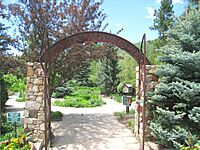
- Betty Ford Alpine Gardens: The highest botanical gardens in the world.
- Colorado Ski Museum: A museum about the history of skiing in Colorado.
- The Steadman Clinic & Steadman Philippon Research Institute: A famous sports medicine clinic and research center.
- Vail Health Hospital: The local hospital.
- Vail Ski Resort: The main attraction for winter sports.
- Vail Nature Center: A place to learn about the local environment.
Education in Vail
Vail's public schools are part of the Eagle County School District RE-50. High school students usually go to Battle Mountain High School in Edwards. The school district also has the Vail Ski & Snowboard Academy. This program is for students in grades 5–12 who are competitive skiers and snowboarders.
There are also private schools in the Vail area. These include Vail Mountain School, Vail Christian High School, St. Clare of Assisi Catholic School, and the Vail Academy. For higher education, students can attend the Vail Valley campus of Colorado Mountain College in Edwards.
Media in Vail
The local newspaper in Vail is the Vail Daily. You can also listen to public radio station KUNC at 99.7 FM.
Vail has two special TV networks: Plum TV and Resort Sports Network (known as TV-8). In the mid-1970s, Vail was sometimes called the "Western White House." This was because President Gerald Ford often worked from The Lodge at Vail hotel. News channels would show pictures of Vail's mountains, making the town famous.
Transportation in Vail
Vail is served by Eagle County Airport, which is about 30 miles (48 kilometers) to the west. The town of Vail is designed like European ski towns, where people often walk instead of drive. Parts of Vail are even car-free.
Vail has the largest free shuttle bus system in the United States. It uses hybrid-electric buses. At each bus stop, signs tell you when the next buses will arrive. The In-Town Shuttle runs very often, especially during winter. Other bus routes connect to East and West Vail.
Eagle County also provides bus service from Vail to other nearby towns. The Colorado Department of Transportation offers intercity bus service to Vail through its Bustang program. This bus line connects Denver to Grand Junction.
Major Highways Serving Vail
Interstate 70 is the main highway that runs through Vail. It's the only road that goes into and out of the town. From the east, I-70 comes from Denver, which is about 97 miles (156 kilometers) away. It passes through the Eisenhower Tunnel and over the Continental Divide. To the west, I-70 goes through towns like Avon and Eagle, then through Glenwood Canyon on its way to Grand Junction.
Notable People from Vail
Many interesting people have lived in or are connected to Vail:
- Joanna Cameron, actress
- Toby Dawson, Olympic skier
- Rob Eaton, musician
- Laurence D. Fink, businessman
- Betty Ford, Former First Lady of the United States
- Gerald Ford, Former President of the United States
- John Glenn, astronaut and politician
- James Hetfield, musician
- Buddy Lazier, auto racing driver
- Flinn Lazier, auto racing driver and skier
- Brad Ludden, kayaker
- Seth Morrison, skier
- Tracee Metcalfe, alpinist and physician
- Sarah Schleper, Olympic skier
- Mikaela Shiffrin, Olympic skier
- Richard Steadman, surgeon
- Oscar Tang, financier
- Katie Uhlaender, Olympic skeleton racer
- Lindsey Vonn, Olympic skier
Sister City
Vail has one sister city, which helps build friendships between different places:
 St. Moritz, Grisons, Switzerland
Images for kids
See also
 In Spanish: Vail para niños
 | Toni Morrison |
 | Barack Obama |
 | Martin Luther King Jr. |
 | Ralph Bunche |


