Yorubaland facts for kids
Quick facts for kids
Yorubaland
Ilẹ̀ Káàárọ̀-Oòjíire
Southwest Nigeria, Southeast & Central Benin, East-Central Togo
|
|
|---|---|
|
Cultural region
|
|
| Yorubaland | |
| Nickname(s):
Ilẹ̀ Oòduà
|
|

Location of Yorubaland (green)
in West Africa (white) |
|
| Part of | |
| Earliest dated Ifẹ̀ artefact | 500 BCE |
| - Oyo Empire | 1300 |
| - British Colony | 1862 |
| - French Colony | 1872 |
| - Dahomey (Now Benin) | 1904 |
| - Nigeria | 1914 |
| Founded by | PYIG (Proto Yoruba-Itsekiri-Igala) |
| Regional capital | •Oyo (Political) •Ilẹ̀-Ifẹ̀ (Cultural/Spiritual) •Lagos/Eko (Economic) |
| Former seat | • Oyo-Ile (Old Political and Former Capital of Oyo Empire) |
| Composed of | |
| Government | |
| • Type | Monarchies • Oba (King) • Ògbóni (Legislature) • Olóye (Chiefs) • Balógun (Generalissimo) • Baálẹ̀ (Village/Regional heads in Western Yorubaland) • Ọlọja (Village/Regional heads in Eastern Yorubaland) |
| Highest elevation | 1,055 m (3,461 ft) |
| Lowest elevation | -0.2 m (-0.7 ft) |
| Population
(2015 estimate)
|
|
| • Total | ~ 55 million |
| • Density | 387/km2 (1,000/sq mi) |
| In Nigeria, Benin and Togo | |
| Demographics | |
| • Language | Yoruba |
| • Religion | Christianity, Islam, Yoruba religion |
| Time zone | WAT (Nigeria, Benin), GMT (Togo) |
Yorubaland (Yoruba: Ilẹ̀ Káàárọ̀-Oòjíire) is the traditional home of the Yoruba people in West Africa. It is a cultural region that stretches across parts of modern-day Nigeria, Togo, and Benin. This area covers about 142,114 square kilometers. Most of Yorubaland, about 74.6%, is in Nigeria. The rest is in Benin (18.9%) and Togo (6.5%). Before European countries took control, parts of this land were known as "Yoruba country." Today, about 55 million people live here, and most of them are ethnic Yorubas.
Contents
Geography of Yorubaland
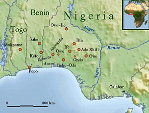
Yorubaland stretches from the Gulf of Guinea in the south, going west from the Niger River into Benin and Togo. In the north, it starts near Lokoja and continues for about 610 kilometers to the Ogou River in Togo. In the south, it begins west of the Benin and Osse rivers and goes about 280 kilometers to Porto-Novo.
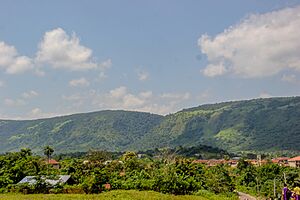
The land has different features. In the south, you find mangrove forests, estuaries, and flat coastal areas. As you go north, the land rises into rolling hills and a rugged highland area. This is often called the Yorubaland plateau or Western upland. The highlands are very noticeable in the Ekiti area, especially around the Effon ridge and the Okemesi fold belt. These areas have heights over 732 meters (2,400 feet) and feature many waterfalls and springs. Examples include Olumirin waterfall and Arinta waterfall. The highest point is at the Idanre Inselberg Hills, which are over 1,050 meters high. Generally, the inland areas have wavy land with occasional inselbergs, which are isolated hills that stick out from the flat landscape. Some of these include Okeagbe hills (790m) and Olosunta in Ikere Ekiti (690m).
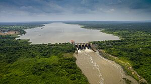
Yorubaland has many large rivers and streams. These rivers flow in two main directions. Some flow south into lagoons, estuaries, and creeks that lead to the Atlantic Ocean. Others flow north into the Niger River. Rivers flowing south include the Osun River, Ogun River, and Ouémé River. Rivers flowing north into the Niger include the Moshi river and Oshin.
The Nigerian part of Yorubaland includes today's Ọyọ, Ọṣun, Ogun, Kwara, Ondo, Ekiti, Lagos, and parts of Kogi. The part in Benin includes several departments like Ouémé Department and Plateau Department. The Togolese parts are in the Plateaux Region and Centrale Region.
Vegetation and Climate
The weather in Yorubaland changes from north to south. The southern, central, and eastern parts have a tropical high forest climate. This area is known as the Nigerian lowland forests. The plants here are thick, closed-canopy forests with many types of hardwood trees. Some common trees are Milicia excelsa (iroko), Antiaris africana, and Terminalia superba (afara). Some trees like Tectona grandis (teak) and Gmelina arborea have been planted in large forest farms.
The coastal areas have swampy flats with plants like mangroves, palms, and coconut trees on the beaches. This area covers most of Ondo, Ekiti, Ogun, Osun, and Lagos states. It gets a lot of rain, with two peak periods: March to July and September to November. For example, Ijebu Ode gets about 2,020 millimeters (80 inches) of rain each year. This region is important for growing cocoa, natural rubber, kola nut, and oil palm. It is also a place where a lot of wood is cut. Ondo, Ekiti, and Osun states are the top cocoa producers in Nigeria.
The northern and western parts of the region have a tropical woodland savanna climate, with one main rainy season. This area includes northern Oyo, northwestern Ogun, Kwara, Kogi, and parts of Benin and Togo. It is a transition zone between the coastal forests and the inner savannas of West Africa. Some parts of this region used to be forest but lost their trees due to farming and other land uses. Annual rainfall here is between 1,100 and 1,500 millimeters (43 and 59 inches). Trees found here include Blighia sapida (ackee) and Parkia biglobosa (locust bean tree).
After the rainy season, a drier period follows. This is when the harmattan winds blow from the Sahara Desert. These cold, dusty winds affect most areas, except a small part of the southern coast.
Major Cities and Towns
|
Largest cities or towns in Yorubaland
2016-2018 Estimates |
||
|---|---|---|
| Rank | Pop. | |
| 1 | Èkó (Metropolis) | 23,437,435 |
| 2 | Ìbàdàn | 3,675,000 |
| 3 | Ìlọrin | 1,120,000 |
| 4 | Ìkòròdú | 1,005,551 |
| 5 | Òṣogbo (Conurbation) | 820,000 |
| 6 | Abẹ́òkúta | 777,000 |
| 7 | Ifọ̀-Àkútè-Ìjòkó (Conurbation) | 750,000 |
| 8 | Ọ̀tà | 733,400 |
| 9 | Ilé-Ifẹ̀ | 701,100 |
| 10 | Àkúrẹ́ | 662,800 |
Administrative Divisions
Yorubaland is divided into different administrative areas across Nigeria, Benin, and Togo. Here's a look at some of these divisions:
| Yorubaland | |||||||
| Country | |
|||||||
|---|---|---|---|---|---|---|---|
| State | Area (km2) | Regional capital | Largest city | 2nd largest city | |||
| Ekiti State | 6,353 | Ado Ekiti | Ado Ekiti | Ikere-Ekiti | |||
| Kogi State | 9,351 | Lokoja | Kabba | Isanlu | |||
| Kwara State | 17,000 | Ilorin | Ilorin | Offa | |||
| Lagos State | 3,345 | Ikeja | Alimosho | Ikorodu | |||
| Ogun State | 16,762 | Abeokuta | Otta-Ijoko-Ifo | Abeokuta | |||
| Ondo State | 15,500 | Akure | Akure | Ondo, okitipupa | |||
| Osun State | 9,251 | Oshogbo | Oshogbo | Ile-Ife, Ilesha | |||
| Oyo State | 28,454 | Ibadan | Ibadan | Oyo, Ogbomosho | |||
| Area = 106,016 km2 | |||||||
| Country | |
|||||||
| Department | Area (km2) | Regional capital | Largest city | 2nd largest city | |||
| Borgu (Shaworo) | 5,000 | ____ | Shaworo | Papane | |||
| Collines | 12,440 | Igbo Idaasha | Shabe | Idaasha | |||
| Donga (Bassila) | 5,661 | ____ | Bassila | Manigri | |||
| Plateau | 3,264 | Sakete | Pobe | Ketu, Sakete | |||
| Weme | 500 | Porto Novo | Porto Novo | Adjarra | |||
| Area ≈ 26,865 km2 | |||||||
| Country | |
|||||||
| Region | Area (km2) | Regional capital | Largest city | 2nd largest city | |||
| Central (Chamba) | 2,900 | ____ | Kaboli | Alejo, Goubi | |||
| Plateaux | 6,482 | Atakpame | Atakpame | Anié, Morita | |||
| Area ≈ 9,233 km2 | |||||||
| Yorubaland Area ≈ 142,114 km2 | |||||||
Early History and Traditions
First Settlements
Oduduwa is seen as the legendary ancestor of the Yoruba people. Almost every Yoruba town believes its origins come from princes of Ile-Ife in Osun State, Nigeria. Because of this, Ife is considered the cultural and spiritual heart of the Yoruba nation. Some stories say Oduduwa came from the east. This might mean the true east on a map, or it could refer to the Ekiti and Okun areas within Yorubaland itself.
Language studies suggest that the eastern part of Yorubaland was settled earlier than the western parts. The Yoruba dialects in the northwest and southwest show more recent language changes than those in the central and eastern areas.
Before the Civil War
Between 1100 and 1700, the Yoruba Kingdom of Ife had a "golden age." This was a time of great art and new ideas. Later, the Oyo Empire became the most powerful Yoruba military and political force from 1700 to 1900. Yoruba people generally feel a strong connection to their culture and traditions. There are sixteen main kingdoms that are believed to be direct descendants of Oduduwa. Other smaller kingdoms and chiefdoms came from these original sixteen.
Yorubaland has many groups and subgroups, each speaking a slightly different dialect of the Yoruba language. While these dialects are all understandable to each other, they have unique differences. The way these diverse groups are governed is complex, and each group has its own style. Generally, government starts at home with the immediate family. The next level is the extended family, led by an Olori-Ebi. Many extended families together form a town. The chiefs who serve these towns, called Olóyès, report to the Baálès who rule over them. Several towns together form a clan. A different group of Oloyes reports to the Oba (king) who rules over a clan. This Oba might even report to another Oba, depending on their rank.
In this, government begins at home. The father of the family is considered the "head" and his first wife is the mother of the house. If her husband chooses to marry another wife, that wife must show proper respect to the first wife even if the first wife is chronologically younger. Children are taught to have respect for all those who are older than they are. This includes their parents, aunts, uncles, elder siblings, and cousins who they deal with every day. ... Any adult presumably has as much authority over a child as the child's parents do. All members of a particular clan live in the same compound and share family resources, rights, and possessions such as land
History of Yorubaland
Governing Systems
The Oyo Empire became the main military and political power in Yorubaland between 1600 CE and 1800 CE, taking over from Ife. The nearby kingdom of Benin was also very strong from 1300 to 1850 CE.
Most city-states were ruled by Obas (priestly kings) and councils of Oloyes. These Oloyes were recognized leaders from royal, noble, and even common families. They worked with the Obas to rule the kingdoms through different groups and societies. The balance of power between the king and the chiefs' council varied. In some places, like Oyo, kings had almost total control. In others, like the Ijebu city-states, the councils were supreme, and the Oba was more of a symbolic leader. However, Yoruba kings always needed the approval of their people. If a king became too bossy or failed, he could be forced to leave the throne. The order to step down was usually given through a symbolic message, like parrot eggs in a covered bowl. This message would often mean the Oba had to take his own life, which he was bound by oath to do.
Civil War and Changes
After a religious war called the Fulani War, led by Uthman Dan Fodio, the Fulani Sokoto Caliphate expanded south. They took over the city of Ilorin and then destroyed Ọyọ-Ile, the capital of the Oyo Empire. The Yoruba people, led by the city-state of Ibadan and the Ijebu city-states, fought back and stopped the Caliphate from expanding further south.
However, the Oyo Empire was severely weakened. Other Yoruba city-states broke away from Oyo's control. This led to a series of wars among the Yoruba people themselves. During this time, many people were taken by force to the Americas and the Caribbean. They ended up in countries like Brazil, Cuba, Haiti, and the United States.
British Colonization
In the 19th century, the British Empire slowly began to take control of Yorubaland. In 1892, the British fought the Ijebu Kingdom because it was blocking trade. The British won and took over the Ijebu capital. After this, the capital became an administrative center for British officials, and the kingdom was added to the Southern Nigeria colony. The British expanded their control by making treaties with other areas. These treaties were key to the British taking over the rest of Yorubaland and eventually all of southern Nigeria and the Cameroons.
In 1960, Yorubaland became part of the independent Federal Republic of Nigeria.
Population and Cities
Yorubaland is one of the most populated ethnic homelands in Africa. It has many cities, with 40% of Nigerian settlements having over 100,000 people. However, there are also many people living in rural areas, just like in other parts of Africa. The population density is quite high, with about 387 people living in every square kilometer. This density is not the same everywhere. Some parts of Lagos, like Mushin and Ajeromi-Ifelodun, are among the densest places in the world, with over 140,000 people per square kilometer. The city center of Ibadan has about 42,000 people per square kilometer. Areas with higher population densities include Ekiti, Osun, southern and central Ogun, Porto Novo, Ibadan metro, Lagos, and the Akoko area of northern Ondo state.
On the other hand, some areas have much lower population densities. For example, Ifelodun and Moro in central Kwara have about 80 people per square kilometer. Ijebu East and Ogun Waterside in eastern Ogun have around 95 people per square kilometer. Central Benin and Togolese Yorubaland also have low population densities.
Typically, Yoruba cities are designed with the king's palace or paramount chief's palace and the main market in the very center. The town itself surrounds this central area, and then farmlands and smaller villages surround the town. Larger settlements in Yorubaland tend to be clustered, with very high densities in the center and low densities in the surrounding farming areas. Cities grow from the inside out. This means that the closer a part of town is to the city center, the older it is. The palace and central market are usually the oldest parts and the very foundation of the city.
See also
 In Spanish: Yorubalandia para niños
 | James Van Der Zee |
 | Alma Thomas |
 | Ellis Wilson |
 | Margaret Taylor-Burroughs |


