Brentwood, Los Angeles facts for kids
Quick facts for kids
Brentwood
|
|
|---|---|
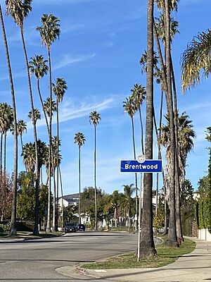
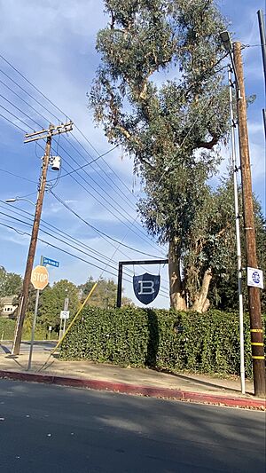
Brentwood neighborhood sign
|
|
| Country | |
| State | |
| County | Los Angeles |
| City | Los Angeles |
| Elevation | 96 m (315 ft) |
| Time zone | UTC−8 (PST) |
| • Summer (DST) | UTC−7 (PDT) |
| ZIP Code |
90049
|
| Area code(s) | 310, 424 |
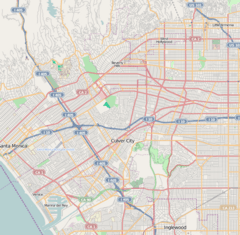
Brentwood is a neighborhood in the Westside part of Los Angeles, California. It is a suburban area known for its beautiful homes and green spaces.
Contents
History of Brentwood
How Brentwood Started
Brentwood began to grow in the 1880s. This was after a large area, about 600 acres, became the Sawtelle Veterans Home. This home was for soldiers and sailors who had served their country.
A small town grew up near the home's west gate. It was first called Westgate. In 1916, the City of Los Angeles took over Westgate. This area included parts of what are now Pacific Palisades and Bel-Air. Westgate Avenue is a street that still reminds people of the old name.
Local Traditions
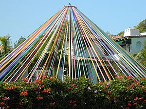
One special tradition in Brentwood is the Maypole celebration. Each year, a Maypole is put up at the Archer School for Girls. This tradition comes from the Eastern Star Home that used to be there.
Fire Safety in Brentwood
Brentwood has areas that are officially called "Very High Fire Hazard Severity Zones." This is because of the many hillsides and canyons. These areas have a lot of dry plants, which can catch fire easily. The community works hard to prevent fires and keep everyone safe.
For example, in 1961, a big fire started nearby. Strong winds, called Santa Ana winds, helped the fire spread quickly. Many firefighters worked to stop the blaze. Residents had to leave their homes for safety. This event showed how important it is to be prepared for fires in the area.
Geography of Brentwood
Where Brentwood Is Located
Brentwood is at the bottom of the Santa Monica Mountains. It has clear borders:
- To the east: the San Diego Freeway
- To the south: Wilshire Boulevard
- To the southwest: the Santa Monica city limits
- To the west: Sullivan Canyon/Westridge Trail
- To the north: Mulholland Drive
Brentwood's Environment
Brentwood has a mild climate. This is because cool breezes blow in from the Pacific Ocean. Many mornings, residents wake up to a "marine layer" (a type of fog) and sunshine.
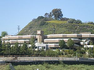
The land in Brentwood changes. North of Sunset Boulevard, you'll find hills and canyons. South of Sunset, the land is mostly flat. There's even an underground spring south of San Vicente Boulevard. It forms a small creek near the Brentwood Country Club.
| Climate data for Brentwood, Los Angeles | |||||||||||||
|---|---|---|---|---|---|---|---|---|---|---|---|---|---|
| Month | Jan | Feb | Mar | Apr | May | Jun | Jul | Aug | Sep | Oct | Nov | Dec | Year |
| Mean daily maximum °F (°C) | 67 (19) |
68 (20) |
69 (21) |
73 (23) |
75 (24) |
80 (27) |
85 (29) |
86 (30) |
84 (29) |
80 (27) |
72 (22) |
67 (19) |
76 (24) |
| Mean daily minimum °F (°C) | 47 (8) |
48 (9) |
48 (9) |
50 (10) |
53 (12) |
57 (14) |
60 (16) |
61 (16) |
60 (16) |
56 (13) |
50 (10) |
47 (8) |
53 (12) |
| Average precipitation inches (mm) | 4.76 (121) |
5.15 (131) |
4.13 (105) |
0.96 (24) |
0.34 (8.6) |
0.08 (2.0) |
0.02 (0.51) |
0.17 (4.3) |
0.32 (8.1) |
0.65 (17) |
1.59 (40) |
2.65 (67) |
20.81 (529) |
People in Brentwood
Population and Diversity
In 2000, about 31,344 people lived in Brentwood. By 2008, this number grew to about 33,312.
Most people in Brentwood are White (84.2%). There are also Asian American (6.5%), Hispanic or Latino (4.5%), and African American (1.2%) residents. About 21% of residents were born in other countries. Many came from Iran and the United Kingdom.
The average yearly household income in Brentwood is quite high compared to other parts of Los Angeles.
Cool Places in Brentwood
Local Landmarks
San Vicente Boulevard has a wide grassy area in the middle. Many large coral trees grow there. This green space used to be a track for a trolley. The trees are now a special historic monument for Los Angeles.
Brentwood has several smaller areas, each with its own feel:
- Brentwood Circle: A private, gated community.
- Brentwood Glen: A small area with many single-family homes.
- Bundy Canyon: Home to Mount St. Mary's College.
- Crestwood Hills: Known for its unique, modern homes from the mid-1900s.
- Mandeville Canyon: A long canyon road, popular for walks and drives.
- Sullivan Canyon: A neighborhood where many people enjoy horseback riding.
- The "Polo Field": Located near Will Rogers State Park.
- Brentwood Park: An area with large, grand estates.
- Brentwood Terrace: Found between the Brentwood Country Mart and Brentwood Country Club.
Each of these areas has its own group that helps manage the neighborhood.
Fun and Recreation
Barrington Recreation Center
The Barrington Recreation Center is a great place for activities. It has an indoor gym that can also be used as a small theater. Outside, you'll find:
- Lighted baseball fields
- Indoor and outdoor basketball courts
- A children's play area
- Picnic tables
- Lighted tennis courts
The community has worked hard to improve the park's facilities. Across the street is the Barrington Dog Park, where dogs can play.
Businesses and Economy
Local Shops and Services

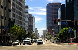
Most offices in Brentwood are for professional services. These include accountants, lawyers, and doctors.
There are three main shopping areas:
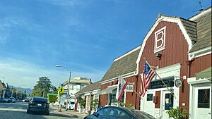
- Brentwood Country Mart
- Barrington Plaza
- San Vicente Business District
These areas have restaurants, clothing stores, and other nice shops.
Some businesses have been in Brentwood for a long time:
- Brent-Air Pharmacy: This pharmacy served Brentwood for over 50 years. Many famous actors worked there when they were young.
- The Brentwood Country Mart: This shopping and food center opened in 1948. It's near San Vicente Blvd and 26th Street.
- Vicente Foods: This grocery store has been serving Brentwood since 1948. Other grocery stores include Whole Foods and Ralphs.
Brentwood Village, at Barrington and Sunset, is a popular spot for dining and coffee. You can find many different kinds of restaurants there.
Dutton's Brentwood Books, a well-known local bookstore, closed in 2008.
Education in Brentwood
Schools in the Area
Many adults in Brentwood have a college degree. This is a high percentage for the area.
Here are some of the schools in Brentwood:
Public Elementary Schools:
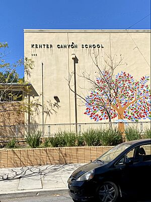
- Kenter Canyon Elementary School (a charter school)
- Brentwood Science Magnet Elementary School (an alternative school)
Public Middle School:
- Paul Revere Charter Middle School
Public High Schools (students attend nearby):
- University High School in West Los Angeles
- Palisades Charter High School in Pacific Palisades
Private Schools:
- Westland School (elementary)
- The Mirman School
- Berkeley Hall School (elementary)
- Milken Community High School
- Brentwood School (K–12)
- Archer School for Girls
- Saint Martin of Tours School (elementary)
Public Libraries
The Los Angeles Public Library has a branch in Brentwood called the Donald Bruce Kaufman - Brentwood Branch Library.
Famous People from Brentwood
- James Arness – Actor
- Bea Arthur – Actress
- David Baerwald – Musician
- Tom Brady – Football player
- Andrew Breitbart – Author and commentator
- Eli Broad – Businessman and giver to charity
- Gisele Bündchen – Model
- Dee Caruso – Writer and producer for TV
- Dabney Coleman – Actor
- Bert Convy – Actor and game show host
- Joan Crawford – Actress
- Stephen W. Cunningham – UCLA manager and city council member
- Don DeFore – Actor
- Joan Didion – Writer
- Dr. Dre – Rapper and music producer
- John Gregory Dunne – Writer
- Dane Elkins – Professional racquetball player
- Glenn Frey – Musician (from the band Eagles)
- James Garner – Actor
- Mark Harmon – Actor
- Leland Hayward – Entertainment agent
- Bob Iger – CEO of The Walt Disney Company
- LeBron James – Basketball player
- Monica Lewinsky – Activist
- Robert Loggia – Actor
- Lea Michele – Actress
- Marilyn Monroe – Actress
- Alanis Morissette – Musician
- Former President and First Lady Richard Nixon and Pat Nixon
- Conan O'Brien – TV talk show host
- Gwyneth Paltrow – Actress
- Wolfgang Petersen – Film director
- Gregor Piatigorsky – Cellist
- Faye Resnick – TV personality
- Bob Saget - Actor and comedian
- Jill St. John – Actress
- Arnold Schoenberg – Composer
- Arnold Schwarzenegger – Actor and former governor
- Maria Shriver – Journalist and former first lady of California
- Oliver Stone – Director and screenwriter
- Margaret Sullavan – Actress
- Robert Taylor – Actor
- Robert Wagner – Actor
- Reese Witherspoon – Actress
- Betty White – Actress
See also
 In Spanish: Brentwood (Los Ángeles) para niños


