
Bécancour River facts for kids
Quick facts for kids Bécancour River |
|
|---|---|
 |
|
| Native name | Rivière Bécancour |
| Country | Canada |
| Province | Quebec |
| Region | Chaudière-Appalaches, Centre-du-Québec |
| Physical characteristics | |
| Main source | Bécancour Lake Thetford Mines, Chaudière-Appalaches, Quebec, Canada 402 metres (1,319 ft) 46°04′10″N 71°14′39″W / 46.06944°N 71.24417°W |
| River mouth | St. Lawrence River Bécancour, Centre-du-Québec, Quebec, Canada 6 metres (20 ft) 46°22′20″N 72°26′47″W / 46.37222°N 72.44639°W |
| Length | 210 km (130 mi) |
| Basin features | |
| Basin size | 2,607 km2 (1,007 sq mi) |
| Tributaries |
|
The Bécancour River is an important river in Quebec, Canada. It flows through the Centre-du-Québec region. This river is about 210 kilometers (130 miles) long. It starts in Bécancour Lake and ends in the Saint Lawrence River.
Contents
Exploring the Bécancour River
The Bécancour River begins its journey in Bécancour Lake. This lake is located in the town of Thetford Mines. This area is part of the Chaudière-Appalaches region. The river then flows west into William Lake near Saint-Ferdinand.
After that, it turns north towards Inverness. It then flows west again across the Centre-du-Québec region. Finally, it turns northwest near Saint-Wenceslas. The river eventually empties into the Saint Lawrence River. This happens close to the city of Bécancour.
River's Path and Journey
The Bécancour River is about 196 kilometers (122 miles) long. It starts high up at 402 meters (1,319 feet) in the Appalachian Mountains. Its source is Bécancour Lake in Thetford Mines. The river has a winding path until it reaches Lyster. This is where it enters the St. Lawrence Lowlands.
From Lyster, it flows west-southwest to Daveluyville. Then, it turns northwest towards Bécancour. Here, it joins the estuary of Saint Lawrence.
Main Rivers Joining the Bécancour
Many smaller rivers flow into the Bécancour River. These are called tributaries. Some of the most important ones include:
- Rivière au Pin
- Palmer River
- Noire River
- Bourbon River
- Blanche River (near Saint-Rosaire)
- Blanche River (near Thetford Mines)
How Water Flows in the River
The area that collects water for the Bécancour River is called its watershed. This watershed covers about 2,620 square kilometers (1,010 square miles). The river gets water from 87 other streams and rivers.
The watershed also has 62 lakes that are larger than 1 hectare (2.5 acres). The biggest lake in the basin is William Lake. It covers about 492 hectares (1,216 acres). Other important lakes are Bécancour Lake, Stater pond, Lake à la Truite, and Joseph Lake.

People and Nature Around the River
Communities Along the River
In 2008, about 64,354 people lived in the Bécancour River basin. The area is divided into 45 different towns and one Indian reserve. The largest town in the basin is Thetford Mines. It has about 26,190 residents. This means 41% of the basin's population lives there. Other towns with more than 5,000 people are Princeville and Plessisville.
Plants and Animals of the Bécancour Basin
The Bécancour River basin is home to many different plants. There are 378 known plant species. In the flatter areas downstream, you can find trees like gray birch and trembling aspen. There are also white spruce and balsam fir trees. Wet, boggy areas have black spruce and tamarack.
Higher up in the Appalachian areas, you'll see forests of sugar maple and yellow birch. Some areas also have beech trees. Near Thetford Mines, white birch grows on mountain tops.
The river basin is also home to 66 types of fish. If you like fishing, you might find:
- brook trout
- brown trout
- rainbow trout
- Atlantic salmon
- lake trout
- northern pike
- muskellunge
- brown bullhead
- rock bass
- pumpkinseed
- smallmouth bass
- largemouth bass
- perch
- walleye
A Look at the River's Past
Early Settlers and History
Around the year 1600, the Abenakis people settled near the mouth of the river. They called it Wôlinaktekw. Many of these native people came from a place called Namesokântsik. This place is now known as Mégantic. They traveled using the Kennebec River.
The Abenakis eventually settled permanently in Wôlinak in 1735. There was a path called "Piste Bécancour." It connected the Grand lac Saint François to the Bécancour River basin. An old map from 1755 shows an "Indian village of New France" near the river's source.
French settlers started living in the Bécancour plain in 1676. The Appalachian region was later settled by the British in the early 1800s. Later, French Canadians and Irish people moved there in the mid-1800s.
Modern History and Development
The Appalachian region changed a lot starting in 1876. This was when asbestos was discovered there. In 1905, Thetford Mines was founded. It became the most important city in the river basin.
What's in a Name?
The Bécancour River is named after Joseph-François Hertel de la Fresnière. He was the second Baron of Portneuf and lord of Bécancour. His name appeared on a map in 1695. Before that, the river was known by other names. These included "Puante River" and "Saint-Michel River."
The Abenaki people call the river Wôlinaktekw. This means "river at the bay." Scottish settlers in Inverness had their own name for part of the river. They called it "Thames River," like the famous Thames in England.
The name "Rivière Bécancour" was officially recognized on December 5, 1968. This was done by the Commission de toponymie du Québec.
Images for kids
-
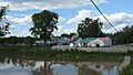
Village of Bécancour
-
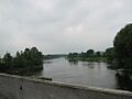
Rivière Bécancour at Lyster


