Castlefield facts for kids
Quick facts for kids Castlefield |
|
|---|---|
 Castlefield, Central Manchester |
|
| OS grid reference | SJ830976 |
| Metropolitan borough | |
| Metropolitan county | |
| Region | |
| Country | England |
| Sovereign state | United Kingdom |
| Post town | MANCHESTER |
| Postcode district | M3 |
| Dialling code | 0161 |
| Police | Greater Manchester |
| Fire | Greater Manchester |
| Ambulance | North West |
| EU Parliament | North West England |
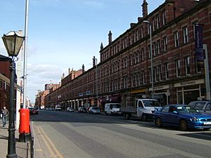
Castlefield is a special historic area in the city of Manchester, England. It is known as a conservation area, which means its important history and buildings are protected. This area is bordered by the River Irwell, Quay Street, Deansgate and Chester Road.
Castlefield was once the site of a Roman fort called Mamucium. This fort actually gave Manchester its name! It was also a very important place during the Industrial Revolution. The Bridgewater Canal, the world's first industrial canal, ended here in 1764. The oldest canal warehouse opened here in 1779.
Later, the world's first passenger railway arrived in Castlefield in 1830. Its station was Liverpool Road railway station. The first railway warehouse also opened here in 1831.
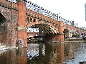
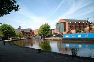
Today, Castlefield is still a busy place. The Rochdale Canal meets the Bridgewater Canal here. Many railway lines cross the area on tall bridges called viaducts. It also has a tram station, Deansgate-Castlefield tram stop, which connects to many parts of Greater Manchester.
In 1980, Castlefield became a conservation area. In 1982, it was named the United Kingdom's first urban heritage park. This means it's a special place where history and nature are preserved for everyone to enjoy.
Contents
What's in a Name?
The name Castlefield comes from the area being "the field below the castle." The "castle" here refers to the old Roman fort. It used to be called "Castle-in-the-field."
Another old name for the area was Campfield. This name also came from the Roman camp or fort. You can still see this name in places like St Matthew's Church, Campfield.
An even older name was Aldport. This is an Old English word meaning "old port." It helped tell it apart from the "new port" in medieval Manchester. A "port" could mean a harbour or a market. So, it could also mean "old market."
A Look Back in Time
Roman Times
Around the year AD 79, the Romans built a fort here called Mamucium. It was placed on a high spot near the River Medlock and River Irwell. This was a good defensive position. The fort was built to help control the Brigantes, a Celtic tribe in northern England.
The fort guarded an important Roman road that went between Chester (Deva Victrix) and York (Eboracum). Another road went north to Ribchester.
At first, the fort was made of wood and turf. It was rebuilt a few times. Around the year 200, its defenses were made stronger with stone walls and gatehouses. About 500 Roman soldiers would have lived here.
People who weren't soldiers also lived near the fort in a civilian settlement called a vicus. These were traders and soldiers' families. There was even an area with many furnaces, like an early industrial zone. The civilian settlement was likely left empty by the mid-200s. However, some soldiers might have stayed until the early 300s.
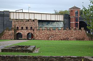
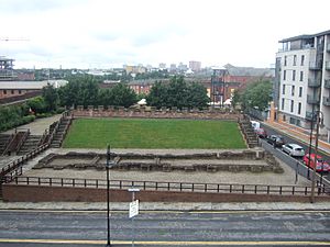
Today, you can visit a reconstructed part of the Roman fort on the site.
Medieval and Early Modern Times
Later, the village of Manchester grew about a kilometre north of the fort. The area around the old Roman settlement became known as "Aldport," or "The Old Town."
In the 1720s, the River Irwell was made easier for boats to use. This led to a quay being built in Castlefield. A quay is a place where boats can load and unload goods. Boats up to 50 tons could travel between Manchester and Liverpool from here.
The Industrial Age
The Industrial Revolution began around the time the Bridgewater Canal reached Castlefield in 1761. This canal was built to carry coal from mines to Manchester. Later, the Rochdale Canal also joined the Bridgewater Canal here.
As time went on, railways became more important than canals. Castlefield became a hub of railway lines. These lines were built on huge, multi-arch bridges called viaducts.
While Castlefield had some cotton mills, it was mostly known for its engineering works and warehouses. The first canal warehouse was built in 1771. It was used to lift coal from barges and store other goods. Later warehouses helped move goods between trains and barges. Some warehouses even had showrooms on the ground floor.
The 20th Century and Beyond
In the 1900s, both canal and railway transport became less popular. The Castlefield area started to look a bit run down.
The railway complex at Liverpool Road was sold for a very small price. It became the Greater Manchester Museum of Science and Industry. In 1982, Castlefield was named an urban heritage park. Part of the Roman fort was also rebuilt on its original foundations.
Castlefield Today
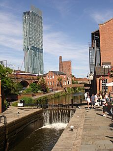
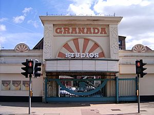
Today, Castlefield has been renewed and is a lively place. There's a large outdoor area called Castlefield Bowl. It is used for many events, including music festivals. The Granada Television studios are also located here.
Castlefield has several bars and restaurants. They are very popular, especially in the summer. Radio stations like Hits Radio and Greatest Hits Radio are also based in Castlefield.
New buildings are being planned and built in the area. Old buildings are being renovated. For example, the empty Jackson's Wharf building was planned to be flats. But locals objected, and it is now a gastropub.
In 1996, a competition was held to design Timber Wharf. This was a new type of housing using modern building methods. The winning design was completed in 2002 and has won awards.
Where is Castlefield?
Castlefield is in the Deansgate ward of Manchester City Centre. To its west is the River Irwell and Salford. To the south are the Bridgewater Canal, the River Medlock, and the Rochdale Canal.
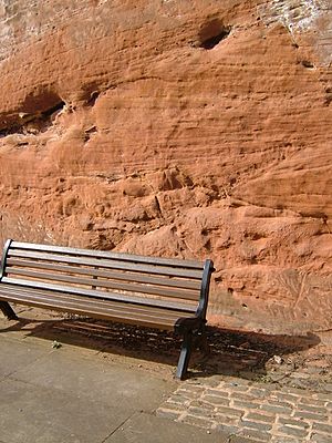
The land here is mostly made of a deep red rock called Collyhurst sandstone. You can see this rock in the cliffs around the Castlefield basin. This strong rock is good for building tall structures. It is also easy to cut for tunnels and channels.
The River Medlock flows into the Bridgewater Canal. The River Irwell also flows through the area. It was made straighter and deeper starting in 1724 to help boats travel.
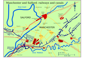
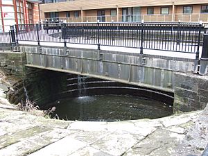
Two main canals define Castlefield: the Bridgewater Canal, built in 1761, and the Rochdale Canal, opened in 1804. There are also two shorter canals that connect to the Irwell. These are the Manchester and Salford Junction Canal and the Hulme Locks Branch Canal. Both are no longer used but can still be seen.
Famous Landmarks

Canals
Before 1750, it was hard to move heavy goods by road. Water transport on rivers was the main way. The River Irwell was improved to make it safer for boats.
Eight locks were built between 1724 and 1734 along the Rivers Irwell and Mersey. This was called the Mersey and Irwell Navigation. Wharfs were built in Manchester in 1740. Small boats could travel from here to the sea. This navigation was later replaced by the Manchester Ship Canal.
The Bridgewater Canal was built to carry coal from mines to Manchester. It was designed by James Brindley. It is known as the world's first true industrial canal. It opened in Castlefield in 1761. Castlefield was the main basin for Manchester. The River Medlock supplied water to the basin. The basin also helped transport other goods like cotton and building materials.
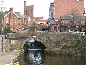
In 1802, the Rochdale Canal joined the Bridgewater Canal here at Lock 92. This was the first canal to cross the Pennine mountains. It brought clean water from Hollingworth Lake. It also connected to other canals, bringing limestone from Derbyshire.
In 1837, the Manchester Bolton & Bury Canal was connected to the Irwell. To link the canals, the Manchester and Salford Junction Canal was built in 1837. It went under the city to connect with the Irwell. The Bridgewater Canal Company also built the Hulme Locks Branch Canal in 1831.
These canals could not handle very large boats. So, goods had to be transferred to bigger ships outside the city. The Manchester Ship Canal was built between 1887 and 1894. It was 36 miles (58 km) long. It allowed Manchester to have direct access to the sea. It was one of the largest navigation canals in the world at the time.
Warehouses of Castlefield
Many warehouses were built in Castlefield to store goods. The Duke's Warehouse was one of the first, built in 1771. It was destroyed by fire twice but rebuilt.
The Grocers Warehouse was also built around the same time. It had five floors and used a waterwheel to lift goods. Part of its front has been restored.
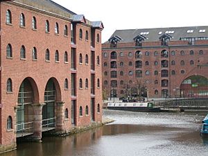
The Merchants' Warehouse was built around 1827. It had four floors and was used for shipping goods. It was badly damaged by fire but has been rebuilt into offices. The Middle Warehouse, built in 1831, is another surviving warehouse. It was used to store maize until the 1970s. Now it is a restaurant, offices, and flats.
The Kenworthy Warehouse, built in 1840, was designed for heavy goods. It had six floors. The Great Northern Viaduct was built over it later.
The New Warehouse, built before 1848, was the largest. It was six stories high and very long.
The Victoria and Albert Warehouses were built directly next to the canal for easy loading.
The 1830 Railway Warehouse of the Liverpool and Manchester Railway was also very important. It was built quickly and used a steam engine to power its hoists.
The Great Northern Warehouse, built between 1896 and 1898, was one of Castlefield's last big warehouses. It was a "trans-shipment" warehouse. This means it could transfer goods between trains, roads, and canals. It was one of Britain's first large steel-framed buildings. It even had hydraulic lifts to move railway wagons between floors.
Manchester was once called Warehouse City because of all its impressive warehouses.
Bridges of Castlefield
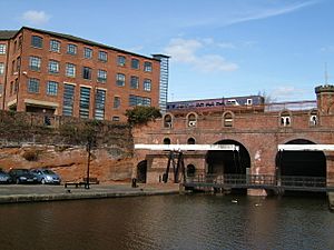
The canal basin in Castlefield is crossed by four large railway viaducts (bridges). They were built in 1848, 1877, and 1898.
The southern viaduct, built in 1849, is made of red brick. It has a cast iron arch bridge over the Rochdale Canal. It carried double railway tracks. It was designed by William Baker.
The central viaduct, built in 1877, is a high-level iron bridge. It is known as Cornbrook Viaduct. It carried trains to Manchester Central railway station, which is now an exhibition centre.
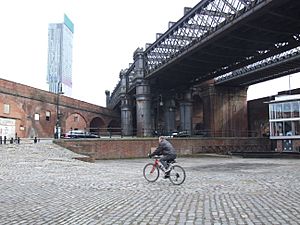
To the north is the 1894 Great Northern viaduct. It is made of steel and decorated with turrets. It served the Great Northern Railway's warehouse.
The Cornbrook and Great Northern viaducts were unused for many years. The Cornbrook Viaduct was later chosen for renovation. It is now used by Metrolink trams.
The Salford branch viaduct, built in 1848-49, is separate from the others. It crosses the basin with a brick arch.
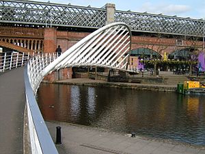
During the area's renewal, a striking footbridge called the Merchant's Bridge was built. It connects Slate Wharf to Catalan Square. It is 3 meters wide and 40 meters long.
Other modern footbridges have also been built. Some are traditional-looking cast iron bridges. Others are "Dutch style" lifting bridges. There is also a stone-clad footbridge over the Rochdale Canal called the Architect's Bridge.
George Stephenson's railway line crossed the River Irwell on a stone bridge built in 1830. This bridge was the first to use a special type of beam called the Hodgkinson beam.
Other Important Buildings
The Liverpool Road railway station complex is very important. It was here that the idea of a passenger train station was created. It was also one of the first places to have separate facilities for different classes of passengers. This station is the oldest main line station in the world.
The station had a booking hall for first and second-class passengers. There were separate waiting rooms and platforms. A sundial was over the first-class entrance. This was because Manchester used "local time" based on the sun until 1847. Then, it adopted "railway time."
Next to the station were the 1830 warehouse and two large cotton stores. The station closed for passengers in 1844. It then became a freight terminal for goods.
Two more railway warehouses can be seen. The 1869 London and North Western Railway Bonded Warehouse is on Grape Street. The four-story 1880 Great Western Railway Lower Byrom Street Warehouse is now part of the Museum of Science and Industry. The Grape Street warehouse is used by Granada Studios for filming and offices.
Bringing Castlefield Back to Life
The regeneration of Castlefield began in 1972. This is when archaeologists started exploring the area. The Liverpool Road goods depot closed in 1975. It then became the North Western Museum of Science and Industry in 1978.
Groups like the Civic Trust and the Victorian Society worked together. They published a report in 1979 called "Historic Castlefield." This report suggested a plan for developing the area.
In 1979, Castlefield was named a conservation area. This happened even though many of its historic canals and buildings were run down. People saw the potential of the area. In 1982, the City Centre Local Plan supported the Museum of Science and Industry. A special committee was formed to guide the conservation area.
In 1983, Castlefield became Britain's first Urban Heritage Park. This led to a lot of public money being invested to bring the area back to life.
In 1988, the Central Manchester Development Corporation was created. Its job was to plan the renewal of a large part of central Manchester, including Castlefield. They wanted to make Castlefield lively again. This meant boosting tourism, supporting businesses, and creating a vibrant community. They also wanted to carefully preserve the historic buildings, canals, and viaducts.
Many grants became available for development projects. One company that benefited was Jim Ramsbottom's Castlefield Estates. They started several important projects, like the Merchants Warehouse.
The Castlefield Management Company was created in 1992. It is a non-profit company that organizes events and helps keep the area clean and well-maintained. An Urban Ranger service was also set up to help visitors and give tours.
Most of the buildings in Castlefield have now been renovated or restored. Many have been turned into modern apartments. Many archaeological digs have also taken place. These digs have taught us a lot about the city's early history. Manchester City Council has encouraged new, high-quality developments. These new buildings help improve the conservation area.
 | Charles R. Drew |
 | Benjamin Banneker |
 | Jane C. Wright |
 | Roger Arliner Young |


