Chagos Archipelago facts for kids
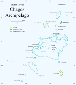
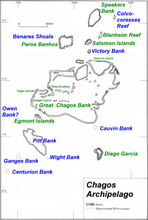
Map of the Chagos Archipelago
|
|
|
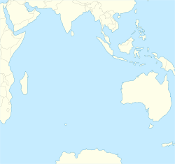
Location of the Chagos Archipelago (circled)
|
|
| Geography | |
|---|---|
| Location | Indian Ocean |
| Coordinates | 6°00′S 71°30′E / 6.000°S 71.500°E |
| Major islands | Diego Garcia, Peros Banhos, Salomon Islands, Egmont Islands |
| Area | 56.13 km2 (21.67 sq mi) |
| Administration | |
| Territory | British Indian Ocean Territory |
| Outer Islands | Chagos Archipelago |
| Demographics | |
| Demonym | Chagossian Chagos Islander Îlois |
| Population | 4,267 (Eclipse Point Town) |
| Ethnic groups | |
The Chagos Archipelago (also called the Chagos Islands) is a group of over 60 islands in the Indian Ocean. These islands are about 500 kilometers (310 miles) south of the Maldives. An archipelago is a group of islands, and an atoll is a ring-shaped coral reef, island, or chain of islands.
The Chagos Islands are the southernmost part of the Chagos–Laccadive Ridge. This is a long underwater mountain range. Key islands include the Salomon Islands, Peros Banhos, and Diego Garcia. Diego Garcia is the largest island by far. Most islands are low-lying atolls with lagoons in the middle.
From 1715 to 1810, France controlled the Chagos Islands. They were managed from Mauritius, which was then called Isle de France. In 1814, after a war, France gave the Chagos Islands and Mauritius to the United Kingdom.
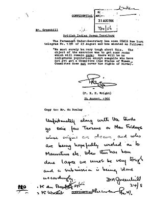
In 1965, the UK separated the Chagos Archipelago from Mauritius. They created a new territory called the British Indian Ocean Territory (BIOT). The UK said the islands had no permanent residents. This was not true.
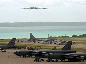
The Chagos Islands were home to the Chagossians. These people spoke a French-based Creole language. Between 1967 and 1973, the UK moved them from their homes. This happened at the request of the United States. The US wanted to build a military base on Naval Support Facility Diego Garcia. Since 1971, only military staff and contractors have lived on Diego Garcia. The Chagossians have not been allowed to return.
Mauritius has long said the Chagos Archipelago belongs to them. The International Court of Justice (ICJ) and another court agreed. They said the UK should return the islands to Mauritius. In October 2024, the British government announced it would transfer the islands. A formal agreement was signed on May 22, 2025. Under this deal, Diego Garcia will be leased back to the UK for at least 99 years. This allows the military base to keep operating.
Contents
Where are the Chagos Islands?
The Chagos Archipelago is located in the middle of the Indian Ocean. It is about 500 kilometers (310 miles) south of the Maldives. It is also about 1,880 kilometers (1,168 miles) east of the Seychelles.
The total land area of the islands is about 56 square kilometers (21.6 square miles). Diego Garcia is the largest island, covering 32.5 square kilometers (12.5 square miles). If you include the lagoons inside the atolls, the total area is over 15,000 square kilometers (5,790 square miles). The Great Chagos Bank is the largest atoll structure in the world.
The Chagos Islands are made of coral rock. They sit on an underwater ridge formed by volcanoes. Unlike the Maldives, the atolls here look a bit scattered. Many of the coral structures are underwater reefs.
The Great Chagos Bank has the world's largest coral atoll. It holds half of all the good quality reefs in the Indian Ocean. Because of this, the Chagos ecosystems have been strong. They have resisted climate change and other environmental problems well.
The largest individual islands are Diego Garcia, Eagle, Île Pierre, Eastern Egmont, Île du Coin, and Île Boddam.
Besides the seven atolls with dry land, there are nine reefs and banks. Most of these are always underwater. The table below lists these features from north to south.
| Atoll/Reef/Bank (alternate name) |
type | Area (km2) | number of islands |
Location | ||||
|---|---|---|---|---|---|---|---|---|
| Land | Total | |||||||
| 0 | unnamed bank | submerged bank | – | 3 | – | 04°25′S 72°36′E / 4.417°S 72.600°E | ||
| 1 | Colvocoresses Reef | submerged atoll | – | 10 | – | 04°54′S 72°37′E / 4.900°S 72.617°E | ||
| 2 | Speakers Bank | unvegetated atoll | 0.001 | 582 | 1) | 04°55′S 72°20′E / 4.917°S 72.333°E | ||
| 3 | Blenheim Reef (Baixo Predassa) | unvegetated atoll | 0.02 | 37 | 4 | 05°12′S 72°28′E / 5.200°S 72.467°E | ||
| 4 | Benares Shoals | submerged reef | – | 2 | 05°15′S 71°40′E / 5.250°S 71.667°E | |||
| 5 | Peros Banhos | atoll | 9.6 | 503 | 32 | 05°20′S 71°51′E / 5.333°S 71.850°E | ||
| 6 | Salomon Islands | atoll | 3.56 | 36 | 11 | 05°22′S 72°13′E / 5.367°S 72.217°E | ||
| 7 | Victory Bank | submerged atoll | – | 21 | – | 05°32′S 72°14′E / 5.533°S 72.233°E | ||
| 8a | Nelson Island | parts of mega-atoll Great Chagos Bank |
0.61 | 12642 | 1 | 05°40′53″S 72°18′39″E / 5.68139°S 72.31083°E | ||
| 8b | Three Brothers (Trois Frères) | 0.53 | 3 | 06°09′S 71°31′E / 6.150°S 71.517°E | ||||
| 8c | Eagle Islands | 3.43 | 2 | 06°12′S 71°19′E / 6.200°S 71.317°E | ||||
| 8d | Danger Island | 1.06 | 1 | 06°23′00″S 71°14′20″E / 6.38333°S 71.23889°E | ||||
| 9 | Egmont Islands | atoll | 4.52 | 29 | 7 | 6°40′S 71°21′E / 6.667°S 71.350°E | ||
| 10 | Cauvin Bank | submerged atoll | – | 12 | – | 06°46′S 72°22′E / 6.767°S 72.367°E | ||
| 11 | Owen Bank | submerged bank | – | 4 | – | 06°48′S 70°14′E / 6.800°S 70.233°E | ||
| 12 | Pitt Bank | submerged atoll | – | 1317 | – | 07°04′S 71°21′E / 7.067°S 71.350°E | ||
| 13 | Diego Garcia | atoll | 32.8 | 174 | 42) | 07°19′S 72°25′E / 7.317°S 72.417°E | ||
| 14 | Ganges Bank | submerged atoll | – | 30 | – | 07°23′S 70°58′E / 7.383°S 70.967°E | ||
| 15 | Wight Bank | 3 | 07°25′S 71°31′E / 7.417°S 71.517°E | |||||
| 16 | Centurion Bank | 25 | 07°39′S 70°50′E / 7.650°S 70.833°E | |||||
| Chagos Archipelago | Archipelago | 56.13 | 15427 | 64 | 04°54' to 07°39'S 70°14' to 72°37' E |
|||
| 1) a number of drying sand cays | ||||||||
| 2) main island and three islets at the northern end | ||||||||
Island Resources
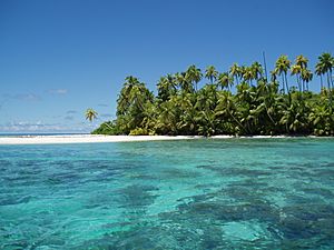
The main natural resources of the Chagos Islands are coconuts and fish. Fishing licenses used to bring in about $2 million each year. However, no new licenses have been given since October 2010. This was after a large marine reserve was created.
Most economic activity is on Diego Garcia. This is where the UK and US military facilities are located. Workers from the UK, Mauritius, the Philippines, and the US support these facilities. There is no farming or industry on the islands. All food and supplies are shipped in.
Experts have studied if the Chagossians could return. Some studies found it would be very expensive and difficult. Others, supported by groups wanting resettlement, said it would be possible. If the Chagossians return, they plan to restart coconut oil production and fishing. They also hope to develop tourism.
Before October 2010, Skipjack tuna and yellowfin tuna were fished seasonally. These fish migrate through Chagos waters. Even though the islands are remote, fishing has had an impact. There is also a lot of illegal fishing for turtles and other marine life. Sharks, important for the ocean's food web, have greatly decreased. This is due to illegal fishing for their fins. Sea cucumbers, which clean the sand, are also illegally taken for Asian markets.
Island Climate
The Chagos Archipelago has a tropical oceanic climate. This means it is hot and humid. But trade winds help to keep it from getting too hot.
The climate has lots of sunshine, warm temperatures, and light breezes. Showers are also common. December to February is the rainy season. This is when the summer monsoon brings more rainfall. June to September is the drier season. It has moderate winds and slightly cooler temperatures. The islands get about 2,600 millimeters (102 inches) of rain each year.
History of the Chagos Islands

Early Discoveries
Stories from the Southern Maldives say that local traders and fishermen sometimes got lost at sea. They would end up on the Chagos Islands. They were eventually rescued and brought home. However, the islands were thought to be too far from the Maldives for people to live there permanently. So, for many centuries, the Chagos Islands were mostly ignored by their northern neighbors.
Despite this, Maldivians used the Chagos as a fishing base. People would camp there to catch, smoke, and dry fish. Also, an exiled Maldivian King, Hassan IX, wrote in 1561 that he was King of the Maldives. He included seven islands of Pullobay, which referred to the Chagos.
In Maldivian stories, the whole group is called Fōlhavahi or Hollhavai. There are no separate names for the different atolls in Maldivian tradition.
European Arrival and Control
Portuguese explorers were the first Europeans to find the islands. Pedro de Mascarenhas may have seen them around 1512–13. Portuguese sailors named the group Bassas de Chagas, meaning "Wounds of Christ." They also named some atolls, like Diego Garcia. The Portuguese never made these islands part of their empire.
The first detailed description of the Chagos was written by Manoel Rangel. He was shipwrecked on the Peros Banhos reefs in 1556.
The French were the first European colonial power to claim the Chagos. This happened after they settled on Réunion (then Île Bourbon) in 1665 and Mauritius (then Isle de France) in 1715. In the 1770s, the French started allowing companies to set up coconut oil farms on the Chagos.
On April 27, 1786, Great Britain claimed the Chagos Islands. However, the territory was officially given to Britain only in 1815, after Napoleon's defeat. The Chagos Islands were then governed from Mauritius, which was also a British colony.
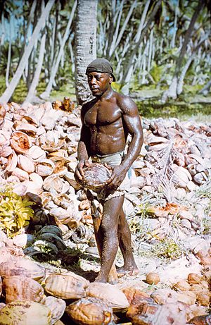
In 1793, the first successful colony was started on Diego Garcia. Coconut farms were set up on many islands. Workers were enslaved by the British. They were freed in 1840. Many of the later workers were descendants of those who had been enslaved. They formed a unique culture called Ilois, which means "islanders" in French Creole.
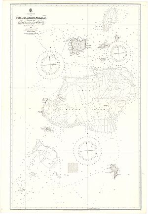
Commander Robert Moresby surveyed the Chagos for the British Navy in 1837–1838. His work created the first accurate maps of the archipelago.
20th Century Changes
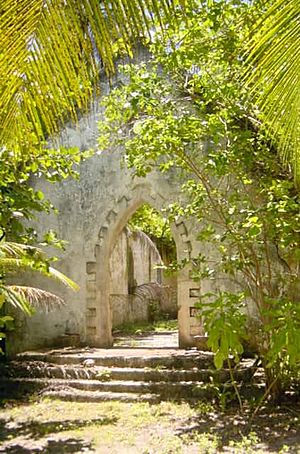
On August 31, 1903, the Chagos Archipelago was separated from the Seychelles. It was then joined to Mauritius for administrative purposes.
Before Mauritius became independent, the UK paid Mauritius £3 million. This was compensation for separating the Chagos Archipelago. The UK also promised to return the islands if they were no longer needed for defense. They also said Mauritius would keep fishing rights. This money was meant to help with development and resettle the Chagossians.
In 1966, the US and UK made an agreement. It allowed the United States Armed Forces to use any island in the BIOT for defense for 50 years. This agreement could be extended. Only Diego Garcia has been turned into a military base.
In 1967, the British government bought all the assets of the Chagos Agalega Company. This company owned all the islands of the BIOT. The plantations were not making money anymore. This was because new oils were available, and large coconut farms were growing in other parts of the world.
Between 1967 and 1973, the people living on the islands were forced to leave. They were moved to Mauritius and the Seychelles. This cleared the way for the joint US–UK military base on Diego Garcia. In March 1971, US Navy construction teams arrived to build the base. The plantation on Diego Garcia was closed in October 1971.
The workers and their families were first sent to plantations on Peros Banhos and Salomon atolls. Those who asked were moved to the Seychelles or Mauritius. In 1972, the UK closed the remaining plantations. They moved the remaining Ilois to the Seychelles or Mauritius. The Mauritian government asked for payment to accept these islanders. In 1973, the UK agreed and paid an additional £650,000.
Recent Events (2000–Present)
In 2002, Diego Garcia was used for US rendition flights.
On April 1, 2010, the British government created the Chagos Marine Protected Area. This was the world's largest marine reserve at the time. It covered 640,000 square kilometers (247,000 square miles). This area is larger than France.
On March 18, 2015, the Permanent Court of Arbitration ruled that this marine protected area broke international law. The Prime Minister of Mauritius said this was a big step. It was the first time the UK's actions regarding the Chagos Archipelago were criticized by an international court.
Mauritius started legal action against the UK in December 2010. This was to challenge the marine protected area. The issue of compensation and return for the former residents continued in court. In 2010, it was taken to the European Court of Human Rights.
In 2018, Mauritius asked the International Court of Justice (ICJ) for an opinion. On February 25, 2019, the ICJ said that the Chagos Archipelago was part of Mauritius. It also said that the UK's separation of the islands was not based on the people's wishes. The ICJ concluded that the UK's continued control was wrong. It said the UK should end its control as quickly as possible.
On May 22, 2019, the United Nations General Assembly (UNGA) voted on a resolution. It said the Chagos Archipelago is part of Mauritius. It demanded that the UK leave within six months. 116 countries voted for the resolution. Only 5 countries supported the UK. The Maldives supported the UK. They were concerned about their own claims to nearby waters if the Chagos became inhabited.
On January 28, 2021, the International Tribunal for the Law of the Sea (ITLOS) agreed with the ICJ. It ordered Britain to hand over the Chagos Archipelago to Mauritius.
In August 2021, the Universal Postal Union stopped allowing BIOT stamps to be used. This was seen as a step towards Mauritius's claim over the Chagos.
On November 26, 2021, Mauritius made a law against misrepresenting its sovereignty. This law makes it a crime to produce or distribute maps or stamps that do not show the Chagos as part of Mauritius.
On February 14, 2022, a group from Mauritius raised the Mauritian flag on the Peros Banhos atoll. This was a symbolic challenge to British control.
On November 3, 2022, the British Foreign Secretary, James Cleverly, announced talks with Mauritius. These talks were about the sovereignty of the British Indian Ocean Territory. Both sides agreed the military base on Diego Garcia would continue to operate.
On October 3, 2024, the UK and Mauritian governments announced a deal. It would transfer sovereignty of the Chagos Islands to Mauritius. The deal still allowed the US military base on Diego Garcia to operate. Chagossians in the UK criticized the deal. They felt they were not included in the decision. However, many Chagossians in Mauritius supported the deal.
The deal was paused after the 2024 US presidential election. On February 27, 2025, US President Donald Trump said he would support the agreement. In April, Trump approved the deal.
On May 22, 2025, UK Prime Minister Sir Keir Starmer signed the formal agreement. The British Conservative Party criticized the deal.
Under the agreement, Diego Garcia and its surrounding area are leased back to the UK. This allows the joint UK/US base to operate for 99 years. There is an option to extend this for another 40 years. Mauritius will receive annual payments from the UK.
On June 10, 2025, UN experts called for the agreement to be paused. They said it did not protect the rights of the displaced Chagossians. They argued that keeping a foreign military presence on Diego Garcia and preventing Chagossians from returning goes against their right to return. The experts asked for a new agreement that fully protects the Chagossians' rights.
The British government plans to introduce new laws to make the agreement official. This includes changing the British Nationality Act 1981. This change will reflect that the BIOT is no longer a UK overseas territory.
On May 23, 2025, India welcomed the agreement. They called it an important step in completing the decolonization of Mauritius.
On June 25, 2025, members of the House of Lords said the government could not ignore the risk of a bad decision. This could affect Britain's right to operate the joint base.
In July 2025, a legal case moved forward in the High Court. It demands that the British government talk with the Chagossians before transferring their territory.
Island Life and People
The Chagossians
The original islanders were known as the Ilois. There were about 1,000 of them. They had mixed backgrounds, including African, South Indian, Portuguese, English, French, and Malay. They lived simple lives, working on coconut and sugar farms, or in fishing. Not much of their culture remains on the islands. However, their language, Chagossian Creole, is still spoken by some of their descendants in Mauritius.
The Ilois were forced to leave their homes by the US and British governments. This happened in the late 1960s and early 1970s. The islands were then turned into a military base. Many islanders have asked to return. The UN General Assembly, the International Court of Justice, and the International Tribunal for the Law of the Sea have all said they have a right to return. However, the US and UK legal systems have not followed these decisions. This means the Chagossians remain in exile.
Current Population
Diego Garcia is the only inhabited island in the Chagos today. It is part of the British Indian Ocean Territory (BIOT). The UK sees it as an Overseas territory of the United Kingdom. The BIOT government is led by a Commissioner appointed by King Charles III. This Commissioner works from London.
There are no native people living on the island now. The UK represents the Territory to other countries. There is no local government like in other places. About 1,700 military personnel and 1,500 civilian contractors live on Diego Garcia. Most of these are American.
As of 2012, about 3,000 people lived on the islands temporarily. This included 300 British government staff and 2,700 US military personnel.
Island Ecology
The Chagos Islands, along with the Maldives and Lakshadweep, form a special terrestrial ecoregion. The islands and their waters are a huge protected area. This area is twice the size of the UK's land.
The deep ocean waters around the Chagos Islands have many unique underwater features. These include deep trenches and sea mounts. These areas likely hold many undiscovered species. The high diversity of the sea floor often means a high diversity of species.
The variety of life in the Chagos archipelago is one of its most special features. In 2010, 76 species living in Chagos were on the IUCN Red List of Threatened Species.
Coral Reefs
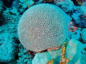
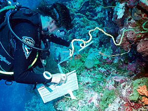
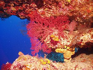
The reefs are home to at least 371 types of coral. This includes the unique brain coral Ctenella chagius. In the past, the coral was thick and healthy, even in deep water. Large stands of branching staghorn coral protected the low-lying islands from waves.
In 1998, much of the coral died due to a bleaching event. However, the Chagos reefs recovered well. Coral cover increased each year until 2014. But high water temperatures in 2015 and 2016 caused more bleaching. This killed over two-thirds of the corals.
Fish Life
The reefs also have at least 784 types of fish that live near the shores. This includes the unique clownfish (Amphiprion chagosensis). Many large wrasse and grouper fish, which have been overfished elsewhere, are still found here.
Besides reef fish, there are many open-ocean fish. These include manta rays, whale sharks, other sharks, and tuna. Shark numbers have dropped a lot because of illegal fishing. They are caught for their fins or as accidental bycatch in legal fisheries.
Bird Life
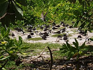
Seventeen types of seabirds nest in huge groups on many islands. Ten islands are named Important Bird Areas. This means Chagos has the most diverse seabird community in this tropical area. Large groups of sooty terns, brown and lesser noddies, wedge-tailed shearwaters, and red-footed boobies are found here. Land birds are few and mostly introduced species.
Mammals
The Chagos Archipelago has rich biodiversity. It supports different types of cetaceans (whales and dolphins). This includes three groups of blue whales and many toothed whales. Dugongs used to live here but are now gone. Sea Cow Island was named because dugongs were once present. Donkeys left behind by the Ilois also roam freely.
Turtles
The remote islands are perfect, quiet places for green turtles and hawksbill turtles to nest. The turtle populations in Chagos are very important globally. This is because hawksbills are critically endangered, and green turtles are endangered. Chagos turtles were heavily hunted for two centuries. But now, they and their homes are protected. Their numbers are recovering well.
Crustaceans
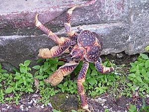
The coconut crab is the world's largest land arthropod. It can have a leg span of over a meter (3 feet) and weigh 3.5–4 kilograms (7.7–8.8 pounds). When young, it acts like a hermit crab. It uses empty coconut shells for protection. As an adult, this giant crab climbs trees. It can even crack open a coconut with its huge claws. Coconut crabs are rare in most places. But the Chagos has one of the most undisturbed populations. Their young can travel long distances as larvae. This means Chagos coconut crabs are important for helping other over-hunted populations in the Indian Ocean.
Insects
113 types of insects have been found on the Chagos Islands.
Plants
Plants started growing on the Chagos Islands when there was enough soil. This was probably less than 4,000 years ago. Seeds and spores arrived by wind, sea, and from seabirds. The native plants of the Chagos Islands include 41 types of flowering plants and four ferns. There are also many mosses, liverworts, fungi, and cyanobacteria.
Today, the state of the native plants depends on how much the islands were used in the past. About 280 types of flowering plants and ferns have been found. This increase is due to non-native plants brought by humans. Some of these non-native plants have spread widely. They threaten the native ecosystems. Plans are being made to control them. On some islands, native forests were cut down to plant coconut palms. Other islands are still untouched. They have many different habitats. These include unique Pisonia forests and large groups of the giant fish poison tree. Untouched islands give us important information. This helps us bring back native plant communities on islands that have been changed a lot. These efforts will help improve the variety of life on the Chagos Islands.
Protecting the Islands
Past Efforts
UK governments have supported protecting the environment of the Chagos. They have promised to treat the whole area as a World Heritage Site. In 2003, the UK government created an Environment Protection Zone. This zone extends 200 nautical miles from the islands. On eastern Diego Garcia, the UK has named the large lagoon and eastern part of the atoll as a "wetland of international importance." This is under the Ramsar Convention.
Present Efforts
On April 1, 2010, Britain announced the creation of the Chagos Marine Protected Area. This was the world's largest continuous marine protected reserve. It covers 545,000 square kilometers (210,000 square miles).
This was a result of efforts by the Chagos Environment Network. This group of conservation organizations wanted to protect the rich biodiversity of the Chagos. The Chagos Environment Network listed several reasons for supporting a protected area.
The UK government asked for public opinions on managing conservation. This consultation ended on March 5, 2010.
On April 1, 2010, the British government created the Chagos Archipelago as the world's largest marine reserve. It is 640,000 square kilometers (247,000 square miles). This doubled the total area of environmental no-take zones worldwide. The Bertarelli Foundation provides money to protect this marine reserve. Some believed the reserve was created to make it harder for the islanders to return. Leaked US documents showed the UK suggesting this to the US.
Court Ruling on Marine Protected Area
On March 18, 2015, the Permanent Court of Arbitration ruled that the marine protected area violated international law. The Prime Minister of Mauritius said this was a major step. It was the first time the UK's actions regarding the Chagos Archipelago were criticized by an international court.
The court looked closely at promises the UK made to Mauritian ministers in 1965. The UK had argued these promises were not legally binding. But the court rejected this. It said the promises became a binding international agreement when Mauritius became independent. This means Mauritius has strong legal rights over the Chagos Archipelago. The UK must respect these rights. The court also found that the UK had not respected Mauritius's rights. This was especially true regarding the creation of the marine protected area.
UN Expert Opinion
On June 10, 2025, UN experts asked for the recent agreement between the UK and Mauritius to be paused. They warned that it did not protect the rights of the displaced Chagossian people. They said that keeping a foreign military presence on Diego Garcia and stopping Chagossians from returning goes against their right to return. The experts also criticized the lack of access to cultural sites. They called for a new agreement that fully guarantees the rights of the Chagossian people.
WikiLeaks Information
According to US diplomatic documents published by WikiLeaks, the UK and US wanted to protect the military value of the Chagos Islands.
A document from the US embassy in London stated:
The UK wanted to create a marine park to protect the environment of the British Indian Ocean Territory (BIOT). A senior official said this park would not affect US military use of the BIOT, including Diego Garcia. He agreed that the UK and US should carefully plan the reserve to protect US interests and the BIOT's strategic value. He also said that if the entire Chagos Archipelago were a marine reserve, it would be difficult for the former inhabitants to claim resettlement.
See also
 In Spanish: Archipiélago de Chagos para niños
- List of islands in the Chagos Archipelago
- Chagos Archipelago sovereignty dispute
- Expulsion of the Chagossians
- Great Chagos Bank
- Chagos Marine Protected Area
- Naval Support Facility Diego Garcia
Novels
- Shenaz Patel, Le silence des Chagos, Éditions de l'Olivier, 2005
- Caroline Laurent, Rivage de la colère, Les Escales, 2020
 | Jackie Robinson |
 | Jack Johnson |
 | Althea Gibson |
 | Arthur Ashe |
 | Muhammad Ali |


