City of Cockburn facts for kids
Quick facts for kids City of CockburnWestern Australia |
|||||||||||||||
|---|---|---|---|---|---|---|---|---|---|---|---|---|---|---|---|

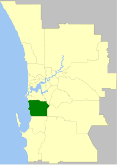
The City of Cockburn within the Perth Metropolitan Area
|
|||||||||||||||
| • Density | 703.34/km2 (1,821.6/sq mi) | ||||||||||||||
| Established | 1871 | ||||||||||||||
| Area | 167.9 km2 (64.8 sq mi) | ||||||||||||||
| Mayor | Logan Howlett | ||||||||||||||
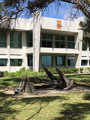
| Council seat | Spearwood | ||||||||||||||
| Region | South Metropolitan Perth | ||||||||||||||
| State electorate(s) | Cockburn, Fremantle, Jandakot, Willagee | ||||||||||||||
| Federal Division(s) | Fremantle | ||||||||||||||
 |
|||||||||||||||
| Website | City of Cockburn | ||||||||||||||
|
|||||||||||||||
The City of Cockburn (pronounced KOH-bərn) is a local government area in the southern part of Perth, the capital city of Western Australia. It's located about 8 km (5 mi) south of Fremantle and 24 km (15 mi) south of Perth's city centre. The City of Cockburn covers an area of about 167.5 square kilometres (64.7 sq mi) and was home to over 104,000 people in 2016.
Contents
The Story of Cockburn
The name Cockburn comes from Cockburn Sound, a body of water named in 1827 by Captain James Stirling. He named it after Admiral Sir George Cockburn. Sir George was a famous British naval officer, born in London in 1772. He became a very high-ranking officer, even Admiral of the Fleet. He was known for his service in the War of 1812. He also took Napoleon to exile on the island of Saint Helena after the Battle of Waterloo in 1815.
How Cockburn Became a City
In 1871, the Fremantle Road District was created. This area covered land south and east of Fremantle. A group called the Fremantle Road Board was set up to manage it. Their main job was to build and look after roads connecting Fremantle to other parts of the colony.
Over time, the district grew. In 1923, it gained more land from the Jandakot Road District. On January 21, 1955, the area was officially renamed Cockburn. This showed that the community wanted its own identity, separate from Fremantle.
On July 1, 1961, the Cockburn Road District became a Shire. This happened because of a new law about local governments. Then, on January 24, 1971, it became a Town, as more people moved there and it became more urban. Finally, on October 26, 1979, the Town of Cockburn became the City of Cockburn.
In May 1966, Rottnest Island and Carnac Island were included in the Shire's boundaries. However, the local council does not manage these islands. State government agencies look after them.
There were some challenging times for the City of Cockburn in 1999 and 2007. During these periods, administrators were put in charge to help run the council. This ensured that local services continued smoothly for the community.
How Cockburn is Governed
The City of Cockburn is divided into three main areas called wards. Each ward elects three councillors to represent its residents. The mayor, who leads the council, is chosen directly by the people living in the City.
- East Ward
- West Ward
- Central Ward
How Many People Live Here?
The City of Cockburn has grown a lot over the years. Here's a look at how its population has changed:
| Historical population | |||||||||||||||||||||||||||||||||||||||||||||||||||||||||||||
|---|---|---|---|---|---|---|---|---|---|---|---|---|---|---|---|---|---|---|---|---|---|---|---|---|---|---|---|---|---|---|---|---|---|---|---|---|---|---|---|---|---|---|---|---|---|---|---|---|---|---|---|---|---|---|---|---|---|---|---|---|---|
|
|
||||||||||||||||||||||||||||||||||||||||||||||||||||||||||||
Suburbs of Cockburn
The City of Cockburn is made up of many different suburbs. Each suburb has its own population and area. Here are some of them, with numbers from the most recent Australian census:
| Suburb | Population | Area | Map |
|---|---|---|---|
| Atwell | 9,287 (SAL 2021) | [convert: needs a number] | |
| Aubin Grove | 6,786 (SAL 2021) | [convert: needs a number] | |
| Banjup | 1,377 (SAL 2021) | [convert: needs a number] | |
| Beeliar | 8,617 (SAL 2021) | [convert: needs a number] | |
| Bibra Lake | 5,892 (SAL 2021) | [convert: needs a number] | |
| Cockburn Central | 1,521 (SAL 2021) | [convert: needs a number] | |
| Coogee | 5,345 (SAL 2021) | [convert: needs a number] | |
| Coolbellup | 5,698 (SAL 2021) | [convert: needs a number] | |
| Hamilton Hill | 11,327 (SAL 2021) | [convert: needs a number] | |
| Hammond Park | 6,985 (SAL 2021) | [convert: needs a number] | |
| Henderson | 36 (SAL 2021) | [convert: needs a number] | |
| Jandakot | 2,533 (SAL 2021) | [convert: needs a number] | |
| Lake Coogee | 4,768 (SAL 2021) | [convert: needs a number] | |
| Leeming | 10,883 (SAL 2021) | [convert: needs a number] | |
| Munster | 199 (SAL 2021) | [convert: needs a number] | |
| North Coogee | 3,741 (SAL 2021) | [convert: needs a number] | |
| North Lake | 1,299 (SAL 2021) | [convert: needs a number] | |
| Rottnest Island | 166 (SAL 2021) | [convert: needs a number] | |
| South Lake | 5,831 (SAL 2021) | [convert: needs a number] | |
| Spearwood | 10,944 (SAL 2021) | [convert: needs a number] | |
| Success | 11,340 (SAL 2021) | [convert: needs a number] | |
| Treeby | 4,214 (SAL 2021) | [convert: needs a number] | |
| Wattleup | 443 (SAL 2021) | [convert: needs a number] | |
| Yangebup | 7,631 (SAL 2021) | [convert: needs a number] |
Mayors of Cockburn
Historic Places in Cockburn
As of 2024, there are 140 places in the City of Cockburn that are listed as important heritage sites. Out of these, 21 are on the official State Register of Heritage Places. Some well-known examples include the Coogee Hotel, the Newmarket Hotel, and the Woodman Light. These places help tell the story of the area's past.
International Connections
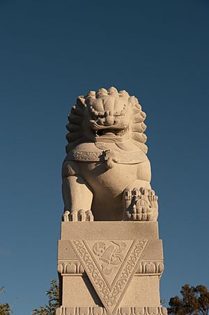
The City of Cockburn has special friendships with cities in other countries. These are called "sister cities." They work together to share culture and ideas.


