
Dalston facts for kids
Quick facts for kids Dalston |
|
|---|---|
 St. Mark's Church – "Cathedral of the East End" |
|

Dalston
|
|
| OS grid reference | TQ345845 |
| • Charing Cross | 4 mi (6.4 km) SW |
| London borough | |
| Ceremonial county | Greater London |
| Region | |
| Country | England |
| Sovereign state | United Kingdom |
| Post town | LONDON |
| Postcode district | E8, N1, N16 |
| Dialling code | 020 |
| Police | Metropolitan |
| Fire | London |
| Ambulance | London |
| EU Parliament | London |
| UK Parliament |
|
| London Assembly |
|
Dalston is a lively area in East London, located within the London Borough of Hackney. It is about 4 miles (6.4 km) northeast of Charing Cross, a famous spot in central London. Dalston started as a small village and has grown over time to include nearby areas like Kingsland and Shacklewell.
In recent years, Dalston has seen many changes, becoming more modern and popular. This was helped by new train lines, like the East London line extension (now part of London Overground), and the reopening of Dalston Junction railway station. These improvements were also part of London's preparations to host the 2012 Olympics.
Contents
Where is Dalston?
Dalston isn't an official administrative area, so its exact borders are not strictly defined. However, people generally agree on its southern and western edges.
- South: Dalston shares a border with Shoreditch.
- West: The old Roman road, the A10 (known as Kingsland Road and Kingsland High Street), is usually seen as Dalston's western edge. Both sides of Kingsland High Street are included, making sure Dalston Kingsland Railway Station is part of Dalston.
- North: There isn't a clear northern border. Dalston's area doesn't usually go much further north than Farleigh Road.
- East: The railway tracks often mark the eastern border. Some people say Dalston reaches as far as London Fields park.
A Look Back in Time
The name Dalston probably comes from "Deorlaf's tun," meaning "Deorlaf's farm." The first time Dalston was written down was in 1294, when it was called Derleston.
Long ago, Dalston was one of four small villages in the Parish of Hackney. These villages were tiny, with only a few houses each.
A map from 1746 by John Rocque shows Kingsland village at what is now Dalston Junction, and Dalston village a bit further east. The old Roman road, now the A10, was already a clear feature.
Around the 18th and 19th centuries, Dalston changed from a farming area to a busy town. By 1849, it was described as a "recently increased suburban village." As railways arrived and more buildings were built, Dalston grew bigger than its neighbours.
In the 1930s, 1940s, and 1960s, Dalston was home to many different communities, including a large Jewish population. This led to some groups trying to cause trouble, but local people and other groups stood up against them. A 2014 novel, Ridley Road, and its TV show adaptation, show some of these events.
How Dalston was Governed
Dalston was part of the Ancient Parish of Hackney for a very long time. This area was part of the historic county of Middlesex. However, many local duties were handled by the Tower Division, led by the Constable of the Tower of London. This meant local men served in the Tower's army instead of the Middlesex army.
In 1900, the Metropolitan Borough of Hackney was created, using the old parish borders. It became part of the County of London. Then, in 1965, Hackney joined with Shoreditch and Stoke Newington to form the London Borough of Hackney, which is part of Greater London today.
Cool Buildings to See
Dalston has some interesting and historic buildings:
- St. Mark's Church: This huge Victorian church was built in 1864–66. It's said to be the biggest parish church in London, even larger than Southwark Cathedral! It can hold up to 2000 people and is sometimes called the "Cathedral of the East End." The area around the church is also very beautiful.
- Rio Cinema: This is a special Art Deco cinema, meaning it has a unique, decorative style from the 1920s and 30s. It's a popular single-screen cinema on Kingsland High Street and has been around for over 100 years.
- German Hospital: These attractive red brick buildings were once a hospital from 1845 to 1987. It was first set up to help London's German-speaking community. Later, it became a regular NHS hospital before its services moved to Homerton University Hospital.
Fun Things to Do
Dalston is known for its music, events, and nightlife.
- Dalston Music Festival: This big festival started in 2015. It takes place around Gillett Square and in several local clubs.
Arts and Entertainment

Dalston has many places for art and entertainment. It used to have many cinemas and a big theatre called the Dalston Theatre, which was once a hippodrome (a place for horse races or shows) and a music hall. This theatre later became a famous blues club. Sadly, the Dalston Theatre was taken down in 2007.

Shopping in Dalston

- Ridley Road Market: This market started in the 1880s and is right opposite Dalston Kingsland railway station. You can find all sorts of fruits and vegetables here, including some unusual ones. There are also many butchers selling Halal meat. This market is said to be the inspiration for the market in the BBC show EastEnders.
- Kingsland Shopping Centre: This shopping centre is just south of Ridley Road Market.
- Kingsland Road: This street and the ones around it are full of cool shops, cafes, and places to eat.
What Dalston is Like Today

Today, Dalston is a busy area with people from many different backgrounds. Its buildings are a mix of old 18th and 19th-century houses and newer 20th-century council estates. The area is changing quickly, partly because of the new train station at Dalston Junction and the improvements made for the 2012 Olympics.
Dalston has welcomed people from all over the world for more than 100 years. In the early 1900s, many Jewish people from central Europe moved here. In the 1950s and 60s, a large Caribbean community settled in Dalston, which is why you can find so much Caribbean food in Ridley Road. Later, Turkish and Vietnamese communities also made Dalston their home. More recently, Polish people have moved to the area, and you can now find Polish shops.
Fassett Square was the inspiration for the famous BBC soap opera EastEnders. The show's fictional Albert Square and Walford Market were based on Fassett Square and Ridley Road Market. Many of the houses in the show look like those in Dalston.
The Hackney Peace Carnival Mural, painted in 1985, shows people marching for peace. It's an important piece of art from that time and can be found opposite Dalston Junction Overground station.
Famous music hall artist Marie Lloyd (1870–1922) used to live on Graham Road. Her house now has a special blue plaque to mark it.
In 2009, The Guardian newspaper even called Dalston the "coolest" place to live in Britain!
Getting Around Dalston
Trains
Dalston is well-connected by the London Overground network, with three stations:
- Dalston Kingsland: From here, you can catch trains to Stratford, Richmond, or Clapham Junction. This connects Dalston to places like Hackney Central, Highbury & Islington, and Camden Road.
- Dalston Junction: Trains from this station go to Highbury & Islington and then on to West Croydon, Crystal Palace, New Cross, or Clapham Junction. This links Dalston to Shoreditch, Whitechapel, and places in South London.
- Haggerston: This station is partly in Dalston and offers similar connections to Dalston Junction.
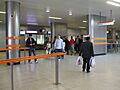
All these stations are in London fare zone 2, and you can use Oyster Cards to travel. Dalston Junction is the busiest of the three stations. There isn't a direct train link to central London, but you can easily connect at other stations. A new station in Dalston has been suggested as part of the Crossrail 2 project.
Buses
Many London Buses routes serve Dalston, including routes 30, 38, 56, 67, 76, 149, 236, 242, 243, 277, 488 and N38. Some routes, like 76, 149, 242, 243, and 277, run all day and night.
Roads
Important roads in Dalston include:
- A10 (Kingsland Road/Kingsland High Street): Goes south towards the City of London and north towards Tottenham.
- A104 (Balls Pond Road/Dalston Lane): Travels west towards Highbury and east towards Clapton.
- A1207 (Graham Road): Heads east to Hackney.
Cycling
Dalston has good cycling routes:
- Cycle Superhighway 1 (CS1): This is a clear, signposted route that runs north to south through Dalston on quieter streets. It connects to Stoke Newington in the north and the City of London in the south.
- Quietway 2 (Q2): This route goes east to west through Dalston on quieter streets. It connects to Bloomsbury in the west and Walthamstow in the east.
There are also other cycle routes nearby, like one through Shacklewell to Clissold Park. The Regent's Canal towpath is also close by in Haggerston, which is great for cycling.
 |
Stoke Newington | Stoke Newington | Lower Clapton | |
| Canonbury | Hackney Central | |||
| De Beauvoir Town | Haggerston | London Fields |
Famous People from Dalston
Many interesting people have lived in Dalston:
- Tony Blair: A former Prime Minister, lived in Dalston from 1980 to 1986.
- Martina Evans: A poet who lives in Balls Pond Road and writes about Dalston in her poems.
- Stephen Fry and Hugh Laurie: Famous performers who shared a house in Dalston in the early 1980s.
- Sam Lee: A folk musician.
- Emily Lloyd: An actress.
- Marie Lloyd: A famous music hall artist from the past.
- Diane Morgan: An interviewer.
- Charles James Martin: A scientist who directed the Lister Institute of Preventive Medicine.
- Alan Spenner: A bass player for bands like the Grease Band and Roxy Music.
- Rachel Whiteread: An artist who won the Turner Prize.
Images for kids
-
Dalston Junction concourse

