Hackney Central facts for kids
Quick facts for kids Hackney Central
|
|
|---|---|
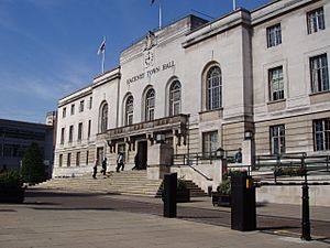 Hackney Town Hall, built 1934–37 for the Metropolitan Borough of Hackney |
|
| Population | 77,336 (2011) |
| OS grid reference | TQ345845 |
| • Charing Cross | 4 mi (6.4 km) SW |
| London borough | |
| Ceremonial county | Greater London |
| Region | |
| Country | England |
| Sovereign state | United Kingdom |
| Post town | LONDON |
| Postcode district | E8 E9 |
| Dialling code | 020 |
| Police | Metropolitan |
| Fire | London |
| Ambulance | London |
| EU Parliament | London |
| UK Parliament |
|
| London Assembly |
|
Hackney Central is a lively area in Hackney, London, England. It's about 6.4 kilometers (4 miles) northeast of Charing Cross, a famous spot in central London.
This area is centered around Mare Street. It includes popular shopping spots like Narrow Way. It stretches from the Regent's Canal in the south, past Broadway Market and London Fields, all the way to Hackney Central railway station. It also has a main shopping area that goes from Hackney Downs station to the Hackney Walk Outlet Village.
Hackney Central was once known as Hackney Village. It became popular during the Tudor period when important people from the King's court lived here. Even King Henry VIII of England had a palace nearby! Hackney Central was a favorite place for Londoners to visit until the Georgian era. After that, it became more built up. Railways, trams, and factories changed its quiet, country feel during the Victorian era.
Today, many old industries are gone. The biggest employers are the NHS and the local council. Many people from different countries and parts of the UK have moved to Hackney. This makes it a very diverse and exciting part of inner London.
Even though much of the area was rebuilt after World War II, you can still find beautiful Georgian houses and Victorian buildings. These older homes are very popular again.
Contents
Exploring Hackney Central's Past
Hackney Central has a long and interesting history. Let's explore how it grew from ancient times to the modern day.
How Hackney Central Began
Long ago, in Roman times, a road called Ermine Street passed west of where Hackney Central is now. The area was covered with forests and marshy lands near rivers. Hackney was part of the Catevallauni tribe's land.
The name "Hackney" comes from an old Saxon settlement. It was called Haca's ey, which means "raised ground in marshland." This settlement was likely near Hackney Brook and the higher ground around the later St Augustine's Tower. Hackney isn't mentioned in the Domesday Book, a famous survey from Norman times. Back then, it was part of the larger area of Stepney.
Hackney in Tudor Times
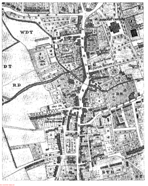
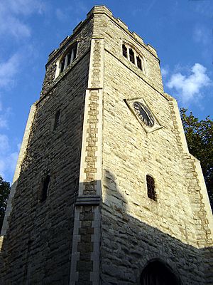
Not much is left from early Hackney, except the Tudor St Augustine's Tower. This tower is Hackney's oldest building. The old road network from medieval times is also still visible. The churchyard and Hackney Brook stopped Hackney from growing too much.
In Tudor times, there were many grand houses along Church Street. Many of King Henry VIII's courtiers (people who worked for the King) lived in nearby Homerton. One of Henry VIII's palaces was in Clopton. His daughter, Mary, even took an important oath there.
Another group of houses existed where Well Street meets Mare Street. In the 1700s, the Loddiges family started a huge plant nursery business on the open land north of here.
The Georgian Era in Hackney
By 1724, Hackney was still mainly one street, but it had a continuous line of buildings. There were large gardens behind the nicer houses and inns. The 16th-century church became too small. So, in 1790, people asked for a new, bigger church.
Building the new church started in 1791 on a field north of the old one. It faced many problems, like builders going bankrupt. It was finally finished in 1812–13. Sadly, a fire damaged it in 1955.
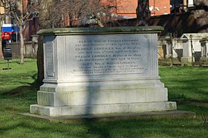
In the churchyard, you can find the tomb of Francis Beaufort. He created the Beaufort wind force scale, which measures wind speed. Also buried there is John Hunter, the second governor of New South Wales, Australia. The Loddiges family also has a tomb and memorials in the church. Records show that "Anthony, a poore old negro, aged 105" died in 1630. He was the first recorded black resident of Hackney.
The villages of Hackney, Lower Clapton, and Homerton were separated by fields until the 1800s. The grand houses remained, with large gardens. Workers and craftspeople lived in smaller cottages built in these gardens. There wasn't much space or desire for big new buildings in the village itself.
By 1800, St Thomas' Square, a Georgian square, was built at the south end of Mare Street. These buildings later became public housing. An old mansion from the early 1700s, now the New Landsdown Club, is at 195 Mare Street. It was once the headquarters of Elizabeth Fry's group, which helped female prisoners. This building is very old and needs repairs.
The new church, built north of the village, changed the road's path. This allowed Clapton Square to be built in 1816 in nearby Lower Clapton. Much of the area around the 1791 church is now a special conservation area.
Victorian Hackney's Growth
During the Victorian era, many old buildings were removed. Large estates were divided into streets of terraced houses. The arrival of the railway in 1850, with a big iron bridge over Mare Street, changed Hackney from a quiet suburb to a busy city area. Trams started appearing in the 1870s, and a tram depot opened in 1882.
Better transport and the covering up of Hackney Brook in 1859–60 led to the current road layout. Many older buildings were pulled down to make room for more development, wider streets, and the railway. The parish hall on the Narrow Way was rebuilt in 1802. In 1900, it was given a new stone front and called 'Hackney Old Town Hall'. A new town hall was built in 1866, and then replaced by today's Town Hall in 1937. By the early 1900s, only St Johns Gardens and Clapton Square remained as public green spaces.
Understanding Hackney's Governance
Hackney Central has its own electoral ward for Hackney Council. This ward is a specific area used for local elections. Its boundaries are set to have roughly the same number of voters as other wards.
Where is Hackney Central?
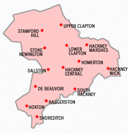
Hackney Central is seen as the main part of Hackney. Before 1899, when London County Council changed things, "Hackney" often meant just this area. Sometimes, people used "Hackney Proper" to tell it apart from other nearby settlements like South Hackney or Hackney Wick.
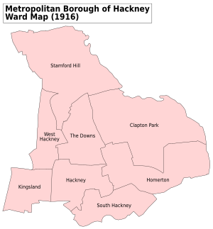
However, in terms of old parish boundaries, the areas of Hackney Proper, Homerton, Clapton, Dalston, De Beauvoir Town, Stamford Hill, and Kingsland all used to be part of the Parish of Hackney until 1835.
Since then, the name "Hackney" has grown to include the larger Metropolitan Borough of Hackney (from 1899) and then the London Borough of Hackney (from 1965).
Hackney Town Hall is about 8 kilometers (5 miles) northeast of Charing Cross. It's also about 6.1 kilometers (3.8 miles) from the GLA City Hall near Tower Bridge.
 |
Dalston | Lower Clapton | Lower Clapton |  |
| Dalston | Homerton | |||
| Haggerston | Bethnal Green | South Hackney |
Famous Places in Hackney Central
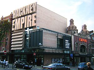

South of Hackney Central railway station, Mare Street goes through Hackney's "cultural quarter" around Town Hall Square. On the north side, you'll see the amazing Hackney Empire. This Grade II* listed music hall was built in 1901 by Frank Matcham. Famous performers like Charles Chaplin and Marie Lloyd once appeared on its stage.
On the west side of Town Hall Square is the Grade II Hackney Town Hall. It was built between 1934 and 1937 from Portland Stone. An open space in front was created when the old Town Hall was knocked down. A new building complex is being built behind the current Town Hall. Across the square, on the east side, is the Ocean Music Venue. This building was renovated in 2001 and combines the Central Library and Methodist Hall.
The Learning and Technology Centre, built in 2002, completes the square. It houses the new Hackney Central Library, the Hackney Archive, the local museum, and offices for the Hackney Learning Trust.
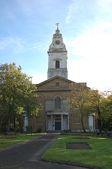
North of the railway bridge, Mare Street becomes The Narroway (originally Church Street). Near St Augustine's Tower, a very important Grade I landmark, is the 'Old Town Hall'. It was built in 1802 to serve the Parish of Hackney and is now a betting shop. To the east are St Johns' Church Gardens. In 2009, these gardens received a special award for being well-maintained green spaces. Inside the gardens stands the Church of St John-at-Hackney, built in 1792.
The Viktor Wynd Museum of Curiosities, Fine Art & Natural History opened in 2015. This museum and bar is located in a former call center on Mare Street. It's run by Viktor Wynd and is part of the Last Tuesday Society.
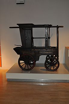
The Ash Grove bus depot was built in 1981 by London Buses. Its roof has a unique design, supported by ten large triangular structures. This depot has also been used by the London Transport Museum to store old vehicles.
Getting Around Hackney Central
Train Services
Hackney Central is about 3.2 kilometers (2 miles) northeast of the City of London. You can catch frequent trains from Hackney Downs railway station to Liverpool Street. Hackney Central railway station is a London Overground station. Westbound trains go to Richmond and Clapham Junction through Dalston Junction. Eastbound trains go to Stratford through Homerton.
Bus Services
Many London bus routes serve Hackney Central, connecting it to different parts of the city. These include routes 30, 38, 55, 106, 236, 242, 253, 254, 276, 277, 394, N38, N55, N242, N253, N277 and W15.
Hackney Central's Economy
The Narrow Way (also called Church Street) is still a busy shopping area. There's a large Tesco supermarket on Morning Lane. Interestingly, this international store group started in Hackney from a market stall in Well Street in 1919.
A former Burberry factory building is also located off Morning Lane. It has a 'factory outlet' shop that is considered Hackney's most visited tourist attraction. This site is currently being redeveloped to include housing while keeping the showroom.
The main local employers are the council and the NHS at Homerton University Hospital. There are also two London Transport bus garages. One is at the bottom of the Narroway, and another is about 1.6 kilometers (1 mile) south at Ash Grove. Between Ash Grove and London Fields, there is a small industrial area.
Learning in Hackney Central
Schools in the area include The Urswick School (which used to be called Hackney Free and Parochial Church of England Secondary School) and BSix Sixth Form College.
Famous People from Hackney Central
Many interesting people have connections to Hackney Central. You can find a longer list of famous people from the wider London Borough of Hackney in the main article.
 | Georgia Louise Harris Brown |
 | Julian Abele |
 | Norma Merrick Sklarek |
 | William Sidney Pittman |


