Geology of Bedford County, Pennsylvania facts for kids
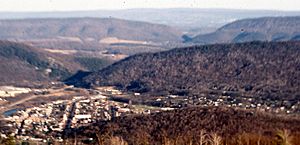

Bedford County, Pennsylvania, is a cool place to explore geology! It sits right on the edge of the Ridge and Valley area. This region is known for its folded and faulted sedimentary rocks. These rocks formed a very long time ago, during the early to middle Paleozoic Era.
To the northwest, the county borders the Allegheny Plateau. This area has flatter sedimentary rocks that are a bit younger. In Bedford County, you'll find rocks from the Cambrian period all the way to the Pennsylvanian period. But you won't find any volcanic or changed rocks here.
Contents
Mountains and Landforms
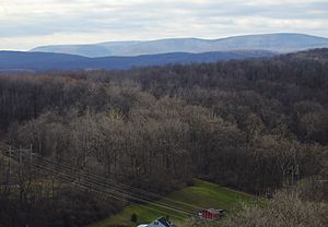
The county has several important mountains that stretch from the border with Maryland up into Blair County. From west to east, these are Wills, Evitts, Dunning, and Tussey mountains.
These mountains are strong because they are made of a tough rock called the Silurian Tuscarora Formation. This rock is a type of sandstone and conglomerate, which is like a natural concrete made of pebbles and sand.
Chestnut Ridge is another interesting feature. It's a wide anticline, which means the rock layers are folded upwards like an arch. It's held up by the Devonian Ridgeley Member, another strong sandstone and conglomerate.
The Broad Top area, located north of Breezewood, is a flat-topped area. Its rocks are younger, from the Mississippian and Pennsylvanian periods. This makes them different from most other rocks in the county, which are older.
Rivers and Waterways
The main river in the northern part of Bedford County is the Raystown Branch of the Juniata River. This river flows east right through the mountains, cutting through them in places called water gaps. These gaps were formed because of faults, which are cracks in the Earth's crust.
After flowing through the mountains, the river turns north and goes into Raystown Lake in Huntingdon County. The southern part of Bedford County is drained by smaller rivers that flow into the Potomac River. Both the Potomac and Juniata rivers are part of the larger Chesapeake Bay Watershed. This means their water eventually flows into the Chesapeake Bay.
Ice Age Effects
Bedford County was never covered by glaciers during the Pleistocene epoch, also known as the "Ice Age." However, it was still very cold! The area experienced "periglacial" processes, which means "around glacier" or simply "cold" conditions.
During this time, most of the county was probably a tundra, a cold, treeless plain. The many rocky areas on mountainsides, called boulder fields, formed because of repeated freezing and thawing of water. This process broke apart the rocks and moved them around.
Natural Resources
Bedford County has several natural resources.
Limestone Quarries
You can find several limestone quarries in Bedford County. Most of these are run by New Enterprise Stone & Lime Company. These quarries dig up limestone, which is used for many things, like making cement or as a building material.
Coal Fields
There are two main coal fields in Bedford County. One is the Broad Top Field in the northeast, and the other is the Georges Creek Field in the southwest. Both of these fields contain bituminous coal, a type of coal used for energy.
Unfortunately, there are old, abandoned mines in both areas. These mines can cause an environmental problem called acid mine drainage. This is when water flows through the mines, picks up harmful chemicals, and then pollutes streams. In the Broad Top area, some streams have no fish because of this pollution.
Natural Gas
Natural gas fields and storage areas are found in southeastern Bedford County, especially in the folded Devonian rocks south of Breezewood. Another deep gas field is located near Blue Knob, close to the border with Blair County.
Cool Geological Spots
Bedford County has many interesting geological features to explore:
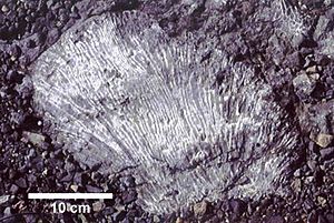
- New Enterprise New Paris Quarry: Here, you can find amazing fossils of corals and bryozoans (tiny sea creatures) in the Devonian Keyser Formation rocks.
- Coral Caverns: Located in Manns Choice, this is a cool cave system to visit.
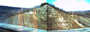
- Warrior Ridge Roadcut: Along Route 30 (Everett Bypass), you can see a roadcut that shows many different rock layers from the Silurian and Devonian periods. You can see everything from limestone to shale to conglomerate.
- The Narrows Water Gap: On the Pennsylvania Turnpike at The Narrows, where the Raystown Branch cuts through Evitts Mountain, you can see many rock layers. Some of these layers are even overturned, folded, and faulted, showing how much the Earth's crust has moved!
- Sweet Root Natural Area: This area, near Chaneysville, has a landscape full of boulders. These boulders were created by the same freeze-thaw processes that happened during the Ice Age, eroding the Tuscarora Formation on Tussey Mountain.
- Blue Knob: This is a popular ski resort and recreational area. It's also the second-highest point in Pennsylvania, standing at 3,146 feet (959 meters) tall.
- Juniata Crossing Thrust Fault: About three miles west of Juniata Crossing on Route 30, you can see a great example of a thrust fault. This is where one block of rock has been pushed up and over another.
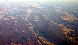
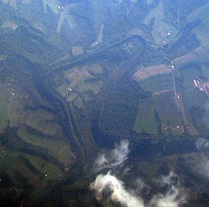
- Juniata River Meanders: The Raystown Branch of the Juniata River between Breezewood and Raystown Lake shows "incised" or "entrenched" meanders. This means the river has cut deep into the land while still keeping its winding, snake-like path.


