Grainger County, Tennessee facts for kids
Quick facts for kids
Grainger County
|
|||
|---|---|---|---|

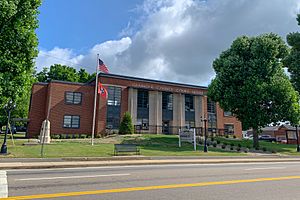
Grainger County Courthouse in Rutledge
|
|||
|
|||
| Motto(s):
Commerce, Agriculture, Recreation
|
|||

Location within the U.S. state of Tennessee
|
|||
 Tennessee's location within the U.S. |
|||
| Country | |||
| State | |||
| Founded | 1796 | ||
| Named for | Mary Grainger Blount | ||
| Seat | Rutledge | ||
| Largest town | Bean Station | ||
| Area | |||
| • Total | 302 sq mi (780 km2) | ||
| • Land | 281 sq mi (730 km2) | ||
| • Water | 22 sq mi (60 km2) 7.2%% | ||
| Population
(2020)
|
|||
| • Total | 23,527 |
||
| • Density | 81/sq mi (31/km2) | ||
| Demonym(s) | Grainger Countian | ||
| Time zone | UTC−5 (Eastern) | ||
| • Summer (DST) | UTC−4 (EDT) | ||
| ZIP Codes |
37708, 37709, 37848, 37861, 37881, 37888
|
||
| Area code | 865 | ||
| Congressional district | 2nd | ||
Grainger County is a county in the state of Tennessee. In 2020, about 23,527 people lived here. Its main town, or county seat, is Rutledge. Grainger County is part of the larger Knoxville area.
History
Grainger County was created in 1796. This was the same year Tennessee became a state! It was formed from parts of Knox and Hawkins Counties. The county is named after Mary Grainger Blount. She was the wife of William Blount, an important figure in Tennessee's early history.
Over time, parts of Grainger County were used to form other counties. These include Anderson, Claiborne, Campbell, Hamblen, Hancock, Scott, and Union Counties.
During the American Civil War, many people in East Tennessee did not want to leave the United States. Grainger County voters agreed. In 1861, they voted strongly against leaving the Union.
Geography
Grainger County covers about 302 square miles. Most of this is land, with about 22 square miles of water. The Clinch River forms the northwest border. This river is held back by Norris Dam, creating Norris Lake. The Holston River is on the southeast side, forming Cherokee Lake.
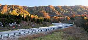
Clinch Mountain is a big natural feature. It divides the county into two main parts. The southern part includes Rutledge, and the northern part includes Washburn.
Indian Cave
Indian Cave is a historic spot along the Holston River near Blaine. People have used this cave for hundreds of years. Native American groups lived in this area around 1000 CE. They left behind things like cane torches, showing they used the cave. The Cherokee people, who spoke the Iroquoian language, later moved into this region.
In the 1700s, a Cherokee village was near the cave. But more and more European settlers moved in. After the American Revolutionary War, even more settlers arrived. In 1830, the government passed a law to move Native Americans from the Southeast.
After the American Civil War, a man named Robert Hoke bought the cave in 1869. He mined it for bat guano, which is a natural fertilizer.
Later, in 1916, local business people decided to open the cave as a tourist attraction. It officially opened to the public in 1924. Today, you can still visit Indian Cave.
Adjacent counties
Grainger County shares borders with these other counties:
- Hancock County (northeast)
- Hawkins County (northeast)
- Hamblen County (east)
- Jefferson County (south)
- Knox County (southwest)
- Union County (west)
- Claiborne County (northwest)
State protected areas
- Buffalo Springs Wildlife Management Area
Demographics
| Historical population | |||
|---|---|---|---|
| Census | Pop. | %± | |
| 1800 | 7,367 | — | |
| 1810 | 6,397 | −13.2% | |
| 1820 | 7,651 | 19.6% | |
| 1830 | 10,066 | 31.6% | |
| 1840 | 10,572 | 5.0% | |
| 1850 | 12,370 | 17.0% | |
| 1860 | 10,962 | −11.4% | |
| 1870 | 12,421 | 13.3% | |
| 1880 | 12,384 | −0.3% | |
| 1890 | 13,196 | 6.6% | |
| 1900 | 15,512 | 17.6% | |
| 1910 | 13,888 | −10.5% | |
| 1920 | 13,369 | −3.7% | |
| 1930 | 12,737 | −4.7% | |
| 1940 | 14,356 | 12.7% | |
| 1950 | 13,086 | −8.8% | |
| 1960 | 12,506 | −4.4% | |
| 1970 | 13,948 | 11.5% | |
| 1980 | 16,751 | 20.1% | |
| 1990 | 17,095 | 2.1% | |
| 2000 | 20,659 | 20.8% | |
| 2010 | 22,657 | 9.7% | |
| 2020 | 23,527 | 3.8% | |
| U.S. Decennial Census 1790-1960 1900-1990 1990-2000 2010-2014 |
|||
In 2020, there were 23,527 people living in Grainger County. Most residents were White (92.44%). There were also smaller numbers of Black or African American, Native American, Asian, Pacific Islander, and people of mixed races. About 3.29% of the population was Hispanic or Latino.
Economy
Grainger County is mostly a rural area. It is known for its farming.
Top employers
Here are the top employers in Grainger County as of 2018:
| # | Employer | # of Employees |
|---|---|---|
| 1 | Grainger County School District | 500 |
| 2 | Clayton Homes (Bean Station) | 350 |
| 3 | Grainger County | 200 |
| 4 | Clayton Homes (Rutledge) | 200 |
| 5 | Sexton Furniture Manufacturing LLC | 150 |
Agriculture
Farming has always been a big part of Grainger County's economy. The soil here is very rich. This makes it great for growing certain crops. The most famous crop is the tomato. Grainger County tomatoes are known all over the country and even internationally! Raising cattle is also important.
In 2018, the county had over 650 greenhouses. There were also 923 farms. These farms grew vegetables on 500 acres of land. Almost 90,000 acres were used for farmland in total.
The county celebrates its famous tomato every year. The Grainger County Tomato Festival started in 1992. About 30,000 people come to the festival. They enjoy music, local produce, handmade gifts, and learn about the county's farming history. The festival happens on the last weekend of July.
Real estate
More homes are being built in Grainger County. Many new houses are near the Cherokee Lake shoreline. The Bean Station and Blaine areas are also seeing new construction.
Living in Grainger County is quite affordable. The average cost of living is around $2,600 per month. The average housing cost is about $420 monthly. In 2017, the average value of property was $110,600. This is lower than the national average of $229,700.
Tourism and leisure

In the late 1800s, people started visiting Grainger County for its natural beauty. There were mineral springs flowing from the Clinch Mountain range. The Tate Springs Resort was a popular place to stay. It had mineral baths, a big hotel, a swimming pool, and a golf course.
The resort closed during the Great Depression. A fire destroyed the hotel in the 1960s. Today, only a few parts of the resort remain.
Since the 1940s, tourism has grown again. This is thanks to Cherokee Lake and Norris Lake. These lakes were created by the Tennessee Valley Authority. People now enjoy fishing, hiking, hunting, camping, golf, boating, and water sports here.
Industry and commerce
In the early days, small businesses were important. There were gristmills (for grinding grain), hat makers, saddle makers, tailors, and dry goods stores. These businesses provided what the farming communities needed.
The Holston Paper Mill was one of the first big industries. A railroad called the Peavine Railroad also ran through the county. However, parts of the tracks were flooded when the TVA built dams in the 1940s.
Later, the Clinchdale Lumber Company cut down a lot of trees in the county. After that, knitting mills and zinc mining became important. Around the late 1900s, Tennessee marble was quarried (mined) in the Thorn Hill area.
Economic opportunities
Grainger County does not have county-wide rules about how land can be used. This means that some areas have seen new developments like RV campgrounds.
Many people who live in Grainger County travel to other cities for work. In 2010, almost two-thirds of residents commuted to places like Morristown and Knoxville. This is because there are more job opportunities in those larger cities.
In 2020, Grainger County was identified as one of the counties in Tennessee that could face economic challenges.
Communities
City
- Bean Station
Towns
Unincorporated communities
- Beech Grove
- Cherokee
- Joppa
- Liberty Hill
- New Corinth
- Powder Springs
- Tater Valley
- Thorn Hill
- Washburn
Education
The Grainger County School District serves the students in the county. It has one high school, one middle school, four elementary/intermediate schools, one primary school, one K-12 school, and one alternative school. About 3,637 students are enrolled in the district.
Primary school
- Rutledge Primary School
Elementary schools
- Bean Station Elementary School
- Joppa Elementary School
- Rutledge Elementary School
- Washburn School
Middle school
- Rutledge Middle School
High schools
- Grainger High School
- Washburn School
Alternative school
- Grainger Academy
Infrastructure
A report in 2018 looked at the main needs for public services in Grainger County. The biggest needs were for transportation, water and wastewater systems, and recreation areas.
Transportation
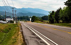
The main roads in Grainger County are U.S. Route 11W and U.S. Route 25E. US 25E is a four-lane highway that goes north and south. US 11W is also a four-lane highway in some towns like Bean Station and Blaine. Outside these towns, it is a two-lane road.
Other important roads include State Route 92, State Route 131, and State Route 375. These roads help connect different parts of the county.
Utilities
Cherokee Dam was built in the early 1940s by the Tennessee Valley Authority. It is a hydroelectric dam that creates electricity for the area. Appalachian Electric Cooperative (AEC) manages the electricity for most of southern Grainger County. AEC also offers fiber internet.
Bean Station Utility District (BSUD) provides municipal water for southeastern Grainger County. This includes Rutledge and Bean Station. Knoxville Utilities Board provides electricity to southwestern Grainger County, including Blaine. Luttrell-Blaine-Corryton Utility District (LBCUD) provides water services there.
The towns of Rutledge, Blaine, and the county's industrial park have access to sewage treatment systems. However, the eastern part of the county, which has many people, does not have a sewage treatment system.
See also
 In Spanish: Condado de Grainger para niños
 | Ernest Everett Just |
 | Mary Jackson |
 | Emmett Chappelle |
 | Marie Maynard Daly |


