Great Northern Expedition facts for kids
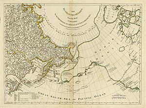
The Great Northern Expedition (also known as the Second Kamchatka Expedition) was one of the biggest exploration projects ever. It mapped most of the Arctic coast of Siberia and parts of North America. This helped fill in many "white areas" on old maps.
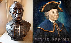
The idea for this huge journey came from Russian Emperor Peter the Great. However, it was carried out by Empresses Anna and Elizabeth. The main leader was Vitus Bering, who had led an earlier trip called the First Kamchatka Expedition. The Second Kamchatka Expedition lasted from about 1733 to 1743. It was later called the Great Northern Expedition because of how much it achieved.
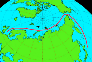
The main goal was to find and map the eastern edge of Siberia. They also hoped to find the western shores of North America. Peter the Great wanted the Russian Navy to map a Northern Sea Route from Europe to the Pacific. This huge project was supported by the Admiralty College in Saint Petersburg.
More than 3,000 people were involved in the expedition. It was one of the largest projects of its kind in history. The Russian government paid for everything, costing about 1.5 million rubles. This was a huge amount of money back then. It was about one-sixth of Russia's total income in 1724.
The expedition made many important discoveries. Europeans found Alaska, the Aleutian Islands, and the Commander Islands. They also mapped the northern and northeastern coasts of Russia. The expedition proved that there was no large landmass in the north Pacific. It also gathered important information about the people, history, and nature of Siberia and Kamchatka. The expedition showed that a useful Northeast Passage (a sea route through the Arctic) was not possible at that time.
Contents
How the Expedition Started
Early Science in Siberia
Systematic exploration and scientific discovery in eastern Asia began in the 1700s. This was thanks to Peter the Great (1672–1725). He traveled through Europe in 1697 and 1698. He was very excited by the idea of starting a science academy in Russia. This plan came true in 1723-1724. He decided to bring foreign scholars to Russia. His goal was to create a scientific academy in St. Petersburg. He hoped to bring European science to Russia and train Russian scholars.
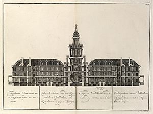
The Academy officially opened in December 1725. Young, mostly German-speaking scholars worked there. One of their jobs was to organize scientific trips. These trips would explore the unknown parts of the Russian Empire. Before Peter died, a German doctor named Daniel Gottlieb Messerschmidt traveled through western and central Siberia from 1720 to 1727. This was the first scientific trip to study the geography, minerals, plants, animals, and languages of the area. It also helped open the region for trade. Messerschmidt's trip was the first of many scientific explorations in Siberia.
Bering's First Journey
Just before he died in February 1725, Peter the Great ordered another big trip to the east. Peter had met with Gottfried Wilhelm Leibniz many times. In 1716, Leibniz asked if there was a land bridge between northeastern Asia and North America. This was an important question at the time. People wondered how humans first settled in the New World.
To answer this question, Peter the Great sent two mapmakers, Iwan Jewreinow and Fjodor Luschin, in 1719. They went to the easternmost parts of his empire. This trip was not successful in finding the land bridge. So, in 1724, Peter gave the same goal to another trip. This was the First Kamchatka Expedition.
This first expedition lasted from 1728 to 1730. It was led by a Danish captain named Vitus Bering (1681–1741). Bering had been an officer in the Russian navy since 1704. He used a ship called the St. Gabriel. This ship was built at the mouth of the Kamchatka River. Bering sailed northeast in 1728 and 1729. He reached 67 degrees north latitude. At that point, the coast no longer went north. He could not reach the North American coast because of bad weather.
Bering learned new things about Siberia's northeast coast. But his report caused arguments. The question about the connection to North America was still unanswered. This made Bering suggest a second Kamchatka expedition.
The Great Expedition Begins
Planning the Big Trip
Bering's Plan and the Fleets
Bering's plan for the new expedition had several main goals. He wanted to map Russia's northern coast. He also wanted to expand the port of Okhotsk. This port was seen as a gateway to the Pacific Ocean. He aimed to find a sea route to North America and Japan. Another goal was to find and use Siberia's natural resources. Finally, he wanted to make sure Russia controlled its eastern lands.
The timing for this huge project was perfect. Empress Anna (who ruled from 1730) wanted to continue Peter the Great's plans. She wanted to expand the empire's land and economy. On April 17, 1732, Empress Anna issued an order for a new expedition. More orders followed in May 1732. These told the Admiralty to prepare the trip and named Vitus Bering as its commander. On June 2, 1732, the Russian Academy of Sciences was told to prepare instructions for the scientific part of the journey.
The expedition was split into three main groups. The northern group's job was to map Russia's northern coast. This stretched from Archangelsk on the White Sea to the Anadyr River in eastern Siberia. Completing this task would show if the Northern Sea Route could connect Europe and the Pacific. This route was seen as a possible alternative to land trade with China.
The Pacific group had two parts. The first part, led by Bering, would sail from Okhotsk. They would search for a legendary place called "Joao-da-Gama-Land". This land was named after a Portuguese explorer who claimed to have found land north of Japan in 1589. From there, Bering's group would sail east to North America. The second Pacific part was led by Captain Martin Spangberg. He had been with Bering on the First Kamchatka Expedition. His job was to explore the sea route from Okhotsk to Japan and China.
The Science Team
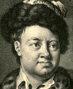
The scientific part of the expedition was led by three professors from the Russian Academy of Sciences. Johann Georg Gmelin (1709–1755) was in charge of studying plants, animals, and minerals. Gmelin was a botanist from Württemberg. He had studied in Tübingen and moved to Russia in 1727. He became a professor of chemistry and natural history in 1731.
The Academy chose Gerhard Friedrich Müller (1705–1783) to lead the history and geography studies. Müller had studied in Rinteln and Leipzig. He came to Saint Petersburg in 1725. He became a full professor in 1731. He studied Russian history deeply and published the first volume of his Collected History of Russia in 1732. Müller also developed his ideas about Ethnography (the study of cultures) during this trip.
The Academy also chose Louis De l'Isle de la Croyère (1690–1741) for astronomy and mapping. He was the younger brother of a famous astronomer, Joseph Nicolas Delisle. Louis had worked at the Academy as an astronomy assistant. He had some experience from a three-year exploration trip to Arkhangelsk and the Kola peninsula.
The science team answered to the St. Petersburg Academy, not to Bering. Each professor had clear instructions for their research. Gmelin wrote his own instructions for natural history. Müller planned his work to research the history of cities they visited. He also collected information about local languages. The team had many scientific tools. Local authorities were ordered to help the researchers.
The Journeys (1733–1743)
The Science Group's Travel
The two Pacific groups, led by Martin Spangberg and Vitus Bering, left Saint Petersburg in early 1733. The science group left on August 8, 1733. This group included professors Gmelin, Müller, and Croyère. They also had students, mapmakers, an instrument maker, and painters. Soldiers went with them for protection. They traveled by horses on land and barges on water.
Their route took them through Velikiy Novgorod, Kazan, Yekaterinburg, and Tyumen to Tobolsk. They arrived there in January 1734. In May, Gmelin and Müller separated from Croyère's group. They traveled to the Irtysh River, then to Semipalatinsk, Novokuznetsk, and Yeniseysk. They passed through Krasnoyarsk and Nizhneudinsk and reached Irkutsk in March 1735. They left some baggage there and explored around Lake Baikal. They studied trade in Kyakhta and visited mines near Argun. They returned to Irkutsk for the winter. Müller studied local archives, and Gmelin studied plants.
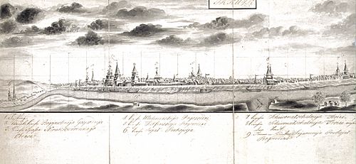
Their next stop was Yakutsk. The science team was supposed to meet Bering there. Then they would travel to Kamchatka together. After leaving Irkutsk, Gmelin and Müller traveled along the icy Angara River to Ilimsk. When the Lena River was free of ice, they continued by boat. They reached Yakutsk in September 1736. Most of the Pacific expedition members were already there. This made it hard for Gmelin and Müller to find places to stay. On November 8, 1736, a fire started in Gmelin's room. He later wrote about it in his travel memories.
Europeans Discover Alaska
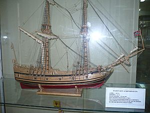
In June 1741, the ships St. Peter and St. Paul sailed from Petropavlovsk-Kamchatsky. Six days later, they lost sight of each other in thick fog. But both ships kept sailing east.
On July 15, Captain Chirikov on the St. Paul saw land. It was probably the west side of Prince of Wales Island in Southeast Alaska. He sent a group of men ashore in a small boat. They were the first Europeans to land on the northwestern coast of North America. When the first group did not return, he sent a second group. They also disappeared. Chirikov then sailed away.
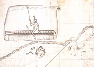
Around July 16, 1741, Bering and his crew on the St. Peter saw a huge mountain on the Alaska mainland. This was Mount Saint Elias. Bering was eager to return to Russia, so he turned westward. He later anchored his ship near Kayak Island. Crew members went ashore to explore and find water. Georg Wilhelm Steller, the ship's naturalist, walked around the island. He took notes on the plants and animals. He also first recorded the Steller's jay, a bird named after him.
Chirikov and the St. Paul headed back to Russia in October. They brought news of the new land they had found.
Bering's ship was badly damaged by storms. In November, his ship was wrecked on Bering Island. Many of the crew thought it was the coast of Kamchatka. Bering became sick with scurvy and died on December 8, 1741. Soon after, the St. Peter was destroyed by strong winds. The stranded crew spent the winter on the island. Twenty-eight crew members died. When the weather improved, the 46 survivors built a new 12-meter (40-foot) boat from the wreckage. They sailed for Petropavlovsk-Kamchatsky in August 1742. Bering's crew reached Kamchatka in 1742. They carried news of the expedition. The sea otter pelts they brought were soon seen as the best fur in the world. This discovery would lead to Russian settlement in Alaska.
See also
 In Spanish: Segunda expedición a Kamchatka para niños
 | Bessie Coleman |
 | Spann Watson |
 | Jill E. Brown |
 | Sherman W. White |


