Hancock County, Ohio facts for kids
Quick facts for kids
Hancock County
|
|||
|---|---|---|---|

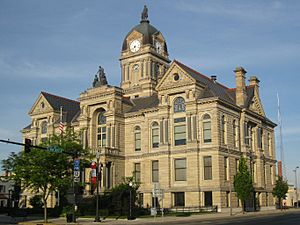
The Hancock County Courthouse in Findlay
|
|||
|
|||

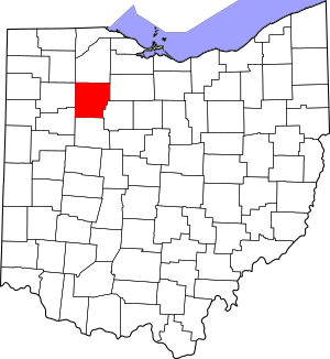
Location within the U.S. state of Ohio
|
|||
 Ohio's location within the U.S. |
|||
| Country | |||
| State | |||
| Founded | March 1, 1828 | ||
| Named for | John Hancock | ||
| Seat | Findlay | ||
| Largest city | Findlay | ||
| Area | |||
| • Total | 534 sq mi (1,380 km2) | ||
| • Land | 531 sq mi (1,380 km2) | ||
| • Water | 2.3 sq mi (6 km2) 0.4%% | ||
| Population
(2020)
|
|||
| • Total | 74,920 | ||
| • Density | 140.30/sq mi (54.17/km2) | ||
| Time zone | UTC−5 (Eastern) | ||
| • Summer (DST) | UTC−4 (EDT) | ||
| Congressional district | 5th | ||
Hancock County is a county located in the U.S. state of Ohio. It is named after John Hancock, who was the first person to sign the Declaration of Independence. As of the 2020 census, about 74,920 people live here. The biggest city and the county's main center is Findlay. Hancock County was officially created in 1820 and started operating in 1828.
Contents
History of Hancock County
Hancock County was officially started on January 21, 1828. It was formed by the Ohio government from parts of Wood County. At first, it only had one area called Findlay Township. Later in April 1828, two more townships, Amanda and Welfare (now Delaware), were added.
Over the years, many more townships were created. These included Jackson in 1829, Liberty and Marion in 1830, and others like Big Lick and Blanchard in 1831. By 1850, the last township, Allen, was formed. In 1845, a small part of Hancock County was used to create the new Wyandot County.
Geography of Hancock County
Hancock County is located in Ohio. It covers a total area of about 534 square miles. Most of this area, about 531 square miles, is land. The remaining 2.3 square miles, which is about 0.4% of the county, is water.
Neighboring Counties
Hancock County shares its borders with several other counties:
- Wood County to the north
- Seneca County to the northeast
- Wyandot County to the southeast
- Hardin County to the south
- Allen County to the southwest
- Putnam County to the west
- Henry County to the northwest
Population of Hancock County
| Historical population | |||
|---|---|---|---|
| Census | Pop. | %± | |
| 1830 | 813 | — | |
| 1840 | 9,986 | 1,128.3% | |
| 1850 | 16,751 | 67.7% | |
| 1860 | 22,886 | 36.6% | |
| 1870 | 23,847 | 4.2% | |
| 1880 | 27,784 | 16.5% | |
| 1890 | 42,563 | 53.2% | |
| 1900 | 41,993 | −1.3% | |
| 1910 | 37,860 | −9.8% | |
| 1920 | 38,394 | 1.4% | |
| 1930 | 40,404 | 5.2% | |
| 1940 | 40,793 | 1.0% | |
| 1950 | 44,280 | 8.5% | |
| 1960 | 53,686 | 21.2% | |
| 1970 | 61,217 | 14.0% | |
| 1980 | 64,581 | 5.5% | |
| 1990 | 65,536 | 1.5% | |
| 2000 | 71,295 | 8.8% | |
| 2010 | 74,782 | 4.9% | |
| 2020 | 74,920 | 0.2% | |
| U.S. Decennial Census 1790–1960 1900–1990 1990–2000 2020 |
|||
The population of Hancock County has grown a lot since 1830, when only 813 people lived there. By 2020, the population had reached 74,920 people. This shows how much the county has developed over time.
Communities in Hancock County
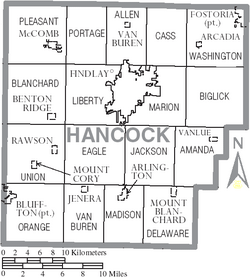
Hancock County has several different types of communities, from big cities to small villages and townships.
Cities
Villages
Townships
- Allen
- Amanda
- Biglick
- Blanchard
- Cass
- Delaware
- Eagle
- Jackson
- Liberty
- Madison
- Marion
- Orange
- Pleasant
- Portage
- Union
- Van Buren
- Washington
Unincorporated Communities
Ghost Town
- Moffit
See also
 In Spanish: Condado de Hancock (Ohio) para niños
 | Isaac Myers |
 | D. Hamilton Jackson |
 | A. Philip Randolph |


