Klickitat County, Washington facts for kids
Quick facts for kids
Klickitat County
|
|
|---|---|

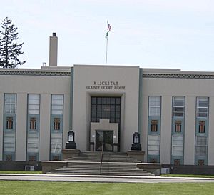
Klickitat County Courthouse
|
|

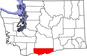
Location within the U.S. state of Washington
|
|
 Washington's location within the U.S. |
|
| Country | |
| State | |
| Founded | December 20, 1859 |
| Named for | Klickitat Tribe |
| Seat | Goldendale |
| Largest city | Goldendale |
| Area | |
| • Total | 1,904 sq mi (4,930 km2) |
| • Land | 1,871 sq mi (4,850 km2) |
| • Water | 33 sq mi (90 km2) 1.7%% |
| Population
(2020)
|
|
| • Total | 22,735 |
| • Estimate
(2023)
|
23,589 |
| • Density | 11.6/sq mi (4.5/km2) |
| Time zone | UTC−8 (Pacific) |
| • Summer (DST) | UTC−7 (PDT) |
| Congressional district | 4th |
Klickitat County is a county in the U.S. state of Washington. It's a place where about 22,735 people lived in 2020. The main city and county seat is Goldendale. The county gets its name from the Klickitat tribe, who are Native Americans.
Contents
History

Klickitat County was formed on December 20, 1859. It was once part of Walla Walla County.
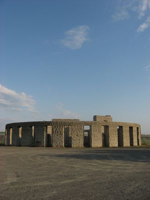
A very important person in the county's early days was Samuel Hill. He helped build better roads. He also created famous landmarks. These include a replica of Stonehenge called Maryhill Stonehenge. This monument honors local soldiers who died in World War I. He also built a large house that is now the Maryhill Museum of Art. The Sam Hill Memorial Bridge across the Columbia River is named after him.
Geography
Klickitat County covers about 1,904 square miles. Most of this area, 1,871 square miles, is land. About 33 square miles, or 1.7%, is water.
Natural Features
Main Roads
Neighboring Counties
- Yakima County - north
- Benton County - northeast
- Morrow County, Oregon - southeast
- Gilliam County, Oregon - southeast
- Sherman County, Oregon - south
- Hood River County, Oregon - southwest
- Wasco County, Oregon - southwest
- Skamania County - west
Protected Areas
People and Population
2020 Census Information
In 2020, Klickitat County had 22,735 people living there. There were 9,332 households. The county had about 12.1 people per square mile.
Most people in the county were White (92.8%). There were also Native American (2.6%), Asian (1.0%), and African American (0.7%) residents. About 2.7% of people were from two or more races. People of Hispanic or Latino origin made up 12% of the population.
About 18.7% of the population was under 18 years old. About 4.6% were under 5 years old. People over 65 years old made up 25.2% of the population. The county was almost evenly split between females (49%) and males (51%).
The average income for a household in the county was $59,583. The average income per person was $34,529. About 13.0% of the people in the county lived below the poverty line.
Communities
Cities
- Bingen
- Goldendale (county seat)
- White Salmon
Census-designated places
Unincorporated communities
See also
 In Spanish: Condado de Klickitat para niños
 | Selma Burke |
 | Pauline Powell Burns |
 | Frederick J. Brown |
 | Robert Blackburn |


