La Crosse County, Wisconsin facts for kids
Quick facts for kids
La Crosse County
|
||
|---|---|---|

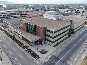
La Crosse County Courthouse
|
||
|
||

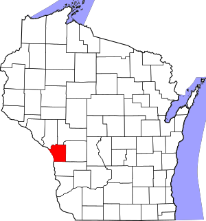
Location within the U.S. state of Wisconsin
|
||
 Wisconsin's location within the U.S. |
||
| Country | ||
| State | ||
| Founded | 1851 | |
| Seat | La Crosse | |
| Largest city | La Crosse | |
| Area | ||
| • Total | 480 sq mi (1,200 km2) | |
| • Land | 452 sq mi (1,170 km2) | |
| • Water | 28 sq mi (70 km2) 5.9%% | |
| Population
(2020)
|
||
| • Total | 120,784 | |
| • Estimate
(2023)
|
120,486 |
|
| • Density | 251.6/sq mi (97.2/km2) | |
| Time zone | UTC−6 (Central) | |
| • Summer (DST) | UTC−5 (CDT) | |
| Congressional district | 3rd | |
La Crosse County is a county in the state of Wisconsin. It's located in the western part of the state. In 2020, about 120,784 people lived here. The main city and county seat is La Crosse. This county is the most populated one along Wisconsin's western border. It's also part of a larger area called the La Crosse-Onalaska Metropolitan Statistical Area.
Contents
Exploring La Crosse County's Geography
La Crosse County covers a total area of about 480 square miles. Most of this area, 452 square miles, is land. The remaining 28 square miles, which is about 5.9%, is water.
Main Roads and Transportation
Getting around La Crosse County is easy with several important roads and transportation options.
Major Highways
 Interstate 90
 U.S. Highway 14
 U.S. Highway 53
 U.S. Highway 61
 Highway 16 (Wisconsin)
 Highway 33 (Wisconsin)
 Highway 35 (Wisconsin)
 Highway 108 (Wisconsin)
 Highway 157 (Wisconsin)
 Highway 162 (Wisconsin)
Railroads
You can find these railway services in the county:
- Amtrak
- BNSF
- Canadian Pacific
- La Crosse station
Bus Services
Local buses help people travel within the county:
- La Crosse MTU
- Scenic Mississippi Regional Transit
Airport
- LSE - La Crosse Regional Airport
Neighboring Counties
La Crosse County shares borders with several other counties:
- Trempealeau County - to the northwest
- Jackson County - to the northeast
- Monroe County - to the east
- Vernon County - to the south
- Houston County, Minnesota - to the southwest
- Winona County, Minnesota - to the west
Climate and Weather
La Crosse County is in the upper midwest of the United States. This means it has a temperate, continental climate. Summers are warm, with July being the warmest month. The average high temperature in July is about 85 degrees Fahrenheit (29 degrees Celsius). Winters are cold, and January is the coldest month. The average high temperature in January is around 26 degrees Fahrenheit (minus 3 degrees Celsius).
Who Lives in La Crosse County?
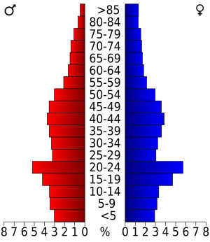
The population of La Crosse County has grown a lot over the years. In 1860, there were just over 12,000 people. By 2020, the population had grown to 120,784 people.
Population Makeup
In 2020, the county's population was mostly White (88.0%). There were also significant numbers of Asian (4.6%), Black or African American (1.7%), and Native American (0.4%) residents. About 4.4% of the population identified with two or more races. People of Hispanic or Latino background made up 2.5% of the population.
Household Income
In recent years, the average income for a household in La Crosse County was about $55,479 per year. For families, the average income was higher, around $67,388.
Cities, Towns, and Villages
La Crosse County has several different types of communities where people live.
Cities
Villages
Towns
Census-Designated Places
These are areas that are like towns but are not officially incorporated as cities or villages.
Unincorporated Communities
These are smaller communities that don't have their own local government.
See also
 In Spanish: Condado de La Crosse para niños
 | Delilah Pierce |
 | Gordon Parks |
 | Augusta Savage |
 | Charles Ethan Porter |


