Laurence Harbor, New Jersey facts for kids
Quick facts for kids
Laurence Harbor, New Jersey
|
|
|---|---|
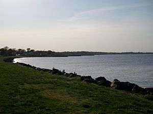
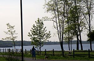
The Raritan Bayshore at Laurence Harbor in Old Bridge, New Jersey, looking westward along Raritan Bay towards the adjacent Middlesex County city of South Amboy
|
|
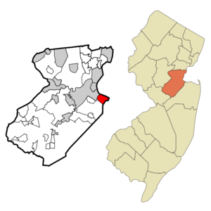
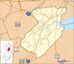
Map of Laurence Harbor CDP in Middlesex County. Inset: Location of Middlesex County in New Jersey.
|
|
| Country | |
| State | |
| County | Middlesex |
| Township | Old Bridge |
| Area | |
| • Total | 3.00 sq mi (7.78 km2) |
| • Land | 2.95 sq mi (7.64 km2) |
| • Water | 0.06 sq mi (0.14 km2) 1.90% |
| Elevation | 30 ft (9 m) |
| Population
(2020)
|
|
| • Total | 6,635 |
| • Density | 2,249.9/sq mi (868.7/km2) |
| Time zone | UTC−05:00 (Eastern (EST)) |
| • Summer (DST) | UTC−04:00 (Eastern (EDT)) |
| ZIP Codes | |
| Area code(s) | 732 |
| FIPS code | 34-39360 |
| GNIS feature ID | 02390040 |
Laurence Harbor is a community found along the beautiful Raritan Bay in Old Bridge Township, Middlesex County, New Jersey, United States. It's known as a "census-designated place" (CDP), which means it's a special area defined for counting people. In 2020, about 6,635 people lived here.
Contents
A Look Back in Time: History of Laurence Harbor
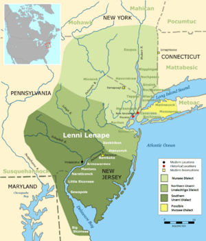
Long ago, the land where Laurence Harbor now stands was home to the Lenni Lenape tribe. This was in the 1600s. Later, in 1664, the area became part of a larger region called East Jersey. By 1684, it was part of South Amboy.
In 1869, a new area called Madison Township was created from South Amboy. This township was later renamed Old Bridge Township in 1975.
European settlers came to this area because it was good for trade along the Raritan River. The high cliffs along the bay were also useful. They allowed people to watch ships traveling between New York Harbor and the Atlantic Ocean.
How Laurence Harbor Got Its Name
Laurence Harbor is named after a man named Laurence Lamb. He was a land developer who bought property here around the year 1900. At that time, the area was still called Madison Township. Mr. Lamb divided the land into smaller pieces, perfect for building bungalow-style homes.
He also created a large, 400-acre golf and country club right on the shore. Many famous people visited his club, like Clark Gable and Guy Lombardo. Even the Prince of Wales and the wealthy Vanderbilts came to party and enjoy the famous "chingarora oysters" from Raritan Bay.
In 1928, the golf club was sold to developers who built more bungalows. There was even a boardwalk with a dance hall, a casino, and a merry-go-round. This merry-go-round famously played only one song: "Let's Remember Pearl Harbor." This boardwalk was a popular spot for fun, hot dogs, and ice cream in the 1940s.
For people traveling from North Jersey or New York, Laurence Harbor was often the first beach area they reached on the Jersey Shore.
Secrets of Prohibition
During the time of Prohibition, when alcohol was illegal, this area had a secret. Local historians say that "rum runners" used the bay to bring in illegal liquor. They would drop their cargo into the bay, and local fishermen would help bring it ashore.
The Old Brickworks
There was once a brick factory called Ochwald Brickworks in Laurence Harbor. It operated from the early 1900s until the early 1960s. About 60 workers made over 84,000 bricks every day! Today, nothing is left of the factory. Homes now stand where it once was.
Where is Laurence Harbor? Geography and Location
Laurence Harbor is the community farthest east in Middlesex County. It sits in the northeast corner of Old Bridge Township.
- To the north, it's bordered by Raritan Bay.
- To the northwest, you'll find Cheesequake Creek. Across the creek is the community of Morgan in Sayreville.
- To the southwest, the Garden State Parkway runs nearby.
- To the southeast, it borders Cliffwood and Cliffwood Beach in Monmouth County.
You can reach Laurence Harbor from Exit 120 of the Garden State Parkway. The main roads are Laurence Parkway and New Jersey Route 35. A railroad track also runs through the community, dividing it into eastern and western parts. The eastern part is often called "The Front" by locals.
The community covers about 3 square miles (7.78 square kilometers). Most of this is land, with a small amount of water.
From the shoreline of Laurence Harbor, you can look directly north and see the southern shore of Staten Island. On a clear night, you might even see the Verrazzano-Narrows Bridge, Lower Manhattan (including the Empire State Building), and Brooklyn.
Homes in Laurence Harbor
Since Laurence Harbor was a popular beach resort from the 1920s to the 1950s, many homes near the water are bungalow style. These smaller homes have often been updated for year-round living. Some people have even combined lots to build much larger houses.
Many homes built on the high cliffs overlooking the water have amazing views of Raritan Bay. You can see the Verrazzano-Narrows Bridge, Outerbridge Crossing, and even New York City in the distance. The higher land helps protect most of these homes from flooding.
A newer development called Bridgepointe was finished in 2005. It has upscale condos and townhouses. This area is popular with people who travel to work in New York and North Jersey. There are also plans for a hotel, convention center, and a train station nearby, but construction hasn't started yet.
Fun Things to Do: Parks and Recreation
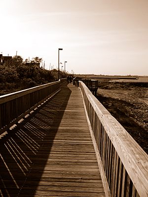
Laurence Harbor is home to the Old Bridge Waterfront Park. This park has a new boardwalk that was completed in 2002. The old boardwalk was damaged in the 1940s and 1950s. The park stretches for about one mile along New Jersey Route 35.
This area is great for fishing because it has three jetties that reach into Raritan Bay. These jetties were also recently redone and are in excellent condition. The park's boardwalk is a popular spot for jogging and walking dogs. At the northern end of the park, you can go swimming at the bay beach. There are also bathrooms and showers available.
Hurricane Sandy's Impact
On October 29, 2012, Hurricane Sandy hit the Raritan Bayshore area very hard. The storm surge, which was like a huge wave, was estimated to be 15 to 20 feet above sea level. This powerful surge destroyed parts of the Old Bridge Waterfront Park.
After the hurricane, improvements were made to the boardwalk, jetties, and parks in 2014. Now, there are new parks, a new boardwalk, and better protection against erosion along the bay.
Animals and Plants: Environment of Laurence Harbor
Laurence Harbor is surrounded by different types of wetlands and bay areas. The shallow bay is a great place for migratory birds to stop and find food.
- You can often see great egrets in the area, except during the coldest winter months. In late September and October, before it freezes, many egrets gather here.
- In April, hundreds of large Atlantic horseshoe crabs come to the shoreline to lay their eggs.
- In the fall and early spring, sea gulls look for food by picking mussels and clams from the bay. They fly up high and drop them on the jetties to break them open.
Fish in the Bay
Many different kinds of fish live and lay their eggs in the local waters.
- Striped bass feed along the coast in early spring when the water gets warmer. They leave when the water gets too warm for them and return in the fall when it cools down.
- Bluefish arrive in the spring and feed a lot. They stay in the water throughout the summer and into the fall. Sometimes, birds follow them when they are feeding.
- Other fish found here include black drum, fluke, winter flounder, eels, cow nose rays, skate, and weakfish.
Along the boardwalk, among the sand dunes, you can find honeysuckle trees that bloom in the spring. You might also spot wildlife like the common box turtle near the boardwalk.
Addressing Environmental Concerns: Pollution and Lead Contamination
There have been some environmental issues on the southern part of the Old Bridge Waterfront Park. The main beach there has been affected by lead. Because of this, the Environmental Protection Agency (EPA) has closed that part of the beach to the public.
You can find more information about this on the EPA's website under the "National Priorities List" for the Raritan Bay Slag Superfund Site. It is believed that a material called "slag" was used along the retaining wall in the 1960s and 1970s to stop erosion. This slag came from the National Lead factory in Sayreville. It looks like large, round discs, about 20 inches across, and is a byproduct from refining lead. It contains mostly steel with small amounts of lead and other heavy metals.
The good news is that the slag does not significantly affect the water quality. The ocean water constantly moves in and out of the bay, which helps to dilute any pollutants. However, tests have shown that the sand under the slag has lead particles. Once the slag is removed or safely contained, the beach will be reopened for everyone to enjoy.
See also
 In Spanish: Laurence Harbor para niños
 | James Van Der Zee |
 | Alma Thomas |
 | Ellis Wilson |
 | Margaret Taylor-Burroughs |


