List of military installations in Montana facts for kids
Montana has been an important place for the U.S. military for a long time! There are at least 60 places in Montana that are or used to be military bases. These places are called military installations. Some are still active today, while others are historical sites that are no longer used for military purposes.
Active Military Bases in Montana
These are the military bases that are still active and used by the U.S. military today. They help protect our country and support military operations.
- Ekalaka Mini-Mutes Radar Site, located in Carter County, Montana. This site is at an elevation of 3,205 feet (977 m).
- Fort William Henry Harrison, located in Lewis and Clark County, Montana. This base is at an elevation of 4,127 feet (1,258 m).
- Hammond Mini-Mutes Radar Site, located in Carter County, Montana. This site is at an elevation of 3,717 feet (1,133 m).
- Haycreek Mini-Mute Radar Site, located in Carter County, Montana. This site is at an elevation of 3,898 feet (1,188 m).
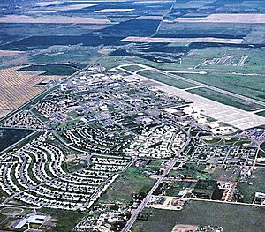
- Malmstrom Air Force Base, located near Great Falls in Cascade County, Montana. This important Air Force base is at an elevation of 3,465 feet (1,056 m).
Montana's Past Military Sites
These places are called "historical installations." This means they used to be military bases or posts, but they are no longer active. Sometimes, there are no buildings left, just the memory of where they once stood.
- Camp Baker Military Reservation, located in Meagher County, Montana. This camp was at an elevation of 4,636 feet (1,413 m).
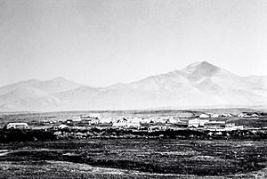
- Camp Cooke, located in Fergus County, Montana. This was the first U.S. Army post built in Montana. It was set up in August 1866 and closed in June 1870. It was named after General Philip St. George Cooke. This camp was at an elevation of 2,431 feet (741 m).
- Camp Crook, located in Rosebud County, Montana. This camp was at an elevation of 3,402 feet (1,037 m).
- Camp Cummings, located in Madison County, Montana. This camp was at an elevation of 5,771 feet (1,759 m).
- Camp Devin, located in Carter County, Montana. Its exact location is unknown today.
- Camp Lewis, located in Fergus County, Montana. This camp was at an elevation of 3,927 feet (1,197 m).
- Camp Morris, located in Liberty County, Montana. This camp was at an elevation of 3,944 feet (1,202 m).
- Camp Poplar River, located in Roosevelt County, Montana. This camp was at an elevation of 1,991 feet (607 m).
- Camp Rimini, located in Lewis and Clark County, Montana. This camp was about 20 miles west of Helena.
- Fort Assinniboine (historical), located in Hill County, Montana. This fort was at an elevation of 2,671 feet (814 m).
- Fort C F Smith (historical), located in Big Horn County, Montana. This fort was at an elevation of 3,268 feet (996 m).
- Fort Carroll (historical), located in Fergus County, Montana. This fort was at an elevation of 2,274 feet (693 m).
- Fort Custer Military Reservation (historical), located in Big Horn County, Montana. This fort was at an elevation of 3,038 feet (926 m).
- Fort Elizabeth Meagher (historical), located in Gallatin County, Montana. This fort was at an elevation of 5,249 feet (1,600 m).
- Fort Ellis (historical), located in Gallatin County, Montana. This fort was at an elevation of 4,987 feet (1,520 m).
- Fort Fizzle (historical), located in Missoula County, Montana. This was a wooden fence built by volunteers to stop Chief Joseph during the Nez Perce War in 1877. The Nez Perce found a way around it, which is why it was called "Fort Fizzle." This fort was at an elevation of 3,383 feet (1,031 m).
- Fort Green Clay Smith (historical), located in Park County, Montana. This fort was at an elevation of 4,383 feet (1,336 m).
- Fort Howes (historical), located in Powder River County, Montana. This fort was at an elevation of 3,297 feet (1,005 m).
- Fort Howie (historical), located in Meagher County, Montana. It was set up in 1867 near Martinsdale, Montana and closed the same year. It was named after Colonel Neil Howie. This fort was at an elevation of 4,931 feet (1,503 m).
- Fort Keogh (historical), located in Custer County, Montana. This fort was at an elevation of 2,372 feet (723 m).
- Fort Logan (historical), located in Meagher County, Montana. This fort was at an elevation of 4,636 feet (1,413 m).
- Fort Maginnis (historical), located in Fergus County, Montana. This fort was at an elevation of 4,160 feet (1,270 m).
- Fort Missoula (historical), located in Missoula County, Montana. This fort was at an elevation of 3,153 feet (961 m).
- Fort Owen (historical), located in Ravalli County, Montana. This fort was at an elevation of 3,294 feet (1,004 m).
- Fort Shaw (historical), located in Cascade County, Montana. This fort was at an elevation of 3,507 feet (1,069 m).
- Fort Skalkaho (historical), located in Ravalli County, Montana. This fort was at an elevation of 3,599 feet (1,097 m).
- Fort Thomas F Meagher (historical), located in Park County, Montana. This fort was at an elevation of 4,442 feet (1,354 m).
- Glasgow Air Force Base (historical), located in Valley County, Montana. This base was at an elevation of 2,749 feet (838 m).
- Havre Air Force Station (historical), located in Hill County, Montana. This station was at an elevation of 3,202 feet (976 m).
- Helena Barracks (historical), located in Lewis and Clark County, Montana. These barracks were at an elevation of 3,868 feet (1,179 m).
- Kalispell Air Force Station, located in Flathead County, Montana. This station was at an elevation of 3,700 feet (1,100 m).
- Lewistown Air Force Station (historical), located in Fergus County, Montana. This station was at an elevation of 6,424 feet (1,958 m).
- Miles City Air Force Station (historical), located in Custer County, Montana. This station was at an elevation of 2,831 feet (863 m).
- Opheim Air Force Station (historical), located in Valley County, Montana. This station was at an elevation of 3,294 feet (1,004 m).
- Powder River Supply Depot (historical), located in Prairie County, Montana. This was a U.S. Army steamboat landing set up in 1876. It was closed in 1882 when the railroad reached the area. This depot was at an elevation of 2,192 feet (668 m).
- Powder River Telegraph Station (historical), located in Powder River County, Montana. This was a U.S. Army station to fix telegraph lines. It was set up in 1878 and closed in 1883. This station was at an elevation of 2,828 feet (862 m).
- Stanley's Stockade (historical), located in Dawson County, Montana. This was a U.S. Army supply base set up in July 1873. General Alfred Terry used it as his main office during a military campaign in 1876. This stockade was at an elevation of 2,133 feet (650 m).
- Yaak Air Force Station (historical), located in Lincoln County, Montana. This station was at an elevation of 4,970 feet (1,510 m).

All content from Kiddle encyclopedia articles (including the article images and facts) can be freely used under Attribution-ShareAlike license, unless stated otherwise. Cite this article:
List of military installations in Montana Facts for Kids. Kiddle Encyclopedia.


