Long Prairie River facts for kids
Quick facts for kids Long Prairie River |
|
|---|---|

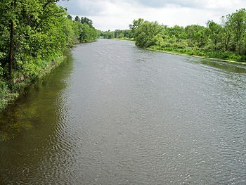
The Long Prairie River in Moran Township in Todd County in 2007
|
|
| Country | United States |
| State | Minnesota |
| Physical characteristics | |
| Main source | Lake Carlos Carlos Township, Douglas County 1,353 ft (412 m) 45°58′58″N 95°19′59″W / 45.98278°N 95.33306°W |
| River mouth | Crow Wing River Motley Township, Morrison County 1,207 ft (368 m) 46°19′27″N 94°36′46″W / 46.32417°N 94.61278°W |
| Length | 96 mi (154 km) |
| Discharge (location 2) |
|
| Basin features | |
| Basin size | 892 sq mi (2,310 km2) |
The Long Prairie River is a river in central Minnesota, United States. It is about 96 mi (154 km) long. This river flows into the Crow Wing River.
The Long Prairie River is part of a larger watershed. A watershed is an area of land where all the water drains into a common river or lake. This river's water eventually flows into the mighty Mississippi River. It drains an area of about 892 square miles (2,310 km2). This region is mostly rural, meaning it has a lot of open land and not many big cities.
Contents
River History: Early Days & Settlements
Before European settlers arrived, the area around the Long Prairie River was home to the Dakota and Ojibwe (also known as Ojibwa) people. In 1832, the land near the river was empty. It served as a boundary or "war road" between the Ojibwe and Dakota tribes.
Land Agreements and Changes
In 1847, new agreements were made with the Chippewa tribes. Land on the west side of the river was set aside for the Menominee people. Land on the east side was for the Ho-Chunk (Winnebago) people. These plans were made because these tribes were expected to move from Wisconsin.
However, the Menominee people decided not to move to Minnesota. The Ho-Chunk people did move, but they faced dangers from ongoing conflicts between the Chippewa and Dakota Sioux. Because of this, the Ho-Chunk asked to move again, this time to southern Minnesota. By 1855, they had given their land along the Long Prairie River back to the United States.
Settlers Arrive
By the 1860s, new settlers began to arrive. They started farming the open grasslands and cutting down trees in the area. The English name of the river comes from the Ojibwe language. It means "Long-narrow-Prairie River," which describes the valley it flows through.
The Long Prairie River was very important for early settlers in Todd County. It was a hunting ground for the Dakota and Ojibwe. The river also served as a way to travel and transport goods. It connected them to the Crow Wing River and the Mississippi River.
River Travel and Roads
In the 1840s, settlers first built homes in the river valley. By the mid-1860s, several towns were growing along the river. People used flatboats and even a steamboat for a short time to move goods. But by 1877, the water level dropped. Only very small boats could use the river regularly.
Later in 1877, a road was built along the west side of the river. For many years, this was the main road in the valley.
Towns Along the River
Some towns along the river grew and thrived, while others disappeared. Hartford was a settlement founded in 1865. It was located where Eagle Creek meets the river. However, when the railroad was built on the west side of the river, the community moved to be closer to it. This new location became what is now Browerville.
The town of Long Prairie was different. It started in the 1840s as a government center. It helped manage agreements with the Ho-Chunk (Winnebago) people. At one point, it was even bigger than St. Paul! But in 1855, the Ho-Chunk moved, and the land was sold. The settlement was left empty during the Dakota War of 1862. Later, new settlers slowly moved in, often using the buildings that were already there.
After the American Civil War, some soldiers who fought for the Union Army settled west of Long Prairie. They were not always welcome back in their home state of Kentucky. Towns like Whiteville and Clotho grew in this area. Clotho was settled because the forests and swamps further west were too thick to pass through.
Forests and Logging
When Europeans first settled Todd County, much of the Long Prairie River area was covered in thick forests. About 65% of the land had different kinds of hardwood and pine trees. Commercial logging, which means cutting down trees for sale, started around 1866. It continued until the mid-1890s.
Smaller creeks like Eagle, Moran, Fish Trap, and Turtle were big enough to power mills. They also helped float logs down to the Long Prairie River. From there, the logs joined others on their way to the Crow Wing and Mississippi Rivers. As most of the trees were cut down, the sandy soil was left bare. This led to more erosion, which filled the streams with dirt. That's why the streams are much smaller today.
By the 1990s, only about 21% of the area was forested. Much of this was due to new tree plantings. Over 60% of the land was used for farming, hay, or grasslands.
River Use Today
As the Long Prairie River area grew, roads and railroads became the main ways to transport goods. Landowners used the river for water for themselves and their animals. More recently, it's been used for irrigation to water crops.
Factories also set up along the riverbanks. They used the river for water and to release waste. Most towns didn't use the river for drinking water. They could easily get water from shallow wells nearby. However, wastewater from towns is still released into the river and Eagle Creek.
In the past, farmers used river water for irrigation. But during dry years in the late 1970s, many irrigation systems had to shut down because the river was too low. This made most farmers switch to using wells instead. Today, many farms in the Long Prairie River Valley use wells for irrigation. By 1994, only a few permits for using surface water (like the river) for irrigation still existed in Todd County.
River Geography: Where Does It Flow?
The Long Prairie River begins in an area with many lakes north of Alexandria. Its headwaters are at Lake Carlos in Carlos Township, Douglas County. This is just south of Lake Carlos State Park.
River's Path
The river first flows eastward into Todd County. In its upper parts, ditches connect the river to Lake Osakis. This means that during times of high water, the Long Prairie River's watershed connects with the Sauk River's watershed.
At the city of Long Prairie, the river turns and flows north-northeast. It passes by Browerville and through a state wildlife area. Then, it enters northwestern Morrison County. Here, it joins the Crow Wing River from the south, near Motley.
Most of the river's watershed is in the North Central Hardwood Forest region. This area has forests of maple and basswood trees mixed with conifers (like pine trees). These forests grow on flat plains and hills left behind by glaciers.
Land Use Around the River
The Minnesota Pollution Control Agency says that about 41% of the land around the Long Prairie River (below Lake Carlos) is used for farming. The main crops grown are potatoes, corn, soybeans, and alfalfa.
About 24% of the watershed is grassland, including pastures for animals. Forests cover 21% of the area, and 10% is water or wetlands. Only 3% of the land is urban or developed.
Because the river's floodplain (the flat land next to the river) is wide, the land right next to the river is mostly farms or wetlands. In the upper part of the river, there used to be forests of aspen and oak trees, wetlands, and tallgrass prairie. Downstream from Browerville, you'll see a mix of farmland and second-growth forest (forests that have grown back after being cut down).
Recreation and Wildlife
The Minnesota Department of Natural Resources suggests the Long Prairie River is a good place for canoeing. You can also find different types of fish in the river. These include northern pike, walleye, smallmouth bass, and largemouth bass.
River Flow Rate: How Much Water?
The United States Geological Survey measures how much water flows in the river. At the city of Long Prairie, the average flow of the river between 1972 and 2005 was 166 cubic feet per second (about 5 cubic meters per second).
The most water ever recorded flowing in the river was 3,270 cubic feet per second (93 cubic meters per second). This happened on July 22, 1972. The least amount of water recorded was only 0.84 cubic feet per second (almost 0 cubic meters per second). This was on January 12, 1977.
 | Laphonza Butler |
 | Daisy Bates |
 | Elizabeth Piper Ensley |


