
Ludwigshafen facts for kids
Quick facts for kids
Ludwigshafen am Rhein
|
|||
|---|---|---|---|

April 2006 aerial view
|
|||
|
|||
| Lua error in Module:Location_map at line 530: Unable to find the specified location map definition: "Module:Location map/data/Germany Rheinland-Pfalz" does not exist. | |||
| Country | Germany | ||
| State | Rhineland-Palatinate | ||
| District | Urban district | ||
| Subdivisions | 10 districts | ||
| Area | |||
| • Total | 77.68 km2 (29.99 sq mi) | ||
| Elevation | 96 m (315 ft) | ||
| Population
(2022-12-31)
|
|||
| • Total | 174,265 | ||
| • Density | 2,243.37/km2 (5,810.3/sq mi) | ||
| Time zone | UTC+01:00 (CET) | ||
| • Summer (DST) | UTC+02:00 (CEST) | ||
| Postal codes |
67059 - 67071
|
||
| Dialling codes | 0621, 06237 | ||
| Vehicle registration | LU | ||
| Website | www.ludwigshafen.de | ||


Ludwigshafen, officially called Ludwigshafen am Rhein, is a city in Germany. It is located in the state of Rhineland-Palatinate, right on the Rhine river. The name means "Ludwig's Port upon Rhine."
Ludwigshafen is known as an industrial city. It is home to BASF, which is one of the biggest chemical companies in the world. The city also has cultural places like the Staatsphilharmonie Rheinland-Pfalz, a famous orchestra.
A former leader of Germany, Helmut Kohl, was born and passed away in Ludwigshafen. In 2012, Ludwigshafen was recognized as a "global city." This means it plays an important role in the world's economy and connections.
Contents
Exploring Ludwigshafen's Past
Ancient Times and Early Settlements
Long ago, Celtic and Germanic tribes lived in the area around the Rhine river. Around the 1st century BC, the Romans took control. They built a fort near what is now the Rheingönheim area.
During the Middle Ages, some of Ludwigshafen's future neighborhoods were founded. These included Oggersheim, Maudach, Oppau, and Mundenheim. However, much of the land was swampy. This made it hard to develop because of floods from the Rhine.
The Rheinschanze Fortress

The Rhine Neckar region was part of the Electorate of the Palatinate. This was a large state within the Holy Roman Empire. In 1606, the new capital city of Mannheim was founded. To protect Mannheim, a fortress called die Rheinschanze was built across the Rhine. This fortress became the very beginning of Ludwigshafen.
In the 17th century, wars like the Thirty Years' War caused a lot of damage and made people leave the region. It was not until the 18th century that the settlements around the Rheinschanze began to grow. They benefited from being close to Mannheim. Oggersheim became important after a small palace and a famous church were built there. The famous German writer Friedrich Schiller even lived in Oggersheim for a short time in 1782.
Wars returned with the French Revolution. The Oggersheim palace was burned, and the area west of the Rhine became part of France. After the French were defeated, the Rhine became a border. The Rheinschanze fortress, now separated from Mannheim, lost its military purpose.
How Ludwigshafen Was Founded

In 1808, a man named Carl Hornig bought the fortress from the French. He turned it into a stop for river boats. Later, the Rheinschanze became a trading post, especially after a flood in 1824 created a safe harbor.
The year 1844 is considered the official start of Ludwigshafen. This is when the land was sold to the state of Bavaria. The Bavarian king, Ludwig I, decided to name the settlement after himself. He planned to build a city there to compete with Mannheim.
In 1848, during a German revolution, rebels took over Ludwigshafen. But they were soon driven out by troops. On December 27, 1852, King Maximilian II gave Ludwigshafen am Rhein its own political freedom. On November 8, 1859, it officially became a city.
Industry and City Growth
| Historical population | ||
|---|---|---|
| Year | Pop. | ±% |
| 1840 | 90 | — |
| 1848 | 600 | +566.7% |
| 1852 | 1,400 | +133.3% |
| 1858 | 2,800 | +100.0% |
| 1871 | 7,900 | +182.1% |
| 1885 | 21,000 | +165.8% |
| 1895 | 40,000 | +90.5% |
| 1900 | 62,000 | +55.0% |
| 1914 | 94,000 | +51.6% |
| 1925 | 102,000 | +8.5% |
| 1939 | 144,000 | +41.2% |
| 1945 | 61,000 | −57.6% |
| 1950 | 124,000 | +103.3% |
| 1956 | 147,000 | +18.5% |
| 1970 | 180,000 | +22.4% |
| 1985 | 161,000 | −10.6% |
| 1995 | 171,000 | +6.2% |
| 2000 | 165,000 | −3.5% |
| 2004 | 166,000 | +0.6% |
| 2006 | 163,000 | −1.8% |
| 2018 | 171,000 | +4.9% |
| Population size may be affected by changes in administrative divisions. | ||

When it was founded, Ludwigshafen was small, with only about 1,500 people. Its real growth began with the rise of factories and industries. Ludwigshafen was perfect for this because of its great location for transport. It had a good harbor on the Rhine. Also, a railway connecting it to the Saar coalfields was finished in 1849.
A very important year for Ludwigshafen was 1865. BASF decided to move its factories from Mannheim to Ludwigshafen. From then on, the city's fast growth was connected to BASF's success. BASF became one of the world's most important chemical companies. Other chemical companies also came to Ludwigshafen, like Benckiser and Giulini Brothers.
With more jobs, Ludwigshafen's population grew very quickly. By 1899, over 62,000 people lived there. This fast growth meant there wasn't enough housing. To solve this, the city expanded. It added the nearby villages of Friesenheim and Mundenheim in the 1890s. New neighborhoods were built on raised ground because the area was marshy and prone to floods.
From World War I to World War II
During World War I (1914–1918), Ludwigshafen's factories were very important for Germany's war efforts. They made chemicals for weapons. On May 27, 1915, French planes attacked the BASF plants. This was one of the first air attacks of its kind.
After Germany lost the war in 1918, French troops occupied the area. This lasted until 1930. In the 1920s, the economy started to get better. However, a huge industrial explosion happened on September 21, 1921. A BASF storage silo in Oppau blew up. More than 500 people died, and many buildings were destroyed.
Despite this, Ludwigshafen reached a population of 100,000 in 1922. This gave it official "City" status. The city did well until 1929, when the Great Depression started. This brought job losses and political problems. The Nazis came to power in Germany. They built many small houses with gardens, especially in the Gartenstadt area. They also added more villages to Ludwigshafen, increasing its population to 135,000. Sadly, the Ludwigshafen synagogue was destroyed in 1938. The city's Jewish population was forced to leave in 1940.
During World War II, Ludwigshafen was heavily bombed. Allied planes attacked the city's industrial plants. By the end of the war, most homes were destroyed or damaged. Many people died or were injured. American troops captured Ludwigshafen in March 1945.
Rebuilding After the War
After World War II, Ludwigshafen was in the French occupation zone. It became part of the new state of Rheinland-Pfalz. The city was rebuilt with help from the Allies, especially the Americans. In 1948, a group from Pasadena, California, sent aid packages to Ludwigshafen. This led to Ludwigshafen and Pasadena becoming sister cities in 1956.
Much of the city was in ruins. It was rebuilt in the style of the 1950s and 1960s. Important projects included new elevated highways and a modern main train station. New apartment buildings and a new neighborhood called Pfingstweide were also built.
The city's economic success allowed for new social programs. The population reached its highest point in 1970, with over 180,000 people.
Recent Times
In recent years, Ludwigshafen has worked to improve its image. The city has reduced its debt. Pollution has been controlled, especially by BASF. Older neighborhoods like Hemshof have been restored.
In 2008, a fire in a building where many Turkish families lived caused 9 deaths. It was first thought to be arson, but this was later found to be untrue.
Ludwigshafen has also worked to improve its shopping areas. A large shopping mall called the Walzmühle was built. Another mall, the Rhein-Galerie, opened in 2010 on the banks of the Rhine. Ludwigshafen remains a very important industrial city.
| Largest groups of foreign residents | |
| Nationality | Population |
|---|---|
| 9,010 | |
| 6,309 | |
| 3,656 | |
| 2,581 | |
| 2,574 | |
| 2,086 | |
| 1,821 | |
| 1,730 | |
| 1,647 | |
| 1,525 | |
| 1,437 | |
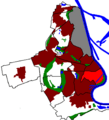
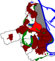
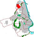
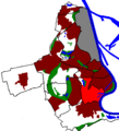
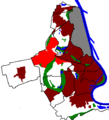
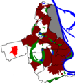
Ludwigshafen's Districts
City Centre
-
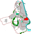
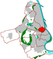
Map showing the city centre
-
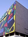
The "Miró-Wand" mural at the Wilhelm Hack Museum of Art
-
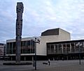
Pfalzbau concert hall and theater
-
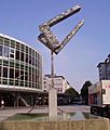
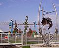
Berliner Platz with the "Conversation II" sculpture


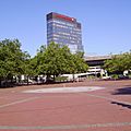
Ludwigshafen's city centre is quite small. It mainly has buildings built after World War II. Highways on stilts mark its northern and southern edges. The Rhine river is to the east. The main train station is to the west, about a 15-minute walk from the main shopping streets.
The main streets are Bismarckstraße and Ludwigsstraße. They connect the northern and southern parts of downtown. Key landmarks include the Pfalzbau, Staatsphilharmonie, Wilhelm-Hack-Museum, and the historic Lutherkirche.
Southern City Centre
-
Map showing the southern city centre
-
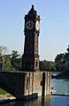
The Pegeluhr, a water level clock
-
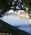
Harbor area
-
Südwestplatz


The Südliche Innenstadt (southern city centre) includes the main downtown area and the "South" quarter. The "South" quarter has some very nice places to live, especially the Parkinsel area. Other parts of "South" are called the Musikantenviertel and the Malerviertel. Soon, a new housing area will be built along the Rhine.
Northern City Centre
-
Map showing the northern city centre
-
Europaplatz
-
Landratsamt building
-
Municipal Clinic with "Ring des Seyns" sculpture


The Nördliche Innenstadt (northern city centre) includes the Hemshof, "North," and "West" districts. Hemshof and "North" are the older parts of Ludwigshafen. They are known for having many people from different countries, making them very diverse. "West" is located between the main train station and the main cemetery.
Friesenheim District
-
Map showing Friesenheim
-
Detail of the Eberthalle
-
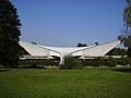
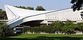
The Friedrich-Ebert-Halle (Eberthalle)
-
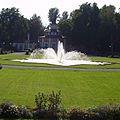
Ebertpark


Friesenheim is north of Hemshof. It is one of Ludwigshafen's "mother villages," meaning it helped manage Ludwigshafen before the city became independent. Former German Chancellor Helmut Kohl was born here. The western part of Friesenheim, called Froschlache, has four tall apartment buildings.
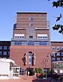
Oppau District
-
Map showing Oppau
-
Catholic church in Oppau
-
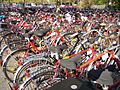
BASF bicycles
-
Memorial for the 1921 explosion


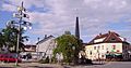
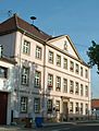
Oppau is in the north of the city. It is very close to the BASF chemical plant. Oppau used to be its own town before it became part of Ludwigshafen. It has faced several disasters, like the huge Oppau explosion in 1921.
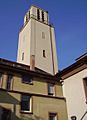
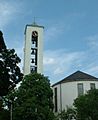
Edigheim District
-
Map showing Edigheim
-
Church in Edigheim
-
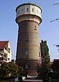
Water tower in Edigheim
-
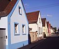
A street in Edigheim


Edigheim was once part of Oppau. Today, it is almost as big as Oppau. The Pfingstweide is the northernmost district of Ludwigshafen. It has many tall buildings and is close to the city of Frankenthal.
Gartenstadt District
-
Map showing Gartenstadt
-
Hospital in Gartenstadt
-
Kindergarten in Gartenstadt
-
Church in Gartenstadt


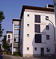
The Gartenstadt (meaning "garden city") is west of Mundenheim. As its name suggests, it is a very green area. It has many houses with flat roofs and some taller buildings. Its smaller parts are called Niederfeld, Hochfeld, and Ernst-Reuter-Siedlung.
Mundenheim District
-
Map showing Mundenheim
-
Triport
-
Cemetery chapel
-
Nursing home


Mundenheim is a very old part of Ludwigshafen. It has its own train station and a large industrial area near the harbor. A part of Mundenheim in the north is called the Herderviertel.
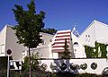
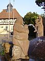
Oggersheim District
-
Map showing Oggersheim
-
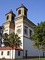
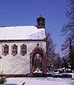
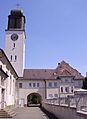
Wallfahrtskirche
-
The "Privatbrauerei Gebrüder Mayer" brewery
-
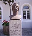
Statue of Friedrich Schiller


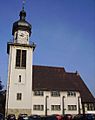
Oggersheim is one of the most important districts. It feels like a town on its own, which it was in the Middle Ages. In the 18th century, Electress Palatine Elisabeth Auguste of Sulzbach used Schloss Oggersheim as her summer palace.
Helmut Kohl owned a house in southern Oggersheim. The district has the Wallfahrtskirche church, a train station, and an important hospital. In recent years, new homes have been built in the northern parts of Notwende and Melm.
Rheingönheim District
-
Map showing Rheingönheim
-
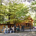
Entrance to the Wildpark
-
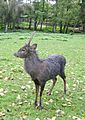
Animals in the Wildpark
-
Catholic church in Rheingönheim


Rheingönheim is the southernmost district of Ludwigshafen. It is known for its industries and its Wildpark, which is a park with wild animals.
Maudach District
-
Map showing Maudach
-
The centre of Maudach
-
Maudacher Castle
-
Path in Maudacher Bruch park


Maudach is in Ludwigshafen's southwest. It is a popular place to live. It is very close to the Maudacher Bruch park.
Ruchheim District
-
Map showing Ruchheim
-
Paul Münch fountain
-
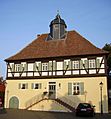
Former town hall of Ruchheim


Ruchheim is the westernmost district. It used to be a small farming village. Now, it is growing quickly with many new homes being built.
Getting Around Ludwigshafen

Ludwigshafen does not have its own airport. However, it is easy to reach several airports nearby. There are small airfields near Speyer, Bad Dürkheim, and Worms. A medium-sized airport is in Mannheim. The Frankfurt International Airport is about an hour's drive away.
The city's harbor is very important. It is the biggest German harbor west of the Rhine. Local industries use the river to transport raw materials and products. The harbor has several basins and wharfs along the river.
Ludwigshafen has excellent connections to highways (Autobahn). The A 650 runs east-west, and the A 61 runs north-south. Other important roads include the A 6, A 65, and B 9. Some elevated expressways in the city center are currently closed for repairs. These roads continue across the Rhine to Mannheim.
Ludwigshafen Hauptbahnhof is a very large train station. Its impressive bridge pier is a landmark for the city. The station's unique design helps connect three different train lines. It also includes an underground tram station and a large road bridge above. Other train stations are in Oggersheim, Mundenheim, Rheingönheim, and the newer Ludwigshafen (Rhein) Mitte station. Since 2003, the S-Bahn Rhein-Neckar suburban train system has served the region.
Ludwigshafen's public transport uses trams and buses. Four tram lines cross the Rhine to Mannheim. Another line runs only within Ludwigshafen. The bus network has about ten city lines and more regional lines. Interestingly, Ludwigshafen has four underground tram stations. These were built in the 1970s for a planned underground network with Mannheim. However, Mannheim canceled the project due to high costs.
Ludwigshafen's Neighbors and Region
The cities of Mannheim and Ludwigshafen work closely together. Even though they are in different states, the border is mostly for administration. Many people from Ludwigshafen go to Mannheim for shopping and entertainment. Likewise, some people from Mannheim work in Ludwigshafen. Many students from the University of Mannheim live in Ludwigshafen because rents are cheaper.
The area around Ludwigshafen on the left side of the Rhine is called Pfalz. This is the eastern part of the Palatinate region. The administrative area around Ludwigshafen is called Rhein-Pfalz-Kreis. North of Ludwigshafen is the industrial town of Frankenthal. To the west, many villages grow huge amounts of vegetables. This gives the Rheinpfalz the nickname "Germany's vegetable garden." South of Ludwigshafen, the area is shaped by the Rhine river and its old channels. The ancient town of Speyer with its grand cathedral is also nearby.
Further away, you can find the beautiful German Wine Route. This region has Germany's largest continuous wine-growing area. To the west is the Palatinate forest, which is the biggest continuous forest in Europe. To the south are the French region Alsace and the German Black Forest hills. To the east are Heidelberg and the Odenwald hills. The Frankfurt Rhine Main Area with the city of Frankfurt is about 100 km to the north.
Culture and Arts

The Pfalzbau is a theatre and concert hall important to the region. The Staatsphilharmonie Rheinland-Pfalz has its own symphonic orchestra. There are also smaller theatres in the Hemshof district that perform plays in local dialects.
The Wilhelm-Hack-Museum is the city's art museum. It has art from ancient times to today. It is famous for the large Miró mural on its outside wall, called the "Miró Wall". This mural was made by the Spanish artist Joan Miró and ceramist Joan Gardy Artigas. It uses 7,200 ceramic tiles.
Several small museums in Ludwigshafen focus on the city's history. These include the Stadtmuseum in the Rathaus Center, the Schillerhaus Oggersheim, and the K.O. Braun-Museum in Oppau.
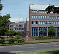
Ludwigshafen also has colleges. The Fachhochschule Ludwigshafen specializes in economics and has an East Asia Institute. There is also the Evangelische Fachhochschule Ludwigshafen, which focuses on social sciences.
Economy and Industry
 BASF is the most important industrial company in Ludwigshafen. However, many other companies are also located here. Trade and industry in Ludwigshafen employ about 90,000 people. They have a total yearly income of nearly 17 billion euros.
BASF is a world leader in chemicals. About 35,000 people work at its Ludwigshafen plant. This plant is also the largest chemical plant in the world. BASF makes products like fertilizers, dyes, coolants, and many other chemical substances.
Other important chemical companies in Ludwigshafen include BK Giulini, Abbvie, Raschig, and Benckiser. Other key industries are mechanical engineering, electrical engineering, IT, and brewing (Mayerbräu Oggersheim).
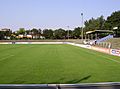
Sports and Recreation

Ludwigshafen has a large stadium called the Südweststadion. It was built using debris from World War II and can hold about 40,000 people. Some international football matches have been played there.
Ludwigshafen has never had a professional football club. The most successful local club was FSV Oggersheim, which played in the third division for a short time. As of 2015, Arminia Ludwigshafen is the highest-ranked football club from the city.
An athletics hall was built near the stadium a few years ago. The TSG Friesenheim handball team has played in Germany's top handball division.
Nature and Parks

Ludwigshafen has several city parks. The Ebertpark is in the North quarter and Friesenheim. It was created for a gardening exhibition in 1925. It includes the Friedrich-Ebert-Halle, a multi-purpose hall.
The official Stadtpark (municipal park) is on the Parkinsel (park island), a bank of the Rhine. You can easily reach it by tram.
The Friedenspark is closer to the city center. It is located north of the main train station. This is the newest park in Ludwigshafen, built on an old industrial area.
There are also many smaller parks in the districts. Examples include the Stadtpark Oggersheim, Riedsaumpark, and Ebertpark.
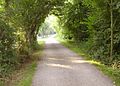
The Maudacher Bruch is a large, horseshoe-shaped area in the west. It includes the Michaelsberg, a hill made from debris after World War II. The Kief´scher Weiher in the south is connected to the Rhine. It is used as a yacht harbor and is surrounded by camping areas.
Notable People from Ludwigshafen
Born in the 19th Century

- Ernst Bloch (1885–1977), a famous philosopher and writer.
- Ernst A. Lehmann (1886–1937), an airship captain and builder of Zeppelins.
- William Dieterle (1893–1972), a Hollywood film director and actor who won an Oscar.
- Edgar Julius Jung (1894–1934), a lawyer, politician, and journalist.
- Gustav Ehrhart (1894–1971), a chemist.
Born in the 20th Century
1901–1940
.jpg)
- Georg Gehring (1903–1943), a wrestler who won an Olympic bronze medal.
- Oswald Karch (1917–2009), a German racing driver.
- Ernst Gutting (1919–2013), an auxiliary bishop of Speyer.
- Klaus Gamber (1919–1989), a Catholic priest and historian of church rituals.
- Max Clos (1925–2002), a French journalist.
- Rudolf Kortokraks (1928–2014), a painter.
- Carl Haas (1929–2016), an American racing driver.
- Waldemar Schreckenberger (1929–2017), a lawyer and former Secretary of State.
- Helmut Kohl (1930–2017), who served as the German Chancellor from 1982 to 1998.
- Kurt Biedenkopf (1930–2021), a politician who was the leader of Saxony from 1990 to 2002.
- Robert Franz Schmidt (1932–2017), a physiologist and professor.
- Fanny Morweiser (1940–2014), an author.
- Lambert Hamel (born 1940), an actor.
1951–1990
- Manfred Kaltz (born 1953), a football player and manager.
- Norbert Bolz (born 1953), a media scientist.
- Doris Barnett (born 1953), a politician who has been a Member of Bundestag since 1994.
- Wolfgang Güllich (1960–1992), a famous rock climber.
- Barbara Eligmann (born 1963), a television presenter.
- Claudio Passarelli (born 1965), a wrestler and champion.
- Joachim Weickert (born 1965), a mathematician.
- Mario Kordić (born 1972), a politician and mayor of Mostar.
- Sanne Kurz (born 1974), a camera woman.
- Richard Möller (born 1977), a football player and manager.
- Jan-Peter Peckolt (born 1981), a sailor.
- André Schürrle (born 1990), a footballer.
1991–Present
- Christian Dissinger (born 1991), a handball player.
- Paul Ehmann (born 1993), a footballer.
- Nadiem Amiri (born 1996), a footballer.
- Apache 207 (born 1997), a rapper.
Sister Cities
Ludwigshafen is connected with these cities around the world:
 Pasadena, United States (1948)
 Lorient, France (1963)
 Havering (London), United Kingdom (1971)
 Sumqayit, Azerbaijan (1987)
 Dessau-Roßlau, Germany (1988)
 Antwerp, Belgium (1999)
 Gaziantep, Turkey (2012)
 Zviahel, Ukraine (2022)
Images for kids
-
Map showing the city centre
-
Map showing the southern city centre
-
Map showing the northern city centre
-
Map showing Friesenheim
-
Map showing Oppau
-
Map showing Edigheim
-
Map showing Gartenstadt
-
Map showing Mundenheim
-
Map showing Oggersheim
-
Map showing Rheingönheim
-
Map showing Maudach
-
Map showing Ruchheim
See also
 In Spanish: Ludwigshafen am Rhein para niños
