Monroe County, Arkansas facts for kids
Quick facts for kids
Monroe County
|
|
|---|---|
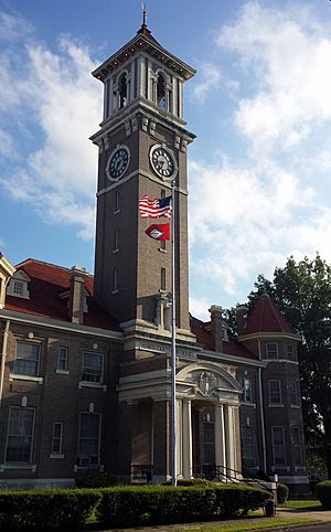
Monroe County Courthouse in Clarendon
|
|
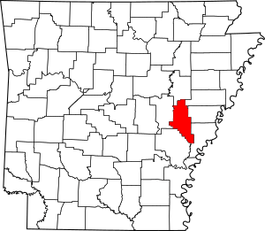
Location within the U.S. state of Arkansas
|
|
 Arkansas's location within the U.S. |
|
| Country | |
| State | |
| Founded | November 2, 1829 |
| Named for | James Monroe |
| Seat | Clarendon |
| Largest city | Brinkley |
| Area | |
| • Total | 621 sq mi (1,610 km2) |
| • Land | 607 sq mi (1,570 km2) |
| • Water | 14 sq mi (40 km2) 2.3%% |
| Population
(2020)
|
|
| • Total | 6,799 |
| • Estimate
(2023)
|
6,512 |
| • Density | 10.948/sq mi (4.227/km2) |
| Time zone | UTC−6 (Central) |
| • Summer (DST) | UTC−5 (CDT) |
| Congressional district | 1st |
Monroe County is a county in the U.S. state of Arkansas. It is found in a flat, fertile area called the Arkansas Delta. The county is named after James Monroe, who was the fifth President of the United States.
Monroe County became Arkansas's 20th county on November 2, 1829. It has two towns and three cities. Clarendon is the main town, called the county seat. Brinkley is the largest city. You can also find many small, unnamed communities and even some ghost towns here.
Monroe County is about 621 square miles (1,608 square kilometers) big. This makes it the 22nd smallest county in Arkansas. In 2020, about 6,799 people lived here. This makes it the fifth smallest county in Arkansas by population.
The land in Monroe County is mostly flat and has rich soil. Long ago, it was covered with forests, swamps, and grasslands. Early European-American settlers cleared this land for farming. They used enslaved African Americans to grow cotton. The county has three main rivers: the Cache River, Bayou DeView, and the White River.
Three large protected areas help save the old bald cypress forests and swamps. These are the Cache River National Wildlife Refuge (NWR), Dagmar Wildlife Management Area, and White River NWR. They are great places for hunting and fishing.
Interstate 40 is the main highway in Monroe County. It crosses the county from east to west through Brinkley. Three U.S. highways also run through the county. These are U.S. Route 49, U.S. Route 70, and U.S. Route 79. There are also twelve Arkansas state highways. A Union Pacific Railroad train line also crosses the county.
Contents
History of Monroe County
Early Settlements and County Creation
People started settling in Monroe County around 1816. Dedrick Pike was one of the first. He settled where the Cache River meets the White River. This place was first called Mouth of the Cache. Later, in 1824, it was renamed Clarendon. This name honored the Earl of Clarendon.
Monroe County was officially created in 1829 by the Arkansas territorial government. The main town, or county seat, was first set up in Lawrenceville. A jail and courthouse were built there.
Civil War and Rebuilding
In 1836, a ferry started crossing the White River. This helped people travel. In 1857, the county seat moved to Clarendon, Arkansas. A new brick courthouse was almost finished when the American Civil War began.
Monroe County sent five groups of soldiers to fight for the Confederate side. In 1863, the Union army captured Clarendon and destroyed the city. The Union army even took apart the brick courthouse and sent the bricks away. After the war, there was Martial law for four years. The county worked hard to rebuild. In 1876, a local newspaper, the Monroe County Sun, was started.
Louisiana Purchase Survey Point
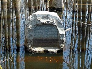
A very important spot is located near where Monroe, Phillips, and Lee counties meet. This is where surveyors started mapping out the Louisiana Purchase. This huge area of land, about 900,000 square miles (2,300,000 square kilometers), was bought by the United States. President James Madison ordered this survey.
In 1961, the Arkansas General Assembly marked this special spot. It is now part of Louisiana Purchase State Park.
Geography of Monroe County
Location and Landscape
Monroe County is in the Arkansas Delta, which is one of Arkansas's main geographic areas. The Arkansas Delta is part of the Mississippi Alluvial Plain. This is a flat area with rich, fertile soil left behind by the Mississippi River. A large part of Monroe County is also in the Grand Prairie. This area is known today for growing rice and raising fish.
The U.S. Census Bureau says Monroe County covers 621 square miles (1,608 square kilometers). About 607 square miles (1,572 square kilometers) is land, and 14 square miles (36 square kilometers) is water.
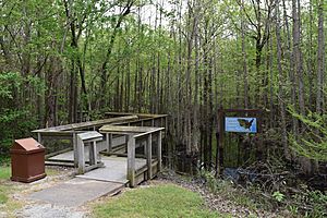
Before people settled here, Monroe County was covered in thick forests. There were also many bayous, sloughs, and swamps. Settlers cleared the land to use the rich soil for farming. Today, about 52 percent of the county is still used for farming. Some swamp areas are protected in places like the Cache River NWR and White River NWR. Some old farmland has even been replanted with trees.
Monroe County is about 73 miles (117 kilometers) east of Little Rock. It is also about 88 miles (142 kilometers) west-southwest of Memphis, Tennessee. Six other counties surround Monroe County: Woodruff County to the north, St. Francis County to the northeast, Lee County and Phillips County to the east, Arkansas County to the southwest, and Prairie County to the west.
Rivers and Waterways
Water is very important to Monroe County's geography, history, and way of life. Many rivers, streams, and bayous cross the county. Native American tribes like the Quapaw built burial mounds near Indian Bay long ago.
The White River was very important for early settlers. It allowed boats to travel, bringing trade and people. During the Civil War, controlling the White River led to battles, like a gunboat fight in Clarendon in 1864. The Flood of 1927 caused a lot of damage. Clarendon was flooded when its protective walls broke on April 20. Later, people worked to create protected areas around the Cache and White rivers. These efforts started in 1935 and continue today.
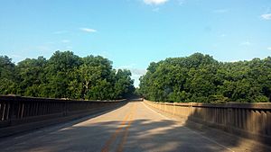
The White River is the county's most important water feature. It forms the southwestern border with Arkansas County. The Cache River runs along the west side of Monroe County. It partly forms the border with Prairie County. Both the Cache River and Roc Roe Bayou flow into the White River near Clarendon. Bayou De View runs through the northern part of the county and meets the Cache River north of Dobbs Landing.
Protected Natural Areas
Monroe County is home to parts of two important national wildlife refuges:
People of Monroe County
Population Changes
Monroe County's population has changed a lot over the years.
| Historical population | |||
|---|---|---|---|
| Census | Pop. | %± | |
| 1830 | 461 | — | |
| 1840 | 936 | 103.0% | |
| 1850 | 2,049 | 118.9% | |
| 1860 | 5,657 | 176.1% | |
| 1870 | 8,336 | 47.4% | |
| 1880 | 9,574 | 14.9% | |
| 1890 | 15,336 | 60.2% | |
| 1900 | 16,816 | 9.7% | |
| 1910 | 19,907 | 18.4% | |
| 1920 | 21,601 | 8.5% | |
| 1930 | 20,651 | −4.4% | |
| 1940 | 21,133 | 2.3% | |
| 1950 | 19,540 | −7.5% | |
| 1960 | 17,327 | −11.3% | |
| 1970 | 15,657 | −9.6% | |
| 1980 | 14,052 | −10.3% | |
| 1990 | 11,333 | −19.3% | |
| 2000 | 10,254 | −9.5% | |
| 2010 | 8,149 | −20.5% | |
| 2020 | 6,799 | −16.6% | |
| 2023 (est.) | 6,512 | −20.1% | |
| U.S. Decennial Census 1790–1960 1900–1990 1990–2000 2010 |
|||
In 2020, the U.S. Census counted 6,799 people living in Monroe County. There were 3,333 households and 1,974 families.
Communities in Monroe County
Cities and Towns
Monroe County has several cities and towns:
- Cities:
- Brinkley (the largest city)
- Clarendon (the county seat)
- Holly Grove
- Towns:
Townships
Monroe County is divided into smaller areas called townships. These include:
- Brinkley
- Brown
- Cache
- Cleburne
- Cypress Ridge
- Dixon
- Duncan
- Greenfield
- Hindman
- Jackson
- Keevil
- Montgomery-Smalley
- Pine Ridge
- Raymond
- Richland
- Roc Roe
Transportation and Services
Airports
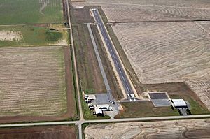
Monroe County has three public airports. They are mostly used for planes that spray crops on farms.
- The Clarendon Municipal Airport is near Clarendon and Roe.
- The Frank Federer Memorial Airport is in Brinkley.
- The Holly Grove Municipal Airport is near Holly Grove.
Major Roads
Here are the main highways in Monroe County:
 Interstate 40
 U.S. Highway 49
 U.S. Highway 70
 U.S. Highway 79
 Highway 1
 Highway 17
 Highway 33
 Highway 39
 Highway 86
 Highway 146
 Highway 238
 Highway 241
 Highway 302
 Highway 316
 Highway 362
 Highway 366
Bus Service
You can catch a bus in Brinkley. Jefferson Lines provides bus service to and from the county.
Water Systems
The Arkansas Department of Health makes sure that public water systems are safe. Monroe County has six community water systems. These include Brinkley Waterworks, Clarendon Waterworks, and Holly Grove Waterworks. Most of these systems get their water from underground.
Notable Person
- Sheffield Nelson was born in Monroe County in 1940. He was a leader in the Republican party in Arkansas. He ran for governor in 1990 and 1994.
See also
 In Spanish: Condado de Monroe (Arkansas) para niños
 | William Lucy |
 | Charles Hayes |
 | Cleveland Robinson |


