
National Register of Historic Places listings in San Francisco facts for kids
.svg)
This is a list of special places and buildings in San Francisco, California that are part of the National Register of Historic Places. These places are important because they have a lot of history or are very unique. You can even find their exact spots on an online map!
There are 200 of these special places in San Francisco. Some of them, like Alcatraz Island, are even more important and are called National Historic Landmarks. A couple of places used to be on the list but aren't anymore.
Amazing Historic Places in San Francisco
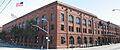
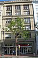
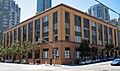
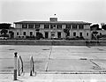
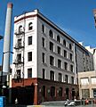
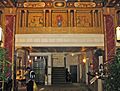
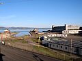
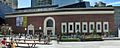
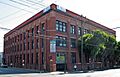
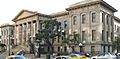
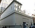
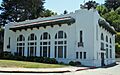
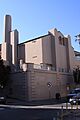
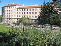
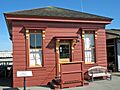
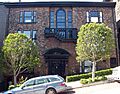
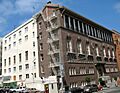
Administration Building, Treasure Island
.jpg)
This building is on Treasure Island, San Francisco, a man-made island in the San Francisco Bay. It was built in 1938 for the Golden Gate International Exposition. It's a cool example of old architecture.
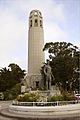
Alcatraz Island

Alcatraz is a famous island in San Francisco Bay. It used to be a super-secure federal prison. Not many people ever escaped from there! Today, it's part of the Golden Gate National Recreation Area. Lots of tourists visit it by ferry.
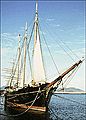
Alma (1891)
_2.JPG)
The ALMA is a special flat-bottomed scow schooner ship. It was built way back in 1891. Its job was to carry goods around San Francisco Bay and the nearby river areas. You can find it at Hyde Street Pier.
Apollo (Storeship)

The APOLLO was a storeship, which means it was used to store things. It's now buried under the ground at the corner of Sacramento and Battery Streets in the Financial District, San Francisco. It's a cool piece of San Francisco's early history!
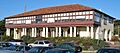
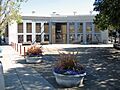
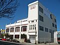
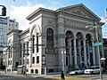
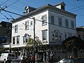
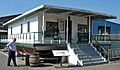
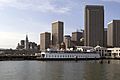
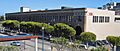
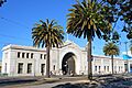
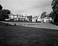
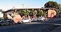
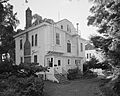
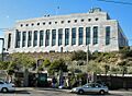
Aquatic Park Historic District

This historic area is near Fisherman's Wharf. It includes a cool building that was a public bathhouse. It was built in 1936 by the WPA, a government program that created jobs during the Great Depression. The building has a cool, smooth design called Streamline Moderne.
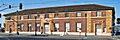
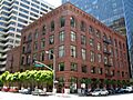
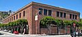
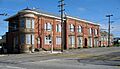
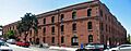
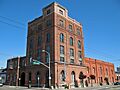
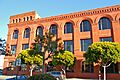
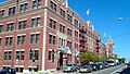
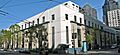
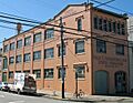
Armour & Co. Building

This building at 1050 Battery Street was built in 1907. It was used by Armour and Company as a meat packing plant and smokehouse until 1934. It's a reminder of how food was processed long ago.
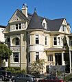
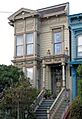
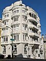
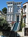
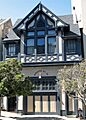
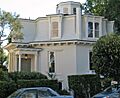
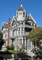
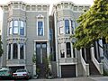
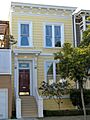
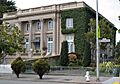
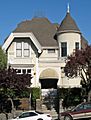
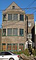
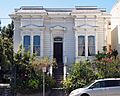
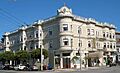
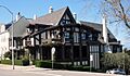
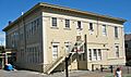
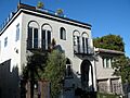
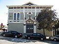
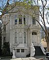
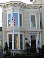
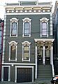
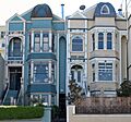
Atherton House
.JPG)
The Atherton House is a beautiful old home located at 1990 California Street in Lower Pacific Heights, San Francisco. It's a great example of the fancy homes built in San Francisco a long time ago.
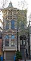
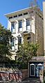
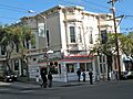
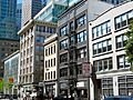
Audiffred Building
.JPG)
The Audiffred Building is at 1-21 Mission Street in the South Beach area. It's an interesting building with a long history in the city.
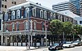
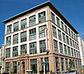
Baker and Hamilton Building
.jpg)
This building at 601 Townsend Street is in the South of Market, San Francisco area. It was added to the National Register in 2005.
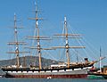
Balclutha (1886)
.JPG)
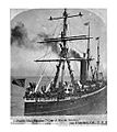
The BALCLUTHA is a large sailing ship built in 1886. It has square sails, which means it's a "square-rigged" ship. It's a cool piece of history from the age of sailing ships and is located at Pier 41 East near Fisherman's Wharf.
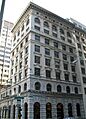
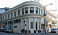
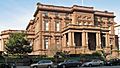
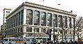
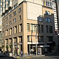
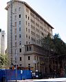
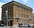
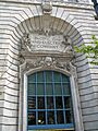
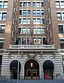
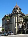
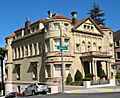
Bank of Italy Building
.JPG)
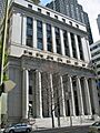
The Bank of Italy building at 552 Montgomery Street is in the Financial District, San Francisco. It's an important building because it was the original home of the Bank of Italy, which later became Bank of America.
Beach Chalet
.JPG)
The Beach Chalet is located at 1000 Great Highway, right by Ocean Beach, San Francisco. It's a historic building with murals and a great view of the ocean.
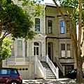
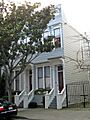
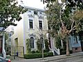
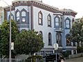
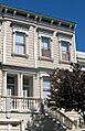
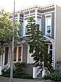
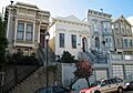
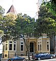
C. A. Belden House
.JPG)
This historic house is at 2004-2010 Gough Street in Pacific Heights, San Francisco. It's a beautiful old home that shows how people lived in San Francisco many years ago.
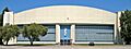
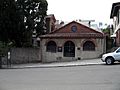
Belt Railroad Engine House and Sandhouse
.JPG)
This building is near Fisherman's Wharf, bounded by Lombard, Sansome, and the Embarcadero. It was part of the old Belt Railroad, which helped move goods around the city's waterfront.
Historic Buildings in Western Addition and Japantown
Several buildings in the Western Addition, San Francisco and Japantown, San Francisco areas are on the National Register. These include:
- Building at 1735-1737 Webster Street
- Building at 1813-1813B Sutter Street (now 1815 Sutter St.)
- Building at 1840-1842 Eddy Street
- Building at 33-35 Beideman Place
- Building at 45-47 Beideman Place
These buildings are important examples of the architecture and history of these neighborhoods.
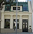
Building at 465 Tenth St.
.JPG)
This building, also known as the Rothschild Building, is at 465 Tenth Street in South of Market, San Francisco.
Building at 735 Market Street
.JPG)
This building is located at 735 Market Street in the Financial District, San Francisco.
Burr House
The Burr House at 1772 Vallejo Street is in Pacific Heights, San Francisco. It was added to the list in 2015.
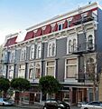
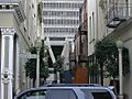
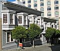
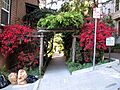
Bush Street-Cottage Row Historic District

This historic district includes buildings on Bush Street, Cottage Row, and Sutter Street in Lower Pacific Heights, San Francisco. It's a group of buildings that together tell a story about the area's past.
C.A. Thayer (1895)

The C.A. THAYER is a schooner, a type of sailing ship, built in 1895. It's part of the San Francisco Maritime National Historical Park and is located at the Hyde Street Pier.
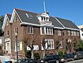
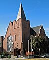
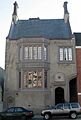
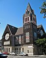
Calvary Presbyterian Church
_3.JPG)
This church at 2501-2515 Fillmore Street is in Pacific Heights, San Francisco. It's a beautiful and historic church.
Camera Obscura
.JPG)
The Camera Obscura is a unique building at 1096 Point Lobos Avenue in the Richmond District, San Francisco. It uses mirrors and lenses to project a live, moving image of the outside world onto a screen inside. It's a really cool optical illusion!
Central Embarcadero Piers Historic District

This historic district includes Piers 1, 1½, 3, and 5 along The Embarcadero. These piers are important parts of San Francisco's waterfront history.
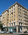
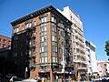
Chambord Apartments
.JPG)
The Chambord Apartments are at 1298 Sacramento Street in Nob Hill, San Francisco. This building is a historic apartment complex.
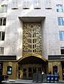
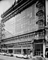
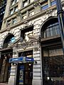
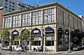
City of Paris Dry Goods Co.
.JPG)
The City of Paris Building, at 181-199 Geary Street in Downtown, was once a famous department store. Today, a different store, Neiman Marcus, is on the same spot, but the beautiful rotunda dome from the original building is still there!
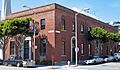
Coffin-Redington Building
.JPG)
This building is located at 301 Folsom Street and 300 Beale Street in the Rincon Hill, San Francisco area.
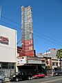
Coit Tower

Coit Tower is a famous landmark at 1 Telegraph Hill Boulevard on Telegraph Hill, San Francisco. It offers amazing views of the city and the bay.
Colombo Building
.JPG)
The Colombo Building is at 1-21 Columbus Avenue in the Financial District, San Francisco.
Dallam-Merritt House

This historic house is at 2355 Washington Street in Pacific Heights, San Francisco.
Delano House
.JPG)
The Delano House is at 70 Buena Vista Terrace in the Buena Vista neighborhood.
Richard P. Doolan Residence and Storefronts

This property includes a residence and storefronts at 557 Ashbury Street and 1500-1512 Haight Street in the famous Haight-Ashbury neighborhood.

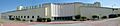
Drydock 4 is located southeast of the junction of Spear Avenue and Morrell Street in Bayview–Hunters Point, San Francisco. Drydocks are special areas where ships can be repaired out of the water.
Frank G. Edwards House
.JPG)
The Frank G. Edwards House is at 1366 Guerrero Street in Noe Valley, San Francisco.
Engine House No. 31
.JPG)
This old fire station, Engine House No. 31, is at 1088 Green Street in Russian Hill, San Francisco.
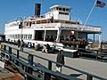
Eureka (1890)
.JPG)
The EUREKA is a historic steam ferryboat built in 1890. It's also at the Hyde Street Pier as part of the San Francisco Maritime National Historical Park.
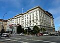
The Fairmont San Francisco

The Fairmont Hotel at 950 Mason Street is a very famous and fancy hotel in Nob Hill, San Francisco.
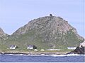
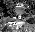
Farallon Islands

The Farallon Islands are a group of islands about 28 miles west of San Francisco in the Gulf of the Farallones. They are important for wildlife and have a unique history.
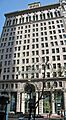
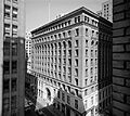
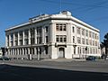
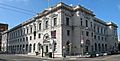
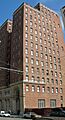
Federal Reserve Bank of San Francisco Building
.JPG)
This building at 400 Sansome Street is the Federal Reserve Bank of San Francisco. It's an important financial building in the Financial District, San Francisco.
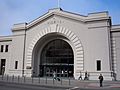
Ferry Station Post Office Building
.jpg)
The Ferry Station Post Office Building is located at the Embarcadero at Mission Street. It's a historic building that served as a post office near the ferry terminal.
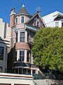
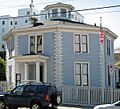
Feusier Octagon House
.JPG)
The Feusier Octagon House at 1067 Green Street in Russian Hill, San Francisco is special because of its eight-sided shape. It's a very unique and historic home.
Fillmore-Pine Building

This building is at 1946 Fillmore Street in Lower Pacific Heights, San Francisco.
Fleishhacker Pool

The Delia Fleishhacker Memorial Building, which included the Fleishhacker Pool, was located at Zoo Road and Sloat Boulevard in Parkside, San Francisco. Sadly, it was destroyed by fire in 2012.
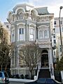
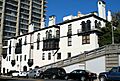
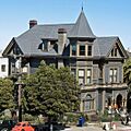
James C. Flood Mansion
_4.JPG)
The James C. Flood Mansion is a very grand house at California and Mason Streets in Nob Hill, San Francisco. It's a National Historic Landmark.
Folger Coffee Company Building
.JPG)
This building at 101 Howard Street in South Beach was once the home of the Folger Coffee Company.
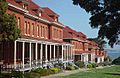
Fort Mason Historic District

Fort Mason is a historic district that includes parts of Fort Mason north and east of Franklin Street and McArthur Avenue. It's a former military post with a rich history.
Fort Miley Military Reservation

The Fort Miley Military Reservation is off CA 1 in the Richmond District, San Francisco. It was a military site used for defense.
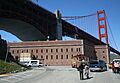
Fort Point National Historic Site

Fort Point is a historic fort located at the northern tip of the San Francisco Peninsula, right under the Golden Gate Bridge. It was built to protect San Francisco Bay.
Four Fifty Sutter Building

The Four Fifty Sutter Building at 450 Sutter Street is in the Union Square, San Francisco area.
Frederick Griffing's (ship)

The remains of the ship FREDERICK GRIFFING'S were discovered in 1978. It's still buried today under the Levi Plaza fountain near Fisherman's Wharf.
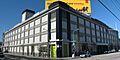
Fuller Company Glass Warehouse
.JPG)
This warehouse at 50 Green Street is in Fisherman's Wharf, San Francisco. It was used by the Fuller Company for glass storage.
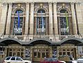
Geary Theatre
.JPG)
The Geary Theatre at 415 Geary Street in Downtown is a historic theater.
Geneva Office Building and Power House

This building at 2301 San Jose Avenue is in the Excelsior District, San Francisco. It was an important part of the city's power system.
Daniel Gibb & Co. Warehouse
.JPG)
The Daniel Gibb & Co. Warehouse is at 855 Front Street and 101 Vallejo Street, near Fisherman's Wharf.
Girls Club
.JPG)
The Girls Club building at 362 Capp Street is in the Mission District, San Francisco.
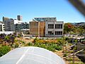
Golden Gate Park

Golden Gate Park is a huge and famous park in San Francisco. It's bounded by Fulton, Stanyan, Fell, Baker, Oak Streets, Lincoln Way, and The Great Highway. It's a beautiful green space in the city.
Golden Gate Park Conservatory

The Conservatory of Flowers is a beautiful greenhouse in Golden Gate Park. It's located north of John F. Kennedy Drive at the east end of the park.
Goodman Building
.JPG)
The Goodman Building is at 1117 Geary Boulevard in Western Addition, San Francisco.
Grabhorn Press Building
.JPG)
The Grabhorn Press Building at 1335 Sutter Street in Lower Pacific Heights, San Francisco was home to a famous printing company.
Haas Candy Factory
_2.JPG)
The Haas Candy Factory building is at 54 Mint Street in South of Market, San Francisco.
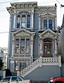
Haas-Lilienthal House
_2.JPG)
The Haas-Lilienthal House at 2007 Franklin Street in Pacific Heights, San Francisco is a beautiful Victorian-era home. It's open for tours and shows what life was like in old San Francisco.
Hale Brothers Department Store
.JPG)
The Hale Brothers Department Store building is at 901 Market Street in South of Market, San Francisco. It was once a major shopping destination.
Hall of Transportation, Treasure Island
.JPG)
This building is on the southeast side of California Avenue between Avenue D and Avenue F on Treasure Island, San Francisco. It was also built for the Golden Gate International Exposition.
Hallidie Building

The Hallidie Building at 130 Sutter Street in the Financial District, San Francisco is famous for its glass curtain wall, which was very modern when it was built.
Haslett Warehouse
.jpg)
The Haslett Warehouse at 680 Beach Street is in Fisherman's Wharf, San Francisco. It's a large historic warehouse.
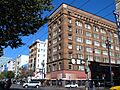
Herald Hotel
.JPG)
The Herald Hotel at 308 Eddy Street in Tenderloin, San Francisco was built in 1910. It's now a place for low-income seniors to live.
Hercules (1907)
.JPG)
The HERCULES is a steam tugboat built in 1907. It's also at the Hyde Street Pier as part of the San Francisco Maritime National Historical Park.
Hotel Californian
.JPG)
The Hotel Californian at 403 Taylor Street in Tenderloin, San Francisco was built in 1923. It's now called the Serrano Hotel.
Historic Houses in Western Addition and Telegraph Hill
Several houses are listed for their historical importance:
- House at 1239-1245 Scott Street in Western Addition, San Francisco
- House at 1249-1251 Scott Street in Western Addition, San Francisco
- House at 1254-1256 Montgomery Street in Telegraph Hill, San Francisco
- House at 1321 Scott Street in Western Addition, San Francisco
- House at 1331-1335 Scott Street in Western Addition, San Francisco
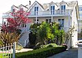
House at 584 Page Street
.JPG)
This house at 584 Page Street in Hayes Valley, San Francisco is also known as the Daniel Einstein House.
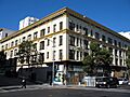
Hunter-Dulin Building
.jpg)
The Hunter-Dulin Building at 111 Sutter Street is in the Financial District, San Francisco.
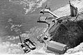
Hunters Point Commercial Drydock Historic District

This historic district is east of the junction of Fisher Avenue and Robinson Drive in Bayview–Hunters Point, San Francisco. It's an important area for shipbuilding and repair.
International Hotel
.JPG)
The International Hotel at 848 Kearny Street in Chinatown, San Francisco is famous for the protests that happened there to save it from demolition.
Jackson Brewing Company
.JPG)
The Jackson Brewing Company building is at 1475-1489 Folsom Street and 319-351 11th Street in South of Market, San Francisco.
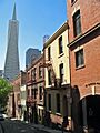
Jackson Square Historic District

The Jackson Square Historic District is roughly bounded by Broadway, Sansome, Washington, and Columbus Avenue in the Financial District, San Francisco. It's one of the few areas that survived the 1906 earthquake and fire.
Jessie Street Substation
.JPG)
The Jessie Street Substation at 222-226 Jessie Street in South of Market, San Francisco now houses the Contemporary Jewish Museum.
San Francisco Juvenile Court and Detention Center

This building at 150 Otis Street in South of Market, San Francisco is the San Francisco Juvenile Court and Detention Center.
King Philip and Reporter Shipwreck Site

This site contains the remains of two shipwrecks: the clipper ship King Philip and the schooner Reporter. They are located off Ocean Beach, San Francisco.
Koshland House

The Koshland House is at 3800 Washington Street in Presidio Heights.
Dr. Martin M. Krotoszyner Medical Offices and House
.JPG)
This building at 995-999 Sutter Street in Downtown was once the medical offices and home of Dr. Martin M. Krotoszyner.
Don Lee Building
.JPG)
The Don Lee Building at 1000 Van Ness Avenue in Western Addition, San Francisco is a historic building.
Lewis Ark (Houseboat)
.JPG)
The LEWIS ARK is a historic houseboat located at the Hyde Street Pier as part of the San Francisco Maritime National Historical Park.
Liberty Street Historic District
.JPG)
The Liberty Street Historic District includes buildings on Liberty Street in Eureka Valley, San Francisco.
Long Syrup Refinery
.JPG)
The Long Syrup Refinery building is at 2701 Sixteenth Street in the Mission District, San Francisco.
Lotta Crabtree Fountain
.JPG)
Lotta Crabtree Fountain is a famous fountain at the intersection of Market, Geary, and Kearny Streets in the Financial District, San Francisco. It's a well-known meeting spot.
Lower Nob Hill Apartment Hotel District

This historic district includes many apartment hotels in the Downtown and Union Square, San Francisco areas.
The Lydia (Whaling Bark)

The Lydia was a whaling bark, a type of sailing ship used for whaling. Its shipwreck site is at the foot of King Street near Pier 42 in South of Market, San Francisco.
M.V. Santa Rosa (Ferryboat)

The M.V. SANTA ROSA is a historic ferryboat located at Pier 3 in San Francisco. It's now owned by Hornblower Yachts and has even been used for concerts!
Market Street Theatre and Loft District

This historic district includes theaters and loft buildings on Market Street and nearby streets in Tenderloin, San Francisco.
Matson Building and Annex
.jpg)
The Matson Building and Annex at 215 Market Street are in the Financial District, San Francisco.
McElroy Octagon House
_2.JPG)
The McElroy Octagon House at 2645 Gough Street in Cow Hollow is another unique eight-sided house in San Francisco.
John McMullen House
.JPG)
The John McMullen House is at 827 Guerrero Street in Eureka Valley, San Francisco.
Mills Building and Tower
.jpg)
The Mills Building and Tower at 220 Montgomery Street and 220 Bush Street is a historic skyscraper in the Financial District, San Francisco.
Mish House
.JPG)
The Mish House at 1153 Oak Street is in Haight-Ashbury.
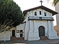
Mission Dolores

Mission Dolores at 320 Dolores Street in the Mission District, San Francisco is one of the oldest buildings in San Francisco. It was founded in 1776!
Moss Flats Building
.JPG)
The Moss Flats Building at 1626 Great Highway is in the Sunset District, San Francisco.
Mutual Savings Bank Building

The Mutual Savings Bank Building at 700 Market Street is in the Financial District, San Francisco.
Myrtle Street Flats
.JPG)
The Myrtle Street Flats at 234-248 Myrtle Street are in Western Addition, San Francisco.
National Carbon Company Building
.jpg)
The National Carbon Company Building at 599 8th Street is in South of Market, San Francisco.
New Mission Theater
.JPG)
The New Mission Theater at 2550 Mission Street in the Mission District, San Francisco is a historic movie theater.
Niantic (Storeship)
.jpg)
The NIANTIC was another storeship, now buried at the corner of Clay and Sansome Streets in the Financial District, San Francisco.
Ohlandt Newlyweds House

The Ohlandt Newlyweds House is at 1260 Potrero Avenue in the Mission District, San Francisco.
Old Ohio Street Houses
.JPG)
The Old Ohio Street Houses are at 17-55 Osgood Place in the Financial District, San Francisco.
Old U.S. Mint
_3.JPG)
The Old U.S. Mint at 5th and Mission Streets in South of Market, San Francisco is a very important historic building. It was built to make coins for the United States.
One Lombard Street

One Lombard Street is a building in Fisherman's Wharf, San Francisco.
Otis Elevator Company Building
.JPG)
The Otis Elevator Company Building at 1 Beach Street is in Fisherman's Wharf, San Francisco.
Pacific Gas and Electric Company General Office Building and Annex
.jpg)
This building at 245 Market Street is the Pacific Gas and Electric Company General Office Building and Annex, located in the Financial District, San Francisco.
Pacific Gas and Electric Company Substation J
.jpg)
This substation at 565 Commercial and 568 Sacramento Streets is also in the Financial District, San Francisco.
Paige Motor Car Co. Building
.JPG)
The Paige Motor Car Co. Building at 1699 Van Ness Avenue is in Civic Center, San Francisco.
Palace of Fine and Decorative Arts, Treasure Island
.jpg)
This building is on the southeast side of California Avenue between Avenue F and Avenue I on Treasure Island, San Francisco. It was part of the 1939 Golden Gate International Exposition.
Palace of Fine Arts

The Palace of Fine Arts at 3301 Lyon Street in the Marina District, San Francisco is a beautiful landmark. It was originally built for the 1915 Panama-Pacific International Exposition.
Park View Hotel
.JPG)
The Park View Hotel at 750 Stanyan Street in Haight-Ashbury is now known as the Stanyan Park Hotel.
Theodore F. Payne House
.JPG)
The Theodore F. Payne House is at 1409 Sutter Street in Lower Pacific Heights, San Francisco.
Abner Phelps House
.JPG)
The Abner Phelps House at 1111 Oak Street in Haight-Ashbury is a historic home.
Pier One
.jpg)
Pier One on The Embarcadero at Washington Street is part of the Central Embarcadero Piers Historic District.
Pioneer Trunk Factory-C. A. Malm & Co.
.JPG)
This building at 2185-2199 Folsom and 3180 18th Streets is in the Mission District, San Francisco. It was once a factory for making trunks.
Pioneer Woolen Mills and D. Ghirardelli Company

This building at 900 North Point Street is now known as Ghirardelli Square, a famous shopping and dining area. It was originally a woolen mill and then the Ghirardelli chocolate factory.
Point Lobos Archaeological Sites
.jpg)
These archaeological sites are located at Point Lobos in the Richmond District, San Francisco, near the historic Sutro Baths.
Port of San Francisco Embarcadero Historic District

This historic district covers the Embarcadero from Pier 45 to Pier 48. It's a large area of San Francisco's historic port.
Presidio

The Presidio is a large park and former military post at the northern tip of the San Francisco Peninsula. It's a beautiful area with lots of history and great views.
Pumping Station No. 2 San Francisco Fire Department Auxiliary Water Supply System
.JPG)
This pumping station at the north end of Van Ness Avenue is in Fisherman's Wharf, San Francisco. It's part of a special water system designed to fight fires in San Francisco.

This building is at 1 Whiting Way on Yerba Buena Island. It was part of the naval training station there.
Quarters 10 and Building 267, Yerba Buena Island
.JPG)
These buildings are at the junction of Northgate and Macalla Roads on the North Shore of Yerba Buena Island.
Rialto Building

The Rialto Building at 116 New Montgomery Street is in South of Market, San Francisco.
Rincon Annex
.jpg)
The Rincon Annex at 101-199 Mission Street is in the South Beach area.
Roos House

The Roos House is at 3500 Jackson Street in Presidio Heights.
Russian Hill Historic Districts
There are several historic districts in Russian Hill, San Francisco:
- Russian Hill-Macondray Lane District: Includes streets like Green, Jones, Macondray, and Taylor.
- Russian Hill-Paris Block Architectural District: Roughly 1017-1067 Green Street.
- Russian Hill-Vallejo Street Crest District: Includes Broadway, Florence, Jones, Russian Hill Place, Taylor, and Vallejo streets.
These districts are known for their beautiful homes and unique street layouts.
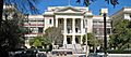
San Francisco Art Institute

The San Francisco Art Institute at 800 Chestnut Street in Russian Hill, San Francisco is a historic art school.
San Francisco Cable Cars

The San Francisco Cable Cars are a famous symbol of the city. The main powerhouse is at 1390 Washington Street. They are the last manually operated cable car system in the world!
San Francisco Civic Center Historic District

The San Francisco Civic Center Historic District is roughly bounded by Golden Gate Avenue, 7th, Franklin, Hayes, and Market Streets. It includes many important government and cultural buildings.
San Francisco Fire Department Engine Co. Number 2

This fire station at 460 Bush Street is in Downtown.
San Francisco Maritime National Historic Park

The San Francisco Maritime National Historic Park is located at Fort Mason, Building 201. It helps preserve the city's rich maritime history.
San Francisco National Guard Armory and Arsenal
.jpg)
This building at 1800 Mission Street is in the Mission District, San Francisco. It was used by the National Guard.
San Francisco–Oakland Bay Bridge

The San Francisco–Oakland Bay Bridge is a huge bridge that connects San Francisco to Oakland across San Francisco Bay. It's a major landmark.
San Francisco Port of Embarkation, US Army

This historic area at Fort Mason was an important military port for the U.S. Army.
San Francisco Public Library North Beach Branch

This library branch at 2000 Mason Street is in North Beach, San Francisco.
San Francisco State Teacher's College

This building at 55 Laguna Street in Hayes Valley, San Francisco was once the San Francisco State Teacher's College, which later became San Francisco State University.
Schoenstein and Company Pipe Organ Factory

This factory at 3101 20th Street in the Mission District, San Francisco makes pipe organs.
Irving Murray Scott School
.JPG)
The Irving Murray Scott School at 1060 Tennessee Street is in Potrero Hill.
Second and Howard Streets District

This historic district includes buildings on 2nd, Howard, Natoma, and New Montgomery streets in South of Market, San Francisco.
Senior Officers Quarters Historic District, Yerba Buena Island

This historic district on Yerba Buena Island includes the homes of senior military officers and their garages.
Sinton House

The Sinton House is at 1020 Francisco Street in Russian Hill, San Francisco.
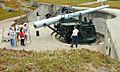
Six-Inch Rifled Gun No. 9

This large gun, Six-Inch Rifled Gun No. 9, is located at Baker Beach in the Presidio of San Francisco. It was part of the coastal defenses.
South San Francisco Opera House

The South San Francisco Opera House at 4701-4705 Third Street and 1601 Newcomb Avenue is in Bayview–Hunters Point, San Francisco.
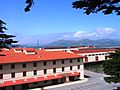
Southern Pacific Company Hospital Historic District
.JPG)
This historic district at 1400 Fell Street is in the North Panhandle area. It was once a hospital for the Southern Pacific Company.
John Spencer House
.JPG)
The John Spencer House at 1080 Haight Street is in Haight-Ashbury.
SS Jeremiah O'Brien National Historic Landmark
.JPG)
The SS JEREMIAH O'BRIEN is a Liberty ship, a type of cargo ship built during World War II. It's a National Historic Landmark and is docked at Pier 3, Fort Mason Center, near Fisherman's Wharf.
SS Rio De Janeiro Shipwreck

The shipwreck of the SS RIO DE JANEIRO is located in the Golden Gate area.
Stadtmuller House
.JPG)
The Stadtmuller House at 819 Eddy Street is in Western Addition, San Francisco.
St. John's Presbyterian Church
_2.JPG)
St. John's Presbyterian Church at 25 Lake Street and 201 Arguello Boulevard is in Presidio Heights.
St. Joseph's Church and Complex
.JPG)
St. Joseph's Church and Complex at 1401-1415 Howard Street is in South of Market, San Francisco.
St. Joseph's Hospital
.JPG)
St. Joseph's Hospital at 355 Buena Vista Avenue East is in the Buena Vista neighborhood.
St. Paulus Lutheran Church

St. Paulus Lutheran Church at 999 Eddy Street in Western Addition, San Francisco was unfortunately destroyed by fire in 1995.
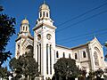
Swedenborgian Church
.jpg)
The Swedenborgian Church at 3200 Washington Street in Pacific Heights, San Francisco is a National Historic Landmark.
Temple Sherith Israel

Temple Sherith Israel at 2266 California Street in Pacific Heights, San Francisco is a beautiful synagogue.
The Real Estate Associates (TREA) Houses
_House.JPG)
These houses at 2503, 2524, 2530, and 2536 Clay Streets are in Pacific Heights, San Francisco.
Tobin House

The Tobin House is at 1969 California Street in Lower Pacific Heights, San Francisco.
Torpedo Storehouse-Torpedo (Mine) Assembly Building & Long Range Accuracy Storage Building

This building at East Point on the North Shore of Yerba Buena Island was built in 1891. It was used by the U.S. Army to assemble torpedoes.
Trinity Presbyterian Church
.JPG)
Trinity Presbyterian Church at 3261 23rd Street is in the Mission District, San Francisco.
Tubbs Cordage Company Office Building
.JPG)
This building is at the Hyde Street Pier as part of the San Francisco Maritime National Historical Park. It was the office for a company that made ropes.
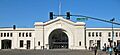
Union Ferry Depot
.jpg)
The Union Ferry Depot at the Embarcadero at Market Street is a very famous landmark. It's where ferries used to arrive and depart, and now it's a popular marketplace.
Union Iron Works Historic District

This historic district is east of Illinois Street between 18th and 22nd Streets in Potrero Point. It was a major shipbuilding and iron works area.
Uptown Tenderloin Historic District

The Uptown Tenderloin Historic District covers many blocks in Tenderloin, San Francisco. It's important for its history and unique buildings.
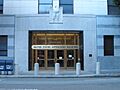
U.S. Appraisers Stores and Immigration Station

This building at 630 Sansome Street is in the Financial District, San Francisco. It served as a place where goods were checked and immigrants were processed.
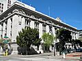
U.S. Customhouse
.JPG)
The U.S. Customhouse at 555 Battery Street is in the Financial District, San Francisco. It was where taxes were collected on imported goods.
U.S. Mint
.JPG)
The U.S. Mint at 155 Hermann Street in Hayes Valley, San Francisco is where U.S. coins are made.
U.S. Post Office and Courthouse
.jpg)
This building at the northeast corner of 7th and Mission Streets in South of Market, San Francisco is a National Historic Landmark. It serves as a post office and courthouse.
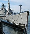
USS Pampanito (submarine)
.JPG)
The USS PAMPANITO is a World War II submarine. It's a National Historic Landmark and is docked at Pier 45 in Fisherman's Wharf, San Francisco. You can even tour it!
USS CONESTOGA (shipwreck and remains)

The shipwreck and remains of the USS CONESTOGA are located in the Greater Farallones National Marine Sanctuary.
Veterans Affairs Medical Center-San Francisco, California

This medical center at 4150 Clement Street is in Sea Cliff, San Francisco. It provides healthcare for veterans.
Wapama (steam schooner)
.jpg)
The WAPAMA was a historic steam schooner. It was located at the Hyde Street Pier but was unfortunately scrapped in 2013.
Russell Warren House
.JPG)
The Russell Warren House at 465-467 Oak Street and 368 Lily Street is in Hayes Valley, San Francisco.
Julian Waybur House

The Julian Waybur House at 3232 Pacific Avenue is in Presidio Heights.
William Westerfeld House
.JPG)
The William Westerfeld House at 1198 Fulton Street in Alamo Square, San Francisco is a beautiful and historic Victorian house.
Whittier Mansion
_2.JPG)
The Whittier Mansion at 2090 Jackson Street in Pacific Heights, San Francisco is a grand historic home.
Albert Wilford Houses
.jpg)
The Albert Wilford Houses are at 2121 & 2127 Vallejo Street in Pacific Heights, San Francisco.
Woman's Athletic Club of San Francisco
.JPG)
The Woman's Athletic Club of San Francisco at 640 Sutter Street is in Union Square, San Francisco.
Yerba Buena Island Lighthouse

The Yerba Buena Island Lighthouse is on Yerba Buena Island. It's a historic lighthouse that helped guide ships in the bay.
YMCA Hotel
.jpg)
The YMCA Hotel at 351 Turk Street in Tenderloin, San Francisco was built in 1928. It's part of the Uptown Tenderloin Historic District.
Images for kids
-
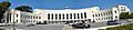
The historic Administration Building on Treasure Island.
-
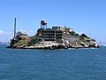
Alcatraz Island, once a famous prison.
-
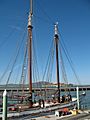
The scow schooner ALMA.
-
The area where the APOLLO storeship is buried.
-
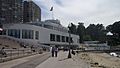
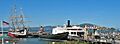
The San Francisco Maritime Museum building at Aquatic Park.
-
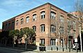
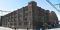
The old Armour & Co. Building.
-
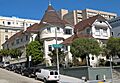
The historic Atherton House.
-
The Audiffred Building.
-
The Baker and Hamilton Building.
-
The historic sailing ship BALCLUTHA.
-
The old Bank of Italy Building.
-
The Beach Chalet, near Ocean Beach.
-
The C. A. Belden House.
-
The old Belt Railroad Engine House.
-
Building at 1735-1737 Webster Street.
-
Building at 1813-1813B Sutter Street.
-
Building at 1840-1842 Eddy Street.
-
Building at 33-35 Beideman Place.
-
Building at 45-47 Beideman Place.
-
The Rothschild Building, also known as 465 Tenth St.
-
The building at 735 Market Street.
-
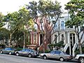
A view of the Bush Street-Cottage Row Historic District.
-
The schooner C.A. THAYER.
-
Calvary Presbyterian Church.
-
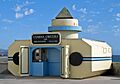
The Camera Obscura building.
-
Pier 1, part of the Central Embarcadero Piers Historic District.
-
The Chambord Apartments.
-
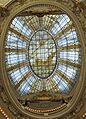
The beautiful rotunda dome of the former City of Paris Building.
-
The Coffin-Redington Building.
-
Coit Tower on Telegraph Hill.
-
The Colombo Building.
-
The Dallam-Merritt House.
-
The Delano House.
-
The Richard P. Doolan Residence and Storefronts.
-
Drydock 4 at Hunters Point Naval Shipyard.
-
The Frank G. Edwards House.
-
Engine House No. 31.
-
The steam ferryboat EUREKA.
-
The grand Fairmont Hotel.
-
A view of the Farallon Islands.
-
The Federal Reserve Bank of San Francisco.
-
The Ferry Station Post Office Building.
-
The unique Feusier Octagon House.
-
The Fillmore-Pine Building.
-
The former Fleishhacker Pool and Bath House.
-
The grand James C. Flood Mansion.
-
The Folger Coffee Company Building.
-
Wharves at Fort Mason.
-

An old storehouse at Fort Miley.
-
Fort Point, beneath the Golden Gate Bridge.
-
The Four Fifty Sutter Building.
-
The Levi Plaza Fountain, under which the FREDERICK GRIFFING'S ship is buried.
-
The Fuller Company Glass Warehouse.
-
The historic Geary Theatre.
-
The Geneva Office Building and Power House.
-
The Daniel Gibb & Co. Warehouse.
-
The Girls Club building.
-
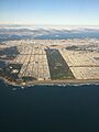
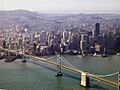
An aerial view of Golden Gate Park.
-
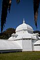
The Conservatory of Flowers in Golden Gate Park.
-
The Goodman Building.
-
The Grabhorn Press Building.
-
The Haas Candy Factory building.
-
The Haas-Lilienthal House.
-
The Hale Brothers Department Store building.
-
The Hall of Transportation on Treasure Island.
-
The Hallidie Building.
-
The Haslett Warehouse.
-
The Herald Hotel.
-
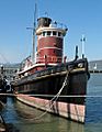
The steam tugboat HERCULES.
-
The Hotel Californian, now the Serrano Hotel.
-
House at 1239-1245 Scott Street.
-
House at 1249-1251 Scott Street.
-
House at 1254-1256 Montgomery Street.
-
House at 1321 Scott Street.
-
House at 1331-1335 Scott Street.
-
The Daniel Einstein House.
-
The Hunter-Dulin Building.
-
Hunters Point Commercial Drydock Historic District.
-
The International Hotel.
-
The Jackson Brewing Company building.
-
Hotaling Place in the Jackson Square Historic District.
-
The Jessie Street Substation, now the Contemporary Jewish Museum.
-
The San Francisco Juvenile Court and Detention Center.
-
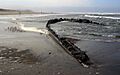
Part of the King Philip shipwreck at Ocean Beach.
-
The Koshland House.
-
The Krotoszyner Medical Offices and House.
-
The Don Lee Building.
-
The houseboat LEWIS ARK.
-
A view of the Liberty Street Historic District.
-
The Long Syrup Refinery building.
-
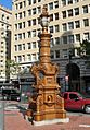
Lotta Crabtree Fountain.
-
Buildings in the Lower Nob Hill Apartment Hotel District.
-
The site of The Lydia shipwreck.
-
The ferryboat M.V. SANTA ROSA.
-
Buildings in the Market Street Theatre and Loft District.
-
The Matson Building and Annex.
-
The McElroy Octagon House.
-
The John McMullen House.
-
The Mills Building and Tower.
-
The Mish House.
-
Mission Dolores.
-
The Moss Flats Building.
-
The Mutual Savings Bank Building.
-
The Myrtle Street Flats.
-
The National Carbon Company Building.
-
The New Mission Theater.
-
The NIANTIC storeship.
-
The Ohlandt Newlyweds House.
-
The Old Ohio Street Houses.
-
The Old U.S. Mint.
-
One Lombard Street.
-
The Otis Elevator Company Building.
-
The Pacific Gas and Electric Company General Office Building.
-
Pacific Gas and Electric Company Substation J.
-
The Paige Motor Car Co. Building.
-
The Palace of Fine and Decorative Arts on Treasure Island.
-
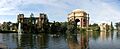
The beautiful Palace of Fine Arts.
-
The Park View Hotel, now Stanyan Park Hotel.
-
The Theodore F. Payne House.
-
The Abner Phelps House.
-
Pier One on The Embarcadero.
-
The Pioneer Trunk Factory.
-
The Pioneer Woolen Mills and D. Ghirardelli Company building, now Ghirardelli Square.
-

The area of the Point Lobos Archaeological Sites, near Sutro Baths.
-
Pier 31, part of the Embarcadero Historic District.
-
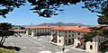
The Presidio of San Francisco.
-
Pumping Station No. 2.
-
Quarters 1 on Yerba Buena Island.
-

Quarters 10 on Yerba Buena Island.
-
The Rialto Building.
-
The Rincon Annex building.
-
The Roos House.
-
Macondray Lane in the Russian Hill-Macondray Lane District.
-
Buildings in the Russian Hill-Paris Block Architectural District.
-
Buildings in the Russian Hill-Vallejo Street Crest District.
-
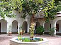
The atrium of the San Francisco Art Institute.
-
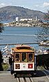
A San Francisco cable car on Hyde Street.
-
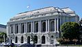
The San Francisco Opera House, part of the Civic Center.
-
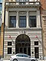
San Francisco Fire Department Engine Co. Number 2.
-
The San Francisco Maritime National Historic Park.
-
The San Francisco National Guard Armory and Arsenal.
-
The San Francisco–Oakland Bay Bridge.
-
The San Francisco Port of Embarkation at Fort Mason.
-
The North Beach Branch of the San Francisco Public Library.
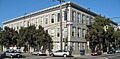
-
The San Francisco State Teacher's College building.
-
The Schoenstein and Company Pipe Organ Factory.
-
The Irving Murray Scott School.
-
A building in the Second and Howard Streets District.
-
A building in the Senior Officers Quarters Historic District.
-
The Sinton House.
-
The Six-Inch Rifled Gun No. 9 at Battery Chamberlin.
-
The South San Francisco Opera House.
-
The Southern Pacific Company Hospital.
-
The John Spencer House.
-
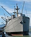
The SS JEREMIAH O'BRIEN Liberty ship.
-
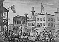
Boys on board the SS City of Rio De Janeiro in 1898.
-
The Stadtmuller House.
-
St. John's Presbyterian Church.
-
St. Joseph's Church.
-
St. Joseph's Hospital.
-
The former St. Paulus Lutheran Church.
-
The Swedenborgian Church.
-
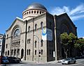
Temple Sherith Israel.
-
One of The Real Estate Associates (TREA) Houses.
-
The Tobin House.
-
The Torpedo Storehouse on Yerba Buena Island.
-
Trinity Presbyterian Church.
-
The Tubbs Cordage Company Office Building.
-
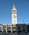
The iconic Ferry Building.
-
Old Bethlehem Steel Headquarters, part of the Union Iron Works Historic District.
-
The Arlington Hotel, part of the Uptown Tenderloin Historic District.
-
The U.S. Appraisers Stores and Immigration Station building.
-
The U.S. Customhouse.
-
The New U.S. Mint.
-
The U.S. Post Office and Courthouse.
-
The USS PAMPANITO submarine.
-
The stern of the USS CONESTOGA shipwreck.
-
The VA Medical Center in San Francisco.
-

The steam schooner WAPAMA.
-
The Russell Warren House.
-
The Julian Waybur House.
-
The William Westerfeld House.
-
The Whittier Mansion.
-
The Albert Wilford Houses.
-
The Woman's Athletic Club of San Francisco.
-
The Yerba Buena Island Lighthouse.
-
The YMCA Hotel.


_2.jpg)
.jpg)
.jpg)
.jpg)
.jpg)
.JPG)
.jpg)
_2.jpg)


