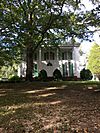
National Register of Historic Places listings in Weakley County, Tennessee facts for kids
Have you ever wondered about old buildings or places that are super important to history? In Weakley County, Tennessee, there's a special list of these places! It's called the National Register of Historic Places. This list helps protect and celebrate buildings, sites, and objects that have played a big part in American history, architecture, archaeology, engineering, or culture.
When a place is added to the National Register, it means it's recognized as a valuable part of our past. This can help save it from being torn down or changed too much. Weakley County has 11 different places on this important list. There was once another site listed, but it has since been removed. You can even find the exact spots of many of these places on a map using their special location codes!
| Anderson – Bedford – Benton – Bledsoe – Blount – Bradley – Campbell – Cannon – Carroll – Carter – Cheatham – Chester – Claiborne – Clay – Cocke – Coffee – Crockett – Cumberland – Davidson – Decatur – DeKalb – Dickson – Dyer – Fayette – Fentress – Franklin – Gibson – Giles – Grainger – Greene – Grundy – Hamblen – Hamilton – Hancock – Hardeman – Hardin – Hawkins – Haywood – Henderson – Henry – Hickman – Houston – Humphreys – Jackson – Jefferson – Johnson – Knox – Lake – Lauderdale – Lawrence – Lewis – Lincoln – Loudon – Macon – Madison – Marion – Marshall – Maury – McMinn – McNairy – Meigs – Monroe – Montgomery – Moore – Morgan – Obion – Overton – Perry – Pickett – Polk – Putnam – Rhea – Roane – Robertson – Rutherford – Scott – Sequatchie – Sevier – Shelby – Smith – Stewart – Sullivan – Sumner – Tipton – Trousdale – Unicoi – Union – Van Buren – Warren – Washington – Wayne – Weakley – White – Williamson – Wilson |
Historic Places in Weakley County
| Name on the Register | Image | Date listed | Location | City or town | Description | |
|---|---|---|---|---|---|---|
| 1 | Dr. Robert W. Bandy House |
(#84003726) |
College St. 36°12′45″N 88°36′48″W / 36.2125°N 88.613333°W |
Gleason | ||
| 2 | William Parker Caldwell House |
(#79002485) |
Off State Route 22 36°21′55″N 88°53′37″W / 36.365278°N 88.893611°W |
Gardner | ||
| 3 | Cary Lawn |
(#92000779) |
321 Linden St. 36°17′16″N 88°42′18″W / 36.287778°N 88.705°W |
Dresden | ||
| 4 | First Christian Church |
(#02001338) |
College St. 36°12′46″N 88°36′49″W / 36.212778°N 88.613611°W |
Gleason | ||
| 5 | Ivandale |
(#82004067) |
115 N. McCombs St. 36°20′38″N 88°50′49″W / 36.343889°N 88.846944°W |
Martin | ||
| 6 | W.T. Lawler House |
(#82004068) |
229 University St. 36°20′34″N 88°51′24″W / 36.342778°N 88.856667°W |
Martin | ||
| 7 | Marshalldale |
(#82004069) |
115 Ryan Ave. 36°20′12″N 88°50′57″W / 36.336667°N 88.849167°W |
Martin | ||
| 8 | Capt. William Sims House |
(#82004066) |
Route 2, Liberty Rd. 36°12′13″N 88°42′26″W / 36.203611°N 88.707222°W |
Greenfield | ||
| 9 | University Street Historic District |
(#96000750) |
225-248 University St. 36°20′35″N 88°51′23″W / 36.343056°N 88.856389°W |
Martin | ||
| 10 | US Post Office |
(#96000751) |
100 Main St. 36°20′37″N 88°50′21″W / 36.343611°N 88.839167°W |
Martin | ||
| 11 | Varsity Theatre |
(#10000464) |
104 Oxford St. 36°20′36″N 88°51′05″W / 36.343333°N 88.851389°W |
Martin |
Former Listings
Sometimes, a place might be removed from the National Register. This can happen if it is destroyed or if it no longer meets the special requirements. Weakley County had one such place:
| Name on the Register | Image | Date listed/removed | Location | City or town | Summary | |
|---|---|---|---|---|---|---|
| 1 | Oakland |
(#82004065) |
State Routes 22 and 89 36°17′05″N 88°43′45″W / 36.2847°N 88.7292°W |
Dresden |


