
National Register of Historic Places listings in Shelby County, Tennessee facts for kids

Shelby County, Tennessee, is home to many amazing places that are important to history! This list tells you about the buildings, areas, and sites in Shelby County that are on the National Register of Historic Places.
The National Register of Historic Places is like a special club for buildings, neighborhoods, and other spots that are super important to American history. When a place is on this list, it means it's been recognized for its historical value, its cool architecture, or its connection to important events or people.
Shelby County has over 200 places on this list! Four of these are even more special and are called National Historic Landmarks. Some places that were once on the list have been removed, usually because they were changed too much or no longer exist.
| Anderson – Bedford – Benton – Bledsoe – Blount – Bradley – Campbell – Cannon – Carroll – Carter – Cheatham – Chester – Claiborne – Clay – Cocke – Coffee – Crockett – Cumberland – Davidson – Decatur – DeKalb – Dickson – Dyer – Fayette – Fentress – Franklin – Gibson – Giles – Grainger – Greene – Grundy – Hamblen – Hamilton – Hancock – Hardeman – Hardin – Hawkins – Haywood – Henderson – Henry – Hickman – Houston – Humphreys – Jackson – Jefferson – Johnson – Knox – Lake – Lauderdale – Lawrence – Lewis – Lincoln – Loudon – Macon – Madison – Marion – Marshall – Maury – McMinn – McNairy – Meigs – Monroe – Montgomery – Moore – Morgan – Obion – Overton – Perry – Pickett – Polk – Putnam – Rhea – Roane – Robertson – Rutherford – Scott – Sequatchie – Sevier – Shelby – Smith – Stewart – Sullivan – Sumner – Tipton – Trousdale – Unicoi – Union – Van Buren – Warren – Washington – Wayne – Weakley – White – Williamson – Wilson |
Cool Historic Places in Shelby County
Let's explore some of the most interesting and important places in Shelby County that are on the National Register of Historic Places.
Beale Street Historic District

Beale Street in Memphis is a super famous street, especially for its music history. It's known as the "Home of the Blues" and has been a center for music, entertainment, and African American culture for over a century. Many legendary musicians, like B.B. King, got their start here. It became a National Historic Landmark in 1966. Today, it's still a lively place with clubs, restaurants, and shops.
Graceland

Graceland is the former home of the "King of Rock and Roll," Elvis Presley. Located in Memphis, this mansion is a huge attraction for fans from all over the world. Elvis bought Graceland in 1957, and it became his sanctuary. After his death, it was opened to the public as a museum. It was named a National Historic Landmark in 1991, celebrating its connection to one of the most important figures in music history.
Chucalissa Indian Village

The Chucalissa Indian Village is an archaeological site and museum in Memphis. It shows what life was like for the Mississippian culture people who lived here over 500 years ago. You can see reconstructed Native American houses and learn about their daily lives. It's a great place to understand the ancient history of the area. This site became a National Historic Landmark in 1973.
Sun Studio

Sun Studio in Memphis is a legendary recording studio where many famous musicians got their start. It's often called the "Birthplace of Rock and Roll." Artists like Elvis Presley, Johnny Cash, Jerry Lee Lewis, and Carl Perkins recorded here. It was founded by Sam Phillips in 1950. The studio played a huge role in shaping modern music. It was recognized as a National Historic Landmark in 2003.
Elmwood Cemetery

Elmwood Cemetery in Memphis is one of the oldest and most beautiful cemeteries in Tennessee. It opened in 1852 and is known for its peaceful, park-like setting with rolling hills and old trees. Many important people from Memphis history are buried here, including mayors, governors, and famous citizens. It's a quiet place that tells many stories about the city's past.
Peabody Hotel

The Peabody Hotel is a historic and fancy hotel in downtown Memphis. It's famous for its daily "Duck March," where a group of ducks marches through the lobby to the fountain. The hotel first opened in 1869 and has hosted many famous guests over the years. It's a symbol of Memphis's elegance and history.
Memphis Pink Palace Museum

The Memphis Pink Palace Museum is a cool museum housed in a beautiful pink marble mansion. It was originally built by Clarence Saunders, who founded the Piggly Wiggly grocery stores. The museum has exhibits on natural history, cultural history, and science, making it a fun and educational place for everyone. It was listed on the National Register in 1980.
Memphis & Arkansas Bridge

The Memphis & Arkansas Bridge is a large bridge that carries U.S. Route 55 across the Mississippi River, connecting Memphis, Tennessee, with West Memphis, Arkansas. It's an important part of the region's transportation history and a significant engineering feat. It was added to the National Register in 2001.
Other Notable Places
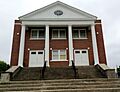
Shelby County has many other interesting historic places, including:
- Adams Avenue Historic District: A neighborhood in Memphis with many old and beautiful buildings.
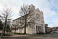
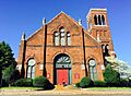
- Calvary Episcopal Church: A historic church in Memphis known for its architecture.
- Central Gardens Historic District: Another lovely historic neighborhood in Memphis.
- Collierville Historic District: The historic town square and surrounding area in Collierville.
- Cooper-Young Historic District: A vibrant and historic neighborhood in Memphis known for its unique shops and restaurants.
- Cordova School: An old schoolhouse in Cordova.
- Davies Manor: A historic plantation house in Memphis.
- Orpheum Theatre: A grand theater in Memphis that hosts Broadway shows and concerts.
- Sears, Roebuck and Company Catalog Distribution Center and Retail Store: Now known as Crosstown Concourse, this huge building was once a major hub for Sears.
Places No Longer on the List
Sometimes, historic places are removed from the National Register. This usually happens if they are destroyed, moved, or changed so much that they lose their historic importance.
For example:
- The First Methodist Church in Memphis was removed in 2007 after it was destroyed by a fire.
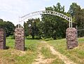
- The Libertyland Grand Carousel was removed in 2009 because the amusement park closed and the carousel was moved to a new location.
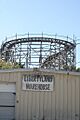
- The Zippin Pippin roller coaster, once a famous ride at the Mid-South Fairgrounds, was moved to Green Bay, Wisconsin, and removed from the list in 2011.
Images for kids
-
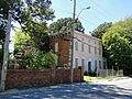
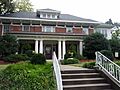
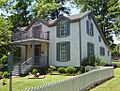
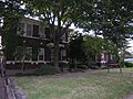
The Anderson-Coward House
-
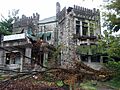
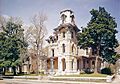
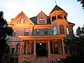
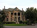
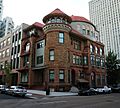
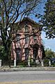
Ashlar Hall
-
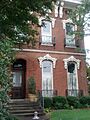
The John Alexander Austin House
-
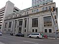
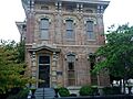
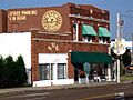
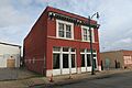
The Bank of Commerce and Trust Company Building
-
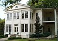
The Boyce-Gregg House
-
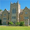
The John Willard Brister Library
-
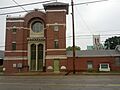
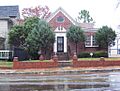
Calvary Episcopal Church and Parish House
-
The Capt. Harris House
-
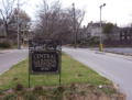
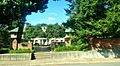
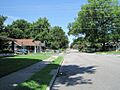
A street in the Central Gardens Historic District
-
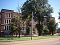
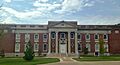
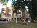
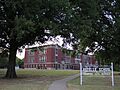
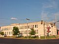
Central High School
-
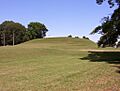
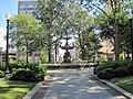
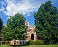
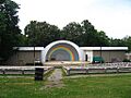
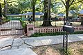
Chickasaw Heritage Park
-
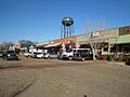
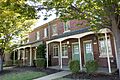
Collierville Historic District
-
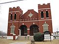
Collins Chapel CME Church and Site
-
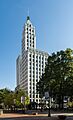
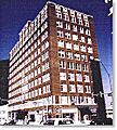
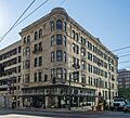
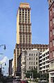
The Columbian Mutual Tower
-
A street in the Cooper-Young Historic District
-

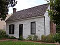
The Cordova School
-
Cotton Row Historic District
-
Court Square Historic District
-
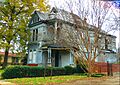
The E.H. Crump House
-
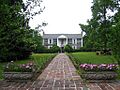
Davies Manor
-
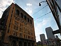
The Dermon Building
-
The Dixie Greyhound Bus Lines Complex
-
William C. Ellis and Sons Ironworks and Machine Shop
-
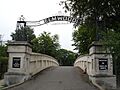
Elmwood Cemetery Office and Entrance Bridge
-
A home in the Evergreen Historic District
-
First Baptist Church (Beale Avenue)
-
First Colored Baptist Church
-
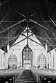
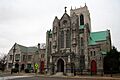
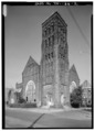
First Presbyterian Church
-

Forrest Park Historic District
-
The Fowlkes-Boyle House
-
The Nicholas Gotten House
-
Greenwood
-

High Point Terrace Historic District
-
The Hunt-Phelan House
-
Idlewild Presbyterian Church
-
The Knickerbocker Apartments
-
Lauderdale Courts Public Housing Project
-
The Lee and Fontaine Houses of the James Lee Memorial
-
The James Lee House (239 Adams Avenue)
-
The Lenox School
-
The Lowenstein House
-
A building in the Madison-Monroe Historic District
-
The Magevney House
-

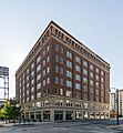
The Memphis Bank and Trust Building
-
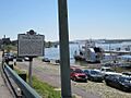
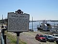
Memphis Landing
-
The Memphis Merchants Exchange
-

Memphis National Cemetery
-
The Memphis Parkway System
-
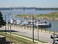
The Memphis Queen II Floating Vessel
-
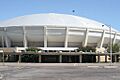
The Mid-South Coliseum
-
The William R. Moore Dry Goods Building
-
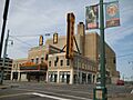
The Orpheum Theatre
-
Overton Park Historic District
-
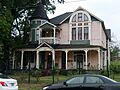
Paisley Hall
-
Peabody Elementary School
-

The Dr. D.T. Porter Building
-
The Elvis Presley House
-
The Newton Copeland Richards House
-
Rozelle Elementary School
-
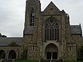
St. Mary's Cathedral, Chapel, and Diocesan House
-
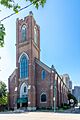
St. Mary's Catholic Church
-
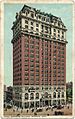
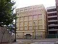
The Scimitar Building
-
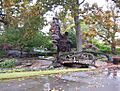
Sculptures of Dionicio Rodriguez at Memorial Park Cemetery
-

The Sears, Roebuck and Company Catalog Distribution Center and Retail Store
-
Second Congregational Church
-
Second Presbyterian Church
-

The Shrine Building
-
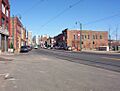
South Main Street Historic District
-
Southwestern at Memphis Historic District
-
A street in the Speedway Terrace Historic District
-

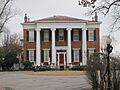
Squire's Rest
-
The Sterick Building
-
The Leslie M. Stratton YMCA
-
Sun Record Company, Memphis Recording Service
-
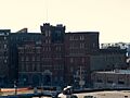
The Tennessee Brewery
-
The Tennessee Club-Overall Goodbar Building
-

The Tennessee Trust Building
-
The Toof Building
-
The John S. Toof House
-
Tri-State Bank
-
The U.S. Marine Hospital Executive Building and Laundry-Kitchen
-

The U.S. Post Office-Front Street Station
-
The Universal Life Insurance Company
-
Victorian Village District
-
The Zippin Pippin roller coaster (now moved)
-
Zion Cemetery


_1.jpg)


