Omak, Washington facts for kids
Quick facts for kids
Omak
|
|||
|---|---|---|---|
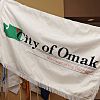
| City of Omak | |||
|
|||
|
|||
| Motto(s):
Heart of the Okanogan
|
|||
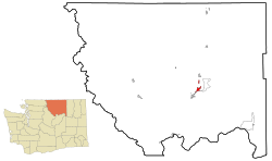
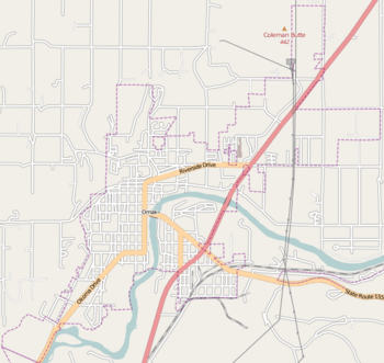
Location of Omak in
Okanogan County, Washington |
|||
| Country | United States | ||
| State | Washington | ||
| County | Okanogan | ||
| Established | January 1, 1907 | ||
| Incorporated | February 11, 1911 | ||
| Founded by | Ben Ross | ||
| Government | |||
| • Type | Mayor–council | ||
| Area | |||
| • City | 3.94 sq mi (10.21 km2) | ||
| • Land | 3.86 sq mi (10.00 km2) | ||
| • Water | 0.08 sq mi (0.21 km2) | ||
| • Urban | 4.83 sq mi (12.5 km2) | ||
| Elevation | 843 ft (257 m) | ||
| Population
(2020)
|
|||
| • City | 4,860 | ||
| • Density | 1,233.5/sq mi (476.0/km2) | ||
| • Demonym | Omakian | ||
| Time zone | UTC-8 (PST) | ||
| • Summer (DST) | UTC-7 (PDT) | ||
| ZIP code |
98841
|
||
| Area code(s) | 509 | ||
| FIPS code | 53-51340 | ||
| GNIS feature ID | 1524048 | ||
Omak is a city in north-central Washington, United States. It is located in the foothills of the Okanogan Highlands. In 2020, Omak had 4,860 residents. It is the largest city in Okanogan County. The larger Omak area has about 8,229 people. This area includes its nearby "twin city" of Okanogan.
The name Omak comes from the Okanagan word umák. It also comes from the Salishan term Omache. This means "good medicine" or "plenty." It refers to the area's nice climate. Omak is often called the "Heart of the Okanogan." It is a gateway to the Okanogan–Wenatchee National Forest.
Omak is a "code city" with a seven-member council. Its economy relies on farming and forestry. However, it also has sawmills and tourism. You can find walking trails, state parks, and national forests nearby. These include Conconully State Park and Bridgeport State Park. The city has a local newspaper, the Omak–Okanogan County Chronicle. It also has a Wenatchee Valley College campus. Major roads like U.S. Route 97 pass through Omak.
Contents
History of Omak
Early Days and Native Americans
The Syilx (also called Okanogan) Native Americans lived in the Okanogan Valley. Their land reached north into what is now British Columbia. They started using horses in the mid-1700s. This helped them travel and trade more. They met non-native traders and missionaries in the early 1800s.
In 1811, Fort Okanogan was built where the Okanogan and Columbia Rivers meet. This fort was important for fur trading. The Okanogan River was a key route for traders. Later, this route became known as the Okanagan Trail. It was used by many people heading to the Fraser Canyon Gold Rush in the late 1850s.
Settlement and Land Changes
In the 1850s, European-Americans began settling in the Omak area. They built homes and started mining, logging, and farming. As more settlers arrived, there were disagreements over land. A treaty was signed to create an Indian reservation for Native Americans. The remaining land went to the European-Americans.
The Colville Indian Reservation was created around 1872. Its size was later reduced many times. In 1887, the Confederated Tribes of the Colville Reservation was formed. This group included 12 different Native American bands.
Founding of Omak City
A nearby community, Alma, was set up around 1886. It was later renamed Okanogan. A man named J.I. Pogue was unhappy about this. He asked Ben Ross to start a new town about 4 miles north. Ben Ross was a surveyor and settler.
Ross decided to found a new community in 1907. He named it Omak. The name supposedly means "good medicine" or "plenty." This referred to the town's good climate. Ross built a cabin in 1907 for his family. He was one of the first white settlers in the area.
Omak's Growth and Industries
Omak began to grow after the Okanogan Irrigation Project was finished. This project helped farming in the area. Many farmers moved to Omak. They grew fruits like apples, peaches, and watermelons after 1910. Omak officially became a city on February 11, 1911.
During the Great Depression of 1933, many people in Omak needed work. The United States Bureau of Reclamation offered jobs at the Grand Coulee Dam. This project employed about 5,000 people from 1933 to 1951. By 1950, Omak had many buildings, including the St. Mary Mission church.
In the 1910s, a sawmill was built in Omak to help the economy. The Biles-Coleman Lumber Company bought it in 1924. They built another sawmill on Omak Mountain. This company and its mills were later bought by Crown Zellerbach in 1975.
The company eventually went bankrupt. Employees bought the mill and renamed it Omak Wood Products. They tried to save their jobs. However, Omak Wood Products also went bankrupt. The Confederated Tribes of the Colville Reservation bought the mill in 2000. It closed in 2009 due to low demand, costing over 130 jobs. There have been talks about reopening the mills. Part of the mill burned down in a fire in September 2020.
Geography of Omak
Land and Water Features
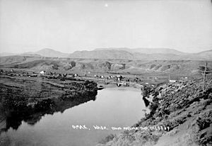
Omak is about 45 miles south of the Canada–United States border. The Idaho border is about 160 miles southeast. Seattle is about 237 miles southwest. The Okanogan River forms the city's northern border. The city of Okanogan defines its southern border. The area has mountains and forests.
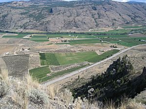
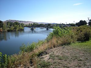
Omak is in the foothills of the Okanogan Highlands. It is part of the Okanagan Country region. This region extends into British Columbia. The Okanogan River flows through the city. It is a 115-mile long river that flows into the Columbia River.
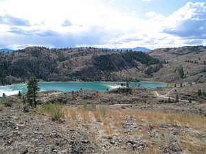
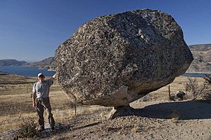
Omak Lake is known for its balancing Omak Rock. It is the largest salty lake in Washington. It is 3,244 acres big and 950 feet above sea level. Crawfish Lake is about 15 miles northeast of Omak. It is near the Colville Indian Reservation and Okanogan–Wenatchee National Forest. This forest is 1,499,023 acres and has varied terrain and mountains.
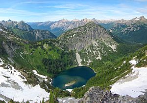
Elevations in the area range from 780 feet at the Okanogan River to 6,774 feet at Moses Mountain. The average elevation in Omak is 843 feet above sea level. Moses Mountain, Little Moses Mountain, and Omak Mountain are east of the city. West of Omak are the North Cascades mountains.
Omak covers about 3.5 square miles of land. This includes 0.07 square miles of water. In April 2010, Omak expanded its area. It is the fourth largest settlement in Okanogan County by area. The Greater Omak Area includes Okanogan city and North Omak.
Omak's Climate and Weather
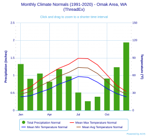
Omak has a semi-arid climate. This means it gets little rain. Summers are hot, and winters are cold. Average temperatures range from 16.6°F in January to 88.8°F in July. The lowest temperature ever was -26°F in 1950. The highest was 117°F in 2021.
Omak has four clear seasons. Summers are hot and dry. Winters are the wettest, with about 22.3 inches of snow. Spring and autumn are mild with little rain. Omak is in plant hardiness zone 6a.
In July 2012, a big thunderstorm hit Omak. It caused heavy rain, strong winds, and hail. This forced U.S. Route 97 to close temporarily. Omak was also affected by the 1872 North Cascades earthquake. This was the state's largest historical earthquake. Its center was at Omak Lake.
| Climate data for Omak, Washington, 1991–2020 normals, extremes 1909–present | |||||||||||||
|---|---|---|---|---|---|---|---|---|---|---|---|---|---|
| Month | Jan | Feb | Mar | Apr | May | Jun | Jul | Aug | Sep | Oct | Nov | Dec | Year |
| Record high °F (°C) | 62 (17) |
63 (17) |
79 (26) |
96 (36) |
104 (40) |
117 (47) |
114 (46) |
109 (43) |
102 (39) |
90 (32) |
77 (25) |
74 (23) |
117 (47) |
| Mean maximum °F (°C) | 45.6 (7.6) |
51.9 (11.1) |
66.0 (18.9) |
77.3 (25.2) |
88.0 (31.1) |
95.2 (35.1) |
101.7 (38.7) |
101.4 (38.6) |
92.5 (33.6) |
76.4 (24.7) |
58.3 (14.6) |
46.2 (7.9) |
103.3 (39.6) |
| Mean daily maximum °F (°C) | 32.8 (0.4) |
39.8 (4.3) |
52.5 (11.4) |
62.8 (17.1) |
72.4 (22.4) |
79.1 (26.2) |
89.4 (31.9) |
88.8 (31.6) |
78.2 (25.7) |
60.7 (15.9) |
43.0 (6.1) |
32.5 (0.3) |
61.0 (16.1) |
| Daily mean °F (°C) | 28.0 (−2.2) |
32.5 (0.3) |
41.8 (5.4) |
49.8 (9.9) |
58.8 (14.9) |
65.1 (18.4) |
73.7 (23.2) |
72.8 (22.7) |
63.3 (17.4) |
49.1 (9.5) |
35.9 (2.2) |
27.9 (−2.3) |
49.9 (9.9) |
| Mean daily minimum °F (°C) | 23.3 (−4.8) |
25.2 (−3.8) |
31.1 (−0.5) |
36.8 (2.7) |
45.1 (7.3) |
51.1 (10.6) |
58.1 (14.5) |
56.8 (13.8) |
48.4 (9.1) |
37.5 (3.1) |
28.9 (−1.7) |
23.3 (−4.8) |
38.8 (3.8) |
| Mean minimum °F (°C) | 4.2 (−15.4) |
10.2 (−12.1) |
18.8 (−7.3) |
24.6 (−4.1) |
30.5 (−0.8) |
38.8 (3.8) |
45.1 (7.3) |
44.9 (7.2) |
33.5 (0.8) |
22.3 (−5.4) |
12.7 (−10.7) |
6.1 (−14.4) |
−0.6 (−18.1) |
| Record low °F (°C) | −22 (−30) |
−26 (−32) |
−7 (−22) |
15 (−9) |
19 (−7) |
30 (−1) |
35 (2) |
31 (−1) |
20 (−7) |
5 (−15) |
−6 (−21) |
−21 (−29) |
−26 (−32) |
| Average precipitation inches (mm) | 1.33 (34) |
0.91 (23) |
1.06 (27) |
0.83 (21) |
1.19 (30) |
0.98 (25) |
0.52 (13) |
0.27 (6.9) |
0.40 (10) |
0.92 (23) |
1.24 (31) |
1.95 (50) |
11.60 (295) |
| Average snowfall inches (cm) | 8.0 (20) |
4.7 (12) |
0.8 (2.0) |
0.0 (0.0) |
0.0 (0.0) |
0.0 (0.0) |
0.0 (0.0) |
0.0 (0.0) |
0.0 (0.0) |
0.0 (0.0) |
3.0 (7.6) |
8.5 (22) |
25.0 (64) |
| Average precipitation days (≥ 0.01 in) | 10.0 | 8.0 | 7.6 | 5.8 | 7.6 | 6.7 | 3.1 | 2.3 | 3.8 | 6.0 | 9.1 | 11.5 | 81.5 |
| Average snowy days (≥ 0.1 in) | 4.1 | 2.3 | 0.5 | 0.0 | 0.0 | 0.0 | 0.0 | 0.0 | 0.0 | 0.0 | 1.4 | 3.9 | 12.2 |
| Source 1: NOAA | |||||||||||||
| Source 2: National Weather Service (average snowfall/snow days 1909-1997) | |||||||||||||
City Layout and Buildings
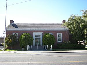
Omak was a planned city. Ben Ross designed it throughout the 20th century. Within a year, it had a downtown area with a bank and hotel. These were supported by local farming. Omak also got a post office.
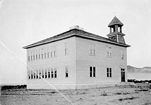
Ross founded the Omak School District in 1906. The first school, Omak Schoolhouse, was built soon after. By 1910, Downtown Omak had many shops and offices. A steel bridge built in 1911 collapsed but was quickly rebuilt.
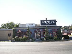
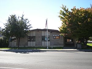
The city has a downtown area and places where people live. Downtown Omak is the main economic hub for the county. There are several churches in the city. The Omak post office is the only building in the city listed on the National Register of Historic Places. The Breadline Cafe is a popular restaurant and music spot downtown.
The City of Omak manages the Omak Memorial Cemetery. It has about 3,747 graves. The 118-acre North Omak Business Park is bordered by U.S. Route 97. The main residential areas are East Omak and South Omak.
Omak's Population
| Historical population | |||
|---|---|---|---|
| Census | Pop. | %± | |
| 1910 | 520 | — | |
| 1920 | 525 | 1.0% | |
| 1930 | 2,547 | 385.1% | |
| 1940 | 2,918 | 14.6% | |
| 1950 | 3,791 | 29.9% | |
| 1960 | 4,068 | 7.3% | |
| 1970 | 4,164 | 2.4% | |
| 1980 | 4,007 | −3.8% | |
| 1990 | 4,117 | 2.7% | |
| 2000 | 4,721 | 14.7% | |
| 2010 | 4,845 | 2.6% | |
| 2020 | 4,860 | 0.3% | |
| Sources: Greater Omak Comprehensive Plan U.S. Decennial Census 2020 Census |
|||
In 1910, before Omak became a city, it had 520 residents. By 1920, the population grew to 2,500. This made Omak the largest city in Okanogan County. The population kept growing to about 4,000.
In 1980, the population decreased. This was because fruit prices rose, land was lost, and major businesses closed. After that, the population slowly increased. By 2000, it was almost 5,000 residents. Between 1990 and 2000, Omak's population grew by 14.7 percent. From 2000 to 2010, it grew by 2.6 percent.
In 2010, Omak had 4,845 residents in 2,037 households. The average age was 38. About 15 percent of residents were single. 13 percent were single-parent households. The city had 2,168 housing units. There were 2,540 females and 2,305 males.
Most of the population (71 percent) was white. Between 2000 and 2010, the number of families increased. About 89.5 percent of residents over five spoke English at home. Many residents have German (18.5 percent) or Irish (15.3 percent) ancestry. Omak also has a high percentage of American Indian and Mexican people. Together, they make up 28 percent of residents.
Omak's Economy
Omak is the main business center for Okanogan County. It is a regional hub for services and trade. In 2007, the city's economy was growing well. It is an agricultural community with a strong forestry industry. In the late 1990s and early 2000s, almost 90 percent of Omak's manufacturing jobs were in its two sawmills.
Infrastructure services and retail were also big industries. About 425 private companies employed 3,332 workers. These jobs were in manufacturing, retail, and infrastructure. The nearby city of Okanogan is the county's largest employer.
In 2010, 1,859 people over 16 were employed in Omak. Even though it's known for farming, only 26 people worked in agriculture and forestry. Office and sales jobs were the largest group, making up 30 percent of employees. About 7 percent of people in Omak are unemployed. 25 percent live below the poverty line. This includes 34 percent of those under 18.
Omak has a Walmart store. It was built in 1993 and was the first Walmart in Washington state. Opening the store involved many discussions. Local businesses worried it would hurt them. However, others thought it would bring more shoppers to the city. Walmart hired about 200 people, which helped Omak's economy.
Tourism and Shopping
Omak's economy also benefits from tourism. The mild climate and nearby lakes, rivers, and mountains make it a great outdoor spot. Retail stores like Harbor Freight, Big 5 Sporting Goods, and Walmart sell licenses for outdoor activities.
The Omache Shopping Center is a large mall in North Omak. It is 1,541,470 square feet. It was built in 1987 and has 12 stores. It attracts people from nearby rural communities. Omak is also home to two infrastructure companies: Okanogan County Transportation & Nutrition and Cascade and Columbia River Railroad.
Culture and Fun in Omak
City Nicknames and Events
Omak has been named a "tree city" for many years. This is because of its efforts to keep urban forests healthy. The city calls itself the "Heart of the Okanogan." This shows its important role in the region. People from Omak are called Omakians.
The Omak Stampede is a big annual event. It happens on the second weekend of August. During this time, Omak's population can grow to about 30,000 people. Horses in the event must pass health and swim tests. This ensures they can safely cross the river. Some animal rights groups have raised concerns about the horses' safety during this event.
Other fun events include the Omak Film Festival. It shows movies at Wenatchee Valley College and the Omak Theater. The Okanogan County Fair is an annual carnival. The Omak Western and Native Art Show is a Native American carnival. The city also offers a Main Street Historical Tour.
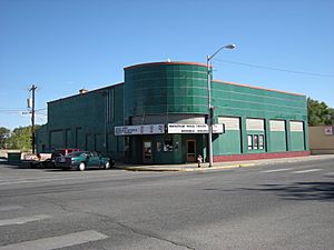
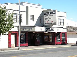
Omak has a Native American wooden sculpture area. There are two movie theaters: the Omak Theater (built 1928) and the Mirage Theater (built 2004). The Omak Visitor Information Center helps tourists. It has historical pictures and gifts. The Okanogan County Historical Museum shows the area's history.
The Omak Performing Arts Center is a 500-seat venue. It hosts shows and events. The Confederated Tribes of the Colville Reservation operate a 58,000 square foot casino. It has over 400 gaming machines.
Outdoor Recreation
Omak's mild climate and nearby natural areas make it great for outdoor fun. The city has eight parks. Eastside Park is the largest. It has a skate park, pool, baseball fields, soccer fields, and tennis courts. Civic League Park is the oldest park.
Omak has beaches on Omak Lake. You can go fishing and boating there. Other lakes for fishing include Fry Lake, Duck Lake, and Conconully Lake. The Valley Lanes bowling alley hosts competitions. The Okanogan Valley Golf Club is also in Omak.
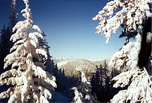
The Okanogan–Wenatchee National Forest is the largest forest on the West Coast. It has trails for walking, hiking, and biking. It also has skiing areas. Many visitors come to the forest each year. You can also go hunting and see interesting rock formations.
There are hiking trails in the hills, like Omak Mountain and Moses Mountain. Skiing is available at the Loup Loup Ski Bowl, about 25 miles west. Nearby state parks include Conconully State Park and Bridgeport State Park. Birdwatchers can see quail, wild turkeys, and bald eagles.
Camping is available at RV parks and campgrounds near Omak. The Omak–Okanogan area is known for rock climbing. You can also go horseback riding and hunting in nearby communities. The Omak Pioneers are the sports teams for Omak High School. They have teams for baseball, basketball, football, soccer, volleyball, and wrestling.
Media in Omak
The Omak Chronicle newspaper started in 1910. Three years later, it became The Omak-Okanogan County Chronicle. It now covers the whole county. An online version started in 1998. Other newspapers like the Okanogan Valley Gazette–Tribune and The Wenatchee World also serve Omak.
Omak has several radio stations. KOMW plays oldies music. KNCW plays country music. KZBE plays adult contemporary music. KQWS is a Northwest Public Radio station.
Omak also has good television service. All major U.S. networks are available. You can also watch Canadian channels from Vancouver. Several local TV stations broadcast in Omak. These include PBS, CBS, ABC, and NBC affiliates.
Education in Omak
In 2010, about 1,057 people in Omak had attended college. 504 residents had a college degree. About 91.5 percent of residents graduated from high school or higher. This is two percent higher than the state average.
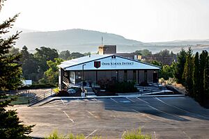
Omak's schools are part of the Omak School District. This is the county's largest school district. It has two high schools, one middle school, and two elementary schools. It also has three virtual schools. Omak High School was built in 1919.
In February 2010, Omak became the third city in Washington to have a virtual school. These are called Washington Virtual Academy Omak Elementary, Middle, and High School. The private Omak Adventist Christian School also operates in the area.
The Omak Public Library is part of NCW Libraries. It opened in 1956. The community college, Wenatchee Valley College, has a campus in Omak. It offers adult education and two-year degrees. Heritage University also has an Omak campus. It offers degrees in many subjects.
Omak's Infrastructure
In 2010, about 89.3 percent of Omak residents drove to work. This is more than the state average. Four percent carpooled, and 3.8 percent walked. The average time to get to work was 11.5 minutes. This is less than the state average.
In the late 1960s, U.S. Route 97 was moved to bypass Downtown Omak. Large signs on U.S. Route 97 promote the downtown area. Washington State Route 215 runs north-south through Omak. It connects Omak to Okanogan. U.S. Route 97 and State Route 20 also run through Omak.
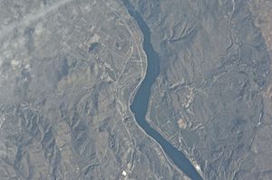
Omak has train, air, and bus services. Train lines from Cascade and Columbia River Railroad enter Omak. The City of Omak operates the Omak Airport. It has a paved runway, the third largest in central Washington. It offers three daily charter flights.
Mid-Valley Hospital is a 30-bed hospital in Omak. It provides medical services, including a 24-hour emergency room. Okanogan Behavioral Healthcare is another medical facility. Several nursing homes also operate in Omak. The city's clinic was built in 1996.
The City of Omak manages drinking water, storm drains, and garbage services. Electricity is supplied by Okanogan County Public Utility District. Natural gas comes from Amerigas. Other utility companies include AT&T (telephone) and Comcast (telephone, Internet, and cable TV).
Notable People from Omak
- Joe Feddersen was born in Omak in 1953. His mother was Okanagan and Sinixt. Feddersen is a sculptor, painter, and photographer. He is known for artworks with geometric patterns. These patterns reflect the landscape and his Native American heritage. He taught art at the Evergreen State College. In 2009, he moved back to Omak.
- Marv Hagedorn was born in Omak in 1956. He served in the United States Navy from 1973 to 1994. He later entered politics. He was elected to the Idaho House of Representatives in 2007. In 2012, he was elected to the Idaho State Senate.
- Don McCormack was born in Omak in 1955. He became a professional baseball player. He made his Major League Baseball debut as a catcher in 1980 for the Philadelphia Phillies. He played in five major league games. He also played nine years in the minor leagues.
- William Stephen Skylstad was born in Omak around 1934. He became a Roman Catholic Bishop. He was trained for the priesthood in the United States. He retired as Bishop Emeritus of the Roman Catholic Diocese of Spokane in 2010.
International Connections
Omak is a sister city with Summerland, British Columbia, Canada. Summerland is a district with about 11,280 people. It is located on Okanagan Lake. Summerland was incorporated in 1906. It is about 96 miles north of Omak.
See also
 In Spanish: Omak (Washington) para niños
 | Sharif Bey |
 | Hale Woodruff |
 | Richmond Barthé |
 | Purvis Young |


