
Prairie du Rocher, Illinois facts for kids
Quick facts for kids
Prairie du Rocher
|
||
|---|---|---|

A grain elevator in Prairie du Rocher
|
||
|
||

Location of Prairie du Rocher in Randolph County, Illinois.
|
||
.svg)
Location of Illinois in the United States
|
||
| Country | United States | |
| State | Illinois | |
| County | Randolph | |
| Precinct | Prairie du Rocher | |
| Founded | 1722 | |
| Area | ||
| • Total | 0.57 sq mi (1.48 km2) | |
| • Land | 0.57 sq mi (1.48 km2) | |
| • Water | 0.00 sq mi (0.00 km2) | |
| Elevation | 394 ft (120 m) | |
| Population
(2020)
|
||
| • Total | 502 | |
| • Density | 879.16/sq mi (339.24/km2) | |
| Time zone | UTC-6 (CST) | |
| • Summer (DST) | UTC-5 (CDT) | |
| ZIP Code(s) |
62277
|
|
| Area code(s) | 618 | |
| FIPS code | 17-61639 | |

Prairie du Rocher means "The Rock Prairie" in French. It is a small village in Randolph County, Illinois, United States. It was founded a long time ago during the French colonial period in the American Midwest. The village is close to tall cliffs next to the Mississippi River. This area is often called the "American Bottom". In 2020, about 502 people lived there.
Prairie du Rocher is one of the oldest towns in the United States that was started by French settlers. Just four miles west, near the Mississippi River, is Fort de Chartres. This was a French military fort and a main office for the French government, built in 1720. Some parts of the fort have been rebuilt and it is now a state park. The fort and the town were important centers for government and trade. This was when France claimed a huge area in North America called New France or La Louisiane. This land stretched from what is now Louisiana and the Illinois Country all the way to Canada.
French colonists, mostly from Canada, founded the village in 1722.
Contents
History of Prairie du Rocher
Early French Settlement
In 1718, a man named Pierre Dugué de Boisbriand built the first Fort de Chartres. A few years later, in 1722, his nephew, St. Thérèse Langlois, started the village of Prairie du Rocher. The town was built on land given by the Royal Indian Company. Boisbriand later became the leader of this area.
The town was in a great spot because the land near the Mississippi River was very good for farming. Farmers, called habitants, grew a lot of wheat and corn. This extra food was sent to places like New Orleans and other towns further south in the Louisiana Territory.
An inspector from the early 1700s, D'Artaguette, wrote about the area:
This country is one of the most beautiful in all Louisiana. Every kind of grain and vegetables are produced here in the greatest abundance .... they have, also, large numbers of oxen, cows, sheep, etc., upon the prairies. Poultry is abundant, and fish plentiful. So that, in fact, they lack none of the necessaries or conveniences of life.
In 1743, the government gave the village a special piece of land called the Prairie du Rocher Common. All the villagers could use this land. They used it until 1852. The villagers had long, narrow farm plots that stretched from the river through the common land. They kept these plots open and built a fence around the common to keep animals out. There was even a school in the village as early as the 1760s. Students would stay with local families to attend.

Over time, the soil became tired because farmers didn't add nutrients back to it. Also, more people moved to the village, and there wasn't enough land for everyone. So, some villagers moved across the Mississippi River. Around 1750, they started a new town called Ste. Genevieve in what is now Missouri. This new town was also a farming community, much like Prairie du Rocher.
Under British Rule
After winning the French and Indian War (also known as the Seven Years' War), the British took control of French lands east of the Mississippi River. This happened with the Treaty of Paris in 1763. However, the British soldiers didn't fully arrive until 1765.
To avoid living under British rule, many French residents of Prairie du Rocher moved. They went across the Mississippi River to towns like Ste. Genevieve and St. Louis. These towns were now part of Spanish Louisiana, thanks to a secret agreement. Also, King George III made a rule in 1763 that said all land west of the Appalachians and east of the Mississippi was for Native Americans. He tried to stop settlers from the British Colonies from moving there.
The American Revolution and After
During the American Revolutionary War, a leader named George Rogers Clark captured Prairie du Rocher for the American colonies. This was part of his Illinois campaign, which also included taking Vincennes, Indiana. Some French settlers who were still in Prairie du Rocher moved to the Spanish-controlled lands west of the Mississippi after this.
Many of the new settlers in the area were soldiers from Clark's campaign or their relatives. They had heard how fertile the land was in the "American Bottom" area and wanted to live there.
The Great Flood of 1993
Prairie du Rocher was one of the few towns along the Mississippi River that did not flood during the Great Flood of 1993. Levees (walls built to hold back water) broke north of the town, near Columbia and Valmeyer, Illinois. Floodwaters then covered Fort de Chartres. They also started to threaten Prairie du Rocher.
Only the Prairie du Rocher Creek levee was protecting the town. People realized that the floodwater coming towards this levee was actually higher than the water in the main Mississippi River channel. The Army Corps of Engineers (COE) decided to break through the Mississippi River levee near Fort de Chartres. This would let some floodwaters flow back into the main river. However, this didn't lower the water level much.
Late one night, with floodwaters almost topping the sandbags on the Prairie du Rocher Creek levee, the local levee district leaders made a big decision. They voted to use dynamite to make two more openings in the levee. The COE had warned against this because it was risky. The village asked for help, and people added more sandbags to the creek levee. Finally, the two new openings allowed enough water to flow back to the main river. This saved the town from flooding. The levee is still strong today.
Old Houses in the Village
French settlers started Prairie du Rocher around 1722. At least twelve houses built in the 1700s are still standing in the village today. One of these is the Melliere House, built in 1735. Another is the Creole House, built in 1800. This house was built in the French Colonial style.

Arts and Culture
Prairie du Rocher keeps many French traditions alive. One special custom is La Guiannée. This is a type of caroling on New Year's Eve that dates back to the Middle Ages in France. People in Prairie du Rocher have celebrated it every New Year's Eve since the town was settled in 1722.
The town also celebrates Rendezvous twice a year, in summer and winter, at Fort de Chartres. During this event, people from many places come to camp out for the weekend. They dress up like Native Americans and French soldiers from the 1700s. They camp at the fort and act out the old wars that decided who owned the fort.
Fort de Chartres is an old French military fort built in the 1700s. It is now an Illinois state historic site.
Geography
Prairie du Rocher covers about 0.57 square miles (1.48 square kilometers) of land.
Illinois Route 155 is the main state highway that goes through Prairie du Rocher. It connects the town to Ruma, which is about 7 miles northeast. It also connects to Fort de Chartres, about 4 miles west. Bluff Road also connects the town to other places like Ellis Grove to the south and Columbia to the north.
Population Changes
| Historical population | |||
|---|---|---|---|
| Census | Pop. | %± | |
| 1880 | 228 | — | |
| 1890 | 408 | 78.9% | |
| 1900 | 347 | −15.0% | |
| 1910 | 511 | 47.3% | |
| 1920 | 535 | 4.7% | |
| 1930 | 510 | −4.7% | |
| 1940 | 576 | 12.9% | |
| 1950 | 662 | 14.9% | |
| 1960 | 679 | 2.6% | |
| 1970 | 658 | −3.1% | |
| 1980 | 701 | 6.5% | |
| 1990 | 540 | −23.0% | |
| 2000 | 613 | 13.5% | |
| 2010 | 604 | −1.5% | |
| 2020 | 502 | −16.9% | |
| U.S. Decennial Census | |||
In 2000, there were 613 people living in the village. About 39% of households had children under 18. Most households were married couples living together. The average age in the village was 34 years old.
Education
The town has one elementary school for students from kindergarten to 8th grade. After 8th grade, students go to high school in a nearby town. The village also has a library and two parks. One park belongs to the school, and the other is owned by the town.
Town Services
The volunteer fire department is located in the city hall building. The city hall also has the post office.
Notable People
- Henry C. Hansbrough, a U.S. Congressman and Senator from North Dakota
Gallery
-
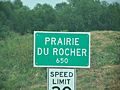
Road sign
-
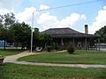
French-Colonial style house
-
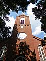
St. Joseph Roman Catholic Church


See also
 In Spanish: Prairie du Rocher para niños
