Preston, Texas facts for kids
Quick facts for kids
Preston, Texas
|
|
|---|---|
|
Census-designated place
|
|
| Nickname(s):
Preston Bend
|
|
| Country | United States |
| State | Texas |
| County | Grayson |
| Settled | 1836 |
| Founded by |
|
| Area | |
| • Total | 8.1 sq mi (21.1 km2) |
| • Land | 5.1 sq mi (13.1 km2) |
| • Water | 3.1 sq mi (8.0 km2) |
| Elevation | 708 ft (216 m) |
| Population
(2010)
|
|
| • Total | 2,096 |
| • Density | 416/sq mi (160.6/km2) |
| Time zone | UTC-6 (CST) |
| FIPS code | 48-59420 |
| GNIS feature ID | 1380395 |
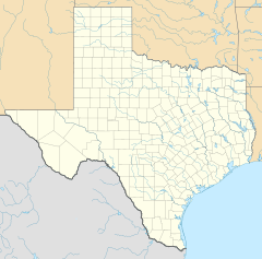
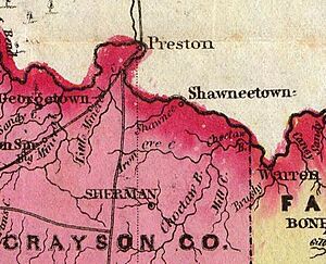
Preston, also known as Preston Bend, is a small community in Grayson County, Texas, United States. It's located right on the Red River. In the 1800s, Preston was a very important place. It sat where several military and trade roads met. It was also a key crossing point on the Shawnee cattle trail.
However, Preston became less important when the MK&T railroad was built. The railroad went around the town, so fewer travelers and cattle drives passed through. Today, much of the original town is underwater. It's covered by the waters of Lake Texoma. In 2010, about 2,096 people lived in the area.
Contents
Preston's Past: A Look at Its History
First People and Early Settlers
Long before European settlers arrived, the Caddo people lived in the Preston area. The Comanche and Kiowa tribes lived further west. One of the first American settlers was John Hart. He farmed land near a bend in the Red River before 1826. He left after being attacked by Native Americans around 1830.
In the 1830s, the United States moved many Native American tribes. These tribes, called the Five Civilized Tribes, moved to the Indian Territory. This territory was on the north side of the Red River. In 1834, the First Dragoon Expedition explored this region. They set up a base called Leavenworth Camp near Preston. Famous artist George Catlin painted some of his Native American pictures from this camp.
John Hart returned to the area in 1838. He cleared land and built cabins. He later leased his land to another person.
Holland Coffee and the Trading Post
Holland Coffee and Silas Cheek Colville started a company together. They wanted to build trading posts on the Red River. They set up a trading post in the Washita Bend area. This was after John Hart's tenant was killed by Native Americans. Holland Coffee later became a member of the Texas Legislature. In 1838, he helped make a peace treaty with several Native American tribes.
The town of Preston grew up around this trading post. It became a busy center for trade. In 1936, a historical marker was placed at the site of Holland Coffee's Trading Post.
Important Roads and Trails
Preston was located at a key crossroads. The Texas Road went north from Preston into the Indian Territory. It led all the way to Missouri. The Preston Road went south into Texas. This road followed an old Native American trail. In 1840, Colonel William Gordon Cooke built a military road. It went from Coffee's trading house to Austin. The Preston Road was about 100 miles (160 km) long. It stretched from Preston to the Trinity River near Dallas.
Fort Preston: A Military Base
The Republic of Texas asked Colonel Cooke to build a supply post. This post was named Fort Preston. It was named after Captain William Gilwater Preston. He was part of the military road expedition. Some people are not sure if the town was named after him. The origin of the town's name is still a bit of a mystery.
In 1840, Cooke was in charge of soldiers there. The small village around Fort Preston grew into the town of Preston, Texas. The fort was built on a bluff. This bluff was about 40 to 50 feet (12 to 15 m) above the river. Some of the fort's buildings were made from local bricks.
Later, the United States Army used Fort Preston as a supply depot. This depot supplied the Fifth Infantry from 1851 to 1853. Famous military leaders like Albert Sidney Johnston passed through Preston.
Glen Eden: Holland Coffee's Home
In 1839, Holland Coffee married Sophia Suttonfield Aughinbaugh. They lived in a large log stockade at his trading post. In 1843, Coffee started building a proper house for his wife. This house was called Glen Eden. It was about 2 miles (3.2 km) west of his trading post. The house was finished in 1845.
Holland Coffee died in 1846. Sophia later married several more times. Glen Eden became the most well-known home in the area.
Preston: A Growing Town
Preston grew around Coffee's trading house. By 1845, it was a good-sized town. A survey of the town was completed by William H. Hunt. In 1851, the town got its own government. Tom Jackson became the first mayor. Preston also had a Masonic lodge by 1852.
A United States post office opened in Preston in 1856. It operated again from 1880 to 1914. Preston had general stores where people could buy supplies. It also had at least one blacksmith shop.
Cattle Crossing Point
As the cattle business grew in Texas, cattle trails were needed. These trails led to processing places in Kansas. The Shawnee Trail passed right through the Preston area. This made Preston an important spot for cattle drives.
Before 1850, the crossing at Preston was also used by many wagons. Over 1,000 wagons crossed the river there in one year.
Ferries Across the River
Ferry services were available at the trading post as early as 1839. These ferries were often simple log rafts. Holland Coffee, George Butts, and Slone Love all ran ferries in the area.
The Rock Bluff Ferry operated near Preston. In the late 1830s, James Tyson ran this ferry. Later, Jim Shannon and Bud Randolph owned it.
Around 1853, Ben Colbert opened his ferry downstream. He wanted to make money from the California gold rush. Preston was on one part of the California Trail. This trail crossed into Texas from the Indian Territory.
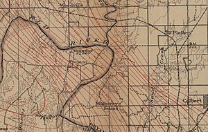
Thompson's Ferry was about 6 miles (9.7 km) west of Colbert's. It was run by James George Thompson. He was the first chief justice in Grayson County. His home became the county's first post office and courthouse.
Dreams of Expansion
Supplying military posts on the frontier was hard. One idea was to use steamboats to supply the army depot at Preston. But this plan was stopped in 1853. It was too difficult to navigate the upper Red River. A huge logjam called the Great Raft blocked the river. Later, after the Great Raft was cleared, steamboats could finally reach Preston. Preston even had its own steamboat landing.
In 1847, the Texas Legislature ordered a road to be built. This road would connect Preston to Sherman.
In 1853, Congress funded a project to find the best route for a transcontinental railroad. This railroad would cross the country. In 1854, an expedition surveyed a route from New Mexico to Preston. This route was later abandoned. The first transcontinental railroad was built further north after the Civil War.
Preston's Decline
Preston was the biggest community in the area for many years. But several things caused it to decline. When new counties were created, their main towns (county seats) were usually in the center. When Grayson County was formed, its county seat was placed in Sherman. Sherman was east of the Preston Trail. This made travelers go through Sherman instead of Preston.
Butterfield Trail Changes Things
The Butterfield Overland Mail stagecoach route started in 1857. This route went between St. Louis and San Francisco. It crossed the Red River at Colbert's Ferry. This was a few miles east of Preston. The stage line decided to bypass Preston. Colbert's Ferry became a more popular crossing. This was because Sherman and McKinney were growing. By 1871, 14 stage lines were going through Sherman.
The Railroad's Impact
After the Civil War, a peace treaty allowed a railroad to be built. This railroad, the Missouri, Kansas and Texas (MK&T), crossed the Red River near Colbert's Ferry in 1871. This was east of Preston. By this time, Preston was already declining. Many people had left. As other cities along the railroad grew, Preston became a small rural community.
Preston in the 1900s
In the 20th century, Preston had a public school system. It also had two churches and a cotton gin. There was a cemetery too. In the 1930s, only about 20 people lived in the town. A "New Preston" developed more centrally within the river bend.
Lake Texoma: A New Chapter
The United States Congress approved the building of Lake Texoma in 1938. This huge lake was built for flood control and to make electricity. The lake's waters covered the old town site of Preston. The United States Army Corps of Engineers bought all the land in the late 1930s.
After Lake Texoma was filled, only the cemetery was left. It was on high ground overlooking the old town. The cemetery was made bigger when the lake was created. Some graves that would have been underwater were moved to the new section.
Today, Preston Point is a peninsula in Lake Texoma. It was the high ground that overlooked the old town. A community called Preston still exists on this peninsula. It has campgrounds and cabins for recreation.
Preston's Population
| Historical population | |||
|---|---|---|---|
| Census | Pop. | %± | |
| 2020 | 2,101 | — | |
| U.S. Decennial Census 1850–1900 1910 1920 1930 1940 1950 1960 1970 1980 1990 2000 2010 |
|||
People in Preston Today (2020)
In 2020, there were 2,101 people living in the Preston area. There were 834 households and 355 families.
| Race | Number | Percentage |
|---|---|---|
| White (NH) | 1,845 | 87.82% |
| Black or African American (NH) | 6 | 0.29% |
| Native American or Alaska Native (NH) | 35 | 1.67% |
| Asian (NH) | 6 | 0.29% |
| Pacific Islander (NH) | 1 | 0.05% |
| Some Other Race (NH) | 6 | 0.29% |
| Mixed/Multi-Racial (NH) | 113 | 5.38% |
| Hispanic or Latino | 89 | 4.24% |
| Total | 2,101 |
Where is Preston? (Geography)
Preston was located in Texas, right on its border with the Indian Territory. This territory later became the state of Oklahoma. It was in the Red River Valley, on a bend in the river. This spot was just downstream from where the Washita River flows into the Red River. The area was also known as Washita Bend or Coffee Bend.
A rock bluff overlooked the Red River from the Texas side. This bluff was about 100 to 110 feet (30 to 34 m) above the river. This bluff marked a crossing point for an old Native American trail. Later, it was used as the crossing point for the Shawnee Cattle Trail. The Oklahoma side of the river was a flat, sandy plain.
The current Preston community is on the Preston Peninsula. This peninsula is surrounded by Lake Texoma. The main part of the lake is to the west. The Little Mineral Arm of the lake is to the east. The peninsula ends at Preston Point in the north. The community extends south to Meadow Lake Drive and Highport Road.
Texas State Highway 289 starts in Preston. It goes south about 7 miles (11 km) to Pottsboro. Denison is about 14 miles (23 km) to the southeast. Sherman, the main town of Grayson County, is about 20 miles (32 km) to the south-southeast.
The Preston area covers about 21.1 square kilometers (8.1 square miles). About 13.1 square kilometers (5.1 square miles) is land. The other 8.0 square kilometers (3.1 square miles), or 38.02%, is water from Lake Texoma.
Images for kids
See also
 In Spanish: Preston (Texas) para niños
 | John T. Biggers |
 | Thomas Blackshear |
 | Mark Bradford |
 | Beverly Buchanan |


