West Windsor, New Jersey facts for kids
Quick facts for kids
West Windsor, New Jersey
|
||
|---|---|---|
|
Township
|
||
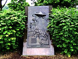
War of the Worlds monument in Grovers Mill
|
||
|
||
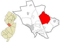
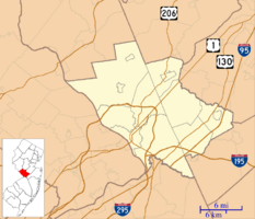
Location of West Windsor in Mercer County highlighted in red (right). Inset map: Location of Mercer County in New Jersey highlighted in orange (left).
|
||
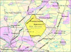
Census Bureau map of West Windsor Township, New Jersey
|
||
| Country | ||
| State | ||
| County | ||
| Incorporated | February 21, 1798 | |
| Government | ||
| • Type | Faulkner Act Mayor-Council | |
| • Body | Township Council | |
| Area | ||
| • Total | 26.25 sq mi (68.00 km2) | |
| • Land | 25.55 sq mi (66.17 km2) | |
| • Water | 0.71 sq mi (1.83 km2) 2.69% | |
| Area rank | 101st of 565 in state 3rd of 12 in county |
|
| Elevation | 92 ft (28 m) | |
| Population
(2020)
|
||
| • Total | 29,518 | |
| • Estimate
(2023)
|
30,509 | |
| • Rank | 82nd of 565 in state 7th of 12 in county |
|
| • Density | 1,155.3/sq mi (446.1/km2) | |
| • Density rank | 367th of 565 in state 10th of 12 in county |
|
| Time zone | UTC−05:00 (Eastern (EST)) | |
| • Summer (DST) | UTC−04:00 (Eastern (EDT)) | |
| ZIP Codes |
08550 – Princeton Junction and 08540 – Princeton, New Jersey
|
|
| Area code(s) | 609 | |
| FIPS code | 3402180240 | |
| GNIS feature ID | 0882124 | |
| Website | ||
West Windsor is a township in Mercer County, New Jersey. It's located between the Delaware Valley and Raritan Valley regions. The township is considered a suburb of New York City.
In 2020, West Windsor had a population of 29,518 people. This was the highest number of residents ever recorded for the township. West Windsor is often ranked among the wealthiest towns in New Jersey. In 2018, it was listed as the 9th highest-income town in the state.
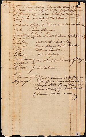
West Windsor and nearby East Windsor were created on February 9, 1797. They became official townships on February 21, 1798. This happened when the original Windsor Township was divided.
A part of Princeton University is located in West Windsor. The university owns about 400 acres of land here. West Windsor is also closely linked to the town of Princeton. Many places in West Windsor use "Princeton" in their names, like Princeton Junction.
Contents
History of West Windsor
Before Europeans settled here, the Lenape Native Americans lived in the West Windsor area. The Assanhicans, a Lenape group, lived in the greater Trenton area. You can still find artifacts from their society in West Windsor today.
In 1634, an English captain named Thomas Yong explored the Delaware River. He reached the Trenton area, but it's not known who the first European to step foot in West Windsor was.
The area of West Windsor was part of Piscataway Township in 1666. This changed when Middlesex County was formed in 1683.
How West Windsor Was Formed
New Windsor Township, which later became Windsor Township, was officially created on March 9, 1751. It was formed from a part of Piscataway Township. This original township included today's West Windsor, East Windsor, Hightstown, and Robbinsville. It also included parts of Princeton and other nearby towns.
In 1756, The College of New Jersey moved to Nassau Hall in Princeton. When West Windsor and East Windsor were created in 1797, West Windsor's borders reached Nassau Street. Later, in the 1800s, West Windsor's borders were changed to their current size of about 26.84 square miles.
Farming and Growth
For a long time, West Windsor was mainly a farming community. Farmers grew crops like wheat, tomatoes, rye, and potatoes. This way of life was common until the late 1900s.
The township grew very quickly from the late 1970s to the 2000s. A 1999 article in The New York Times noted that West Windsor had become a place with many expensive homes.
Local Hamlets and Famous Events
West Windsor never had one main "downtown" area. Instead, it had several small communities called hamlets. Some of these names are still used today:
- Aqueduct Mills
- Canal/Princeton Basin
- Clarksville
- Dutch Neck
- Edinburg
- Grovers Mill
- Penns Neck
- Port Windsor/Mercer
- Princeton Junction
Grover's Mill in West Windsor became famous in 1938. It was the fictional landing site for Martians in Orson Welles's radio broadcast of The War of the Worlds.
In 2001, the West Windsor post office was affected by the 2001 anthrax attacks. In 2002, a memorial was dedicated to the seven West Windsor residents who died in the September 11 terrorist attacks.
Geography of West Windsor
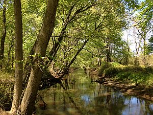
West Windsor Township covers about 26.25 square miles. Most of this area is land, with a small part being water.
Princeton Junction is an unincorporated community within West Windsor. This means it's a recognized place but doesn't have its own separate local government. Other communities here include Dutch Neck and Grover's Mill.
West Windsor shares borders with several other towns. These include East Windsor, Hamilton, Lawrence Township, Princeton, and Robbinsville in Mercer County. It also borders Plainsboro in Middlesex County.
A large piece of land near Route 1 is being redeveloped. Plans for this area have changed over time. In 2022, approval was given to build 5.5 million square feet of warehouse space there.
Climate and Nature
West Windsor Township has a climate with hot summers. This is known as a Humid Continental climate.
The natural plant life in West Windsor would mostly be Appalachian Oak trees. The area is part of the Eastern Hardwood Forest region.
Population and People
| Historical population | |||
|---|---|---|---|
| Census | Pop. | %± | |
| 1810 | 1,714 | — | |
| 1820 | 1,918 | 11.9% | |
| 1830 | 2,129 | 11.0% | |
| 1840 | 1,536 | −27.9% | |
| 1850 | 1,596 | 3.9% | |
| 1860 | 1,497 | −6.2% | |
| 1870 | 1,428 | −4.6% | |
| 1880 | 1,396 | −2.2% | |
| 1890 | 1,329 | −4.8% | |
| 1900 | 1,279 | −3.8% | |
| 1910 | 1,342 | 4.9% | |
| 1920 | 1,389 | 3.5% | |
| 1930 | 1,711 | 23.2% | |
| 1940 | 2,160 | 26.2% | |
| 1950 | 2,519 | 16.6% | |
| 1960 | 4,016 | 59.4% | |
| 1970 | 6,431 | 60.1% | |
| 1980 | 8,542 | 32.8% | |
| 1990 | 16,021 | 87.6% | |
| 2000 | 21,907 | 36.7% | |
| 2010 | 27,165 | 24.0% | |
| 2020 | 29,518 | 8.7% | |
| 2023 (est.) | 30,509 | 12.3% | |
| Population sources: 1800–1920 1840 1850–1870 1850 1870 1880–1890 1890–1910 1910–1930 1940–2000 2000 2010 2020 |
|||
West Windsor is known as a great place to raise children. This is because of its excellent school district and safe neighborhoods. In 2009, it was named the best neighborhood for families.
As of 2018, West Windsor had the second most educated population in New Jersey. Over 81% of residents had a bachelor's degree or higher. Almost half of the residents had advanced degrees.
Population Details
In 2010, there were 27,165 people living in West Windsor. About 45.5% of households had children under 18. Most households (73%) were married couples living together.
The population was diverse. About 55% were White, 3.7% Black, and 37.7% Asian. About 4.5% of the population was Hispanic or Latino.
The median age in 2010 was 39.6 years. About 28.4% of the population was under 18.
Economy of West Windsor
West Windsor's economy includes a mix of businesses. There are large companies, retail stores, and local services. NRG Energy, an electricity company, has its main office here.
The township's location near New York City and Philadelphia helps its economy. This makes it a good spot for finance, technology, and healthcare businesses. Many small and medium-sized companies operate in West Windsor.
Shopping centers like MarketFair in West Windsor are important for commerce. Nearby, the Quaker Bridge Mall also brings in shoppers.
Farming is still a small but important part of the economy. Local farms provide fresh produce for farmers' markets. West Windsor also supports green initiatives and environmentally friendly policies.
Arts and Culture
The West Windsor Arts Center is a place where art and the community come together. It offers performances, classes, workshops, and art shows. It is located in the historic Princeton Junction Firehouse.
The Mercer County Italian-American Festival is held every year in West Windsor. It started in 2000 and celebrates Italian-American culture.
Local TV Channel
MCTV 26 is a local TV station in West Windsor. It is owned by Mercer County Community College. This station broadcasts educational programs to homes across Mercer County.
Parks and Recreation
West Windsor has several parks for outdoor activities.
- Richard J. Coffee Mercer County Park is a large park mostly in West Windsor. It has athletic fields, a dog park, and picnic areas. There's also a boathouse and marina on Mercer Lake. You can find bike trails and an ice skating rink here.
- West Windsor Community Park is the main park for active recreation. It has a playground, paths for jogging and biking, and courts for basketball, tennis, and pickleball. There are also baseball fields and an indoor baseball facility. The park is home to the West Windsor Waterworks Family Aquatics Center.
- Duck Pond Park is a new park that is still being built. It will have lighted soccer fields, which are already in use. Future plans include a playground, picnic areas, and a fishing pond.
Government of West Windsor
West Windsor is governed by a mayor and a five-member Township Council. This system is called the mayor-council form of government. It was adopted in 1993. Before that, the township was run by a township committee.
The mayor is the chief executive and leads the township's administration. The mayor is elected for a four-year term. The Township Council is the law-making part of the government. Its five members are also elected for four-year terms.
The current mayor of West Windsor is Hemant Marathe. His term ends on December 31, 2025. He is the first Indian-American mayor of the township. The Township Council members are Andrea Sue Mandel (Council President), Michael Ray Stevens (Council Vice President), Sonia Gawas, Linda Geevers, and Martin Whitfield.
Representation in Government
West Windsor is part of the 12th Congressional District for national elections. For state elections, it is in New Jersey's 15th legislative district.
Education in West Windsor
West Windsor offers many educational opportunities.
Colleges and Universities
The West Windsor Campus of Mercer County Community College is located here. A satellite campus of Princeton University is also in West Windsor.
Public Schools
West Windsor and Plainsboro share a school district called the West Windsor-Plainsboro Regional School District. This district serves students from pre-kindergarten through high school.
The district has 10 schools in total. There are four elementary schools (grades Pre-K/K–3), two upper elementary schools (grades 4 and 5), two middle schools (grades 6–8), and two high schools (grades 9–12).
Some of the schools in the district include:
- Dutch Neck Elementary School (West Windsor)
- Maurice Hawk Elementary School (West Windsor)
- Village School (West Windsor)
- Thomas R. Grover Middle School (West Windsor)
- West Windsor-Plainsboro High School South (West Windsor)
- Town Center Elementary School (Plainsboro)
- J.V.B. Wicoff Elementary School (Plainsboro)
- Millstone River School (Plainsboro)
- Community Middle School (Plainsboro)
- West Windsor-Plainsboro High School North (Plainsboro)
Several schools in the district have received national recognition. West Windsor-Plainsboro High School South, Maurice Hawk Elementary School, and West Windsor-Plainsboro High School North have all been recognized by the National Blue Ribbon Schools Program.
Students in Mercer County can also apply to high school programs at the Mercer County Technical Schools. These schools offer career and technical education.
Private Schools
The Wilberforce School is a private school in West Windsor. It teaches students from kindergarten through 12th grade. It moved to new facilities in the township in 2014.
Transportation and Roads
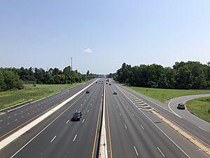
West Windsor has many roads and highways. The township maintains over 123 miles of roadways.
U.S. Route 1 is the biggest and busiest highway in West Windsor. It runs through the northwestern part of the township. Other important roads include County Route 533, County Route 526, County Route 571, and County Route 535.
Public Transportation
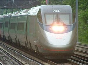
The Princeton Junction station is located in West Windsor. It is a busy train station for Amtrak and NJ Transit trains. It is one of the busiest train stations in New Jersey.
A unique train line called the "Dinky" runs between Princeton Junction station and Princeton station. It's a one-car train that travels about 2.7 miles each way. It is the shortest regularly scheduled passenger train route in the United States.
NJ Transit also provides bus service to Trenton and other areas.
Healthcare Services
Penn Medicine Princeton Medical Center is a large hospital located in nearby Plainsboro Township. It has 355 beds and serves the greater Princeton area. It is part of the Penn Medicine Health System.
The hospital offers many services at its main campus. It also has primary and specialty care offices throughout Central Jersey, including one in West Windsor.
Other hospitals close to West Windsor include CentraState Medical Center in Freehold Township and Robert Wood Johnson University Hospital in Hamilton Township.
Notable People
- Jack Aker (born 1940), former Major League Baseball pitcher
- Kevin Barry (born 1978), former Atlanta Braves relief pitcher
- Kevin G. Chapman, author and attorney
- Aneesh Chopra (born 1972), first Chief Technology Officer of the United States
- Stanley Dancer (1927–2005), harness racing driver and trainer
- Eileen Filler-Corn (born 1964), first woman to serve as Speaker of the Virginia House of Delegates
- Douglas Forrester (born 1953), former mayor of West Windsor Township
- John W. Hartmann (born 1967), politician
- Ethan Hawke (born 1970), actor
- Sachidananda Kangovi (born 1948), engineer and author
- Katie Kellner (born 1991), distance runner and coach
- Kris Kolluri (born c. 1969), former Commissioner of the New Jersey Department of Transportation
- Matt Lalli (born 1986), professional lacrosse player
- Paul Lansky (born 1944), composer
- Ben H. Love (1930–2010), former Chief Scout Executive of the Boy Scouts of America
- Brad Mays (born 1955), screenwriter and director
- Ramesses McGuiness (born 2000), footballer for the U.S. Virgin Islands national team
- Christopher McQuarrie (born 1968), screenwriter, director and producer
- Glenn Michibata (born 1962), retired professional tennis player
- James Murphy (born 1970), singer and musician (as LCD Soundsystem)
- John Forbes Nash Jr. (1928–2015), Nobel Prize-winning mathematician
- Taktin Oey (born 1986), composer
- Fernando Perez (born 1983), former Tampa Bay Rays outfielder
- Steve Rogers (born 1949), former MLB pitcher
- Bryan Singer (born 1965), film and television director
- David Zhuang (born 1963), Olympic table tennis player
See also
 In Spanish: Municipio de West Windsor para niños
 | James Van Der Zee |
 | Alma Thomas |
 | Ellis Wilson |
 | Margaret Taylor-Burroughs |


