
Queanbeyan facts for kids
Quick facts for kids QueanbeyanNew South Wales |
|||||||||||||||
|---|---|---|---|---|---|---|---|---|---|---|---|---|---|---|---|

Queanbeyan Council Chambers
|
|||||||||||||||

Queanbeyan
Location in New South Wales
|
|||||||||||||||
| Population | 37,511 (2021 census) | ||||||||||||||
| • Density | 210/km2 (540/sq mi) | ||||||||||||||
| Established | 1838 | ||||||||||||||
| Elevation | 576 m (1,890 ft) | ||||||||||||||
| Area | 173 km2 (66.8 sq mi) | ||||||||||||||
| Time zone | AEST (UTC+10:00) | ||||||||||||||
| • Summer (DST) | AEDT (UTC+11:00) | ||||||||||||||
| Location |
|
||||||||||||||
| LGA(s) | Queanbeyan-Palerang Regional Council | ||||||||||||||
| County | Murray | ||||||||||||||
| Parish | Queanbeyan | ||||||||||||||
| State electorate(s) | Monaro | ||||||||||||||
| Federal Division(s) | Eden-Monaro | ||||||||||||||
 |
|||||||||||||||
|
|||||||||||||||
|
|||||||||||||||
Queanbeyan (pronounced KWEEN-bee-ən) is a city in south-eastern New South Wales, Australia. It's right next to the Australian Capital Territory in the Southern Tablelands region. The city is located on the Queanbeyan River and is the main office for the Queanbeyan-Palerang Regional Council. In 2021, the part of Queanbeyan within the Canberra–Queanbeyan area had about 37,511 people living there.
Queanbeyan's economy relies on things like building, making goods, services, shops, and farming. Canberra, Australia's capital city, is only about 15 kilometers (9 miles) to the west. Because of this, many people who live in Queanbeyan travel to Canberra for work. The name Queanbeyan comes from the Aboriginal word Quinbean, which means "clear waters."
Contents
History
The first people to live in the Queanbeyan area were the Ngambri people, part of the Walgalu Nation.
The town started from a farm owned by Timothy Beard, who was a former convict and ran an inn. His farm was on the banks of the Molonglo River. The center of Queanbeyan today is on the Queanbeyan River, which flows into the Molonglo River. It's about 1.4 kilometers (0.9 miles) south-east of where Beard's farm was.
Queanbeyan officially became a township in 1838. At that time, only about 50 people lived there. Captain Alured Tasker Faunce was appointed as the police magistrate in 1837. The town's layout was planned by surveyor James Larmer in 1838.
Small amounts of gold were found in 1851, and lead and silver mines also operated for a short time. Settlers faced problems from bushrangers, who were like outlaws. Some famous bushrangers in the area included John Tennant, Jacky Jacky, Frank Gardiner, and Ben Hall. A Post Office was set up in 1836.
The Commercial Banking Company of Sydney (now part of the National Australia Bank) opened in Queanbeyan in 1859. The Bank of New South Wales started its services in 1878. The Golden Age, which is now called The Queanbeyan Age, was Queanbeyan's first newspaper. It was started in 1860 by John Gale. In 1880, the house of John James Wright, who was Queanbeyan's first mayor, was built by the Queanbeyan River. This building became the Queanbeyan Art Centre in 1982.
The Salvation Army opened a branch in Queanbeyan in 1884.
Queanbeyan became a successful farming area. It was made a Municipality in February 1885, covering an area of about 5,700 acres (23 square kilometers). The railway arrived at Queanbeyan railway station in 1887. It became a hub for train lines going to Canberra and Bombala. Today, the town is served by the NSW TrainLink Xplorer train, which travels between Canberra and Sydney three times a day.

William James Farrer, a scientist who experimented with wheat, helped Queanbeyan become known for its farming. He developed a famous type of wheat called "Federation" that was resistant to rust disease. He did this work on his property called "Lambrigg" near Tharwa.
When farming was at its peak, Queanbeyan had many pubs and flourmills. The Royal Hotel on Monaro Street opened in 1926. For a time, alcohol was not allowed in Canberra (from 1911 to 1928). During this period, many people from Canberra would cross the border to Queanbeyan to drink at its hotels.
Queanbeyan officially became a city on 7 July 1972. The Queen's Bridge was opened on 21 July 1975. This bridge helped reduce traffic on the older bridge by connecting Monaro Street directly to the east. From 1982 to 1989, the Canberra Raiders rugby league team played their home games in Queanbeyan at Seiffert Oval.
Since 2008, the Australian Defence Forces' main command center, Joint Operations Command, has been located near Queanbeyan. It's about 15 kilometers (9 miles) east of the city.
Historic Places
Queanbeyan has several places that are listed for their historical importance. These include:
- Antill Street: Rusten House
- 69 Collett Street: Hibernia Lodge
- 19–41 Farrer Place: Queanbeyan Showground
- Goulburn-Bombala railway: Queanbeyan railway bridge
- Henderson Road: Queanbeyan railway station
- Morrisett Street: Byrnes Mill and Millhouse
- 2 Morisset Street: St Stephen's Presbyterian Church and Manse
- Rutledge Street: Christ Church
- 3 Tharwa Road: Kawaree
Queanbeyan Today
Queanbeyan has three government high schools: Queanbeyan High, Karabar High, and Jerrabomberra High. There are also several primary schools, including Queanbeyan South Public School, Queanbeyan West Public School, Queanbeyan East Public School, Queanbeyan Public School, Jerrabomberra Public School, and St Gregory's Primary School.
The Queanbeyan District Hospital is a modern hospital that offers services like maternity care, emergency services, and some community health programs. Queanbeyan also has an ambulance station, indoor and outdoor swimming pools, a community center, a performing arts center, a public library, and many parks.
The city's local bus service is CDC Canberra. These buses connect Queanbeyan and its suburbs to places like City Interchange and Woden Interchange in Canberra. They also go to other towns in NSW, such as Bungendore and Yass.
A new police station was built in Queanbeyan. The old station was taken down in 2019, and the new one, costing A$24 million, opened in March 2021. It was officially opened on 26 April 2021.
Population

In 2021, the Queanbeyan part of the Canberra–Queanbeyan area had a population of 37,511 people. This number does not include the nearby town of Googong. The central suburb of Queanbeyan itself had 6,409 people in 2021.
| Historical population | ||
|---|---|---|
| Year | Pop. | ±% |
| 1921 | 1,825 | — |
| 1933 | 4,019 | +120.2% |
| 1947 | 5,033 | +25.2% |
| 1954 | 7,310 | +45.2% |
| 1961 | 9,448 | +29.2% |
| 1966 | — | |
| 1971 | — | |
| 1976 | 18,923 | — |
| 1981 | 19,383 | +2.4% |
| 1986 | 21,850 | +12.7% |
| 1991 | 23,714 | +8.5% |
| 1996 | 25,689 | +8.3% |
| 2001 | 29,752 | +15.8% |
| 2006 | 34,084 | +14.6% |
| 2011 | 35,878 | +5.3% |
| 2016 | 36,348 | +1.3% |
| 2021 | 37,511 | +3.2% |
| Source: Australian Bureau of Statistics data. | ||
Business and Industry

Queanbeyan has two areas for light manufacturing and industry, located around Gilmore Road and Yass Road. The Queanbeyan Solar Farm is in the Yass Road area. It has 720 solar panels and can produce 50 kilowatts of electricity. Queanbeyan is also known for its large market of roses, which are grown in the local area.
Transport
.jpg)
Queanbeyan is served by the NSW TrainLink Xplorer train. This train runs several times a day between Canberra and Sydney and stops at the historic Queanbeyan railway station. NSW TrainLink also runs regional buses through Queanbeyan city.
Other regional bus services to the coast and Canberra are provided by Rixons Buses and Murrays.
If you need to fly, Canberra Airport is only about 10 kilometers (6 miles) away.
Local bus services, including those that cross the border into Canberra and go to Canberra Airport, are provided by CDC Canberra.
Sports and Culture
Queanbeyan has many sports teams that play in local competitions.
| Team | Sport | Tournament |
|---|---|---|
| Queanbeyan Whites | Rugby Union | ACTRU Premier Division |
| Monaro Panthers FC | Association Football | NPL |
| Queanbeyan City FC | Association Football | |
| Queanbeyan Blues | Rugby league | Canberra Rugby League |
| Queanbeyan Kangaroos | Rugby League | Canberra Rugby League |
| Queanbeyan Tigers | Australian Rules Football | AFL Canberra |
| Queanbeyan Cricket Club | Cricket | ACT Cricket Competition |
| Queanbeyan United Hockey Club | Field Hockey | Hockey ACT |

The Queanbeyan Show has been happening for over 100 years. It's held every November at the Queanbeyan Showground over two days. You can see horse events, rides, art and craft displays, cooking exhibits, and farm animals. There are also competitions like Showgirl and Miss Junior Showgirl. Seiffert Oval is one of the biggest sports stadiums in the area.
In February, the Queanbeyan Showground hosts the "Convoy for Kids." This event helps raise money for cancer research. Many community groups, local businesses, and emergency services support it. Hundreds of trucks and other vehicles take part, and a highlight is when all the horns sound, which can be heard far away. Other regular events include a Rodeo in March and Field Days. The Queanbeyan Basketball Stadium is in Karabar and is used for indoor sports like basketball and netball.
On December 3rd, Queanbeyan holds an annual Festival of Ability. This event celebrates International Day of Persons with Disabilities. It's a community party that shows off the strengths and achievements of people with disabilities in the Queanbeyan area.
Queanbeyan also hosts several car shows throughout the year. These include Shannons Wheels and "Terribly British Day," which is a car and bike show that has been held in the region since 1975.
In March 2008, the Queanbeyan Performing Arts Centre, known as the Q, became the new home for the Queanbeyan Players. This group has been putting on live plays and shows for the community for over thirty years.
Canberra's Harmonie German Club holds an Oktoberfest every October. In 2017, this event moved to the Queanbeyan Showground.
In 2021, a smaller version of the Canberra-based National Folk Festival was held in Queanbeyan. It was called "Good Folk" and took place on April 3rd and 4th.
Media
Television
Queanbeyan gets five free TV channels that are sent from Canberra. These channels broadcast from Black Mountain.
Radio
The town has these radio stations:
- ABC Radio Canberra on 666 AM
- Hit 104.7 on 104.7 FM (commercial)
- 2CA on 1053 AM/105.7 FM (commercial)
- QBN FM on 96.7 FM (community)
Newspapers
The local newspaper is The Queanbeyan Age.
Historic Places and Monuments

- 1838 Anna Maria Faunce memorial: This is the oldest known memorial gravestone in Queanbeyan. It was for Anna Maria Faunce, who was the eight-month-old daughter of Captain Allured Tasker Faunce. The memorial was lost for many years but was found again.
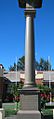
- 1903 Queanbeyan Boer War memorial: This memorial is made of sandstone and was first placed at the intersection of Monaro and Crawford Streets. It was damaged twice by the same truck in the 1950s. Since it couldn't be fixed, a new concrete replica was made and put up in 1964. Even though it's a replica, it still honors those who fought in the Second Boer War.
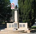
- 1923 Soldiers Memorial: This memorial was first called the Soldiers Memorial and was revealed on Anzac Day in 1923. Over time, it has been known by many names, like the World War 1 memorial. Now, it is often called the Memorial for all Wars, honoring all men and women who served in any war.
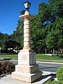
- 1936–1938 William Farrer memorial: This memorial is located in Farrer Place. It's made of sandstone and bronze and honors William Farrer. The central part with Farrer's bronze portrait was revealed in 1936. The four smaller bronze plaques, showing the wheat industry, were revealed in 1938 during Queanbeyan's 100-year celebration.
-
Second Boer War memorial
-
World War I memorial
-
William Farrer memorial
-
Memorial Gates - Queanbeyan Showgrounds
-
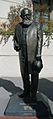
John Gale (journalist) "The Father of Canberra"
-
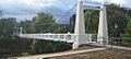
Historical Queanbeyan suspension foot bridge


.jpg)


Famous People from Queanbeyan

Many well-known people have come from Queanbeyan, including:
- Mark Asbock − Rugby League player
- Suzanne Balogh – Olympic Gold Medal winner in sport shooting
- David Campese – Famous Rugby Union player for the Wallabies
- Terry Campese – Rugby League player, nephew of David Campese
- Anthony Fainga'a – Rugby Union player for the Queensland Reds and Wallabies
- Saia Fainga'a – Rugby Union player for the Queensland Reds and Wallabies
- David Furner – Rugby League player and coach
- Matt Giteau – Rugby Union player for the Wallabies
- Brad Haddin – Cricketer for NSW and Australia
- Matt Henjak – Rugby Union player for the Wallabies
- Joe Janiak – Horse trainer, famous for Takeover Target
- Harry Holland – Politician and leader of the New Zealand Labour Party
- Brent Kite – Rugby League player for NSW and Australia
- Hau Latukefu – Award-winning MC and radio/TV presenter
- Glenn Lazarus – Former Senator and Rugby League player
- George Lazenby – Actor, the only Australian to play James Bond
- Megan Marcks (née Still) – Olympic gold medalist in women's rowing
- Heather McKay AM, MBE – Australian squash champion
- Lawrence Mooney – Australian comedian
- Tommy Murphy – Award-winning playwright
- Omar Musa – Australian poet, hip-hop artist, and author
- Fergus Pragnell – Member of the Australian rowing team
- Karly Roestbakken - Women's Soccer Player
- Ben Snow – Academy Award nominee for visual effects
- Clint Chadwick – Rugby Union player
- Ricky Stuart – Rugby League player and coach
- Mark Webber – Former Formula 1 driver and World Endurance Champion


Suburbs
Queanbeyan includes these suburbs:
- Carwoola
- Crestwood
- Environa
- Googong
- Greenleigh
- Jerrabomberra
- Karabar
- Queanbeyan East
- Queanbeyan West
- Queanbeyan
- The Ridgeway
- Royalla
- Tralee
- (Note: Oaks Estate is sometimes thought to be part of Queanbeyan, but it's actually in the Australian Capital Territory.)
In Popular Culture
The song 'Struggle Town' by The Choirboys was written about Queanbeyan. The band's drummer's father used to call Queanbeyan "Struggle Town," which inspired the lead singer, Mark Gable.
Climate

Queanbeyan has an oceanic climate, which means it has warm summers and cool winters. This is similar to the climate in Canberra.
| Climate data for Queanbeyan Bowling Club (1909–1956, rainfall 1870–2019); 580 m AMSL | |||||||||||||
|---|---|---|---|---|---|---|---|---|---|---|---|---|---|
| Month | Jan | Feb | Mar | Apr | May | Jun | Jul | Aug | Sep | Oct | Nov | Dec | Year |
| Mean daily maximum °C (°F) | 29.0 (84.2) |
28.5 (83.3) |
25.6 (78.1) |
20.6 (69.1) |
15.9 (60.6) |
12.5 (54.5) |
11.8 (53.2) |
13.7 (56.7) |
17.3 (63.1) |
20.7 (69.3) |
24.4 (75.9) |
27.6 (81.7) |
20.6 (69.1) |
| Mean daily minimum °C (°F) | 12.7 (54.9) |
12.9 (55.2) |
10.7 (51.3) |
6.6 (43.9) |
3.3 (37.9) |
0.9 (33.6) |
−0.2 (31.6) |
0.9 (33.6) |
3.3 (37.9) |
6.0 (42.8) |
8.9 (48.0) |
11.4 (52.5) |
6.5 (43.6) |
| Average rainfall mm (inches) | 55.3 (2.18) |
51.5 (2.03) |
51.2 (2.02) |
43.8 (1.72) |
42.9 (1.69) |
44.4 (1.75) |
39.2 (1.54) |
43.9 (1.73) |
47.7 (1.88) |
59.0 (2.32) |
58.9 (2.32) |
56.0 (2.20) |
593.8 (23.38) |
| Average rainy days (≥ 1.0 mm) | 4.7 | 4.4 | 4.3 | 4.3 | 4.5 | 5.5 | 5.4 | 6.0 | 6.2 | 6.6 | 6.1 | 5.3 | 63.3 |
| Source: Australian Bureau of Meteorology (1909–1956 temperatures, rainfall 1870-2019) | |||||||||||||
Images for kids
-
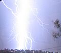
Lightning storms over Queanbeyan, 21 February 2007
See also
 In Spanish: Queanbeyan para niños
