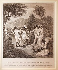
Saint Vincent (island) facts for kids
|
Native name:
Yurumei or Hairouna
|
|||||||||
|---|---|---|---|---|---|---|---|---|---|
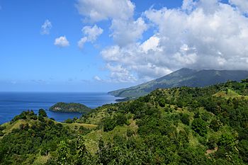
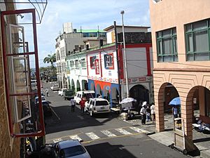
View of Saint Vincent.
|
|||||||||
| Geography | |||||||||
| Location | Caribbean Sea on the West Coast Atlantic Ocean on the East Coast. |
||||||||
| Coordinates | 13°15′N 61°12′W / 13.250°N 61.200°W | ||||||||
| Archipelago | Windward Islands | ||||||||
| Area | 345 km2 (133 sq mi) | ||||||||
| Length | 18 mi (29 km) | ||||||||
| Width | 11 mi (18 km) | ||||||||
| Highest point | La Soufrière 4,048 ft (1,234 m) |
||||||||
| Administration | |||||||||
| Parishes | 6 | ||||||||
| Constituencies | 15 | ||||||||
| Largest settlement | Kingstown (pop. 25,418) | ||||||||
| Demographics | |||||||||
| Population | 100,000 (2012) | ||||||||
| Pop. density | 347.83 /km2 (900.88 /sq mi) | ||||||||
| Ethnic groups | Black 66%, East Indian 6%, Garifuna 2%, Mixed Race 19%, White 4%, Other 3%. | ||||||||
| Additional information | |||||||||
|
|||||||||
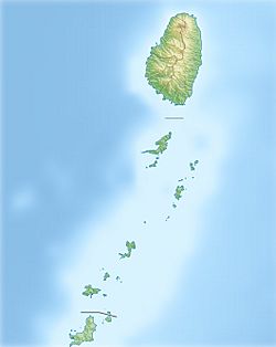
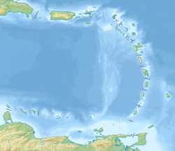
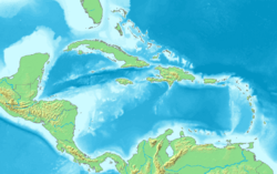
Saint Vincent is a volcanic island in the Caribbean. It is the biggest island in the country of Saint Vincent and the Grenadines. This island is found in the Caribbean Sea, between Saint Lucia and Grenada. It is made of volcanic mountains that are partly underwater.
The island's largest volcano is La Soufrière. It is also the highest point in the country. This volcano is active. Its most recent activity started in December 2020 and became stronger in April 2021.
In the 1700s, there were big wars over land. These wars were between the native people, called the Black Caribs or Garifuna, and Great Britain. The island was given to the British in 1763 and again in 1783.
Saint Vincent and the Grenadines became independent from the United Kingdom on October 27, 1979. After that, it joined the British Commonwealth of Nations. About 130,000 people live on the island today. Many people moved from the island to the UK in the early 1900s. More people moved between the 1940s and 1980s. People also moved to Canada and other larger nearby Anglo-Caribbean islands.
The main island has the capital city, Kingstown. The rest of the island is divided into five main towns along the coast. These towns are Layou, Barrouallie, Chateaubelair, Georgetown, and Calliaqua.
Contents
People of Saint Vincent
People from Saint Vincent and the Grenadines are called Vincentians. Sometimes, they are informally called Vincies or Vincys. Most people on the island are of Afro-Vincentian background.
However, many people are also descendants of the Black Caribs. There are also white people whose families came from English colonists. Some people are descendants of Portuguese workers. A large number of people are Indo-Vincentians, whose families came from workers with Indian heritage. About 19% of the population is of mixed race.
In 2012, about 130,000 people lived on the island. The main religions are Anglican (47%), Methodist (10%), and Roman Catholic (13%). Other religions include different Protestant groups like Seventh-day Adventism and Spiritual baptism, as well as Hinduism.
In 2004, about 88.1% of adults could read and write. In 2006, for every 1,000 babies born, 17 did not survive. Men lived for about 69 years on average, and women lived for about 74 years.
History of Saint Vincent
Before 1498, the native people called the island Hairouna. Christopher Columbus named the island Saint Vincent. He is said to have found it on January 22, which is the feast day of Saint Vincent of Saragossa.
In 1511, Columbus and the Spanish conquerors started expeditions to capture people for slavery. They did this in and around St. Vincent. This forced the native people to move to the rough, inner parts of the island. However, the Spanish could not settle on the island.
In the 1500s, Columbus and the conquerors saw many African people living with the native population. They thought these Africans had come from shipwrecked slave ships. Or, they might have escaped from St. Lucia or Grenada to find safety in St. Vincent. These people were called "Black Caribs," but today they are known as Garifuna.
The large number of native people strongly stopped Europeans from settling on St. Vincent until the 1700s.
French Colony Period
The first Europeans to take over St. Vincent were the French. But after many wars and peace agreements, these islands were eventually given to the British. The English first claimed St. Vincent in 1627. However, the French, who were based on the island of Martinique, were the first Europeans to invade. They set up their first colony in 1719 at Barrouallie on the Leeward side of St. Vincent.
The French colonizers made African slaves grow crops like coffee, tobacco, indigo, corn, and sugar on plantations. When the French ruled, Saint Vincent was known as Ile Saint Marcouf.
St. Vincent was given to Britain by the Treaty of Paris (1763). After this, problems between the British and the native people led to the First Carib War. When the British took control in 1763, they started building Fort Charlotte. It was finished in 1806.
The island went back to French rule in 1779. Then, the British got it back under the Treaty of Versailles (1783). Between 1793 and 1796, the Black Caribs, led by their chief, Joseph Chatoyer, fought many battles against the British. The fighting ended with a treaty. After this, 5,000 Garifuna people were sent away to Baliceaux, a smaller island near Bequia.
Fighting between the British and the native peoples continued until 1796. General Ralph Abercromby stopped a revolt that was started by Victor Hugues. The British sent more than 5,000 Black Caribs to Roatán, an island near Honduras.
Like the French before them, the British also made African slaves work on plantations. They grew sugar, coffee, indigo, tobacco, cotton, and cocoa. Slavery was fully ended in 1838. After this, the economy became weaker. Many landowners left their farms, and the land was farmed by the freed slaves.
Life became even harder after two eruptions of the La Soufriere volcano. These happened in 1812 and 1902. Much of the island was destroyed, and many people died. The volcano erupted again in 1979, but no one died that time. In the same year, St Vincent & The Grenadines became fully independent from Britain. It is still a member of the Commonwealth of Nations.
British Colony Period
From 1763 until it became independent, St. Vincent was a British colony in different ways. A group of representatives was allowed in 1776. The British ended slavery in 1834. This caused a shortage of workers on the plantations.
Because of this, Portuguese immigrants came in the 1840s. Many of them were of Jewish background. East Indians came in the 1860s to work. Life was still hard for both former slaves and immigrant farm workers. The price of sugar around the world was low, which kept the economy from growing until the early 1900s.
A Crown Colony government was set up in 1877. A Legislative Council was created in 1925. In 1951, all adults were allowed to vote. During this time, the British tried several times to join St. Vincent with other Windward Islands. They wanted to rule the area with one government. The most famous attempt was the West Indies Federation, which ended in 1962.
Self-Rule and Independence
St. Vincent was given associate statehood status by Britain on October 27, 1969. This meant it had full control over its own matters. After a vote in 1979, St. Vincent and the Grenadines became the last of the Windward Islands to gain independence. This happened on October 27, 1979. The country celebrates Independence Day every year on October 27.
Geography of Saint Vincent
The island of Saint Vincent is part of the Lesser Antilles chain. It is 29 kilometres (18 mi) long and 18 kilometres (11 mi) wide. It is located 160 kilometres (99 mi) west of Barbados.
The island is very mountainous and has many forests. It has an active volcano called La Soufriere, which is 1,234-metre (4,049 ft) tall. This volcano erupted strongly in 1812 and 1902. The most recent eruption was on April 9, 2021. This caused 20,000 people to leave their homes.
The island has a total area of 344 square kilometres (133 sq mi). This is about 88% of the country's total land area. It is 19 times larger than Bequia, the country's second-largest island. The coastline is about 84 kilometres (52 mi) long.
The climate is tropical and humid. The average temperature is between 18 and 31 °C (64 and 88 °F), depending on how high up you are.
More than 95% of the beaches on the main island have black sand. Most of the beaches in the Grenadines have white sand.
For many years, this sand was used for building. Recently, because of damage to the coastal areas, the government has limited how much sand can be taken from beaches. They also limit which beaches sand can be taken from. The sand is still used to build roads. It blends in with the color of the asphalt used for roads.
Biodiversity and Wildlife
Saint Vincent is home to special birds found only there, called endemic birds. These include the Lesser Antillean Tanager, the Whistling Warbler, and the Saint Vincent Amazon.
Some small areas of tropical rainforest are still left on the volcanic hills. Two types of reptiles that live only on Saint Vincent are named after the island: Chironius vincenti and Sphaerodactylus vincenti.
Saint Vincent in Popular Culture
In 2002, Saint Vincent was one of the places where the American adventure fantasy movie Pirates of the Caribbean: The Curse of the Black Pearl was filmed. Filming happened from October 2002 to March 2003. Hundreds of local people were hired to be actors in the movie.
Educational Institutions
Saint Vincent has several international medical schools. These schools are:
- All Saints University School of Medicine
- Saint James School of Medicine
- Trinity School of Medicine
- American University of St. Vincent School of Medicine
Besides these international schools, Saint Vincent also has local schools for education.
See also
 In Spanish: Isla de San Vicente (San Vicente y las Granadinas) para niños
 | James B. Knighten |
 | Azellia White |
 | Willa Brown |


