Transport in Birmingham facts for kids
Birmingham is a very important city for travel in central England. It's easy to get around Birmingham and to other places using trains, roads, and canals. A group called Transport for West Midlands (TfWM) helps manage all the public transport and main roads in the city.
Contents
Trains
A Look Back at Birmingham's Trains
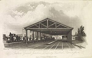
Birmingham's first train station was Vauxhall station. It opened in 1837 as a temporary shed. This station was the first stop in Birmingham for the Grand Junction Railway from Warrington.
Then, Curzon Street station opened in 1838. This became the main station in the city. Vauxhall then changed to only handle goods. The front of the old Curzon Street station is still there today. It was designed by Philip Hardwick. This building is very old and important. It is the world's oldest surviving grand railway building. It stopped being used for trains in 1966.
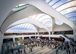
New Street station opened in 1854. After this, Curzon Street station was no longer used for regular passengers. New Street became a central point for many train lines. This made it easier to connect different routes. However, New Street still needed to be made bigger in the 1880s. This was so that trains from Midland Railway could travel between Derby and Bristol without using Camp Hill railway station.
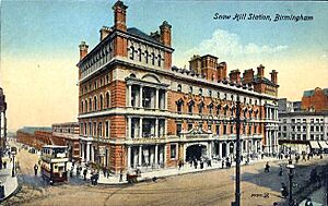
Snow Hill station was the next big station to open. It started in 1852 as Livery Street station. It connected London Paddington to Wolverhampton Low Level. The station was rebuilt in 1871 for longer trains. It was rebuilt again between 1906 and 1912. This was to help it compete with New Street station.
To ease the pressure on Snow Hill, Moor Street station opened in 1909. It was a starting point for lines to North Warwickshire. The two stations were linked by a tunnel. This tunnel closed in 1968. But it reopened in 1987 when the new Moor Street station was finished.
In the 1960s, a plan called the Beeching cuts said Snow Hill station was not needed. So, the station closed in 1972. It was taken down by 1977. Only the original gates and a sign survived. However, in the 1980s, British Rail decided to reopen Snow Hill station. It was part of a big plan for transport in Birmingham. It reopened in 1987. New office buildings and car parks were built over the station. In 2011, a new entrance opened. It linked Snow Hill station to the Jewellery Quarter.
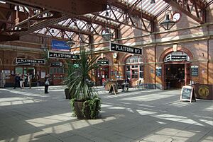
In 1986, Moor Street station moved next to its original spot. But in 2002, the original Moor Street station was updated. This cost £11 million. It was turned into a shopping and food area. This area is connected to the new train platforms.
The Harborne Branch Line opened in 1875. It connected New Street to the area of Harborne. This line started to lose passengers. More people were using buses. Also, trains were often delayed at New Street station. The stations on this line closed to passengers in 1934. The line closed completely in 1963.
In 1978, the Cross-City Line started. It used parts of older lines. This line connects Sutton Coldfield to Birmingham city centre. It is the only passenger train service to Sutton Coldfield.
Main Train Services
Many train lines meet at Birmingham New Street railway station. It is a very important hub for the UK train network. Most long-distance trains to and from Birmingham stop here. Trains to London Marylebone are run by Chiltern Railways. They stop at Moor Street station. Most of these trains then continue to Snow Hill station.
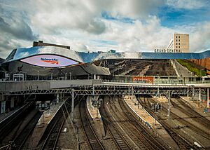
New Street Station has been updated in a huge project. It is called Gateway Plus and cost £500 million. This project made the station better for passengers. It also allowed more passengers to use the station. The station was handling more than double its planned number of people. The first part of the project finished in 2013. The whole project was completed in 2015.
A new high-speed train line is being built. It is called High Speed 2. The first part will connect Birmingham with London. Later, new high-speed links will go from Birmingham to Leeds and Manchester. New Street station cannot handle these new fast trains. So, a new high-speed station will be built at Curzon Street. It will be next to Moor Street. Another new station, Birmingham Interchange, will open near Birmingham International railway station. This will serve the city's airport and the National Exhibition Centre.
Local Train Services
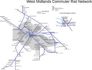
Birmingham and the West Midlands county have many local train services. These are run by West Midlands Trains. They are supported by Transport for West Midlands (TfWM). In 2014/15, nearly 51 million train journeys were made in the TfWM area. Birmingham has more train commuters than any other city in England outside London. The number of people using trains to get into central Birmingham has grown a lot. In 2012, 27% of journeys into the city centre during busy times were by train. This was up from 12% in 1991.
Most local train lines in Birmingham meet at New Street station. These include the Cross-City Line, the Chase Line, and the Coventry-Wolverhampton Line. Three other local routes run through Snow Hill and Moor Street stations. These are known as the Snow Hill Lines.
There are plans to bring back local passenger trains to the Camp Hill line. This line is currently only used for freight. New connections would be built into Birmingham Moor Street station. This would also allow new local services to Tamworth and Nuneaton.
Light Rail (Trams)
West Midlands Metro
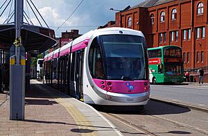
The West Midlands Metro is a tram system. It is managed by TfWM. Currently, it has one line that connects Birmingham to Wolverhampton. It goes through West Bromwich and Wednesbury. The first part of this line opened in 1999. It went from Wolverhampton to Birmingham Snow Hill.
In 2016, the line was extended across Birmingham city centre. It went from Snow Hill to Birmingham New Street station. It was later extended to Centenary Square. Work is still happening in 2021 to extend it further. It will go to Five Ways and Edgbaston. Another line is also being built to the Eastside of the city centre.
There are also long-term plans to make the tram system even bigger. It will spread across Birmingham and the West Midlands. Three new lines are being built to Brierley Hill, Digbeth, and Birmingham Airport. More lines are planned to places like Walsall and Solihull.
Old Birmingham Trams
The Birmingham Corporation Tramways ran a network of trams in Birmingham. They operated from 1904 until 1953. This was the largest narrow-gauge tram network in the UK. It was built to a special width of 3 ft 6 in (1,067 mm). It was the fourth largest tram network in the UK.
Underground System Ideas
In the early 1950s, the government planned secret underground tunnels. These were to protect important telephone lines. They started building the Anchor exchange in Birmingham in 1953. They told the public it was for a new underground train system. Work stopped in 1956. The public was told it was too expensive. Instead, Birmingham got underpasses to help with traffic. But an underground exchange and tunnels were finished. They were 100 feet below Newhall Street. This cost £4 million.
More recently, the city council thought about an underground train system. This was instead of making the Midland Metro bigger. A study was done to see if a £3 billion underground system would be good for the city. After the study, the city council decided to stick with the street tram system.
Buses and Coaches
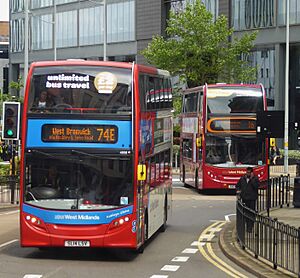
Birmingham has a very large bus network. About 84% of public transport use in the West Midlands is by bus. There are around 50 companies that run local bus services. The biggest bus company is National Express West Midlands. They handle over 80% of all bus journeys. This company runs many services from Birmingham City Centre. They also run the route 11 bus service. This is the longest city bus service in Europe. It mainly follows the A4040 circular road.
Most bus services are run by companies on their own. But some services, like evening and Sunday buses, get help from TfWM. Smaller companies also run services. Some compete with National Express West Midlands. Others are hired by TfWM. These include Diamond West Midlands and The Green Bus.
Even though many buses serve Birmingham City Centre, there is no longer one main bus station. Instead, buses stop at different bus stops around the city centre. These stops have codes based on their area. For example, Moor Street Interchange is MS*.
The airport can be reached by an express bus service. This bus goes from Coleshill Parkway station. It runs four times an hour and takes about fifteen minutes. Also, National Express Coventry runs a regular bus service from the City Centre. The X1 bus goes from Moor Street Queensway to Coventry. It stops at the airport and the National Exhibition Centre.
Birmingham is also a major hub for the National Express coach network. Their main office is in Birmingham. Coaches operate from the Birmingham coach station. This is a new coach station built where the old Digbeth coach station used to be. The company's main NXL Shuttle service goes to London. There are also frequent services to all major airports and cities in Britain. Many of these are long-distance services. Birmingham is a good place to change coaches for these journeys. Megabus coaches also stop in Birmingham. They stop at Brunel Street, west of New Street station.
Roads
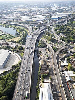
The M40 motorway connects Birmingham to London through Oxford. The M6 motorway also connects Birmingham to London (using the M1). It also links to the north-west of England and Scotland. Junction 6 of the M6 is a famous landmark in Birmingham. It is called Spaghetti Junction.
Other important motorways are:
- The A38(M) which links Spaghetti Junction to the city centre.
- The M5, connecting Birmingham to the south-west of England.
- The M42, which connects Birmingham to Tamworth and the East Midlands.
- The M6 Toll, which lets traffic on the M6 avoid going through Birmingham and Wolverhampton.
Birmingham does not have one single ring motorway like London. Instead, three motorways form a box around most of the city. These are:
- The M42 forms the southern and eastern parts. The M40 joins it here.
- The M5 forms the western part.
- The M6 forms the northern part. The M5 ends at the M6.
Other major roads that go through Birmingham include:
- The A34 from Manchester to Winchester.
- The A38 from Mansfield to Bodmin.
- The A41 from London to Birkenhead.
- The A45 from Birmingham to Thrapston.
- The A47 from Birmingham to Great Yarmouth.
- The A4540 'Middleway' ring road.
- The A4040 Outer Ring Road.
Clean Air Zone
Birmingham started a Clean Air Zone on June 1, 2021. This means that older, more polluting vehicles have to pay to drive into the city centre. This area includes all roads inside the A4540 ring road. Bad air quality causes about 900 deaths a year in Birmingham. The government has told the city to reduce pollution.
The daily charge is £8 for petrol cars made before 2006. It is also £8 for diesel cars made before 2015. Lorries and coaches pay £50. The money collected is used to make public transport better.
Cycling
Sustrans' National Cycle Route 5 goes through central Birmingham. It connects with National Cycle Route 81 at Smethwick. National Cycle Route 535 from Sutton Coldfield ends just north of Birmingham Snow Hill railway station.
In 2021, Transport for West Midlands started a bike hire scheme. It has over 300 bikes and 43 docking stations. These are across the West Midlands, including central Birmingham. There are not many dedicated cycling paths in the outer parts of Birmingham.
Air Travel
History of Birmingham Airports
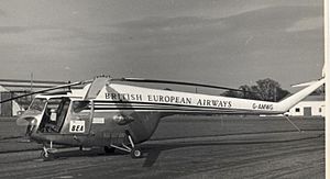
Birmingham's first airport was Castle Bromwich Aerodrome. It was open from 1909 to 1958. Another airport, Elmdon Airport, opened on July 8, 1939. It is still open today and is called Birmingham Airport. A heliport (for helicopters) called Hay Mills Rotor Station operated from 1951 to 1952. It had passenger services to London. Freight flights continued until 1954. Another heliport was near Baskerville House in the 1950s.
Current Airport
Birmingham is served by Birmingham Airport. It is located east of Birmingham in Solihull. It was the seventh-busiest airport in the UK in 2013. The airport is connected to the train network at Birmingham International railway station. This station is also in Solihull.
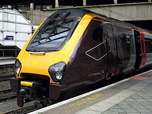
The airport and train station are linked by the AirRail Link. This is a 585 m (1,919 ft) people mover system. It used to be a Maglev system. Now it is a cable-hauled system. Train services are provided by Avanti West Coast, CrossCountry, Transport for Wales, and West Midlands Trains.
Bus services also run from the airport to Coleshill Parkway railway station. This train line goes to Leicester. This link makes it easier to get to the East Midlands. It also connects to North Warwickshire and South-east Staffordshire.
The airport has two main bus services into Birmingham. The X1 bus goes from Birmingham to Coventry. It runs 24 hours a day. The X12 bus goes from Birmingham to Solihull. Most bus services from the airport are run by National Express West Midlands.
Canals
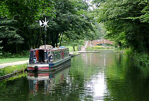
Birmingham's canal network was built during the Industrial Revolution. It was used to move heavy goods. The city is still at the centre of the country's canal network. Canals run for 35 miles (56 km) within the city. Most of these canals can still be used by boats.
People often say Birmingham has more miles of canal than Venice. This is true by about 9 miles (14 km). However, Birmingham is a much larger city than Venice. So, the canals are spread out more. Birmingham's canals are inland waterways. They provide access to only a few buildings. Venice's canals are broad coastal canals. They are the main way to get around.
Many canals have been improved since the 1980s. This includes cleaning them to make it easier for narrowboats to pass. New homes have also been built next to the canals. Recent projects include the Eastside area of Digbeth.
Canals in Birmingham include:
- The Birmingham Canal Navigations network, like the BCN Main Line and the Birmingham and Fazeley Canal.
- Parts of the Worcester & Birmingham Canal.
- Parts of the Grand Union Canal.
Birmingham has reservoirs that feed its canals. These include:
- Edgbaston Reservoir
- Lifford Reservoir
There are no rivers in Birmingham that boats can use. The Rea, where the city started, is mostly a covered stream. The Tame goes through some northern areas. But it is not deep enough for boats. The River Cole is also too shallow for anything bigger than a raft.
Birmingham Public Transport Facts
On a weekday, people in Birmingham who use public transport spend about 94 minutes travelling each day. This is mostly for going to and from work. About 38% of these people travel for more than 120 minutes. People wait at a stop or station for about 11 minutes on average. The average distance people travel on one public transport trip is 6.6 km. About 10% of users travel more than 12 km in one part of their journey each day.
Public Transport Maps
You can find Birmingham public transport maps from Network West Midlands:
- Bus map
- Rail map
- Integrated public transport interactive map
 | Delilah Pierce |
 | Gordon Parks |
 | Augusta Savage |
 | Charles Ethan Porter |


