Solihull facts for kids
Quick facts for kids Solihull |
|
|---|---|
| Town | |
|
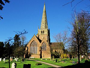
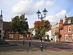
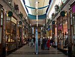
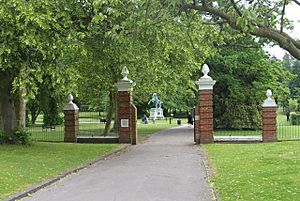
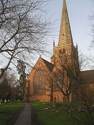
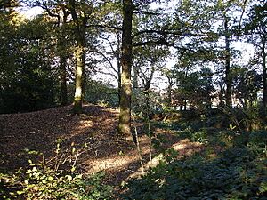
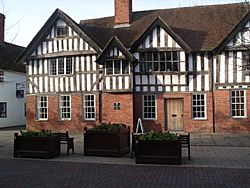
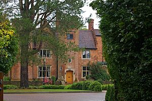
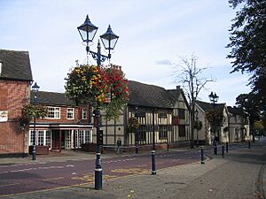
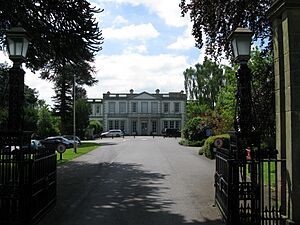
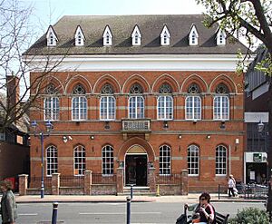
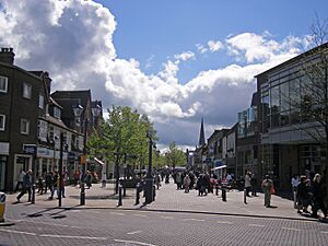
Clockwise from top: St Alphege Church, Touchwood Shopping Centre, Malvern Park and Solihull town square |
|
| Population | 126,577 (2021 Census) |
| Demonym | Silhillian |
| OS grid reference | SP1579 |
| • London | 110 mi (180 km) SE |
| Metropolitan borough |
|
| Metropolitan county | |
| Region | |
| Country | England |
| Sovereign state | United Kingdom |
| Post town | SOLIHULL |
| Postcode district | B36, B37, B90–B94 |
| Dialling code | 0121 |
| Police | West Midlands |
| Fire | West Midlands |
| Ambulance | West Midlands |
| EU Parliament | West Midlands |
| UK Parliament |
|
Solihull is a busy market town and the main centre of the Metropolitan Borough of Solihull in the West Midlands, England. It sits by the River Blythe in the old Forest of Arden. In 2021, about 126,577 people lived in the town.
Solihull is mostly a town, but the wider area around it is very rural. Three-quarters of the borough is protected as green belt land. The town has a long history, going back to the 1st century BC. It was officially started in the medieval times. Today, Solihull is famous as the home of the Land Rover car company. It also hosts training for the British Equestrian teams. Solihull is known as one of the richest areas in the UK.
Contents
What's in a Name?
The name Solihull probably comes from its church, St Alphege. This church was built on a "soily" hill. The hill was made of sticky red clay, which became muddy when it rained.
Solihull's Story
Ancient Times
Long ago, the area where Solihull is now was covered by the huge Forest of Arden.
The oldest known settlement was an Iron Age hill fort called Berry Mound in Shirley. This fortified village was protected by earth banks. It dates back to the 1st century BC and covered about 11 acres. Shirley's name means "a bright clearing" or "a border clearing" in the forest.
During the later Iron Age, the River Cole was likely a border between two powerful Celtic tribes. Solihull was right where these two tribes met.
The Romans did not build many roads through the dense Forest of Arden. The closest big Roman settlements were a few miles away.
Anglo-Saxon Era
By the Anglo-Saxon period, the Forest of Arden was part of the Kingdom of Mercia. A settlement called Ulverlei was created. Its name means "Wulfhere's clearing." Wulfhere was the first Christian King of Mercia. This settlement was a clearing in the thick forest. People farmed the land together. The old Shirley settlement became part of Ulverlei. This idea of being a clearing in the countryside is still seen in Solihull's motto: "Urbs in rure," which means "town in the country."
Local stories say that Alfred the Great fought a battle against the Danes at Berry Mound in Shirley. This was in the mid-9th century.
After Mercia joined the rest of England, Ulverlei became property of the Earls of Mercia. One of these was Leofric, Earl of Mercia, husband of Lady Godiva. Later, the land went to Leofric's grandson, Edwin, Earl of Mercia.
Early Medieval Period
In 1086, Ulverlei was owned by Cristina, a royal family member. She later became a nun. Her lands were given to a Norman lord, Ralph de Limesy.
Between 1170 and 1180, the de Limsey family started the settlement of Solihull. It was a "planned village" south of Ulverlei. It was called a "borough" because people could live there freely. They paid rent instead of working for the lord. Ulverlei later became known as the "Old Town," or Olton, to tell it apart from the new Solihull.
The de Limsey family owned Solihull until Ralph's great-granddaughter married Hugh de Odingsells. The Odingsells were lords of the manor. They are thought to have built a castle at a place now called Hobs Moat. This castle was used until about the 14th century.
The beautiful St Alphege Church was built around 1220. It is made of red sandstone and has a tall spire (168 feet high). You can see it from far away. It is a very important historic building.
By 1242, Solihull was allowed to hold a weekly market and a yearly fair. This made Solihull a central place for the villages around it.
The town of Solihull later grew to include Longdon. Longdon was first mentioned in 1086. Its name means "the long hill." The assimilation of Longdon into Solihull was so complete that few signs remain today that it was once a separate place.
Nearby Knowle also became part of Solihull later. In 1396, people in Knowle wanted their own church. They no longer wanted to cross the dangerous River Blythe to go to church. Their church was built, and Knowle became separate from Hampton in Arden.
Temple Balsall, also in Solihull, was founded by the Knights Templar. They farmed a large estate there in the 12th century.
Later Medieval Period
By 1295, the ownership of Solihull changed hands. It eventually went to the Le Despencer family. This family had conflicts with the Trussell family from nearby Nuthurst. Their rivalry ended when Sir William Trussell helped overthrow King Edward II. Hugh Despenser was executed.
Around the 14th century, Hobs Moat Castle fell into ruin. The Odingsells had built a new manor house closer to the town centre called Silhill Hall.
By the 14th century, Solihull was known for its blacksmiths. The High Street was even called "le Smythestret." This was because the Forest of Arden had many trees to fuel their fires. The town was also known for making textiles.
In the grounds of St Alphege church, there is a 14th-century ruin. It might have been a well house for a holy spring.
Historians think the Shakespeare family, ancestors of William Shakespeare, might have come from Solihull's Balsall. Shakespeare's mother, Mary Arden, was from a branch of the Arden family in Solihull.
Early Modern Period
The ownership of Solihull changed many times. In 1495, the Greswolde family built Lime Tree House on Solihull High Street. This house is sometimes wrongly called the "Manor House."
The manor of Solihull was later given to the Duke of Norfolk. He then passed it to the Throckmorton family in 1530. The Throckmortons were involved in plots against the government, like the 1605 Gunpowder Plot.
In 1604, the Throckmorton family sold Solihull to Edmund Hawes. The Hawes family already owned land in Solihull. They built Hillfield Hall in 1576. This grand Tudor hall had battlements. Hillfield Hall is still a home today.
The historic Solihull School was founded in 1560. One of the town's oldest buildings is The George hotel, which dates from the 16th century.
Solihull survived the English Civil War (1642–1651) mostly unharmed. Important battles happened nearby. It is said that Prince Rupert, a Royalist commander, was on his way to meet King Charles in Solihull when he was attacked.
Modern Times
In the modern era, Solihull became a quieter town. Textile and iron working were still important. The ownership of Solihull continued to change. In 1850, it passed to Robert Short, an officer. His son-in-law, Rev. John Couchman, inherited it. The Couchman family still holds the title of Lords of the Manor of Solihull today.
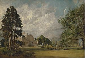
Work on Malvern Hall began in the 1700s. It was finished in the first half of the century. The famous artist John Constable painted the hall in 1809. The Greswolde family later sold the house to Solihull council. The estate became Malvern Park. The hall is now part of Solihull School.
Touchwood Hall was built in 1712. It was home to important local families. The hall was torn down in 1963. However, it gave its name to Solihull's famous shopping centre.
Poets William Shenstone and Richard Jago went to Solihull School. Today, two school houses are named after them.
In 1775, Monkspath Hall was built. It became famous much later when it was illegally torn down. A court case demanded it be rebuilt exactly as it was.
In 1785, the Earl of Aylesford started the Woodmen of Arden. This is a special group of archers who shoot longbows. They meet in the Forest of Arden in Meriden. Archery has always been important in Solihull. Marks on St Alphege church show where archers sharpened their arrows in the 1360s.
In 1838, the local Catholic church, St Augustine of England Church, was built. It was designed by Augustus Pugin.
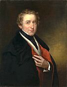
In the early 1800s, Sir Robert Peel, a former Prime Minister and founder of the modern police force, bought the Manor of Hampton in Arden. He made improvements there.
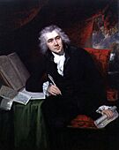
Also, the abolitionist William Wilberforce moved to Solihull. A road, Wilberforce Way, is named after him.
The manor of Longdon came to the famous poet Lord Byron in 1815. Two roads in Solihull are named after his family.
Longdon Hall was later bought by Mr. Alfred Lovekin. He built Tudor Grange Hall. After his death, it was sold to Sir Alfred Bird, 1st Baronet. He later gave the land for a school and park.
In the 1870s, Monkspath Priory was built. It later became a hotel.
In 1870, the inventor James Fern Webster moved to the edge of Solihull. He found a way to make aluminium cheaply. Before this, aluminium was a very expensive metal.
Fowlers Cheese company, the oldest cheese maker in England, moved to Earlswood in 1898.
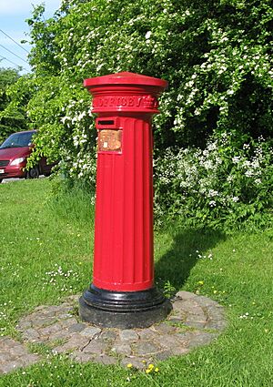
In the 1890s, pen maker Joseph Gillott built New Berry Hall. Around this time, telephone and postal services came to Solihull.
20th Century Growth
The Industrial Revolution mostly missed Solihull. It remained a small market town until the 20th century. The town grew because more land became available for homes. This brought many new people to Solihull.
In 1894, Solihull became the Solihull Rural District. In 1932, it became the Solihull Urban District Council.
Solihull School continued to grow. Arthur Tolkien, father of J. R. R. Tolkien (who wrote The Lord of the Rings), was a student there. J. R. R. Tolkien even mentioned Solihull in some of his letters. His son Michael taught at the school in the 1950s. The poet W. H. Auden grew up in Solihull.
Solihull was affected by the First World War. In 1914, the Army Remount Service, which handled war horses, was in Knowle. The town also had hospitals for injured soldiers.
In 1936, two Solihull farms were bought to build a secret "shadow factory." These factories were hidden to avoid enemy bombing. After the war in 1948, this factory became the home of the Land Rover car company.
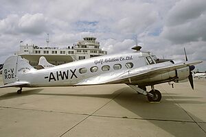
On July 8, 1939, Prime Minister Neville Chamberlain opened "Elmdon Airport" in Solihull. The airport's main building was designed in the Art Deco style. Soon after opening, the airport was used for World War II. It became RAF Elmdon. In 1946, it reopened for civilian flights. In 1960, it was renamed "Birmingham International Airport." It is still sometimes called Elmdon Airport by locals.
When World War II started, Solihull became a place for children evacuated from other cities. Barrage balloons and searchlights were put up to confuse enemy planes. A military hospital opened in Tudor Grange House. An American Army headquarters was set up on Blossomfield Road.
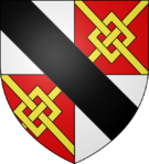
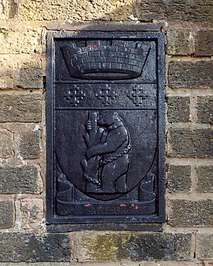
In 1954, Queen Elizabeth II made Solihull a Municipal Borough. Ten years later, it became a County Borough. In 1974, the Metropolitan Borough of Solihull was created. This combined Solihull with most of the Meriden Rural District. A coat of arms was given to the borough.
Until the early 1960s, the main high street looked much like it did in the late 1800s. Then, the central shopping area, Mell Square, was built. This involved tearing down some very old buildings.
In 1966, Silhill Hall, the 13th-century manor house, was illegally torn down. The site is now used for homes.
In 1986, Solihull became a unitary authority. This means it handles most local government services itself.
In 1981, a small tornado touched down in nearby Shirley. It then moved over Solihull town centre, causing some damage.
Solihull Today
Solihull is close to big cities like Birmingham and Coventry. But it still has its own unique feel. It is surrounded by green countryside to the south and east.
Solihull is managed by the Solihull Metropolitan Borough Council. This council provides most local services. Bigger services like policing and public transport are handled by the wider West Midlands area.
Where is Solihull?
Solihull is in the historic Forest of Arden. It sits by the River Blythe, about 127 meters (416 feet) above sea level. The town and most of the area around it are part of the West Midlands Green Belt.
The town is about 8 miles (12 km) southeast of Birmingham. It is 14 miles (21 km) west of Coventry. It is also about 110 miles (177 km) northwest of London.
The village of Meriden in Solihull was once thought to be the exact centre of England. A stone monument marks this spot. However, in the 1920s, the real centre of England was found to be in Leicestershire.
See also
 In Spanish: Solihull para niños
 | Kyle Baker |
 | Joseph Yoakum |
 | Laura Wheeler Waring |
 | Henry Ossawa Tanner |


