Bald Eagle Creek Path facts for kids

The Bald Eagle Creek Path was an important Native American trail in Pennsylvania. It was also known as one of the "Warriors Paths." This path stretched from the Great Island, near today's Lock Haven, all the way southwest to what is now Frankstown.
The trail connected different parts of Pennsylvania. It went through Clinton County, Centre County, and Blair County. This path was a key part of a larger network of trails. These trails linked areas like New York and the lands of the Iroquois people to the north. They also connected to the Ohio River country in the west. To the south, the path led to places like Maryland, Virginia, and the Carolinas.
The Path's Journey
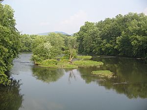
The Bald Eagle Creek Path began at a place called the Great Island. This island is located in the West Branch Susquehanna River where Bald Eagle Creek flows into it. Today, this area is part of Lock Haven.
The Great Island was a busy hub for Native American villages. Many other important trails also met there. For example, the Great Island Path went east to the village of Shamokin. Today, Shamokin is known as Sunbury. The Great Shamokin Path also followed the West Branch of the Susquehanna River to Shamokin. It connected to many other trails going north. The Great Shamokin Path also continued west from the Great Island to Kittanning. Another trail, the Sinnemahoning Path, followed the West Branch west. It then went north along Sinnemahoning Creek to the Allegheny River.
After leaving the Great Island, the Bald Eagle Creek Path followed the west side of Bald Eagle Creek. It soon entered what is now Centre County. Here, it passed through the area that is now Bald Eagle State Park.
Near the Lenape village of Bald Eagle's Nest, the path crossed the creek. This village is now Milesburg. The path then went through a water gap in Bald Eagle Mountain. This gap was formed by Spring Creek. The path then turned south near modern Bellefonte. It followed Buffalo Run along the east side of Bald Eagle Mountain. It continued this way as far as the village of Waddle.
The path kept going southwest along the edge of Bald Eagle Mountain. It left Centre County and crossed a small part of Huntingdon County. There, it passed the Native American village of Warriors Mark. It then followed Logan Spring Run into what is now Blair County.
In Blair County, the path followed Logan Spring Run to the Little Juniata River. It then followed this river upstream to modern Tyrone. Between Tyrone and Bellwood, the path crossed the Little Juniata River twice. It crossed to the west side, then back to the east side.
Continuing southwest, the path reached the current site of Altoona. It then left the Little Juniata River. It headed south to what is now Hollidaysburg. From there, it followed the Beaverdam Branch Juniata River. Finally, it reached the Frankstown Branch Juniata River at the modern village of Frankstown. This was the southern end of the path.
Several other trails met at the Native American village of Frankstown. One Warriors Path led south to Maryland and Virginia. It continued on to the Catawba and Cherokee peoples in North Carolina and South Carolina. The Kittanning Path was another trail that led west from Frankstown. It went towards the Allegheny and Ohio Rivers.
History of the Path
The Bald Eagle Creek Path was named after a Lenape chief named Bald Eagle, or Woapalanee. His village was called Bald Eagle's Nest. It was located near modern Milesburg, Pennsylvania.
There are different stories about Chief Bald Eagle. One chief with this name was known to be friendly and respected. He died in a conflict on the Monongahela River in 1773. Another person named Bald Eagle is believed to have led raids against settlers during the American Revolutionary War. He was involved in a conflict near Williamsport in 1778. He was later killed on the Allegheny River in 1779.
Regardless of the exact person, the name Bald Eagle became very important. It gave its name to Bald Eagle Mountain and two different Bald Eagle Creeks. It also named the Bald Eagle Creek Path itself. Other places named after him include Bald Eagle State Park, the Nittany and Bald Eagle Railroad, and Bald Eagle Township.
In 1949, the Pennsylvania Historical and Museum Commission placed a historical marker. This marker is on Pennsylvania Route 150 near Howard. It honors the path, which they called the "Warriors Path." A book called Indian Paths of Pennsylvania by Wallace, first published in 1964, explained that many north-south paths were called Warriors Path. However, he specifically called this one the Bald Eagle Creek Path.
Today, the original path no longer exists. However, several modern highways follow parts of its old route. From Lock Haven to Milesburg and Bellefonte, Pennsylvania Route 150 follows the general course of the path. From Bellefonte to Tyrone, Pennsylvania Route 550 is a close match. From Tyrone to Hollidaysburg, US Route 220 and Interstate 99 follow the path's approximate route. Finally, US Route 22 is on the same general route from Hollidaysburg to Frankstown.
 | Janet Taylor Pickett |
 | Synthia Saint James |
 | Howardena Pindell |
 | Faith Ringgold |

