
Butler County, Missouri facts for kids
Quick facts for kids
Butler County
|
|
|---|---|

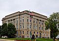
Butler County Courthouse in Poplar Bluff
|
|

Location within the U.S. state of Missouri
|
|
 Missouri's location within the U.S. |
|
| Country | |
| State | |
| Founded | February 27, 1849 |
| Named for | William Orlando Butler |
| Seat | Poplar Bluff |
| Largest city | Poplar Bluff |
| Area | |
| • Total | 699 sq mi (1,810 km2) |
| • Land | 695 sq mi (1,800 km2) |
| • Water | 4.3 sq mi (11 km2) 0.6% |
| Population
(2020)
|
|
| • Total | 42,130 |
| • Density | 60.27/sq mi (23.271/km2) |
| Time zone | UTC−6 (Central) |
| • Summer (DST) | UTC−5 (CDT) |
| Congressional district | 8th |
Butler County is a special area in the southeastern part of Missouri, a state in the United States. It's located in the Ozark Foothills Region, which means it has some beautiful hills and forests. In 2020, about 42,130 people lived here.
The biggest city and the main hub of the county is Poplar Bluff. This is where the county government is located. Butler County was officially created on February 27, 1849. It was named after William Orlando Butler, who was a famous person from Kentucky. He was a U.S. Representative and even ran for Vice President! The very first meeting in the Butler County Courthouse happened on June 18, 1849.
Butler County is also part of the Poplar Bluff, MO Micropolitan Statistical Area. This means it's a smaller city area that's important for jobs and services in the region.
Contents
Exploring Butler County: Geography
Butler County covers a total area of about 699 square miles. Most of this is land, with a small part being water, like rivers or lakes.
Neighboring Areas: Adjacent Counties
Butler County shares its borders with several other counties:
- Wayne County (to the north)
- Stoddard County (to the northeast)
- Dunklin County (to the southeast)
- Clay County, Arkansas (to the south)
- Ripley County (to the west)
- Carter County (to the northwest)
Getting Around: Major Highways
Several important roads help people travel through Butler County:
 Future Interstate 57
 U.S. Route 60
 U.S. Route 67
 U.S. Route 160
 Route 51
 Route 53
 Route 142
Nature's Playground: National Protected Area
A part of the beautiful Mark Twain National Forest is located within Butler County. This forest is a great place for outdoor activities like hiking and exploring nature.
People of Butler County: Demographics
The number of people living in Butler County has changed a lot over the years. Here's a quick look at how the population has grown:
| Historical population | |||
|---|---|---|---|
| Census | Pop. | %± | |
| 1850 | 1,616 | — | |
| 1860 | 2,891 | 78.9% | |
| 1870 | 4,298 | 48.7% | |
| 1880 | 6,011 | 39.9% | |
| 1890 | 10,164 | 69.1% | |
| 1900 | 16,769 | 65.0% | |
| 1910 | 20,624 | 23.0% | |
| 1920 | 24,106 | 16.9% | |
| 1930 | 23,697 | −1.7% | |
| 1940 | 34,276 | 44.6% | |
| 1950 | 37,707 | 10.0% | |
| 1960 | 34,656 | −8.1% | |
| 1970 | 33,529 | −3.3% | |
| 1980 | 37,693 | 12.4% | |
| 1990 | 38,765 | 2.8% | |
| 2000 | 40,867 | 5.4% | |
| 2010 | 42,794 | 4.7% | |
| 2020 | 42,130 | −1.6% | |
| U.S. Decennial Census 1790-1960 1900-1990 1990-2000 2010-2020 |
|||
In 2000, there were about 40,867 people living in the county. Most residents were White, with a smaller number of Black or African American, Native American, and Asian people. About 1% of the population was Hispanic or Latino.
2020 Census: Who Lives Here?
Here's a breakdown of the different groups of people living in Butler County, based on the 2020 Census:
| Race | Num. | Perc. |
|---|---|---|
| White (NH) | 35,745 | 85% |
| Black or African American (NH) | 2,463 | 6% |
| Native American (NH) | 198 | 0.5% |
| Asian (NH) | 304 | 0.72% |
| Pacific Islander (NH) | 12 | 0.03% |
| Other/Mixed (NH) | 2,507 | 6% |
| Hispanic or Latino | 901 | 2.14% |
Beliefs: Religion
Butler County is part of what is sometimes called the "Bible Belt." This means that many people in the area follow Christian religions. The most common groups are Southern Baptists, non-denominational evangelical groups, and Roman Catholics.
Learning in Butler County: Education
Education is important in Butler County. Most adults aged 25 and older have a high school diploma. Many also have a college degree.
Public Schools: Learning for Everyone
Butler County has several public school districts:
- Neelyville R-IV School District - Neelyville
- Hillview Elementary School - Harviell (Grades PK-2)
- Neelyville Elementary School (Grades 3-6)
- Neelyville High School (Grades 7-12)
- Poplar Bluff R-I School District - Poplar Bluff
- Eugene Field Elementary School (Grades 1-3)
- Mark Twain Early Childhood Center (Preschool/Daycare)
- Lake Road Elementary School (Grades 1-4)
- Poplar Bluff Kindergarten Center (Kindergarten)
- O'Neal Elementary School (Grades 1-3)
- Oak Grove Elementary School (Grades 1-3)
- Poplar Bluff Middle School (Grades 4-6)
- Poplar Bluff Jr. High School (Grades 7-8)
- Poplar Bluff High School (Grades 9-12)
- Twin Rivers R-X School District - Broseley
Private Schools: Other Learning Choices
There are also private schools in Poplar Bluff:
- Agape Christian School (Grades K-12) - A Christian school.
- Sacred Heart Elementary School (Grades PK-8) - A Roman Catholic school.
- Southern Missouri Christian School (Grades K-12) - An Assembly of God/Pentecostal school.
- Westwood Baptist Academy (Grades PK-12) - A Baptist school.
- Zion Lutheran School - A Lutheran school.
Special Education and Other Schools
Butler County also has schools for special learning needs:
- Hentz Alternative Learning Center - Poplar Bluff
- Shady Grove State School - Poplar Bluff
- Sierra-Osage Treatment Center - Poplar Bluff
- W.E. Sears Youth Center - Poplar Bluff
College and Beyond: Post-secondary Education
For students who want to continue their education after high school, Three Rivers College is located in Poplar Bluff. It's a public two-year community college.
Reading Fun: Public Libraries
You can find books and more at these public libraries:
- Fisk Community Library
- Poplar Bluff Public Library
Places in Butler County: Communities

Cities: Main Towns
- Fisk
- Neelyville
- Poplar Bluff (This is the county seat and the biggest city!)
- Qulin
Census-Designated Places: Smaller Communities
- Fairdealing (part)
- Harviell
Other Small Towns and Areas
Townships: Local Divisions
Butler County is divided into ten townships, which are like smaller local areas:
- Ash Hill
- Beaver Dam
- Black River
- Cane Creek
- Coon Island
- Epps
- Gillis Bluff
- Neely
- Poplar Bluff
- St. Francois
Famous Faces: Notable People
Some well-known people have connections to Butler County:
- Linda Bloodworth-Thomason, a television producer who created shows like Designing Women.
- Christian Boeving, a fitness model, bodybuilder, and actor.
- Sean Fister, a champion in long-drive golf (hitting the ball very far!). He won three World Long Drive Championships.
- Leroy Griffith, who owned burlesque theaters and produced films.
- Tyler Hansbrough, a professional basketball player who played for teams like the Toronto Raptors and Indiana Pacers.
- Scott Innes, a radio broadcaster and the voice actor for Scooby-Doo.
- Charles Jaco, a reporter for CNN.
- Billie G. Kanell, a brave soldier who received the Medal of Honor.
- Tim Lollar, a professional baseball pitcher.
- Matt Lucas, a singer, drummer, and songwriter.
- Derland Moore, a professional football player.
- Mikel Rouse, a composer.
Images for kids
-
Butler County Courthouse in Poplar Bluff
See also
 In Spanish: Condado de Butler (Misuri) para niños
