County of Grande Prairie No facts for kids
The County of Grande Prairie No. 1 is a special type of local government area called a municipal district in northwestern Alberta, Canada. It's part of a larger area known as Census Division No. 19.
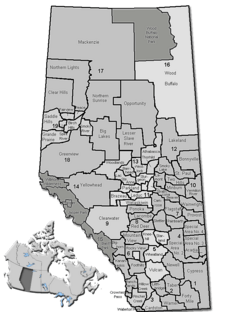
This county has natural borders: the Wapiti River to the south, the Smoky River to the east, and the province of British Columbia to the west.
Quick facts for kids
County of Grande Prairie No. 1
|
||
|---|---|---|
|
Municipal district
|
||

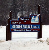
Boundary sign
|
||
|
||
| Nickname(s):
Alberta's First County
|
||
| Country | ||
| Province | ||
| Region | Northern Alberta | |
| Census division | No. 19 | |
| Established | 1943 | |
| Incorporated | 1951 | |
| Area
(2016)
|
||
| • Land | 5,802.21 km2 (2,240.25 sq mi) | |
| Population
(2016)
|
||
| • Total | 22,303 | |
| • Density | 3.8/km2 (10/sq mi) | |
| Time zone | UTC-7 (MST) | |
Contents
How Many People Live Here?
This section tells us about the population of the County of Grande Prairie No. 1. Governments often count their residents to understand how communities are growing.
Recent Population Counts
In 2016, Statistics Canada counted 22,303 people living in the county. These people lived in 7,684 homes. This was a good increase from 2011, when the population was 19,724.
The county itself also did its own count in 2012. They found about 21,157 people. This showed a big jump of 17.6% from their 2006 count of 17,989 people.
Land Area and Density
The County of Grande Prairie No. 1 covers a large area of land. In 2016, its land area was about 5,802.21 square kilometers (or 2,240.25 square miles).
To understand how crowded an area is, we look at population density. This means how many people live in each square kilometer. In 2016, the county had about 3.8 people living per square kilometer. This shows it's a fairly spread-out area.
Towns and Villages Nearby
The County of Grande Prairie No. 1 surrounds several towns and villages. These are separate communities, but they are located within the county's general area.
Urban Municipalities
These are bigger communities with their own local governments.
- Villages
- Summer villages
- none
Hamlets and Reserves
Hamlets are smaller communities that are part of the county's direct government. Indian reserves are lands set aside for First Nations people.
- Hamlets
- Bezanson
- Clairmont
- Demmitt
- Dimsdale
- Elmworth
- Goodfare
- Huallen
- La Glace
- Teepee Creek
- Valhalla Centre
- Wedgewood
Other Localities
There are also many smaller places and named areas within the county. These are often rural areas or small groupings of homes.
|
|
|


