Eastern Plains facts for kids
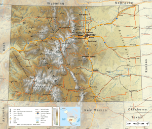
The Eastern Plains of Colorado is a large area in the United States state of Colorado. It is located east of the Rocky Mountains and east of big cities like Denver and Colorado Springs. This region is mostly flat land, similar to the Great Plains found across the central U.S.
Contents
Geography of the Eastern Plains
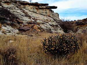
The Eastern Plains are part of the High Plains. This is the western edge of the larger Great Plains. The area has rolling hills and is split by the South Platte River and Arkansas River valleys. You can also find some forests, canyons, and unique flat-topped hills called buttes. There are also a few natural lakes and rivers.
The land here slowly rises from about 3,400 feet (1,036 meters) at the border with Kansas. It goes up to about 7,500 feet (2,286 meters) east of the Denver Basin. Most of this region is in Colorado's 4th congressional district.
Climate in Eastern Colorado
The Eastern Plains have a semi-arid climate. This means they do not get much rain. Many farms in the area use irrigation to grow crops. Summers are usually hot and dry. They often have strong thunderstorms, which can sometimes bring landspouts and tornadoes. Winters are cold and dry, with snow and icy conditions. Very rarely, temperatures can drop to -30 or -40 degrees Fahrenheit (-34 to -40 degrees Celsius).
History of the Eastern Plains
Native American Tribes
Long ago, many Native Americans lived in Eastern Colorado. The Plains Indians here included the Arapaho, Cheyenne, Kiowa, Pawnee, and Sioux tribes. The Ute people also lived across central and western Colorado, reaching into the eastern plains. The Comanche and Jicarilla Apache tribes once lived in southeastern Colorado.
European Settlement
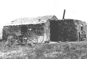
In 1541, Spanish explorers came to southeastern Colorado. They were looking for gold after hearing stories in Mexico City. But they did not find any gold, so they mostly left the area alone. In the late 1600s and 1700s, both Spain and France claimed parts of southeastern Colorado. However, no one really settled there.
In 1803, the United States gained control of the land east of the Rocky Mountains. This happened with the Louisiana Purchase. In 1806, Zebulon Pike was sent by the U.S. government to map the new territory. His trip explored the area near what is now Colorado Springs. A famous mountain there was named Pike's Peak after him.
More expeditions explored the area in the early 1800s. This led to the creation of trading posts for fur. But there were no permanent towns until after the Mexican War ended in 1848. The first town, San Luis, was founded in 1851. It was started by Spanish-speaking settlers who moved north from New Mexico. Soon after, other towns like San Pedro, San Acacio, and Guadalupe were also founded.
Population Changes
The Eastern Colorado plains are one of the most empty areas in the United States. Some parts, except for bigger towns like Sterling, are losing people. This started with the influenza pandemic of 1918 and low farm prices after World War I. The Dust Bowl in the 1930s also caused many people to leave. Kiowa County is an example of an area that has seen a big drop in population.
Parks and Natural Areas
Both the Pawnee National Grassland and Comanche National Grassland are located in the Eastern Plains. These areas were once farmlands that were not doing well. During the Dust Bowl, the government bought these lands. Now they are protected grasslands.
Agriculture and Farming
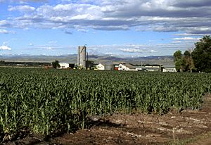
Eastern Colorado is mostly farmland with many small farming towns. The main crops grown here are corn, wheat, hay, oats, and soybeans. There is also a lot of livestock farming, like raising cows for dairy and meat. Poultry farming is also common, with chickens for meat and eggs, and turkeys.
Most towns in the region have grain elevators to store crops and tall water towers. More than 90% of the farms in Eastern Colorado are family farms.
Education in Rural Areas
In Eastern Colorado, most small towns have their own schools and sports teams. But in some areas where fewer people live, several towns might share one school. There are also schools for students from kindergarten to 12th grade run by religious groups or public school districts. Eastern Colorado is one of the few places in the U.S. that still has one-room school houses operating.
Religion
The main religion in Eastern Colorado is Christianity. The largest group is Roman Catholicism.
Transportation
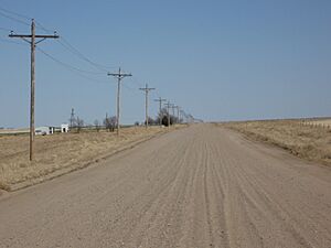
Roads in Eastern Colorado vary a lot. Some are paved, while others are gravel or dirt roads. The unpaved roads are usually county or local roads that do not have much traffic.
Some of the main paved roads include:
- Interstate 76
- Interstate 70
- U.S. Highway 6
- U.S. Highway 24
- U.S. Highway 36
- U.S. Highway 40
- U.S. Highway 50
- U.S. Highway 160
- U.S. Highway 287
- U.S. Highway 350
- U.S. Highway 385
- State Highway 10
- State Highway 11
- State Highway 36
- State Highway 59
- State Highway 71
- State Highway 86
- State Highway 94
- State Highway 96
 | Dorothy Vaughan |
 | Charles Henry Turner |
 | Hildrus Poindexter |
 | Henry Cecil McBay |


