Fowler Mountain facts for kids
Quick facts for kids Fowler Mountain |
|
|---|---|

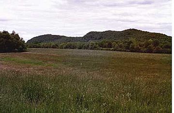
Fowler Mountain ridgeline from below
|
|
| Highest point | |
| Elevation | c. 750 ft (230 m) |
| Parent peak | 41° 26' 39"N, 72° 44' 25"W |
| Geography | |
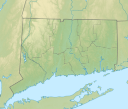
| Location | Durham and Wallingford, Connecticut |
| Parent range | Metacomet Ridge |
| Geology | |
| Age of rock | 200 Ma |
| Mountain type | Fault-block; igneous |
| Climbing | |
| Easiest route | Mattabesett Trail |
Fowler Mountain is a cool mountain made of a special rock called traprock. It stands about 750 feet (229 meters) tall and is located in Connecticut. This mountain is part of a long, narrow chain of mountains called the Metacomet Ridge. This ridge stretches all the way from Long Island Sound up through Connecticut and Massachusetts to the Vermont border.
Fowler Mountain is famous for its rough, natural look. It also has unique mini-ecosystems and rare plants. It rises sharply about 300 feet (91 meters) above the Ulbrich Reservoir and the Quinnipiac River valley on its west side. A popular hiking path, the 50-mile (80 km) Mattabesett Trail, goes right over the mountain.
Where is Fowler Mountain?
Fowler Mountain is found in the towns of Durham and Wallingford, Connecticut. It is about 1.2 miles (1.9 km) long and 0.5 miles (0.8 km) wide. Even though it's not huge, its rugged shape makes it feel much bigger.
This mountain is very important for water. Two reservoirs, which are like big lakes that store drinking water, are at its base. The Ulbrich Reservoir is on the west side in Wallingford. Pistapaug Pond is to the south, between Fowler Mountain and Pistapaug Mountain. The mountain is mostly covered in trees. There are a few spots with rocky ledges where you can look out over the reservoirs below.
The Metacomet Ridge continues from Fowler Mountain. To the north, it becomes Trimountain. To the south, it connects to Pistapaug Mountain. Water from the western part of Fowler Mountain flows into the Muddy River, then into the Quinnipiac River, and finally into Long Island Sound. Water from the east side drains into the Coginchaug River, then into the Connecticut River, and also ends up in Long Island Sound.
How Fowler Mountain Formed and Its Unique Nature
Fowler Mountain, like many parts of the Metacomet Ridge, is made of basalt. This rock is also called traprock, and it comes from volcanic activity. The mountain began to form around 200 million years ago. This was during the end of the Triassic Period, when the supercontinent Pangaea started to break apart. The North American continent began to separate from Africa and Eurasia.
As the land pulled apart, hot Lava pushed up from deep inside the Earth. This lava spread out and cooled into thick layers of rock, hundreds of feet deep. Later, big cracks in the Earth's crust, called faults, and earthquakes tilted these rock layers. This tilting created the steep cliffs and the long ridgeline that you see on Fowler Mountain today.
The mountain has a mix of different environments. The upper slopes are hot and dry, while the ravines are cool and moist. There are also rocky ledges made of basalt talus (broken rock pieces) that are rich in minerals. This combination creates many different microclimates. These tiny climates support plants and animals that are not common in other parts of Connecticut. Fowler Mountain is also a key spot for raptor (birds of prey) migration. You can learn more about the geology and ecosystems of this area by looking up the Metacomet Ridge.
Fun Activities and Protecting the Mountain
A lot of Fowler Mountain's top and west side are protected. They are part of the undeveloped Trimountain State Park and also serve as land that helps protect the local watershed (areas that collect water for reservoirs). The lower slopes on the east side of the mountain have suburban houses.
People enjoy many outdoor activities on the mountain. These include hiking, snowshoeing, and picnicking. However, to keep the water clean, swimming, boating, and fishing are not allowed in the reservoirs.
The Mattabesett Trail is a famous hiking path that goes along the ridgeline of Fowler Mountain. This trail is cared for by the Connecticut Forest and Park Association. It stretches from the northern end of Lamentation Mountain, goes south to Totoket Mountain, and then north again to the Connecticut River.
You can start hiking on Fowler Mountain from the south side. The blue-marked Mattabesett Trail crosses Howd Road there, after coming down from Pistapaug Mountain. After you hike across Fowler Mountain, the trail continues straight to Trimountain. You can find another trailhead on Route 68 after this part of the trail.
The natural environment of Fowler Mountain faces some challenges, like new buildings and rock quarrying (digging out rocks). In 2000, Fowler Mountain was part of a study by the National Park Service. They were looking into creating a new National Scenic Trail. This new trail is now called the New England National Scenic Trail. It would connect the Metacomet-Monadnock Trail in Massachusetts with the Mattabesett Trail and Metacomet Trail in Connecticut.
Groups like the Wallingford Land Trust and the Middlesex Land Trust have been working hard to protect the beautiful viewshed (the area you can see) around Fowler Mountain.
 | Dorothy Vaughan |
 | Charles Henry Turner |
 | Hildrus Poindexter |
 | Henry Cecil McBay |


