History of Kent facts for kids
Kent is a traditional county in South East England with a very long history of people living there. It's known for its beautiful countryside, historic towns, and its important role in English history.
Contents
- Ancient Kent: Early Humans and Stone Tools
- Iron Age Kent: Celtic Tribes and Early Settlements
- Roman Kent: Invasion and Forts
- Early Medieval Kent: Kingdoms and Christianity
- Medieval Kent: Rebellions and Castles
- Early Modern Kent: Naval Power and Smugglers
- Recent Discoveries in Kent
- Kent and London: A Changing Border
- Modern Kent: War and New Boundaries
- Men of Kent and Kentish Men
- Nickname: Kentish Long-Tail
Ancient Kent: Early Humans and Stone Tools
Scientists have found amazing evidence of early humans living in Kent a very long time ago. At a place called Fordwich, near Canterbury, tools were found that are between 560,000 and 620,000 years old! These tools were made by early humans, possibly a type of human called Homo heidelbergensis or early Neanderthals. This is the oldest proof of humans in Britain before a huge ice age.
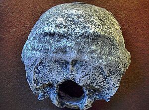
Even older, parts of a human skull, known as the Swanscombe Skull, were found in Swanscombe. This skull is the oldest human skull found in Britain. It's thought to be from a female who lived about 400,000 years ago during a warmer period.
In 2023, archaeologists found over 800 stone tools near the Medway Valley. Some of these tools, like giant hand-axes, are over 300,000 years old! Back then, Kent was a wild place with forests, rivers, and animals like red deer, elephants, lions, and horses.
Later, during the Neolithic (New Stone Age), people built large stone monuments called the Medway megaliths. The Bronze Age also left many signs, like the famous Ringlemere gold cup.
Iron Age Kent: Celtic Tribes and Early Settlements
The name Kent likely means 'rim' or 'border'. It might have described the eastern part of the county as a 'border land' or 'coastal area'. The name probably came from an old Celtic or Latin word.
When Julius Caesar visited Britain in 51 BC, he called the area Cantium. He said the people living in Cantium were "by far the most civilised" of the Britons. They were similar to people across the English Channel in Gaul (modern France). Pottery found here shows that people called the Belgae lived east of the River Medway.
Other Celtic tribes lived in the western part of modern Kent. Early towns like Folkestone and Dover Castle started as Iron Age settlements. We even know the names of a few kings from this time, like Dumnovellaunus.
Roman Kent: Invasion and Forts
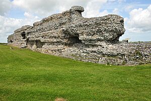
When the Romans invaded Britain around AD 43, Richborough Roman fort was probably their main landing spot. Even though it's now far from the sea, it was once a busy port. The Romans built a special arch there to celebrate their success. You can still see its cross-shaped foundations today.
Later, in the 3rd century, Roman Britain faced attacks from Saxons. Richborough became a strong fort with thick stone walls and ditches. It was one of the most important "Saxon shore forts" and was used for a long time. There's even evidence of an early Christian church inside the fort, showing many Romans lived there in the early 5th century.
Early Medieval Kent: Kingdoms and Christianity
After the Romans left, many Germanic people moved into Kent. They brought the Old English language, which is the base of the English we speak today. However, some native Romano-Britons stayed, and they influenced the name of the area, which became Cantia or Cent.
East Kent became one of the kingdoms of the Jutes in the 5th century, known as the Kingdom of Kent. The people living there were called the Cantwara, or Kentish people. Their main town was Canterbury.
Canterbury is very important for the Anglican faith. It's where Saint Augustine of Canterbury landed in 597 AD, bringing Christianity to the Anglo-Saxons.
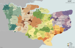
Kent was divided into large areas called "lathes." These divisions were very old and might have started when the Jutes first settled. In 1086, there were seven lathes, which were important for administration and taxes for hundreds of years. Each lathe was then divided into smaller areas called "hundreds."
Medieval Kent: Rebellions and Castles
After William of Normandy invaded Britain, the people of Kent famously adopted the motto Invicta, meaning "unconquered." They claimed they scared the Normans away! This story is supported by the fact that Kent kept some special rights and laws that other parts of England lost. For example, Kent became a special semi-independent area.
One unique law in Kent was Gavelkind. While in most of England, the oldest son inherited everything, in Kent, a man's property was divided equally among all his sons. This meant land was split into smaller and smaller pieces. This law shows that the Normans had to respect Kentish rights. Gavelkind was finally ended in 1925.
During the Middle Ages, Kent saw several rebellions. These included the Peasants' Revolt led by Wat Tyler and Jack Cade's rebellion in 1450. Thomas Wyatt also led an army from Kent against Queen Mary I in 1553.
Canterbury became a major pilgrimage site after Thomas Becket was killed there. His story inspired Geoffrey Chaucer's famous book, Canterbury Tales, which helped develop the English language.
Kent also has many important castles built to protect the coast, the River Medway, or routes to London. These include Dover, Leeds, and Rochester. Kent also played a role in the English Civil War around 1648.
The Royal Navy started using the River Medway in 1547. By the time of Queen Elizabeth I, a small dockyard was set up at Chatham. This dockyard grew to be very important, building and repairing many naval ships.
In the 17th century, wars with the Netherlands and France led to more military buildings in Kent. Forts were built along the coast after the Dutch navy attacked the shipyards on the Medway in 1667.
Chatham Dockyard built over 400 naval ships, including the famous HMS Victory (which was Admiral Nelson's ship). It also built 57 submarines. During World War II, Chatham repaired 1360 warships. The famous writer Charles Dickens' father worked in the dockyard, and many places in Kent, like Chatham and Rochester, appeared in his books.
Kent was so important militarily that the first map ever made by the Ordnance Survey (a mapping agency) was of Kent, published in 1801.
In the early 19th century, smugglers were very active along the Kent coast. Gangs like the Aldington Gang brought illegal goods like spirits and tobacco into Kent and took wool across the English Channel to France.
In 1830, a large uprising by farm workers, known as the Swing Riots, began in East Kent. They destroyed threshing machines, which were taking away their jobs. This unrest led to changes in laws for the poor.
Recent Discoveries in Kent
In 2019, archaeologists found a large Roman building at Abbey Farm. It was 150 feet long and 50 feet wide. The building had special tiles to direct hot air up the walls for heating, heated floors, and even a hot sauna room with colorful painted walls.
Kent and London: A Changing Border
As London grew, especially in the 1800s, it expanded into northwest Kent. Towns in this area became more like London suburbs.
In 1888, a new administrative area called the County of London was created. This took parts of northwest Kent, including Deptford, Greenwich, Woolwich, and Lewisham, and made them part of London.
In 1965, Greater London was created, taking even more of northwest Kent. Then, in 1974, the way local government worked changed again. Canterbury became a district within Kent. The areas taken by London in 1888 became the London Borough of Lewisham and the Royal Borough of Greenwich. Two new boroughs, Bromley and Bexley, were also created from former Kent areas.
Modern Kent: War and New Boundaries
Much of the Battle of Britain during World War II was fought in the skies over Kent. From 1944 to 1945, over 10,000 V1 flying bombs, also called Doodlebugs, were fired at London from France. Many were shot down, but about 2500 hit London, and almost the same number fell in Kent. This led to the area being called Doodlebug Alley.
Today, much of northwest Kent is part of the London commuter belt, meaning many people live there and travel to London for work. The Thames Gateway area, which is being redeveloped, includes parts of north Kent. After World War II, many people moved from London to Kent, especially the Medway area, because London had been heavily damaged.
In 1998, the towns of Rochester, Chatham, Gillingham, and Rainham formed their own separate local government area called Medway. However, they are still considered part of the ceremonial county of Kent.
Kent traditionally has two cities: Canterbury and Rochester. However, after the local government changes in 1998, Rochester lost its official city status.
Men of Kent and Kentish Men
Kent has a unique tradition: people from East Kent are called Men of Kent (or Maids of Kent), and those from West Kent are called Kentish Men (or Kentish Maids). This division goes back a very long way, at least to the Anglo-Saxon period.
Ancient Origins of the Division
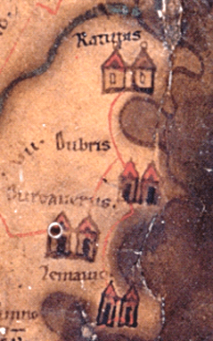
When the Romans were here, they called Kent "Cantium." The local tribe, the Cantiaci, had their main center at Canterbury. It's possible that the division of Kent into East and West goes back to the Iron Age.
Anglo-Saxon Times
The East and West Kentish identities were strong during the Anglo-Saxon period. The early English church even had two dioceses (church areas) in Kent: Rochester in the west and Canterbury in the east. This shows there might have been political divisions between East and West Kent.
Some historians believe this division came from different groups of Germanic settlers. The Jutes settled in the east and south after the Romans left, while the Angles and Saxons might have settled in the west later. The Jutes saw themselves as a separate kingdom with their own laws. They introduced the Gavelkind system, where property was divided equally among sons, unlike the Saxon law where the eldest child inherited everything.
Modern DNA tests suggest that people from Kent are more genetically similar to each other than to people from other English counties.
Where is the Border?
The traditional border between East and West Kent is the River Medway. However, some towns like the Medway Towns (Rochester, Chatham, Gillingham) and Maidstone are on the east side of the river but are sometimes considered part of West Kent.
Further research shows the actual division might be even further east, in Rainham. There was an old boundary stone in Rainham Mark that traditionally marked the division. Even in 1798, a historian named Edward Hasted wrote that Rainham was in East Kent, while Gillingham to the west was in West Kent.
This historic division is still remembered today. For example, Kent had two historic army regiments: the West Kent Regiment and the East Kent Regiment. There were also two parliamentary areas and two separate court systems for East and West Kent until 1814. The Association of the Men of Kent and Kentish Men, formed in 1913, helps keep this tradition alive.
Nickname: Kentish Long-Tail
Many English counties have nicknames for their people. For Kent, the traditional nickname is "Kentish Long-Tail." This comes from an old belief in Medieval Europe that English people had tails!
|
 | Jackie Robinson |
 | Jack Johnson |
 | Althea Gibson |
 | Arthur Ashe |
 | Muhammad Ali |


