
Image: Australia relief map

Size of this preview: 668 × 600 pixels. Other resolutions: 267 × 240 pixels | 1,336 × 1,200 pixels.
Original image (1,336 × 1,200 pixels, file size: 366 KB, MIME type: image/jpeg)
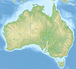
Description: Relief map of Australia
Title: Australia relief map
Credit: File:Australia location map.svg ETOPO1 SRTM30
Author: Виктор В
Usage Terms: Creative Commons Attribution-Share Alike 3.0
License: CC BY-SA 3.0
License Link: http://creativecommons.org/licenses/by-sa/3.0
Attribution Required?: Yes
Image usage
The following 73 pages link to this image:
- 1968 Meckering earthquake
- Aberfoyle River
- Adelaide Superbasin
- Barkindji Biosphere Reserve
- Blotched boulder-frog
- Bowen Basin
- Brisbane Synagogue
- Broad Sound (Queensland)
- Burning Mountain
- Captains Mountain
- Clarence Moreton Basin
- Cloggs Cave
- Cophixalus zweifeli
- Discovery Bay (Australia)
- Environment of Australia
- Forty Lake Peak
- Frederick Reefs
- Geography of Australia
- Glenrock Lagoon
- Great Australian Bight Marine Park
- Great Australian Bight Marine Park (2017)
- Great Barrier Reef Marine Park
- Groote Eylandt
- Honeysuckle Creek Tracking Station
- Kanawinka Geopark
- Kangaroo Island
- Kata Tjuta
- King George River
- Kokerbin Rock
- Koongine Cave
- Kutikina Cave
- Lake Barrine
- Lake Buchanan (Queensland)
- Lake Burley Griffin
- Lake Burragorang
- Lake Condah
- Lake Coogee
- Lake Cooloongup
- Lake Eacham (Queensland)
- Lake Edgar
- Lake Greenly
- Lake Macdonald
- Lake Numalla
- Lake Walyungup
- Lihou Reef National Nature Reserve
- Madjedbebe
- Mount Wheeler
- Murat Bay
- Murat Marine Park
- Myall Lakes
- New Guinea II cave
- Otway Basin
- Petermann Ranges
- Saumarez Reefs
- Smiths Lake (New South Wales)
- South-west Corner Marine Park
- Southern Kangaroo Island Marine Park
- Spencer Gulf
- Tarragal Caves
- Teviotville Tree
- Thredbo, New South Wales
- Uluru
- Wallis Lake
- Wamberal Lagoon
- Watarru Indigenous Protected Area
- Western Eyre Marine Park
- Western Kangaroo Island Marine Park
- Willis Island
- Yan Yean Reservoir
- Yangebup Lake
- Yapunyah waterhole
- Yeo Lake
- Template:Location map Australia

All content from Kiddle encyclopedia articles (including the article images and facts) can be freely used under Attribution-ShareAlike license, unless stated otherwise.