Kimble County, Texas facts for kids
Quick facts for kids
Kimble County
|
|
|---|---|
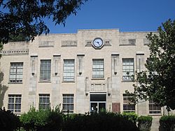
The Kimble County Courthouse in Junction
|
|
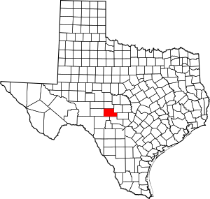
Location within the U.S. state of Texas
|
|
 Texas's location within the U.S. |
|
| Country | |
| State | |
| Founded | 1876 |
| Named for | George C. Kimble |
| Seat | Junction |
| Largest city | Junction |
| Area | |
| • Total | 1,251 sq mi (3,240 km2) |
| • Land | 1,251 sq mi (3,240 km2) |
| • Water | 0.2 sq mi (0.5 km2) 0.02% |
| Population
(2020)
|
|
| • Total | 4,286 |
| • Density | 3.4261/sq mi (1.3228/km2) |
| Time zone | UTC−6 (Central) |
| • Summer (DST) | UTC−5 (CDT) |
| Congressional district | 11th |
Kimble County is a special area of land called a county in the state of Texas. It is located on the Edwards Plateau, a high, flat area of land. In 2020, about 4,286 people lived here. The main town and center of the county is Junction. Kimble County was officially created in 1858 and started working as a county in 1876. It is named after George C. Kimble, a brave person who died during the famous Battle of the Alamo.
Contents
History of Kimble County
Early Days
Long before settlers from other countries arrived, different Native American groups lived in the area that is now Kimble County. These groups included the Comanche, Kiowa, Kiowa Apache, and Lipan Apache.
The first Europeans to visit this area were the Spanish. They explored the region in the mid-1700s. In 1808, a Spanish captain named Francisco Amangual mapped a road through what is now Kimble County. This area was first mentioned in documents from the Republic of Texas in 1842. At that time, a large part of the county was included in the Fisher–Miller Land Grant. This was a big piece of land given for settlement.
First Settlers and County Creation
The first settlers began to arrive in the late 1850s. One of the earliest was Raleigh Gentry, who settled near Bear Creek around 1857. Another early settler was James Bradbury Sr. He moved from Williamson County and chose a spot along the South Llano River. Other families settled in the Big and Little Saline valleys. These early settlers faced many dangers.
The Texas Legislature officially created Kimble County on January 22, 1858. It was formed from a part of Bexar County. The new county was named after Lieutenant George C. Kimble. He was a hero who died at the Battle of the Alamo. For many years, from 1858 to 1875, Kimble County was linked to Gillespie County for legal matters.
After the Civil War, more settlements grew along the Johnson Fork of the Llano River and near the James River. During the 1870s, the small communities in Kimble County faced challenges from Native American groups. These challenges stopped after 1878. The county's hilly land also became a hiding place for some people who were trying to avoid the law.
On September 6, 1875, Kimble County was no longer linked to Gillespie County. Instead, it was connected to Menard County for legal purposes.
Organizing the County
Almost 18 years after it was created, Kimble County was officially organized on January 3, 1876. William Potter became the county's first judge. That spring, two towns were started: Kimbleville and Denman. Denman quickly changed its name to Junction City. Kimbleville was chosen as the first county seat. However, during the first court meeting, the county seat was moved to Junction City. Kimbleville soon disappeared because it was in an area that often flooded.
Other communities also formed in the late 1800s. These included London, Noxville, Roosevelt, Segovia, Telegraph, and Viejo (which later became Cleo).
A Time of Growth
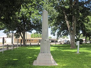
The number of people living in Kimble County grew a lot. It went from 72 people in 1870 to 1,343 in 1880. In 1878, a courthouse was built in Junction City. Sadly, this building and all the county records were destroyed in a fire in 1884. A new two-story stone building was built, but it was partly damaged by fire in 1888. It was repaired and used until the current courthouse was built in 1929. By 1890, the county had 2,243 people and 279 farms and ranches. Raising cattle and sheep soon became the main way people made a living. In 1894, Junction City became known simply as Junction.
Kimble County continued to grow in the early 1900s. The population reached 2,503 in 1900. Many new things came to the county during this time. Four Mile Dam was finished in 1904. The first telephone system arrived in Junction in 1905. The first banks opened a year later. Electric lights came to Junction in 1917, and gas stations appeared soon after.
In 1919, people in the county voted to build gravel and paved roads. By 1922, State Highway 27 was an unpaved road. It went through Junction, southeast to Kerrville, and west to Sonora. Other highways, State Highways 4 and 29, were also in use. By 1930, State Highway 29 reached the communities of London and Telegraph. Most roads in Kimble County were paved by the late 1940s. Old Highways 4 and 27 became U.S. Highway 83. Highway 27 became U.S. Highway 290, and Highway 29 became U.S. Highway 377.
Junction officially became a city in 1927. By the late 1920s, Kimble County was a leader in the wool and mohair industry. Farming and ranching continued to be very important to the local economy.
During the Great Depression, many people lost their jobs. However, the population of Kimble County still grew in the 1930s. It reached 5,064 people by 1940. Electricity came to the rural areas of Kimble County in April 1945. In the mid-1940s, the economy started to change. A small amount of oil was found, and people also began to produce sand, gravel, and gas.
Modern Times
After reaching its highest population in 1940, the number of people in Kimble County started to go down after World War II. Between 1950 and 1970, the county lost about 715 people. The population began to recover slightly by 1980 and continued to grow until 2000.
Geography
Kimble County covers a total area of about 1,251 square miles. Almost all of this area is land, with only a very small part (0.02%) covered by water.
Kimble County has the highest natural point in the Texas Hill Country. This spot is about 2,460 feet above sea level.
Main Highways
 Interstate 10
 U.S. Highway 83
 U.S. Highway 290
 U.S. Highway 377
Neighboring Counties
Kimble County shares borders with these other counties:
- Menard County (to the north)
- Mason County (to the northeast)
- Gillespie County (to the east)
- Kerr County (to the southeast)
- Edwards County (to the southwest)
- Sutton County (to the west)
- Schleicher County (to the northwest)
Population Information
| Historical population | |||
|---|---|---|---|
| Census | Pop. | %± | |
| 1870 | 72 | — | |
| 1880 | 1,343 | 1,765.3% | |
| 1890 | 2,243 | 67.0% | |
| 1900 | 2,503 | 11.6% | |
| 1910 | 3,261 | 30.3% | |
| 1920 | 3,581 | 9.8% | |
| 1930 | 4,119 | 15.0% | |
| 1940 | 5,064 | 22.9% | |
| 1950 | 4,619 | −8.8% | |
| 1960 | 3,943 | −14.6% | |
| 1970 | 3,904 | −1.0% | |
| 1980 | 4,063 | 4.1% | |
| 1990 | 4,122 | 1.5% | |
| 2000 | 4,468 | 8.4% | |
| 2010 | 4,607 | 3.1% | |
| 2020 | 4,286 | −7.0% | |
| U.S. Decennial Census 1850–2010 2010 2020 |
|||
| Race / Ethnicity (NH = Not Hispanic) | Pop 2000 | Pop 2010 | Pop 2020 | % 2000 | % 2010 | % 2020 |
|---|---|---|---|---|---|---|
| White alone (NH) | 3,481 | 3,450 | 3,136 | 77.91% | 74.89% | 73.17% |
| Black or African American alone (NH) | 3 | 16 | 8 | 0.07% | 0.35% | 0.19% |
| Native American or Alaska Native alone (NH) | 10 | 17 | 14 | 0.22% | 0.37% | 0.33% |
| Asian alone (NH) | 20 | 19 | 33 | 0.45% | 0.41% | 0.77% |
| Pacific Islander alone (NH) | 1 | 3 | 3 | 0.02% | 0.07% | 0.07% |
| Other Race alone (NH) | 4 | 6 | 8 | 0.09% | 0.13% | 0.19% |
| Mixed race or Multiracial (NH) | 23 | 19 | 98 | 0.51% | 0.41% | 2.29% |
| Hispanic or Latino (any race) | 926 | 1,077 | 986 | 20.73% | 23.38% | 23.01% |
| Total | 4,468 | 4,607 | 4,286 | 100.00% | 100.00% | 100.00% |
Based on the 2000 census, there were 4,468 people living in the county. These people lived in 1,866 households, and 1,285 of these were families. The county had about 4 people per square mile. There were 2,996 housing units, which means about 2 units per square mile.
The population was made up of different groups. About 90.29% were White, 0.09% African American, and 0.34% Native American. About 0.45% were Asian, and 0.02% were Pacific Islander. About 7.48% were from other races, and 1.34% were from two or more races. Around 20.73% of the people were Hispanic or Latino.
In the households, 28.20% had children under 18 living with them. About 57.20% were married couples. Around 8.60% had a female head of household with no husband. About 31.10% were not families. Around 28.60% of all households were single individuals. About 16.00% had someone living alone who was 65 years or older. The average household had 2.37 people, and the average family had 2.90 people.
The population's age groups were: 23.60% under 18 years old, 6.00% from 18 to 24, 22.60% from 25 to 44, 26.90% from 45 to 64, and 20.90% who were 65 or older. The average age was 43 years. For every 100 females, there were about 92.70 males.
The median income for a household in the county was $29,396. For a family, it was $34,966. Men earned a median income of $24,844, while women earned $20,431. The average income per person in the county was $17,127. About 13.40% of families and 18.80% of the total population lived below the poverty line. This included 28.80% of those under 18 and 14.20% of those 65 or older.
Education
The Junction Independent School District provides education for most of Kimble County. This includes the city of Junction and the communities of London, Roosevelt, and Telegraph. A small part of the county in the southeast is served by the Harper Independent School District. This district is based in Harper in Gillespie County. Also, a very small part of Kimble County is in the Mason Independent School District.
Communities
City
- Junction (This is the main town and county seat.)
Unincorporated Communities
These are communities that are not officially cities or towns.
Ghost Towns
These are places where people used to live, but now they are mostly empty.
See also
 In Spanish: Condado de Kimble para niños
 | Precious Adams |
 | Lauren Anderson |
 | Janet Collins |


