La Paz County, Arizona facts for kids
Quick facts for kids
La Paz County
|
||
|---|---|---|
|
||
|
||
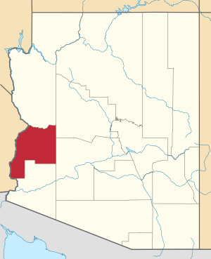
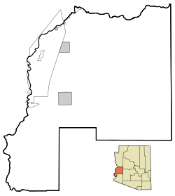
Location within the U.S. state of Arizona
|
||
 Arizona's location within the U.S. |
||
| Country | ||
| State | ||
| Founded | January 1, 1983 | |
| Named for | La Paz, Arizona | |
| Seat | Parker | |
| Largest town | Parker | |
| Area | ||
| • Total | 4,514 sq mi (11,690 km2) | |
| • Land | 4,500 sq mi (12,000 km2) | |
| • Water | 14 sq mi (40 km2) 0.3% | |
| Population
(2020)
|
||
| • Total | 16,557 | |
| • Estimate
(2023)
|
16,710 |
|
| • Density | 3.6679/sq mi (1.41619/km2) | |
| Time zone | UTC−7 (Mountain) | |
| Congressional district | 9th | |
La Paz County is the 15th county in the U.S. state of Arizona. It is located in the western part of the state. In 2020, about 16,557 people lived there. This makes it the second-smallest county in Arizona by population.
The main town, called the county seat, is Parker. The name "La Paz" comes from the Spanish words for "the peace." It was named after an old settlement, now a ghost town, called La Paz along the Colorado River.
Contents
History of La Paz County
La Paz County was created in 1983. It was formed when the northern part of Yuma County separated. This makes it the only county in Arizona to be formed after Arizona became a state in 1912. It is also one of the newest counties in the entire United States.
When the county first started, it didn't have enough money from taxes to run its own government. So, it had to get money from the state of Arizona. Because of this, Arizona changed its laws. It became much harder to split up other counties in the future.
The Colorado River Indian Reservation is located in the western part of La Paz County. Part of this reservation also stretches into California.
Geography and Nature
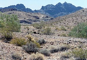
La Paz County covers a total area of about 4,514 square miles (11,690 square kilometers). Most of this area, about 4,500 square miles (11,655 square kilometers), is land. Only a small part, about 14 square miles (36 square kilometers), is water.
Plants and Animals
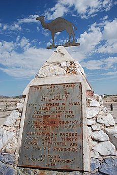
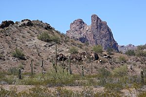
La Paz County is home to many different kinds of plants and animals. One special plant found here is the California Fan Palm. This palm tree is an endangered species, meaning it is very rare.
Neighboring Counties
La Paz County shares its borders with several other counties:
- Mohave County – to the north
- Yavapai County – to the northeast
- Maricopa County – to the east
- Yuma County – to the south
- Imperial County, California – to the southwest
- Riverside County, California – to the west
- San Bernardino County, California – to the northwest
Protected Natural Areas
Several national protected areas are partly located in La Paz County. These areas help protect wildlife and nature:
- Bill Williams River National Wildlife Refuge (part)
- Cibola National Wildlife Refuge (part)
- Imperial National Wildlife Refuge (part)
- Kofa National Wildlife Refuge (part)
People of La Paz County
| Historical population | |||
|---|---|---|---|
| Census | Pop. | %± | |
| 1990 | 13,844 | — | |
| 2000 | 19,715 | 42.4% | |
| 2010 | 20,489 | 3.9% | |
| 2020 | 16,557 | −19.2% | |
| 2023 (est.) | 16,710 | −18.4% | |
| U.S. Decennial Census 1990–2000 2010–2020 |
|||
In 2010, there were 20,489 people living in La Paz County. The county had about 9,198 households. The population density was about 4.5 people per square mile.
Most people in the county were white (69.8%). About 12.8% were American Indian, and 12.5% were from other races. People of Hispanic or Latino origin made up 23.5% of the population. The average age of people in the county was 53.9 years old.
Law Enforcement
| La Paz County Sheriff's Office | |
|---|---|

Patch of La Paz County Sheriff's Office
|
|
| Agency overview | |
| Formed | 1983 |
| Operational structure | |
| Headquarters | Parker, Arizona |
| Agency executive |
|
| Website | |
| La Paz County Sheriff | |
The La Paz County Sheriff's Office is in charge of law enforcement in the areas of the county that are not part of a city or town. They act like the police for these areas. They also manage the county jail system. The main office for the Sheriff's Office is in Parker.
Here are some of the past sheriffs who have served La Paz County:
- Rayburn Evans (1983–1988)
- Marvin Hare (1989–2000)
- Daniel "Hal" Collett (2001–2008)
- Donald Lowery (2009–2012)
- John Drum (2013–2016)
- William Risen (2017–2020)
- William Ponce (2021–Present)
Transportation
Main Roads
These are the major highways that run through La Paz County:
Air Travel
Avi Suquilla Airport is an airport that anyone can use. It is located near Parker, Arizona. The airport is owned by the Colorado River Indian Tribes.
Railways
The Arizona and California Railroad provides freight train services through Parker, Arizona.
Communities in La Paz County
La Paz County has several towns, census-designated places, and even some ghost towns.
Towns
- Parker (This is the county seat, where the main government offices are)
- Quartzsite
Census-Designated Places (CDPs)
These are areas that are like towns but are not officially incorporated as cities.
Unincorporated Communities
These are small communities that are not officially part of a town or CDP.
- Hope
- Love
Ghost Towns
Ghost towns are places where people used to live, but now they are mostly empty.
Indian Communities
Community Population Ranking
This table shows how many people lived in the main communities of La Paz County in 2020.
| Rank | City/Town/etc. | Population (2020 Census) | Type | Established |
|---|---|---|---|---|
| 1 | † Parker | 3,417 | Town | 1948 |
| 2 | Quartzsite | 2,413 | Town | 1989 |
| 3 | Cienega Springs | 1,690 | CDP | |
| 4 | Salome | 1,162 | CDP | |
| 5 | Ehrenburg | 763 | CDP | |
| 6 | Bouse | 707 | CDP | |
| 7 | Bluewater | 682 | CDP | |
| 8 | Parker Strip | 621 | CDP | |
| 9 | Brenda | 466 | CDP | |
| 10 | Wenden | 458 | CDP | |
| 11 | Vicksburg | 418 | CDP | |
| 12 | La Paz Valley | 368 | CDP | |
| 13 | Cibola | 198 | CDP | |
| 14 | Poston | 183 | CDP | |
| 15 | Utting | 92 | CDP | |
| 16 | Sunwest | 5 | CDP | |
| 17 | Alamo Lake | 4 | CDP |
See also
 In Spanish: Condado de La Paz para niños
 | Isaac Myers |
 | D. Hamilton Jackson |
 | A. Philip Randolph |


