Morrow County, Ohio facts for kids
Quick facts for kids
Morrow County
|
|||
|---|---|---|---|
|
|||
|
|||
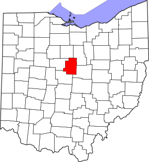
Location within the U.S. state of Ohio
|
|||
 Ohio's location within the U.S. |
|||
| Country | |||
| State | |||
| Founded | March 1, 1848 | ||
| Named for | Jeremiah Morrow | ||
| Seat | Mount Gilead | ||
| Largest village | Mount Gilead | ||
| Area | |||
| • Total | 407 sq mi (1,050 km2) | ||
| • Land | 406 sq mi (1,050 km2) | ||
| • Water | 1.1 sq mi (3 km2) 0.3%% | ||
| Population
(2020)
|
|||
| • Total | 34,950 |
||
| • Density | 86/sq mi (33/km2) | ||
| Time zone | UTC−5 (Eastern) | ||
| • Summer (DST) | UTC−4 (EDT) | ||
| Congressional district | 4th | ||
Morrow County is a county located in the central part of Ohio, a state in the United States. In 2020, about 34,950 people lived there. The main town, or county seat, is Mount Gilead.
Morrow County was created in 1848 from parts of four nearby counties. It was named after Jeremiah Morrow, who was the Governor of Ohio from 1822 to 1826. Before European settlers arrived in the early 1800s, the Shawnee people used this area for hunting.
Morrow County is part of the larger Columbus, Ohio, area. In 2010, the center of Ohio's population was found in Morrow County, near the village of Marengo.
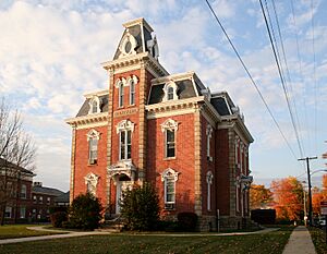
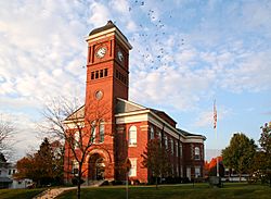
There are many interesting places to visit in Morrow County. These include the historic World War I Victory Shaft in downtown Mount Gilead, which is special because it's the only one of its kind in the United States. You can also explore Mount Gilead State Park, visit Amish farms and shops near Johnsville and Chesterville, or see races at the Mid-Ohio Sports Car Course near Steam Corners. The eastern part of the county has rolling hills, like the Allegheny foothills. You can also find the birthplace of former U.S. President Warren G. Harding near Blooming Grove. Other historical spots include the site of the former Ohio Central College in Iberia, old buildings in Chesterville, Ohio, and monuments for soldiers from the Revolutionary War and Civil War in Mount Gilead and Cardington. The Morrow County Courthouse and Old Jail in Mount Gilead also show off architecture from the mid-1800s.
Contents
Exploring Morrow County's Geography
Morrow County is located in a region often called "Mid Ohio." The U.S. Census Bureau says the county covers about 407 square miles. Most of this area, about 406 square miles, is land. Only a small part, about 1.1 square miles, is water.
Neighboring Counties
Morrow County shares its borders with several other counties:
- Crawford County (to the north)
- Richland County (to the northeast)
- Knox County (to the southeast)
- Delaware County (to the southwest)
- Marion County (to the west)
Waterways and Streams
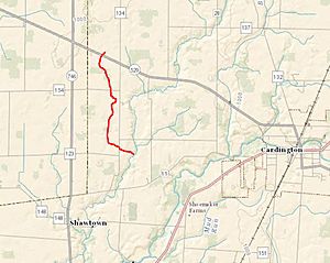
Ossing Run is a small stream that flows through Morrow County. It is a branch of Shaw Creek. Shaw Creek then flows into Whetstone Creek, which is close to Cardington, Ohio. The United States Geological Survey (USGS) officially recognizes Ossing Run as a stream.
People and Population in Morrow County
Morrow County has grown steadily over the years. Here's how the population has changed:
| Historical population | |||
|---|---|---|---|
| Census | Pop. | %± | |
| 1850 | 20,280 | — | |
| 1860 | 20,445 | 0.8% | |
| 1870 | 18,583 | −9.1% | |
| 1880 | 19,072 | 2.6% | |
| 1890 | 18,120 | −5.0% | |
| 1900 | 17,879 | −1.3% | |
| 1910 | 16,815 | −6.0% | |
| 1920 | 15,570 | −7.4% | |
| 1930 | 14,489 | −6.9% | |
| 1940 | 15,646 | 8.0% | |
| 1950 | 17,168 | 9.7% | |
| 1960 | 19,405 | 13.0% | |
| 1970 | 21,348 | 10.0% | |
| 1980 | 26,480 | 24.0% | |
| 1990 | 27,749 | 4.8% | |
| 2000 | 31,628 | 14.0% | |
| 2010 | 34,827 | 10.1% | |
| 2020 | 34,950 | 0.4% | |
| U.S. Decennial Census 1790-1960 1900-1990 1990-2000 2020 |
|||
Population Details from 2010
In 2010, there were 34,827 people living in Morrow County. Most residents, about 97.7%, were white. About 1.1% of the population was of Hispanic or Latino background. Many people in the county have German, American, Irish, or English family roots.
The average age in Morrow County was about 39.5 years old. The average income for a family was around $55,980 per year. About 10.8% of the people in the county lived below the poverty line.
Towns and Areas in Morrow County
Morrow County is made up of different types of communities, from small cities to tiny villages and townships.
Cities
- Galion (only a part of this city is in Morrow County)
Villages
These are smaller towns in the county:
- Cardington
- Chesterville
- Edison
- Fulton
- Marengo
- Mount Gilead (This is the county seat)
- Sparta
Townships
Townships are areas of land that often include smaller communities. Morrow County has many townships:
- Bennington
- Canaan
- Cardington
- Chester
- Congress
- Franklin
- Gilead
- Harmony
- Lincoln
- North Bloomfield
- Perry
- Peru
- South Bloomfield
- Troy
- Washington
- Westfield
Census-Designated Places
These are areas that are like towns but are not officially incorporated as cities or villages:
- Candlewood Lake
- Hidden Lakes
- Iberia
Unincorporated Communities
These are very small communities or neighborhoods that are not part of any city or village:
Famous People from Morrow County
Many notable individuals have connections to Morrow County:
- Chilton C. Baker, a politician
- Tim Belcher, a former professional baseball pitcher
- Richard Dillingham, an abolitionist who worked to end slavery
- Frank W. Gunsaulus, a well-known pastor
- Warren G. Harding, who became a U.S. President
- Dawn Powell, a famous author
- Esther Tuttle Pritchard (1840–1900), a minister and editor
- Samuel Newitt Wood, a politician and supporter of women's rights
See also
 In Spanish: Condado de Morrow (Ohio) para niños
 | William Lucy |
 | Charles Hayes |
 | Cleveland Robinson |


