National Register of Historic Places listings in Baxter County, Arkansas facts for kids
Have you ever wondered about old buildings and places that are super important to history? In Baxter County, Arkansas, there are many special spots listed on the National Register of Historic Places. This is like a special list kept by the United States government. It helps protect places that are important for their history, architecture, or what they mean to a community.
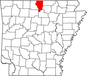
When a place is on this list, it means it's recognized as a valuable part of our country's story. It also helps make sure these places are taken care of for future generations. Baxter County has 20 places and areas on this list. Let's explore some of them!
Contents
Historic Places in Baxter County
Important Buildings
Many buildings in Baxter County have a rich history. They tell us about how people lived, learned, and worked long ago.
Baxter County Courthouse
The Baxter County Courthouse is a grand building located in Mountain Home. It's where important county decisions are made. This courthouse was added to the list in 1995.
Old School Buildings
Several old school buildings in Baxter County are on the list. These buildings remind us of how education used to be.
- Big Flat School Gymnasium: This gym is in Big Flat. It was listed in 1993. Imagine all the games and events that happened here!
- Buford School Building: Found in Buford, this school building joined the list in 1992. It's a piece of history for local students.
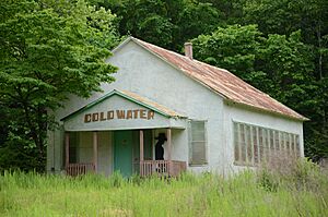
- Cold Water School: Also near Big Flat, the Cold Water School was recognized in 2008. It shows how important community schools were.
- Old Cotter High School Gymnasium: In Cotter, this old gym was listed in 1995. It's another reminder of school days past.
- Horace Mann School Historic District: This whole area in Norfork became a historic district in 2007. It includes buildings related to the Horace Mann School.
Historic Homes
Some houses are so old and special that they are also protected.
- Case-Shiras-Dearmore House: This house in Mountain Home was listed in 1992. It has a long name and a long history!
- Casey House: Also in Mountain Home, the Casey House joined the list in 1975. It's located near the fairgrounds.
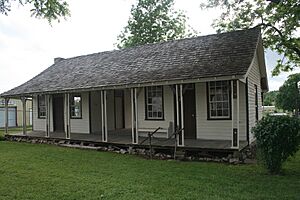
- Davis House: This house in Norfork was listed in 1995. It stands at a key intersection in town.
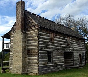
- Jacob Wolf House: One of the oldest buildings, the Jacob Wolf House in Norfork was listed way back in 1973. It's near where the White River and North Fork Rivers meet.
Rollins Hospital
The Rollins Hospital in Gassville was added to the list in 2007. It's a historic building that once served as a place of healing.
Sid Hutcheson Building
This building in Norfork was listed in 2014. It's another important part of the town's past.
Important Structures and Areas
Not just buildings, but other structures and even parts of towns can be historic.
Cotter Bridge
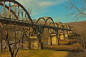
The Cotter Bridge is a famous landmark in Cotter. It crosses the White River and was listed in 1990. Bridges like this are important for travel and trade.
Cotter Water Tower
The water tower in Cotter is also on the list, added in 2007. Water towers are often important parts of a town's history and infrastructure.
Fort Smith to Jackson Road-Talbert's Ferry Segments
These are parts of an old road near Cotter that were listed in 2004. These segments are important because they were part of the Trail of Tears. This was a sad time in history when Native American tribes were forced to move from their homes.
Mountain Home Commercial Historic District
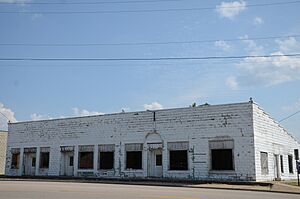
This is a whole area in Mountain Home that was listed in 2010. It includes many historic businesses and buildings that show how the town grew over time.
Old Joe
"Old Joe" in Norfork is a historic site that was listed in 1982. Its exact location is kept private to protect it.
Wolf Cemetery
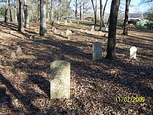
The Wolf Cemetery in Norfork was added to the list in 2013. Cemeteries can be historic because they hold the graves of early settlers and tell stories about a community's past.
Former Listings
Sometimes, a place might be removed from the National Register. This can happen if it's no longer there or if its historical importance changes.
North Fork Bridge
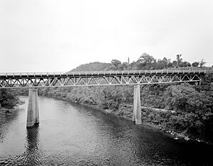
The North Fork Bridge in Norfork was once on the list, added in 1990. It crossed the North Fork of the White River. However, it was removed from the list in 2015.


