National Register of Historic Places listings in Drew County, Arkansas facts for kids
This article is about the cool and historic places in Drew County, Arkansas, that are listed on the National Register of Historic Places. Think of the National Register as a special list of buildings, sites, and objects across the United States that are important to history. When a place is on this list, it means it's worth protecting and remembering for future generations.
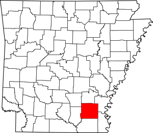
Drew County, located in Arkansas, has 23 different places on this special list. These places include old houses, schools, churches, and even a unique tree! You can see where these places are on a map if their exact location coordinates are shared.
Historic Places in Drew County
Drew County is home to many interesting spots that tell stories about the past. Let's explore some of them!
Homes with History
Many old houses in Drew County have been recognized for their historical importance. These homes often show us how people lived long ago and what kind of architecture was popular.
- Garvin Cavaness House: Located at 404 S. Main St. in Monticello, this house was added to the list on May 23, 1980.
- Robert Lee Hardy House: You can find this house at 207 S. Main St. in Monticello. It became a historic place on April 26, 1982.
- Hotchkiss House: This home at 509 N. Boyd St. in Monticello was listed on December 12, 1976.
- Lambert House: At 204 W. Jackson St. in Monticello, this house joined the register on December 22, 1983.
- Champ Grubbs House: This historic house is located west of New Hope on Highway 172. It was added on November 20, 1992.
- Veasey-DeArmond House: Found about 15 miles north of Monticello on Highway 81 near Lacey. It was listed on September 14, 1989.
Important Buildings and Districts
Beyond individual homes, Drew County also has other significant buildings and even whole areas that are considered historic.
- Drew County Courthouse: This important building at 210 S. Main St. in Monticello is where local government business happens. It was listed on October 17, 1997.
- Jerome Elementary School No. 22: This old school building on N. Louisiana Boulevard in Jerome was recognized on September 28, 2005. It's a reminder of how education used to be.
- Monticello Post Office: The post office at 211 W. Gaines St. in Monticello has been a historic site since August 14, 1998.
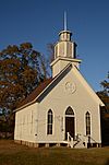
- Selma Methodist Church: Located north of Highway 4 in Selma, this church was listed on September 22, 1972.
- Selma Rosenwald School: This school on Selma-Collins Rd. in Selma was added on March 2, 2006. Rosenwald Schools were special schools built for African American children in the early 20th century.
- St. Mary's Episcopal Church: This church at 115 S. Main St. in Monticello became a historic place on April 4, 1996.
- Frank Tillar Memorial Methodist Episcopal Church, South: You can find this church on W. Railroad St. in Tillar. It was listed on June 4, 1997.
- Monticello Commercial Historic District: This is not just one building, but a whole area in downtown Monticello! It includes streets like Trotter Ave., Edwards St., Railroad Ave., and Chester St. It was recognized on September 23, 2011, for its important role in the town's business history.
- Monticello North Main Street Historic District: Another historic area in Monticello, this district runs along Westwood Ave. and N. Main St. It was listed on February 18, 1979.
- Ridgeway Hotel Historic District: This district includes the buildings at 200-206 E. Gaines St. in Monticello. It became historic on January 22, 2009.
Unique and Special Sites
Not all historic places are buildings. Some are natural features or monuments that hold special meaning.
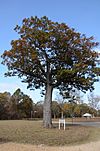
- Look See Tree: This unique tree is located at the southwestern corner of the junction of Highway 83 and Pleasant Springs Rd. in Coleman. It was listed on January 23, 2008. Imagine a tree being so important it's on a national list!
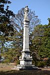
- Monticello Confederate Monument: This monument is in Oakland Cemetery, east of the junction of Oakland Ave. and Hyatt St. in Monticello. It was added to the register on April 26, 1996. Monuments like this help us remember past events.
- Rough and Ready Cemetery: About 1 mile southeast of the Monticello Civic Center on Highway 19, this cemetery was listed on November 22, 1999. Cemeteries can be important historical sites because they tell us about the people who lived in an area long ago.
- Saline Cemetery: This cemetery is about 0.3 miles south of the junction of US 278 & Allis Rd., near Wilmar. It was listed on June 15, 2011.
- Taylor Log House and Site: This site, which includes a log house, is west of Winchester on Highway 138. It was added on October 16, 1995. Log houses are a very old style of building.
List of Historic Places
Here is the full list of properties and districts in Drew County that are on the National Register of Historic Places:
| Name on the Register | Image | Date listed | Location | City or town | Description | |
|---|---|---|---|---|---|---|
| 1 | Garvin Cavaness House |
(#80000775) |
404 S. Main St. 33°37′22″N 91°47′30″W / 33.622778°N 91.791667°W |
Monticello | ||
| 2 | Drew County Courthouse |
(#97001226) |
210 S. Main St. 33°37′36″N 91°47′29″W / 33.626667°N 91.791389°W |
Monticello | ||
| 3 | Champ Grubbs House |
(#92001619) |
Highway 172 west of New Hope 33°30′46″N 91°56′03″W / 33.512778°N 91.934167°W |
New Hope | ||
| 4 | Robert Lee Hardy House |
(#82002113) |
207 S. Main St. 33°37′36″N 91°47′26″W / 33.626667°N 91.790556°W |
Monticello | ||
| 5 | Hotchkiss House |
(#76000404) |
509 N. Boyd St. 33°37′53″N 91°47′39″W / 33.631389°N 91.794167°W |
Monticello | ||
| 6 | Jerome Elementary School No. 22 |
(#05001068) |
N. Louisiana Boulevard 33°24′11″N 91°28′08″W / 33.403056°N 91.468889°W |
Jerome | ||
| 7 | Lambert House |
(#83003545) |
204 W. Jackson St. 33°37′35″N 91°47′34″W / 33.626389°N 91.792778°W |
Monticello | ||
| 8 | Look See Tree |
(#07001427) |
Southwestern corner of the junction of Highway 83 and Pleasant Springs Rd. 33°47′10″N 91°44′59″W / 33.786111°N 91.749722°W |
Coleman | ||
| 9 | Monticello Commercial Historic District |
(#11000688) |
Bounded roughly by Trotter Ave., Edwards St., Railroad Ave. & Chester St. 33°37′46″N 91°47′27″W / 33.629444°N 91.790833°W |
Monticello | ||
| 10 | Monticello Confederate Monument |
(#96000449) |
Oakland Cemetery, east of the junction of Oakland Ave. and Hyatt St. 33°38′04″N 91°47′52″W / 33.634444°N 91.797778°W |
Monticello | ||
| 11 | Monticello North Main Street Historic District |
(#79000437) |
Irregular pattern along Westwood Ave. and N. Main St. 33°38′01″N 91°47′27″W / 33.633611°N 91.790833°W |
Monticello | ||
| 12 | Monticello Post Office |
(#98000920) |
211 W. Gaines St. 33°37′46″N 91°47′31″W / 33.629444°N 91.791944°W |
Monticello | ||
| 13 | Ridgeway Hotel Historic District |
(#08000952) |
200-206 E. Gaines St. 33°37′44″N 91°47′24″W / 33.628889°N 91.79°W |
Monticello | ||
| 14 | Rough and Ready Cemetery |
(#99001376) |
Approximately 1 mile southeast of the Monticello Civic Center on Highway 19 33°36′50″N 91°47′21″W / 33.613889°N 91.789167°W |
Monticello | ||
| 15 | St. Mary's Episcopal Church |
(#96000352) |
115 S. Main St. 33°37′39″N 91°47′26″W / 33.6275°N 91.790556°W |
Monticello | ||
| 16 | Saline Cemetery |
(#11000353) |
.3 miles south of the junction of US 278 & Allis Rd. 33°37′11″N 91°54′30″W / 33.6197°N 91.9083°W |
Wilmar vicinity | ||
| 17 | Selma Methodist Church |
(#72000202) |
North of Highway 4 in Selma 33°41′52″N 91°34′11″W / 33.697778°N 91.569722°W |
Selma | ||
| 18 | Selma Rosenwald School |
(#06000069) |
Selma-Collins Rd., approximately 0.25 miles south of U.S. Route 278 33°40′30″N 91°33′58″W / 33.675°N 91.566111°W |
Selma | ||
| 19 | Taylor Log House and Site |
(#95001168) |
Highway 138 west of Winchester 33°46′11″N 91°33′04″W / 33.769722°N 91.551111°W |
Winchester | ||
| 20 | Frank Tillar Memorial Methodist Episcopal Church, South |
(#97000525) |
W. Railroad St., north of Highway 277 33°42′37″N 91°27′13″W / 33.710278°N 91.453611°W |
Tillar | ||
| 21 | Veasey-DeArmond House |
(#89001424) |
Highway 81, 15 miles north of Monticello 33°30′41″N 91°51′31″W / 33.511389°N 91.858611°W |
Lacey |


